Central Illinois
Weather Forecast Office
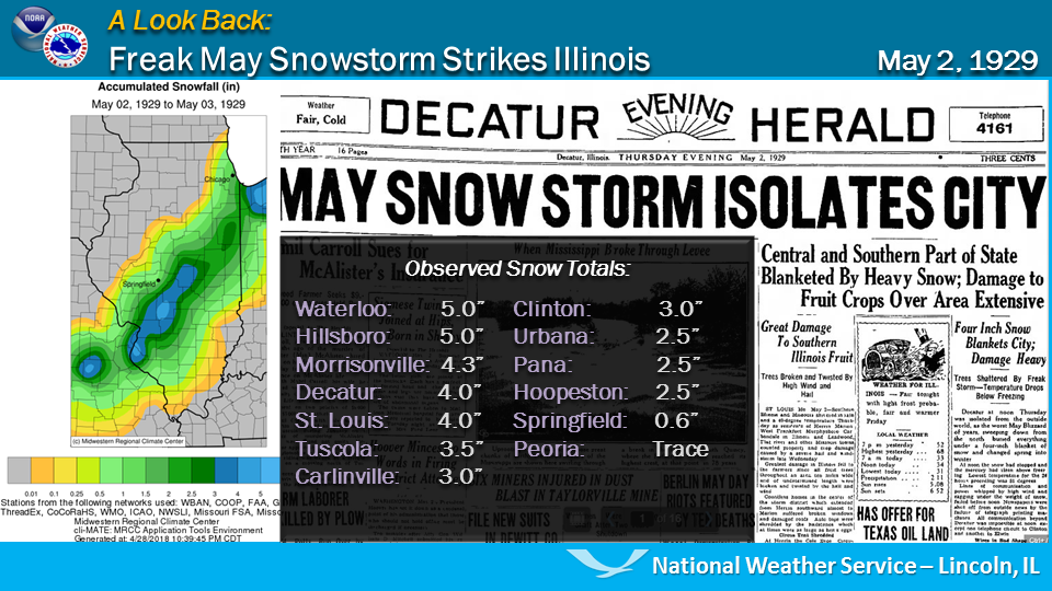
A large part of central and southern Illinois saw its first measurable May snowfall on record on May 2, 1929. A large swath of the state, from around St. Louis to the southern tip of Lake Michigan, observed 2 to 4 inches of snow during the morning and early afternoon hours, with some totals around 5 inches between Decatur and the St. Louis metro area. Most of the snow melted by evening.
Significant damage occurred across the region:
The day before, portions of southern Illinois were impacted by hail that accumulated several inches in depth. Fruit trees and crops in this area suffered about $400,000 worth of damage.
US Dept of Commerce
National Oceanic and Atmospheric Administration
National Weather Service
Central Illinois
1362 State Route 10
Lincoln, IL 62656
217-732-7321 (forecast recording) or 217-732-3089
Comments? Questions? Please Contact Us.

