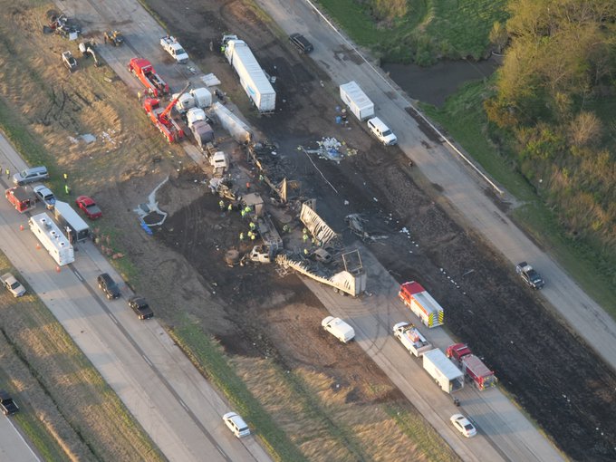
Overhead view of some of the wreckage on I-55.
Image courtesy of the Illinois State Police.
On May 1, multiple crashes occurred on I-55 near the Sangamon/Montgomery County line due to blowing dust reducing visibility to near zero. Illinois State Police reported 72 vehicles involved on both sides of the interstate between mile markers 76 and 78. There were seven fatalities, and 37 people were injured.
The satellite imagery below (click image to enlarge) is from the GOES-16 satellite, with the loop created by NOAA's Cooperative Institute for Meteorological Satellite Studies (CIMMS) at the University of Wisconsin. One of the satellite's 1-minute Mesoscale Domain Sectors happened to cover that area, and the loop contains minute by minute images between 11 am and 3 pm. This particular color scheme combines several different wavelength bands to highlight areas of dust. The dust is most noticeable in the pink bands that extend just south of Springfield (station KSPI) to Effingham (station K1H2), over parts of Sangamon, Montgomery, Christian, Shelby, and Effingham Counties. Clouds (shown in the red and greenish-yellow shades) cover up some of the extent of the dust.
The dust originated from freshly tilled and planted farm fields, and was kicked up by wind gusts of 35 to 45 mph. Winds increased further during the day, peaking at 54 mph at the Springfield airport at 3:42 pm.
Dust storms are more common in the Plains and southwestern U.S. They do not happen often in Illinois, but are most common around May and early June as farming activities continue to ramp up for the season. Some notable ones from central Illinois: