
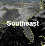
Record setting heat is expected over the next several days from the Intermountain West through the northern Plains. Furthermore, fire weather concerns increase with dry and breezy conditions. Meanwhile, heavy rainfall and severe thunderstorm threats for the Ohio/Tennessee Valleys, central Appalachians and Southeast today. The threat shifts to central Gulf Coast and across central Texas this week. Read More >
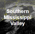
| GeoColor Channel | Southern Mississippi Valley View | CONUS View | Full Disk View | |
 |
 |
 |
||
| GeoColor | Small | Loop | Large | Small | Loop | Large | Small | Loop | Large | |
| Visible Channels | Southern Mississippi Valley View | CONUS View | Full Disk View | |
 |
 |
 |
||
| Visible Blue 0.47 μm (Band 1) | Small | Loop | Large | Small | Loop | Large | Small | Loop | Large | |
| Visible Red 0.64 μm (Band 2) | Small | Loop | Large | Small | Loop | Large | Small | Loop | Large | |
| Near Infrared (NIR) Channels | Southern Mississippi Valley View | CONUS View | Full Disk View | |
 |
 |
 |
||
| Veggie NIR Channel 0.86 μm (Band 3) | Small | Loop | Large | Small | Loop | Large | Small | Loop | Large | |
| Cirrus NIR Channel 1.37 μm (Band 4) | Small | Loop | Large | Small | Loop | Large | Small | Loop | Large | |
| Snow/Ice NIR Channel 1.6 μm (Band 5) | Small | Loop | Large | Small | Loop | Large | Small | Loop | Large | |
| Cloud Particle NIR Channel 2.2 μm (Band 6) | Small | Loop | Large | Small | Loop | Large | Small | Loop | Large | |
| Shortwave IR and Water Vapor Channels | Southern Mississippi Valley View | CONUS View | Full Disk View | |
 |
 |
 |
||
| Shortwave IR Channel 3.9 μm (Band 7) | Small | Loop | Large | Small | Loop | Large | Small | Loop | Large | |
| Upper Level Water Vapor Channel 6.2 μm (Band 8) | Small | Loop | Large | Small | Loop | Large | Small | Loop | Large | |
| Mid Level Water Vapor Channel 6.9 μm (Band 9) | Small | Loop | Large | Small | Loop | Large | Small | Loop | Large | |
| Lower Level Water Vapor Channel 7.3 μm (Band 10) | Small | Loop | Large | Small | Loop | Large | Small | Loop | Large | |
| Infrared (IR) Channels | Southern Mississippi Valley View | CONUS View | Full Disk View | |
 |
 |
 |
||
| Cloud Top IR Channel 8.4 μm (Band 11) | Small | Loop | Large | Small | Loop | Large | Small | Loop | Large | |
| Ozone IR Channel 9.6 μm (Band 12) | Small | Loop | Large | Small | Loop | Large | Small | Loop | Large | |
| Clean Longwave Window 10.3 μm (Band 13) | Small | Loop | Large | Small | Loop | Large | Small | Loop | Large | |
| Legacy Longwave Window 11.2 μm (Band 14) | Small | Loop | Large | Small | Loop | Large | Small | Loop | Large | |
| Dirty Longwave IR Window 12.3 μm (Band 15) | Small | Loop | Large | Small | Loop | Large | Small | Loop | Large | |
| Carbon Dioxide Longwave IR Window 13.3 μm (Band 16) | Small | Loop | Large | Small | Loop | Large | Small | Loop | Large | |


 Local Radar
 Weather Map