
Heat expands across the Desert Southwest, Plains, Mississippi Valley and Midwest into Monday. Fire weather concerns continue for portions of the Intermountain West. Active monsoonal moisture fuels thunderstorms over the Southwest with possible flash flooding. Tropical cyclone Fausto in the Pacific, should weaken as it approaches Hawaii; Dangerous surf, swells and rip currents are expected. Read More >
|
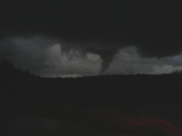
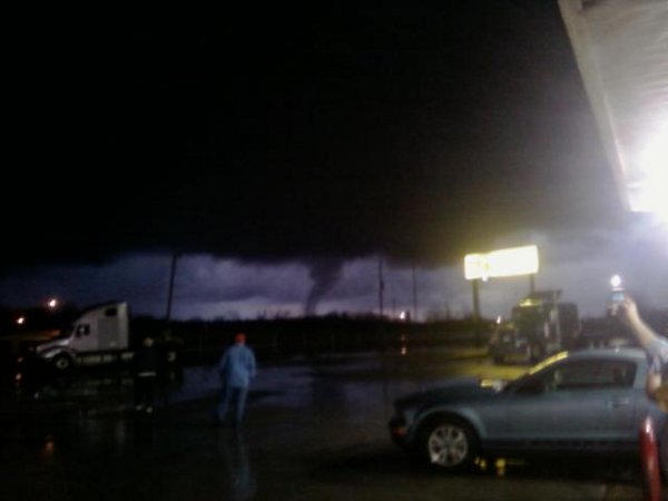
We've received several pictures and videos of the tornado, and associated storm structure, that moved across Madison County. If you have pictures or video you'd like to share with us, please email them to SR-HUN.Spotter@noaa.gov. Video
|
||||
| Huntsville Tornado Pictures
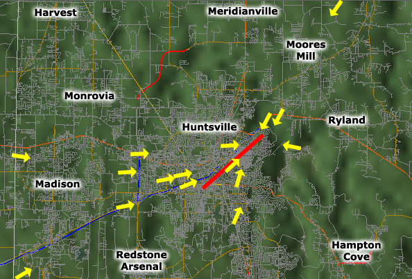
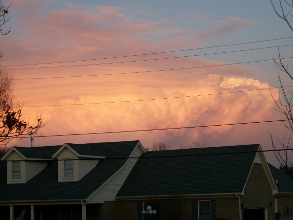
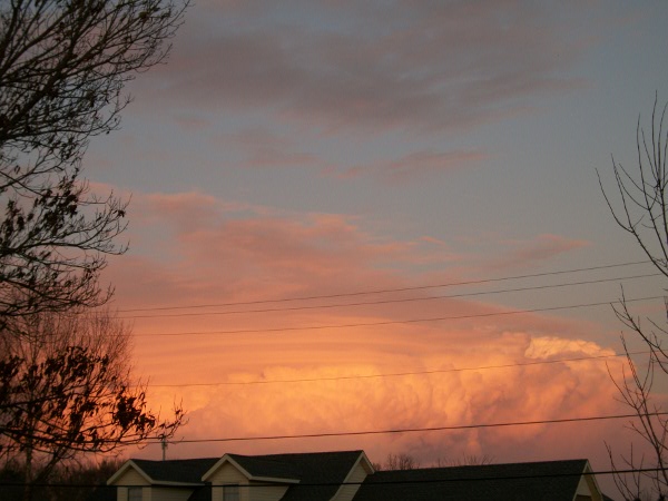
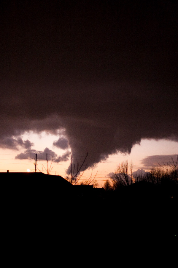
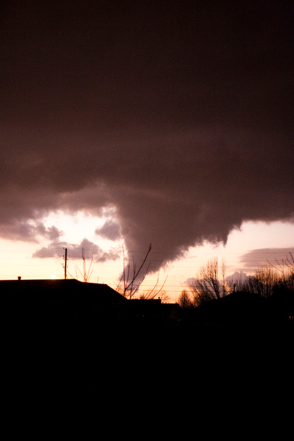
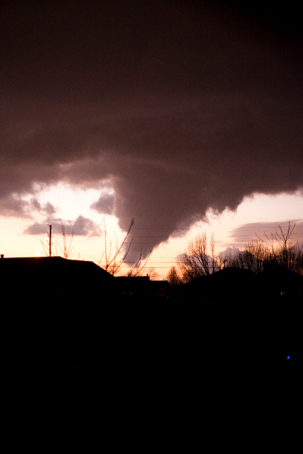
Due to very dry air in the mid levels of the atmosphere and a relatively high cloud base, the Huntsville tornado of January 21, 2010 was likely one of the most visible tornadoes in the history of the city of Huntsville. As a result, pictures of the tornado were taken from almost every conceivable angle. On the map below, the approximate tornado path is represented by a bold red line. The yellow arrows on the map represent locations where pictures were taken, with the arrows pointing in the general direction the camera was facing. To view the associated image(s), click on an arrow on the map. In addition, these pictures have been received of the thunderstorm that produced a tornado in Huntsville: |
||||
| Sewanee Tornado Pictures | ||||
|


 Local Radar
 Weather Map