|
...Period of Moderate to Heavy Rain Causes Minor River/Creek Flooding on 03/11-12/2015...
|
|
Summary:
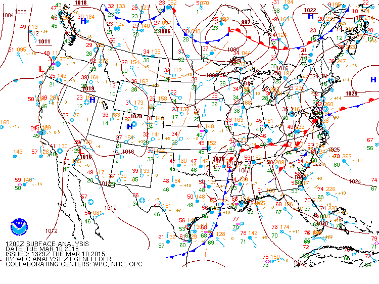
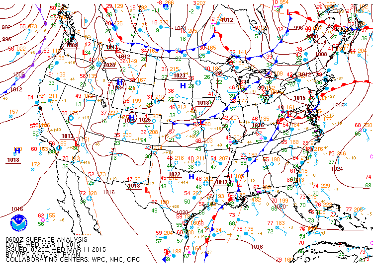
Successive days of rainfall beginning on March 8th, 2015 caused minor river flooding along a few tributaries of the Tennessee River in Northern Alabama. on March 11th and March 12th. As can seen below in the surface analysis at 7 am and midnight on March 10th, relatively warm and moist (dewpoints in the lower to mid 50s) air was in place over northern Alabama and southern middle Tennessee through this period. Lift associated with a frontal boundary and multiple disturbances that formed east of this front produced rounds of frequent and sometimes heavier rainfall.
|
|
|
|
7 AM March 10th Surface Analysis from the NWS Weather Prediction Center
|
Midnight March 10th Surface Analysis from the NWS Weather Prediction Center
|
|
|
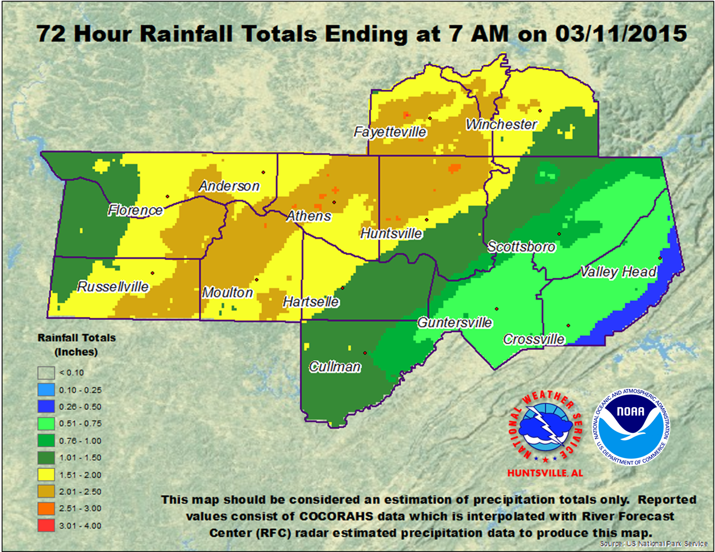
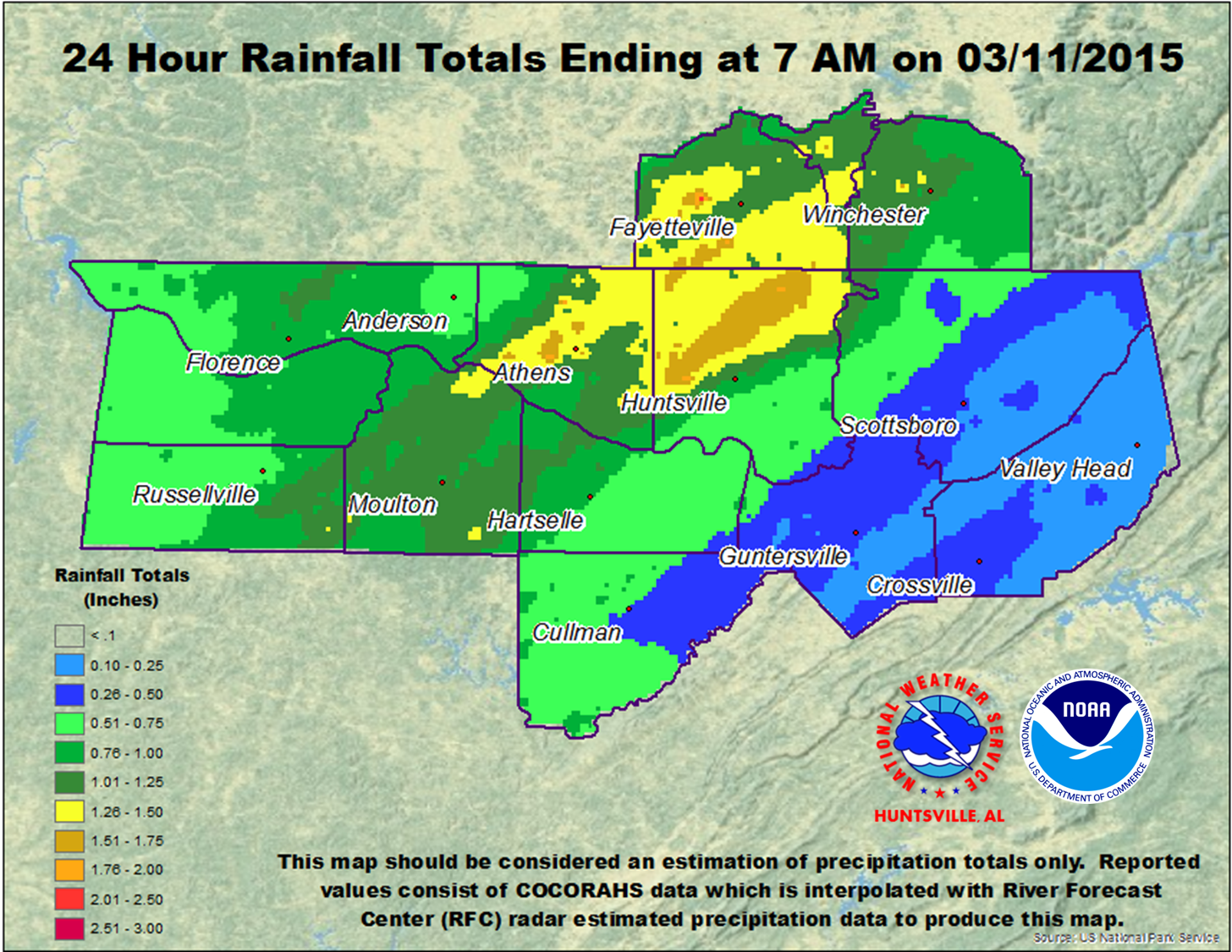
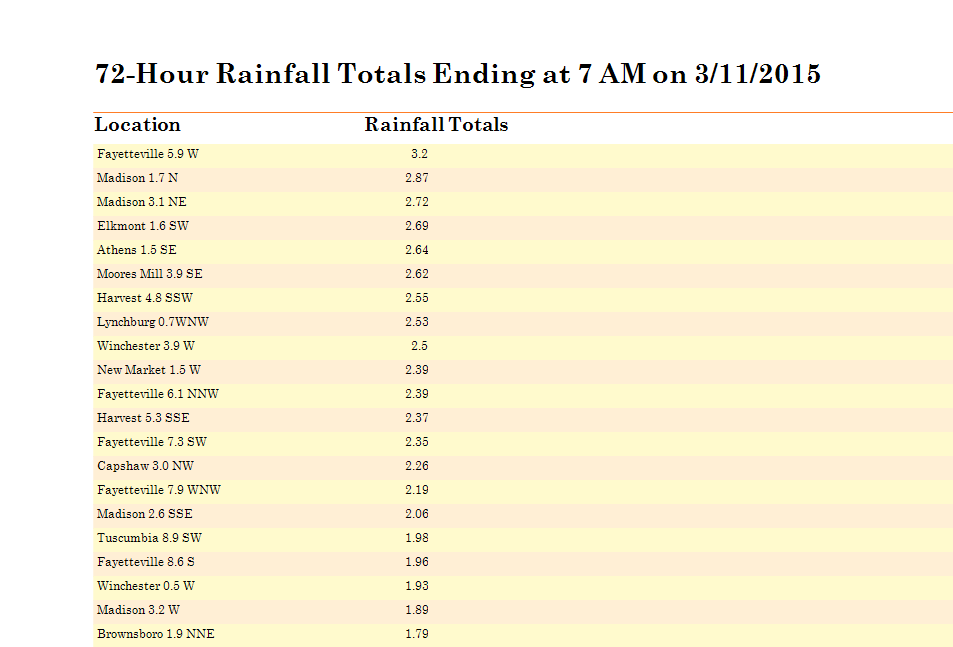
The first round started on Monday, March 8th and ended on the 10th, with areas of northwestern Alabama and Franklin county Tennessee receiving the most rainfall. Further east the heaviest rain fell Tuesday afternoon (March 10th) through Wednesday morning (March 11th). These two rounds combined to produce 2.5 to 3.5 inches of rainfall along a line from just north of Moulton in Lawrence county, through Athens through northern Madison County, and into Franklin county Tennessee. This produced minor river flooding at the following river forecast points in northern Alabama: Flint River at Brownsboro, Indian Creek at Madison, and Big Nance at Courtland.
|
|
|
|
Total (Three Day) Precipitation Through 7 AM (Sunday, March 8th 7 AM through Wednesday 7 AM)
|
Second round of rainfall (Tuesday 7 AM through Wednesday 7 AM) .
|
|
|
|
|
Click on the Image Below For a PDF of More Rainfall Observations
|
 |