| Summary: |
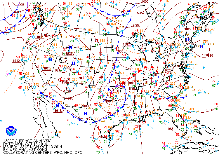
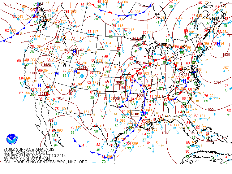
| A strong cold front over Texas and eastern Oklahoma brought heavy rainfall and strong to severe storms to much of the southeast on October 13th, 2014. The low pressure system associated with this system at 7 AM on Monday, October 13, 2014, was located over eastern Oklahoma with a cold front extending south of the low into western Arkansas. A line of strong to severe storms developed ahead this front and pushed quickly east during the day on Monday producing numerous areas of wind damage along it's path in Louisiana, Arkansas, and Mississippi by 4 pm. |
 |
 |
|
Surface analysis at 7 am on Monday, October 13, 2014 with a potent surface low over Oklahoma and a cold front extending southwest into eastern Texas.
|
Surface analysis at 4 pm on Monday, October 13, 2014 as the squall line (indicated by the red dots and lines ahead of the cold front) pushing into northeastern Mississippi.
|
|
|
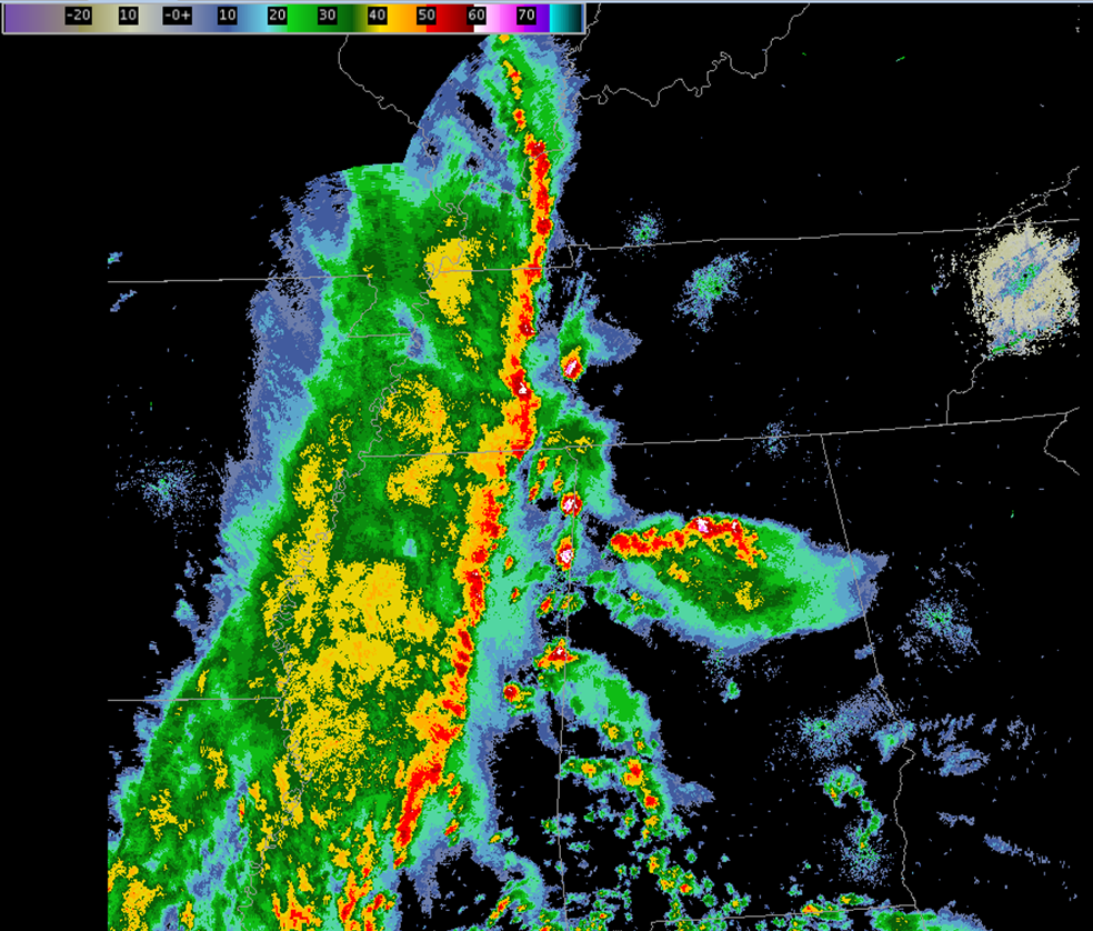
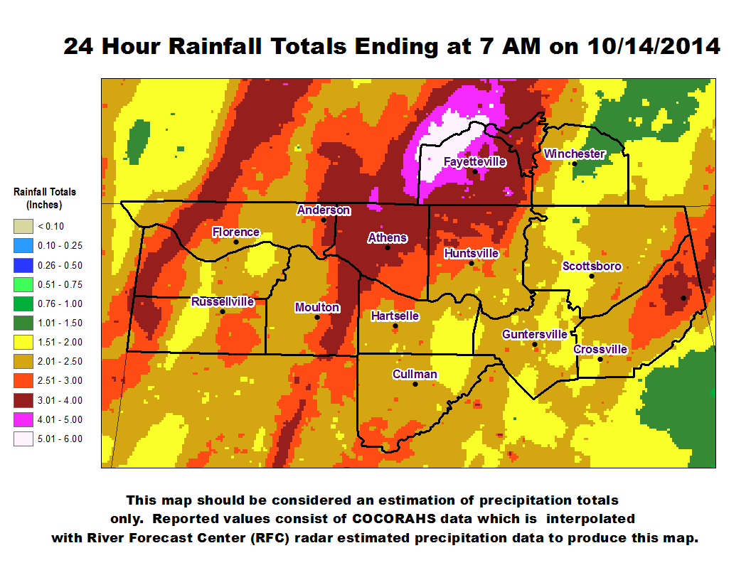
By the late afternoon hours this squall line pushed into eastern Mississippi and was approaching northwestern Alabama. At the same time additional strong to severe thunderstorms pushed north from southern/central Alabama and into northern Alabama ahead of this line. Much of the wind damage seen across Lawrence, Cullman, Morgan, Limestone, and Madison counties in northern Alabama was produced by these storms ahead of the main squall line. The squall line and storm system slowed its eastward movement overnight and by early Tuesday morning 2-6 inches of rainfall was reported across much of northern Alabama and Southern Middle Tennessee (Particularly hard hit were locations in eastern Lawrence (AL), Limestone (AL), northern Madison (AL), western Morgan (AL), Lincoln (TN), and Moore (TN) counties.
|
 |
 |
|
Composite Radar Image at 4:18 pmshowing a large squall line approaching northwest Alabama and additional storms moving north ahead of it into northern Alabama.
|
A map of 24-hour rainfall totals ending on 10/14/2014 at 7 am. Two to six inches of rainfall were observed in many locations.
|
|
|
|
|
|
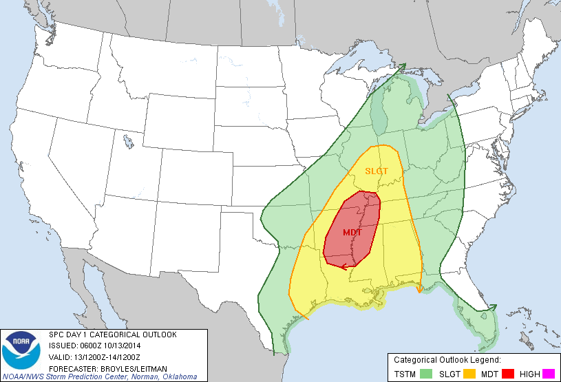
Day 1 Storm Prediction Center
Outlook Issued at 7 AM on October 13th, 2014
|
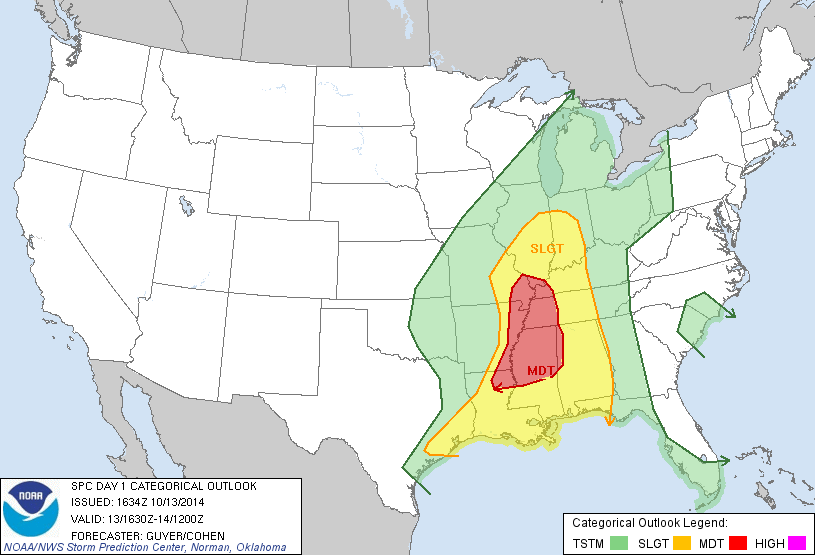
Updated Day 1 Storm Prediction Center
Outlook Issued at 10:30 AM on October 13th, 2014
|
|
|
|
|
|
|