
Record setting heat is expected over the next several days from the Intermountain West through the northern Plains. Furthermore, fire weather concerns increase with dry and breezy conditions. Meanwhile, heavy rainfall and severe thunderstorm threats for the Ohio/Tennessee Valleys, central Appalachians and Southeast today. The threat shifts to central Gulf Coast and across central Texas this week. Read More >
Recap of Heavy Rainfall June 16-18, 2013 |
||||||||||||||||||||||||||||||||||||||||||||||||
|
A complex weather pattern brought heavy rainfall to to portions of the Tennessee Valley Sunday, June 16th through Tuesday, June 18th. A series of disturbances embedded in westerly flow interacted with a unstable and moist atmosphere to produce between 2 and 6 inches of rainfall over portions of the Tennessee Valley. Below is a table of some of the rainfall totals across the Huntsville Forecast Area. Some additional rainfall fell that is not reflected in the table below between 7 am on Tuesday through 7 pm on Tuesday. |
||||||||||||||||||||||||||||||||||||||||||||||||
|
||||||||||||||||||||||||||||||||||||||||||||||||
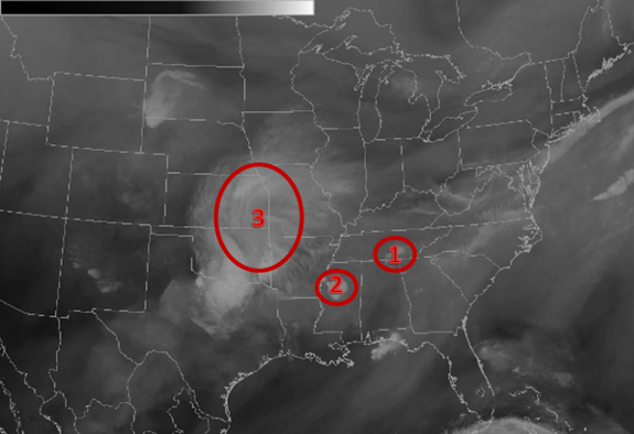
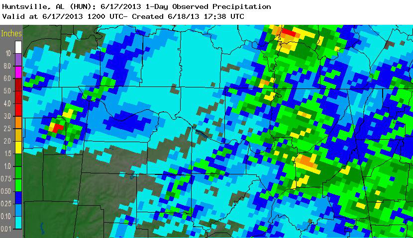
| These disturbances can be seen in the water vapor imagery seen below on the left and are noted by the red circles. The first upper level disturbance (labeled 1) in the water vapor image on the left produced 1 to 3 inches of rainfall east of interstate 65 and in Southern Middle Tennessee Sunday night into Monday morning (June 17). Below on the right is an image of the rainfall during this period. | ||||||||||||||||||||||||||||||||||||||||||||||||
|
||||||||||||||||||||||||||||||||||||||||||||||||
Additional Heavy Rainfall Occurred the Afternoon of the 17th Through the morning of the 18th |
||||||||||||||||||||||||||||||||||||||||||||||||
|
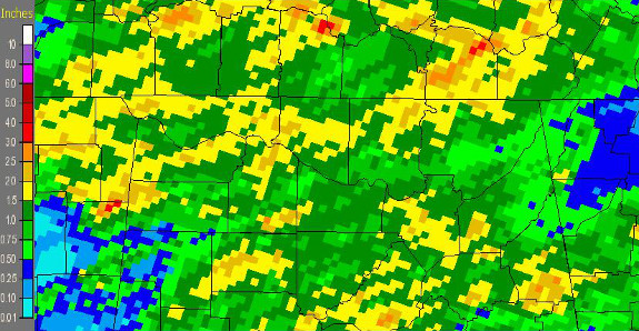
Over the next 36 hours disturbances labeled 2 and 3 in the water vapor imagery shown above on the left continued to push east across northern Alabama and Southern Middle Tennessee producing more heavy rainfall. Below is the precipitation that occurred Monday at 7 am and ended on Tuesday at 7 am associated disturbances labeled 2 and 3 in the water vapor imagery. |
||||||||||||||||||||||||||||||||||||||||||||||||
|
|
||||||||||||||||||||||||||||||||||||||||||||||||


 Local Radar
 Weather Map
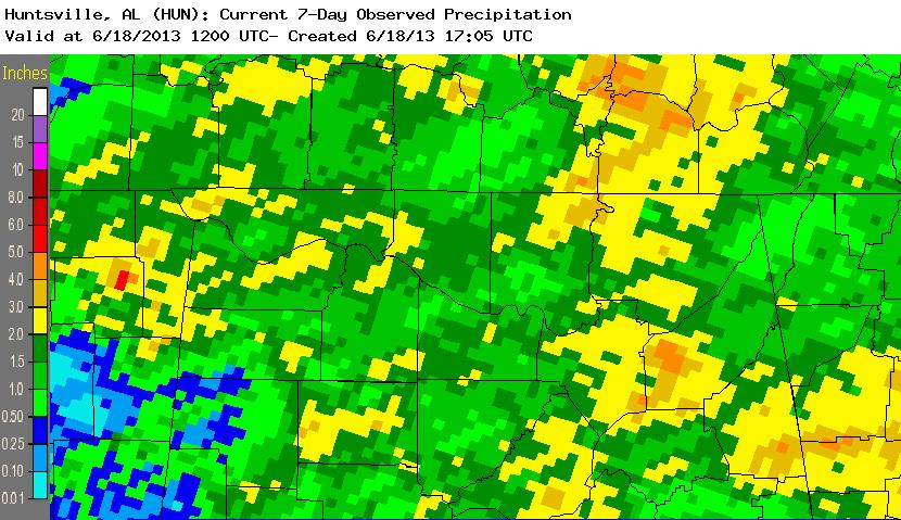