
Heat expands across the Desert Southwest, Plains, Mississippi Valley and Midwest into Monday. Fire weather concerns continue for portions of the Intermountain West. Active monsoonal moisture fuels thunderstorms over the Southwest with possible flash flooding. Tropical cyclone Fausto in the Pacific, should weaken as it approaches Hawaii; Dangerous surf, swells and rip currents are expected. Read More >
|
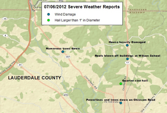
07/06/2012 Severe Weather Summary
Click here to see more details about the severe weather reports received. More Needed Rainfall also Fell
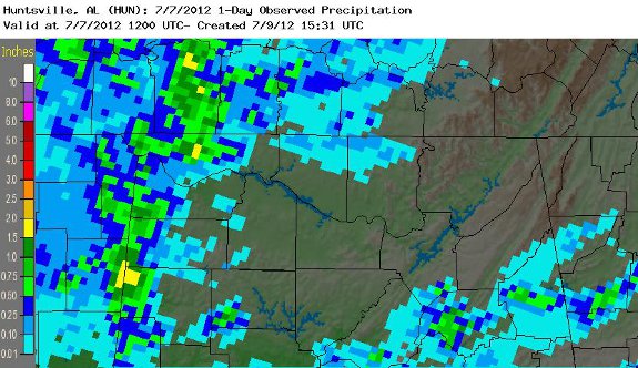
The strong to severe storms did bring another quick shot of needed rainfall to northwestern portions of northern Alabama, mainly near the AL/MS state line. One to two inches of rainfall were the highest amounts received, mainly in the Florence and Petersville communities. Further south in Colbert and Franklin counties in Alabama, rainfall amounts were generally between 0.50 and 1.5 inches. Below are rainfall totals starting on July 6th at 7 am and ending at 7 am on July 7th.
|


 Local Radar
 Weather Map