
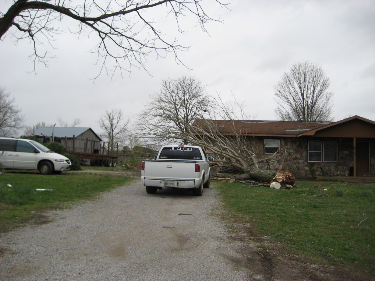
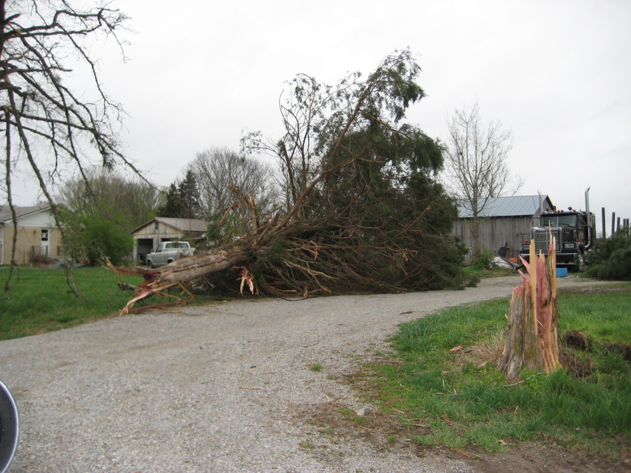
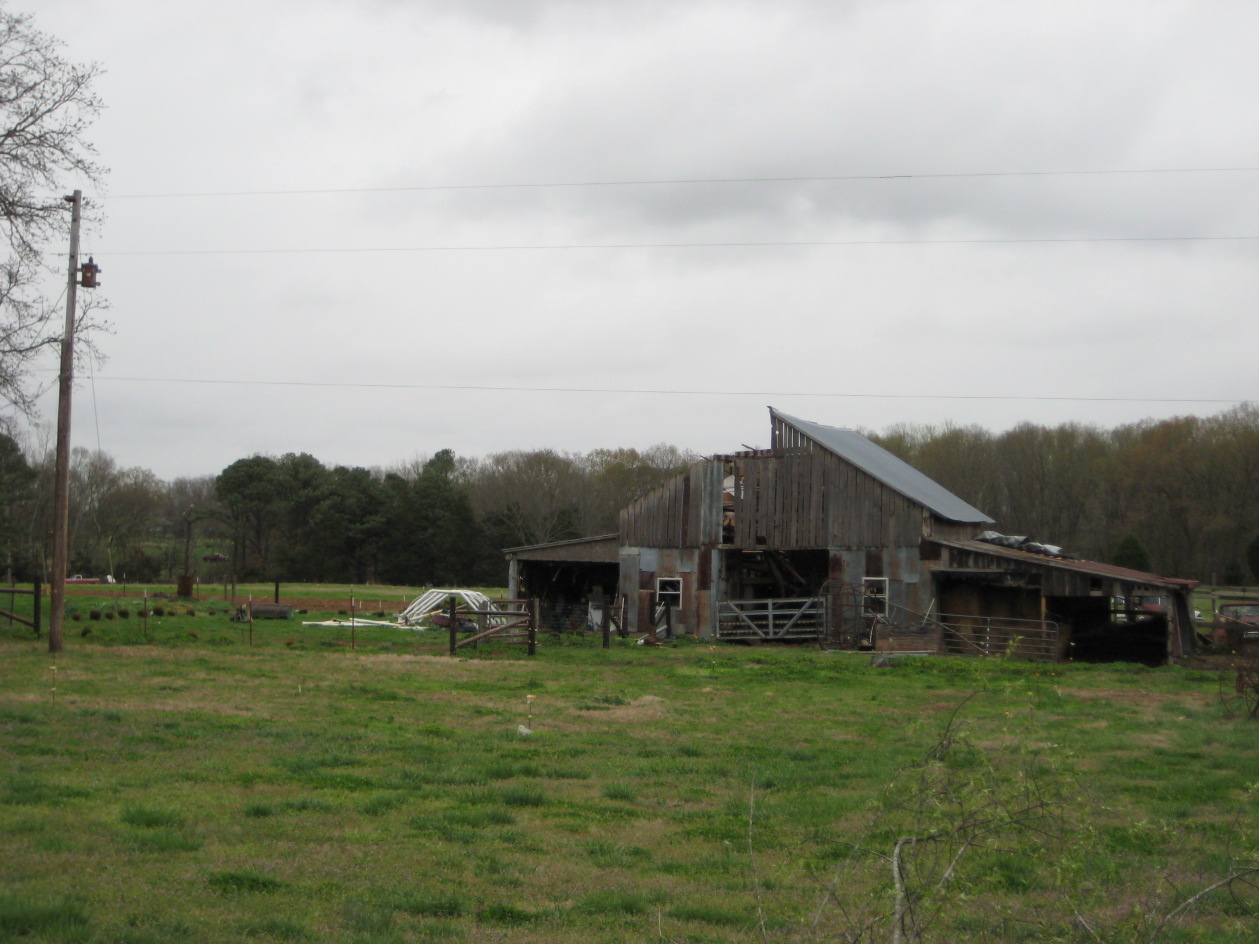
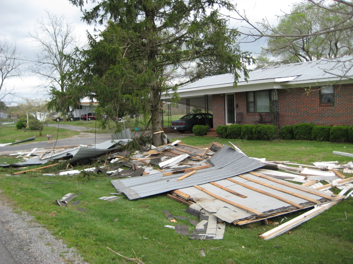
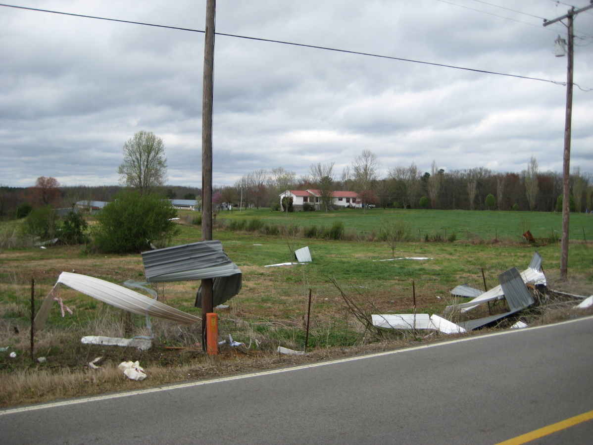
Extremely critical fire weather concerns for portions of the southern High Plans as strong wind and very dry conditions could result in rapid spread of any fires. Meanwhile, severe thunderstorms are expected once again across areas of the Central and Southern Plains, then spreading in the Mississippi Valley regions on Monday. Damaging winds, very large hail and strong tornadoes are possible. Read More >


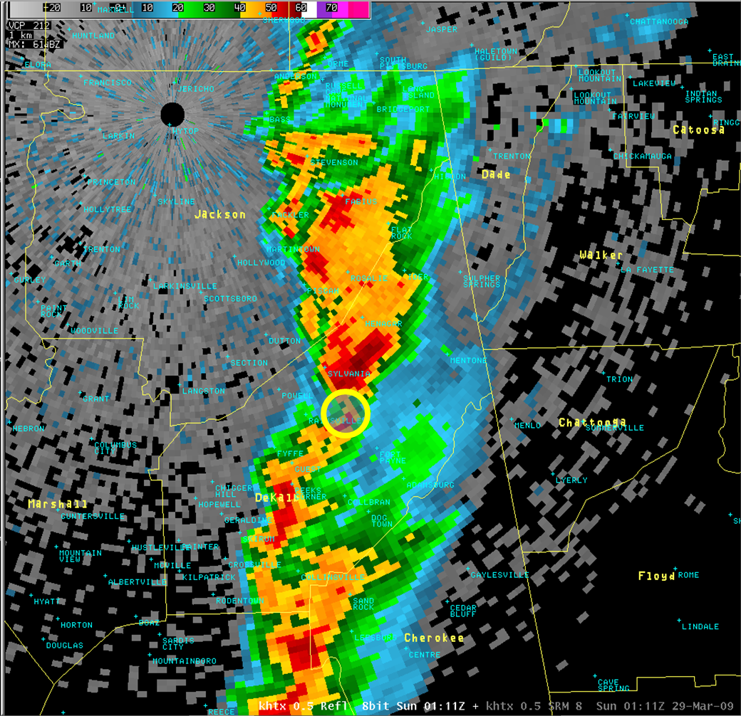
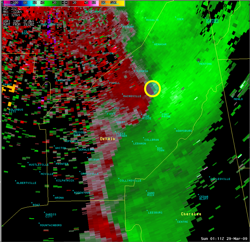
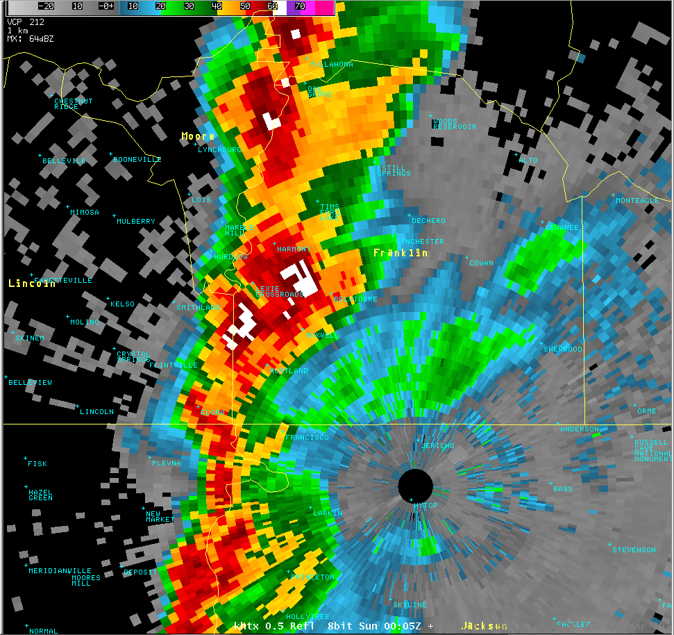
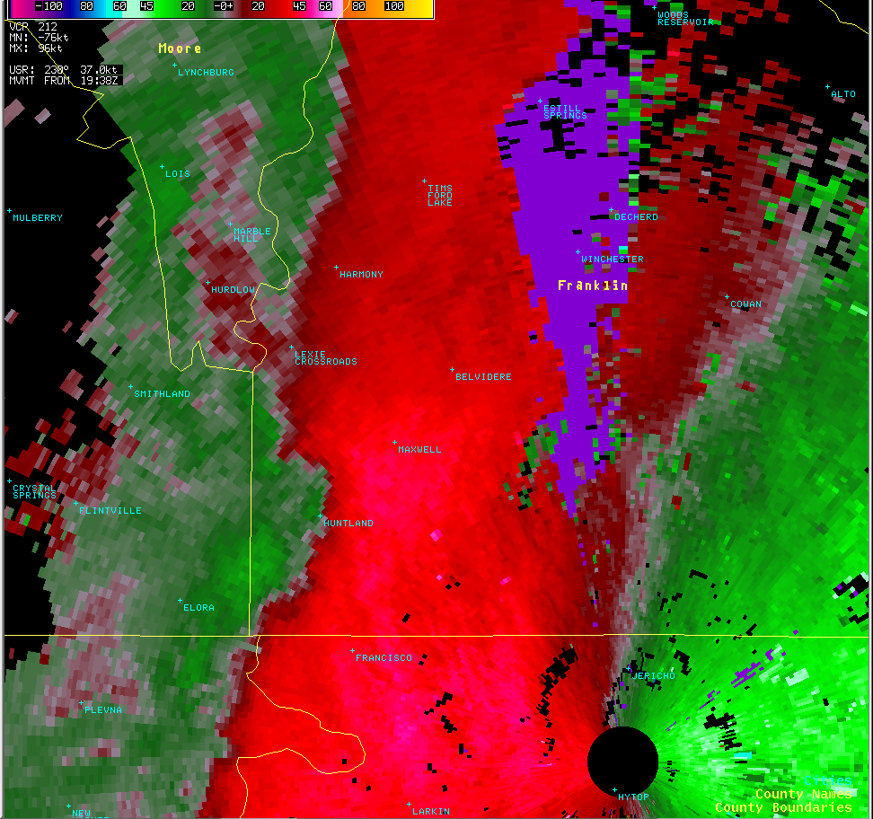
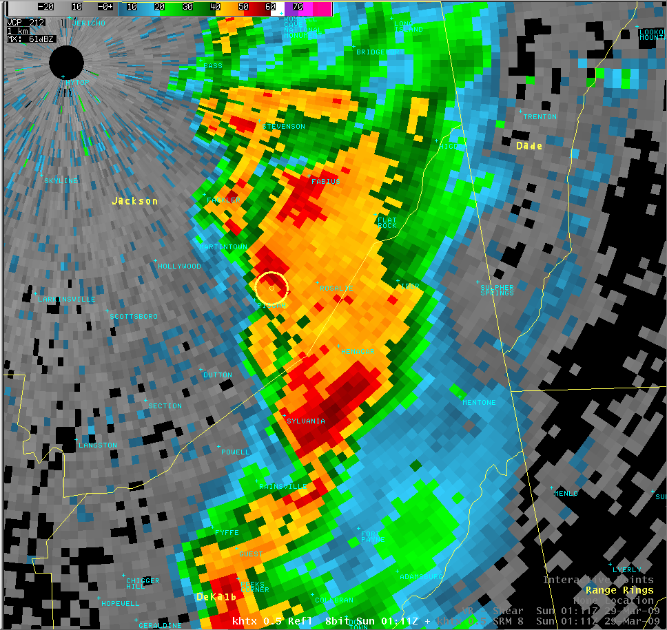
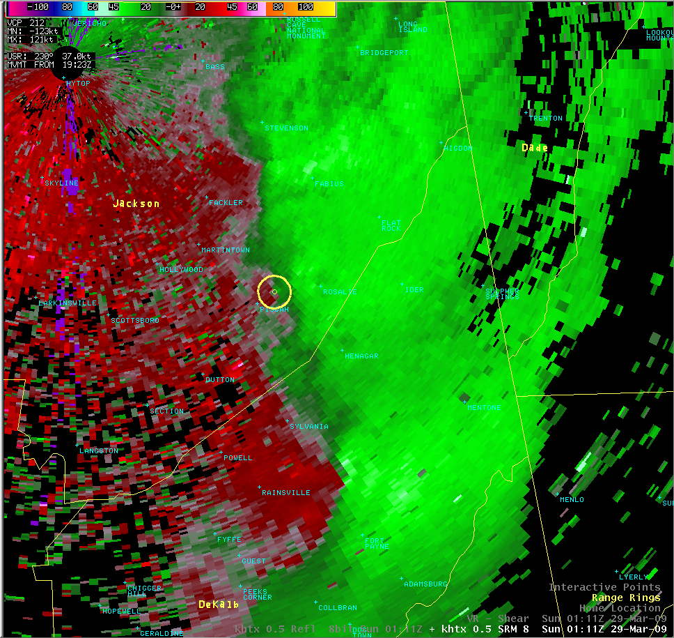
 Local Radar
 Weather Map