National Weather Service United States Department of Commerce

Nor'Easter Continues to Bring Heavy Rain and Coastal Impacts; Nolo Continues to Impact Hawaii

The nor’easter will weaken tonight, easing beach conditions and coastal flooding, though locally heavy rain will continue in parts of the Mid-Atlantic and New England into Monday. Hurricane Nolo continues to bring strong winds and large waves to Hawaii. A multi-day rain event will return to the Four Corners region Monday and expand to the south-central U.S. by midweek. Read More >

Preliminary Storm Survey Information
 
Storm surveys have been completed examining storm damage that occurred in the afternoon hours on Tuesday, May 20th.  Information found in these surveys is described below. All tornado ratings are using the Enhanced Fujita Scale.

Southern DeKalb County
Rating EF-0 Peak Wind 120 mph
Path Length 1/4 mile Peak Path Width 20 yards

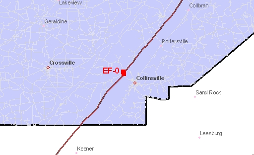
Survey Map
A supercell thunderstorm produced hail up to golfball sized, a swath of straight-line winds up to 80 miles per hour, and a brief weak tornado across southern DeKalb County. Wind damage consistent of a brief weak tornado were found along County Road 51 about 1/2 mile northeast of state highway 68. The tornado snapped large tree branches at a residence, then tracked into a grassy field where convergent patterns were found. The tornado downed a couple of trees along nearby Interstate 59. Straight-line winds just south of the intersection of County Roads 246 and 28 downed, snapped, or uprooted a few trees, destroyed a large chicken barn, and tore a portion of a roof off a trailer home. Other trees or large tree limbs were downed in and near Crossville and Collinsville along the Highway 68 corridor. The storm moved into adjacent Cherokee County also producing wind damage and large hail in the community of Sand Rock.

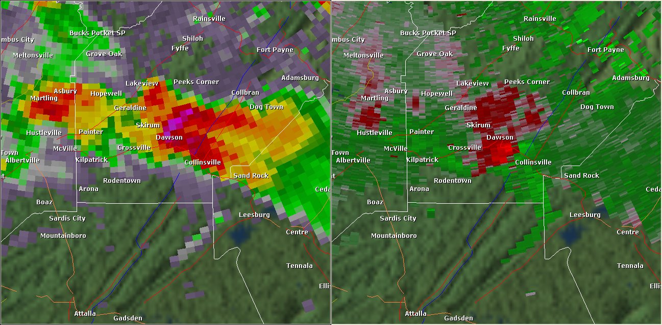
This National Weather Service radar image from 4:48pm shows a tight velocity couplet just northwest of Collinsville in southern DeKalb County. The base reflectivity product in the left panel shows rainfall intensity. The storm relative velocity product in the right panel shows winds toward (in green) and away (in red) from the radar in Hytop, AL.