Limestone/Madison Counties, AL
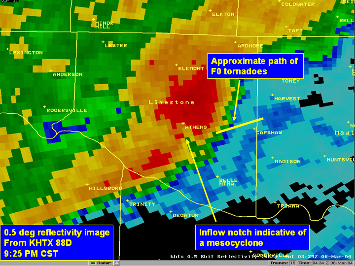
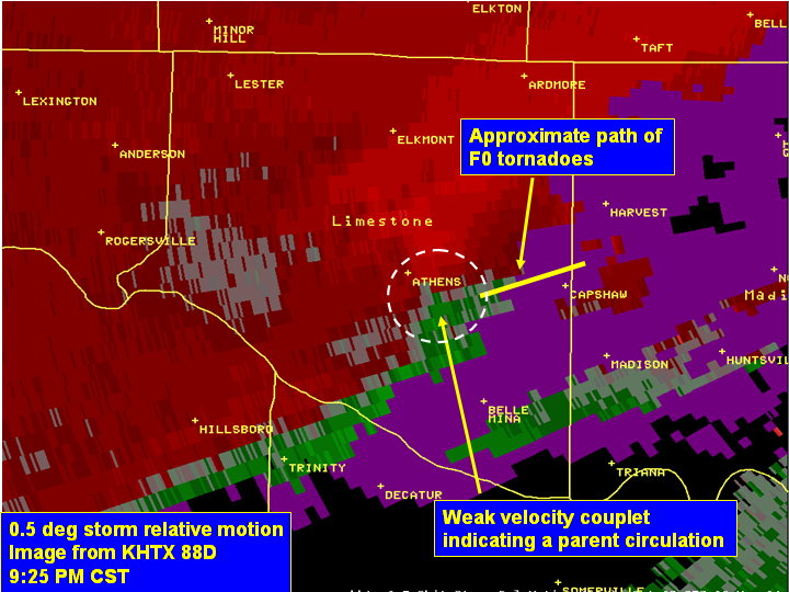
Based on a post-event storm survey completed by NWS Huntsville Science Operations Officer (SOO), Tom Bradshaw, a weak F0 tornado touched down in Limestone county in association with a supercell. The tornado first touched down approximately 6.5 miles east-southeast of Athens, near the intersection of Highway 72 and Mooresville Rd. The approximate time of touchdown was 928 pm CST. The tornado tracked east-northeast for approximately two miles. The tornado lifted at this point (just southeast of East Limestone School).
A second tornado touched down a short time later (at approximately 9:35 pm CST), on the southeast corner of the Limestone Correctional Institute. This tornado tracked northeast into extreme western Madison county, and lifted just east of the intersection of Orville Road and Old Railroad Bed Road. Estimated path width was 75 yards. Damage was principally confined to the roof and one wall of a wooden outbuilding at the Limestone Correctional Institute, a few isolated downed pine trees, and damage to some shingles and eave facings. The two brief F-0 tornadoes had winds estimated at 60 mph through their life span.
|


 Local Radar
 Weather Map