
Heat expands across the Desert Southwest, Plains, Mississippi Valley and Midwest into Monday. Fire weather concerns continue for portions of the Intermountain West. Active monsoonal moisture fuels thunderstorms over the Southwest with possible flash flooding. Tropical cyclone Fausto in the Pacific, should weaken as it approaches Hawaii; Dangerous surf, swells and rip currents are expected. Read More >
|
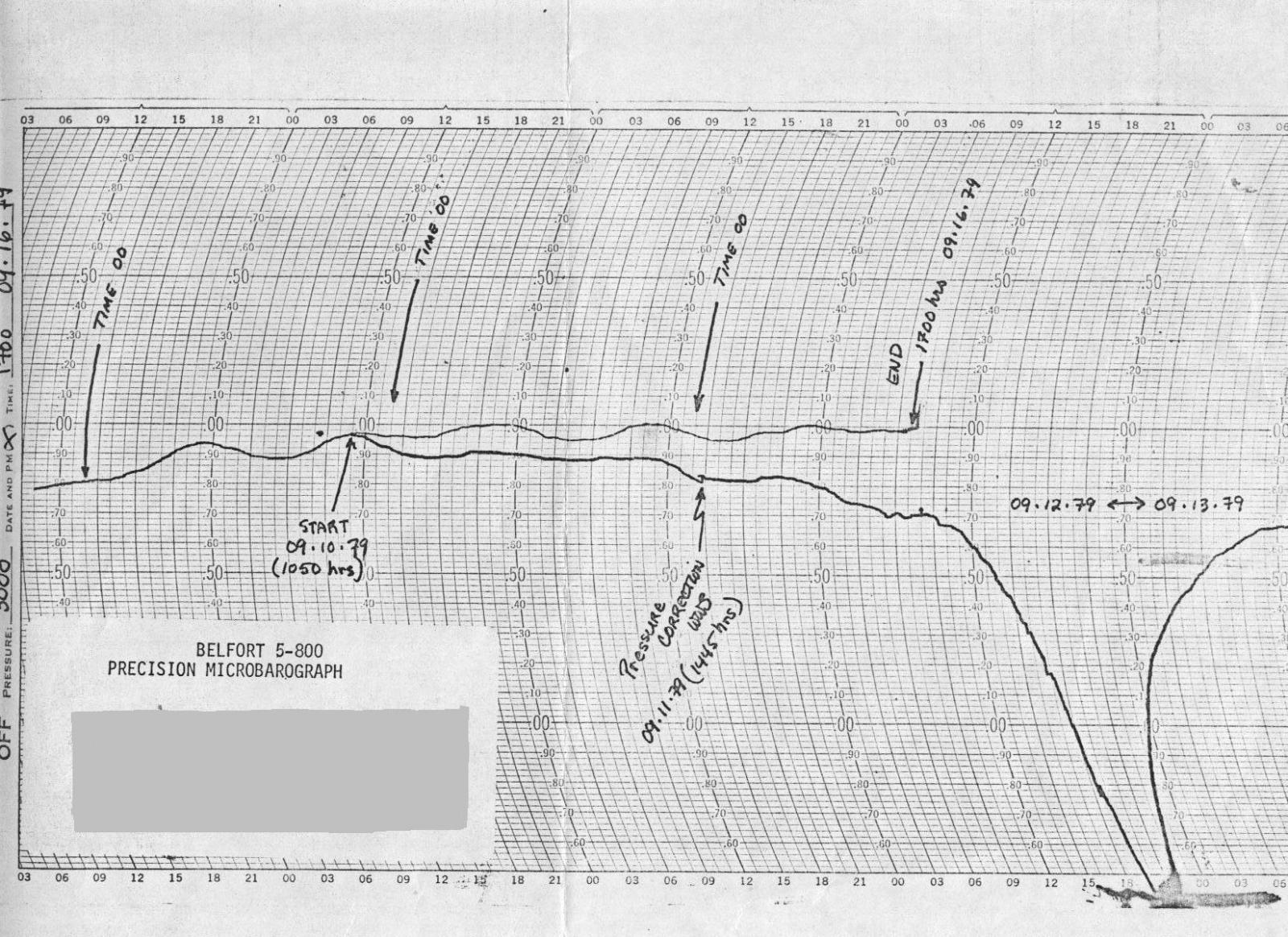
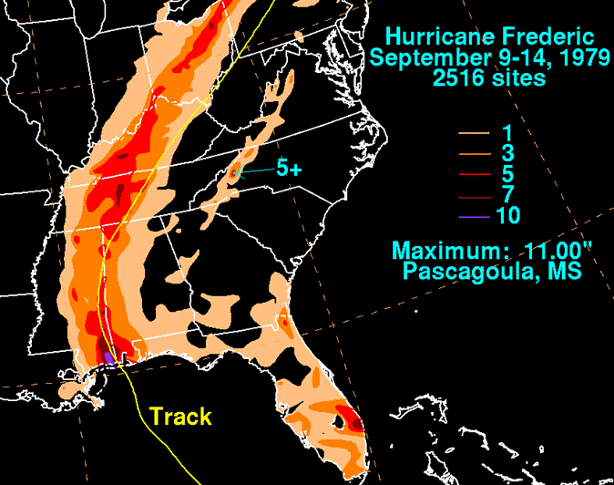
Forming from a tropical wave on the west African coast late on August 27th, there was little to distinguish this storm from any other. But by the morning of August 30th, Frederic gained hurricane strength and began barrelling for the Carribean Sea. Frederic made landfall in Alabama on the evening of September 12th over Dauphin Island, affecting southern Mississippi, southern Alabama, and the western Florida panhandle with the worst conditions (including 8 to 12 inches of rainfall. Wind gusts of 135 mph was measured on the bridge from Dauphin Island. |
||||||
 |
||||||
|
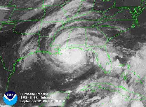
Below are visible satellite images of Hurricane Frederick from NOAA archives. |
||||||
|
||||||
|
Although less significant, portions of northern Alabama also experienced tropical storm force wind gusts and heavy rainfall between 2 to 6 inches of rainfall. 2-4 inches fell along the track all the way to New England, but there were no reported cases of flooding with Frederick anywhere in the United States. |
||||||
 |
||||||


 Local Radar
 Weather Map