
Heat expands across the Desert Southwest, Plains, Mississippi Valley and Midwest into Monday. Fire weather concerns continue for portions of the Intermountain West. Active monsoonal moisture fuels thunderstorms over the Southwest with possible flash flooding. Tropical cyclone Fausto in the Pacific, should weaken as it approaches Hawaii; Dangerous surf, swells and rip currents are expected. Read More >
Event Summary |
||||
|
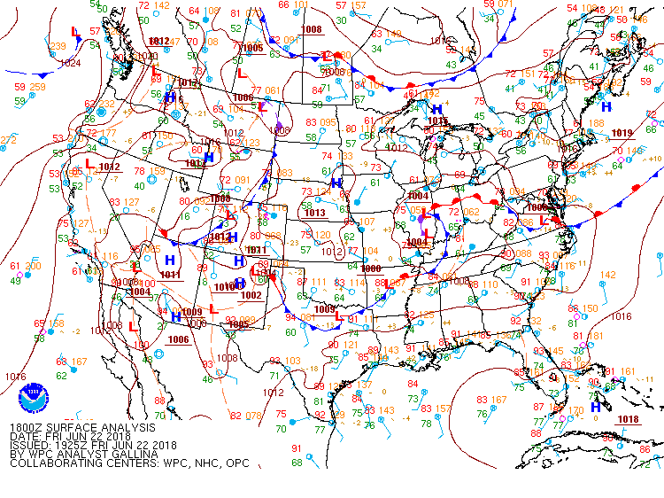
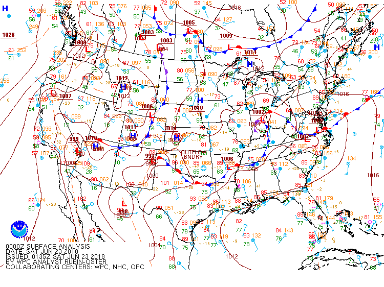
An upper-level low pressure system moved into the Ohio Valley on Friday morning, gradually devolving into an open wave by the evening hours as it shifted into the Central/Southern Appalachians. This storm system brought some stronger wind shear and jet energy into the Tennessee Valley, than what is typically observed for mid to late June in Alabama. Additionally, a very moist air mass was in place further south of this low pressure area, where a pre-frontal trough axis extended southwest into across portions of Middle Tennessee into Northwest Alabama. This moist, unstable air mas created an environment favorable for more intense, organized strong to severe thunderstorms capable of damaging winds and a few isolated tornadoes. |
||||
|
||||
|
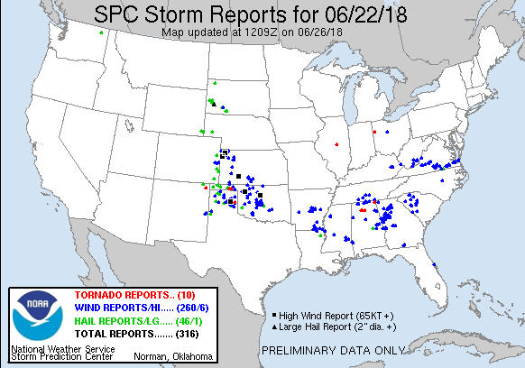
As heating occurred during the morning hours on Friday, instability values increased significantly by early afternoon, and strong to severe thunderstorms developed along near and ahead of this pre-frontal boundary (especially near and north of the AL/TN border). This thunderstorm activity produced damaging winds, small hail, and frequent lightning. |
||||
|
||||
|
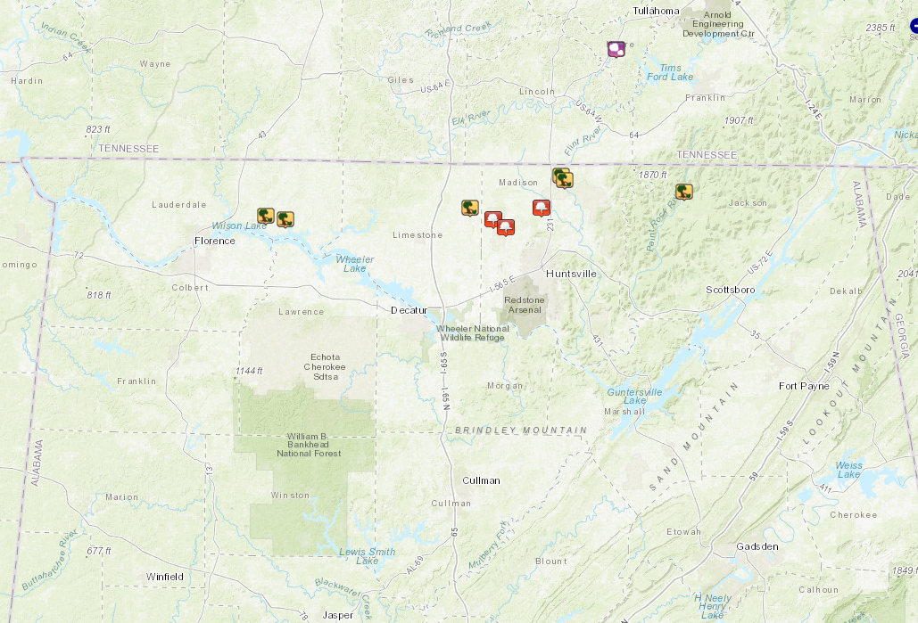
Later in the evening, the primary surface cold front sagged southeast temporarily into northern Alabama, before lifting back to the northwest late Friday evening. This feature served as a focus for severe thunderstorms, locally increased wind shear and helicity values. These conditions, combined with a moderately unstable environment present, helped produce additional severe thunderstorms Friday evening and assisted in the process of tornadogenesis. A strong EF-2 tornado was documented in Cullman County and an EF-1 tornado was documented in Jackson and DeKalb Counties. |
||||
|
||||
|
|
||||
|
|
||||
|
Jones Chapel
|
Track Map 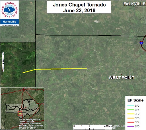 |
||||||||||||||||||||||||||
|
|
|||||||||||||||||||||||||||
|
Higdon, AL
|
Track Map 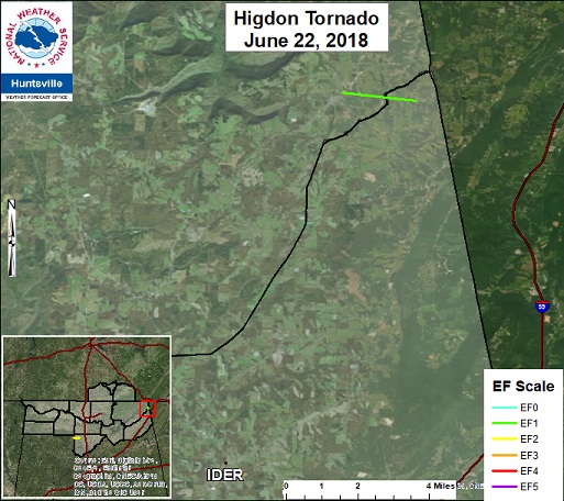 |
||||||||||||||||||||||||||
|
|
|||||||||||||||||||||||||||
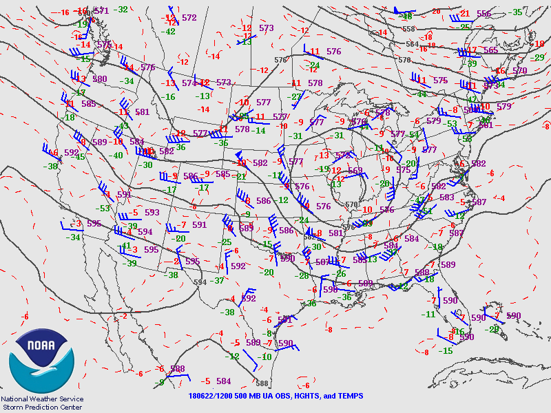
500mb Chart at 7am June 22nd |
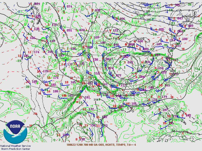
700mb Chart at 7am June 22nd |
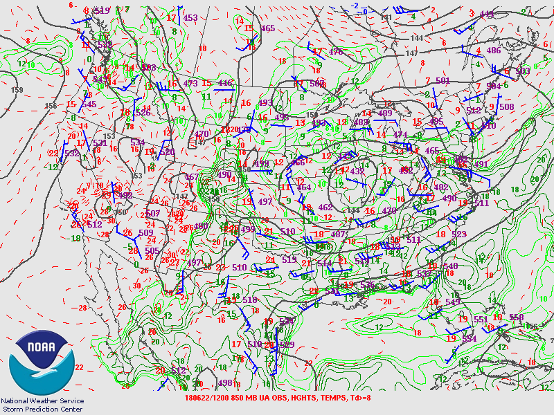
850mb Chart at 7am June 22nd |
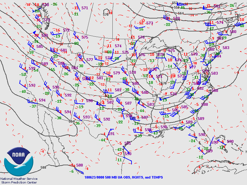
500mb Chart at 7pm June 22nd |
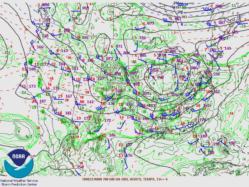
700mb Chart at 7pm June 22nd |
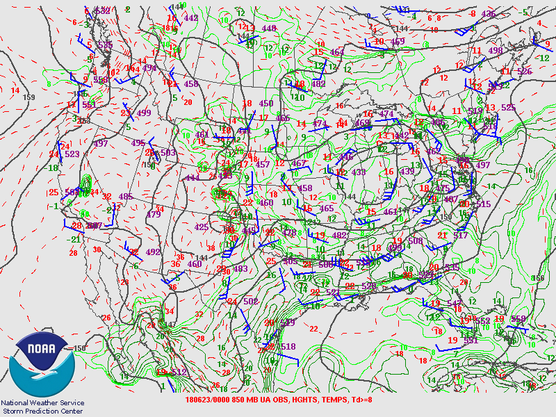
850mb Chart at 7pm June 22nd |
| Back to the Top of the Page |
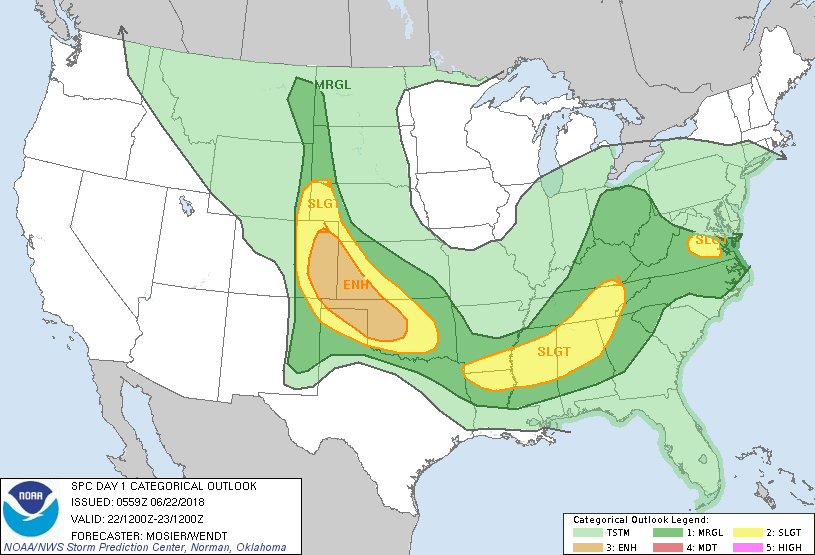
Day 1 Outlook |
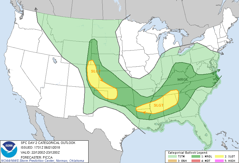
Day 2 Outlook |
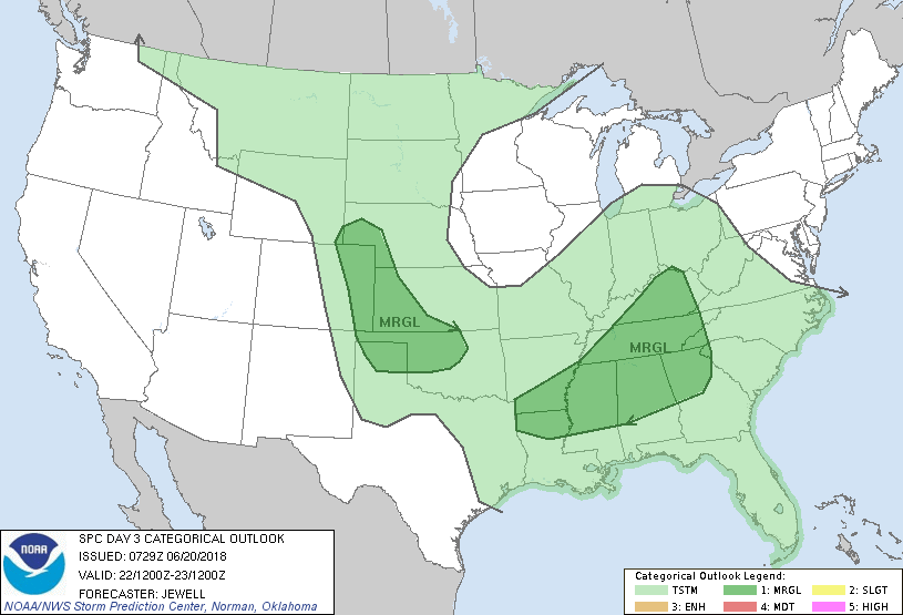
Day 3 Outlook |
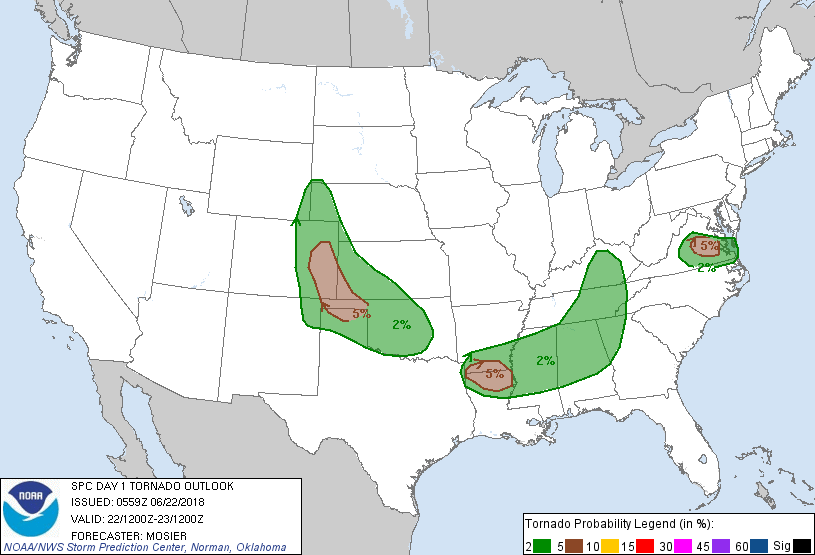
Day 1 Tornado Probability |
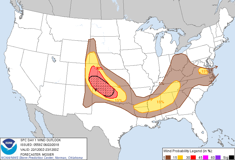
Day 1 Wind Probability |
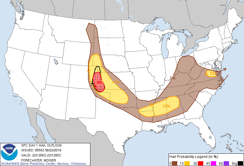
Day 1 Hail Probability |
| Back to the Top of the Page |


 Local Radar
 Weather Map