
The nor’easter will weaken tonight, easing beach conditions and coastal flooding, though locally heavy rain will continue in parts of the Mid-Atlantic and New England into Monday. Hurricane Nolo continues to bring strong winds and large waves to Hawaii. A multi-day rain event will return to the Four Corners region Monday and expand to the south-central U.S. by midweek. Read More >
|
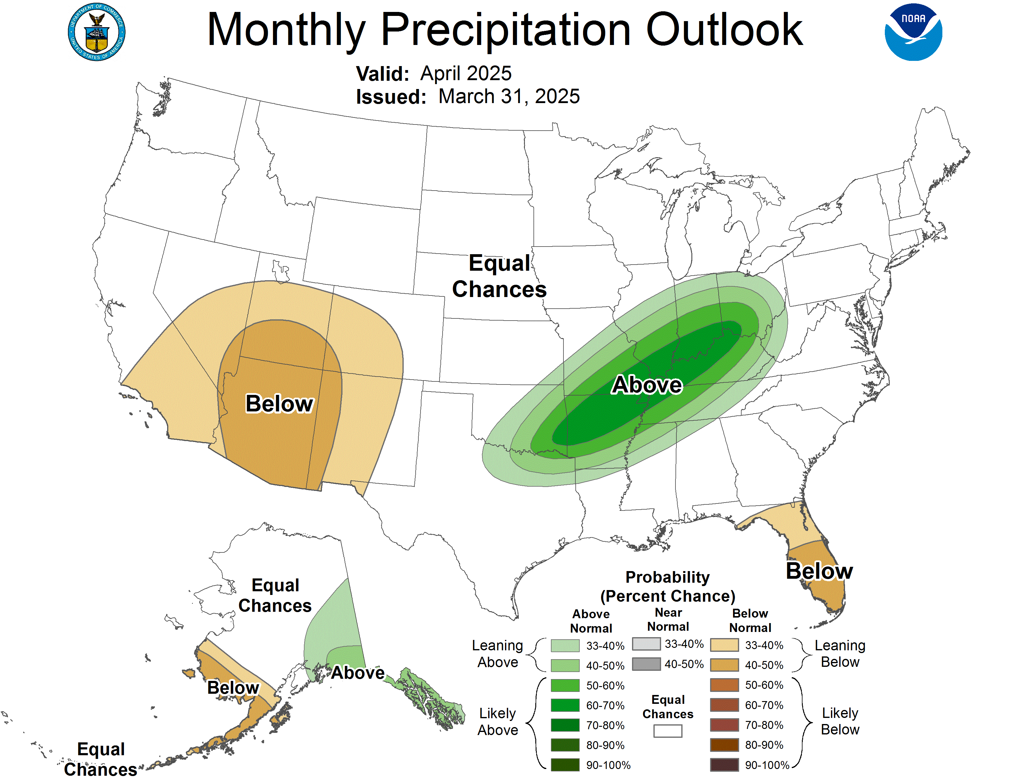
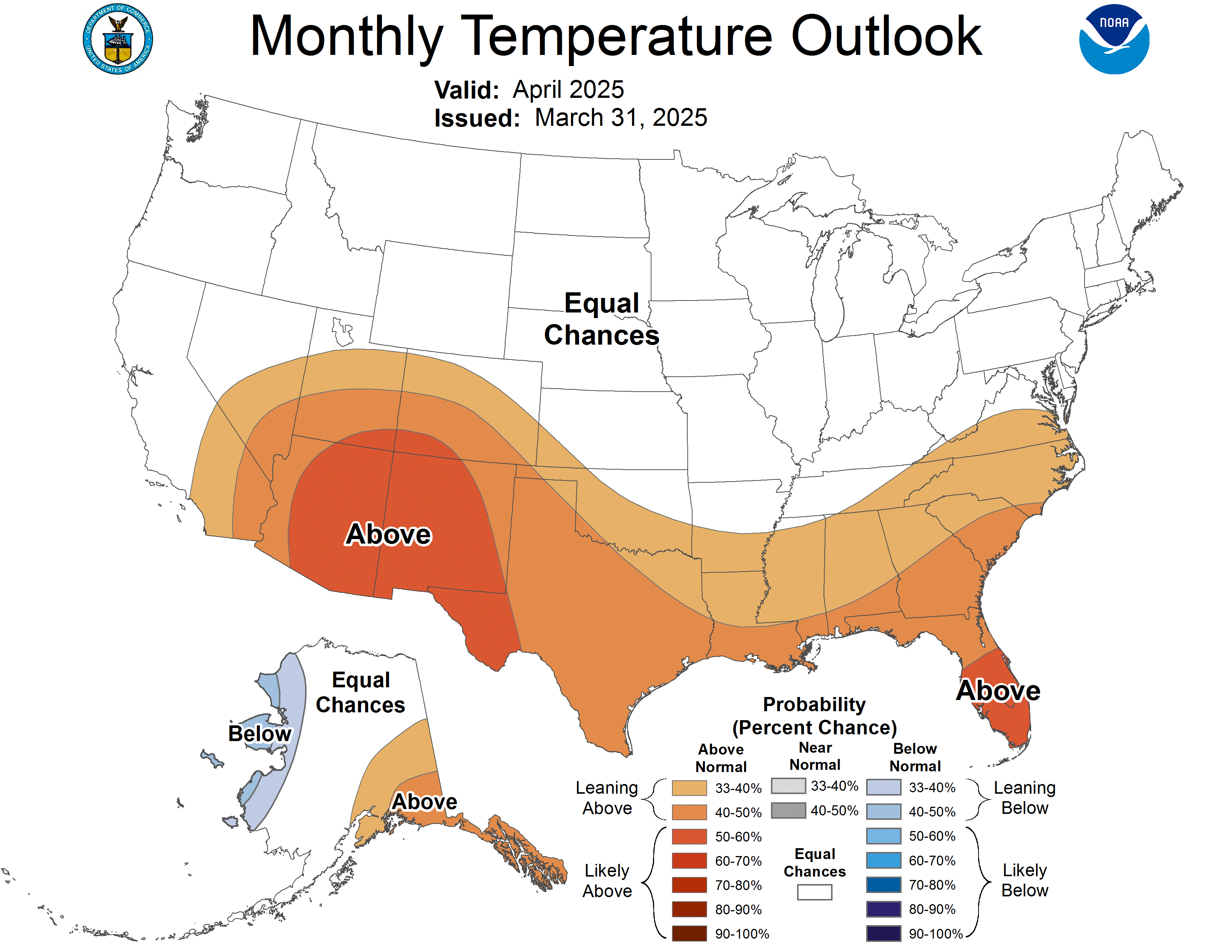
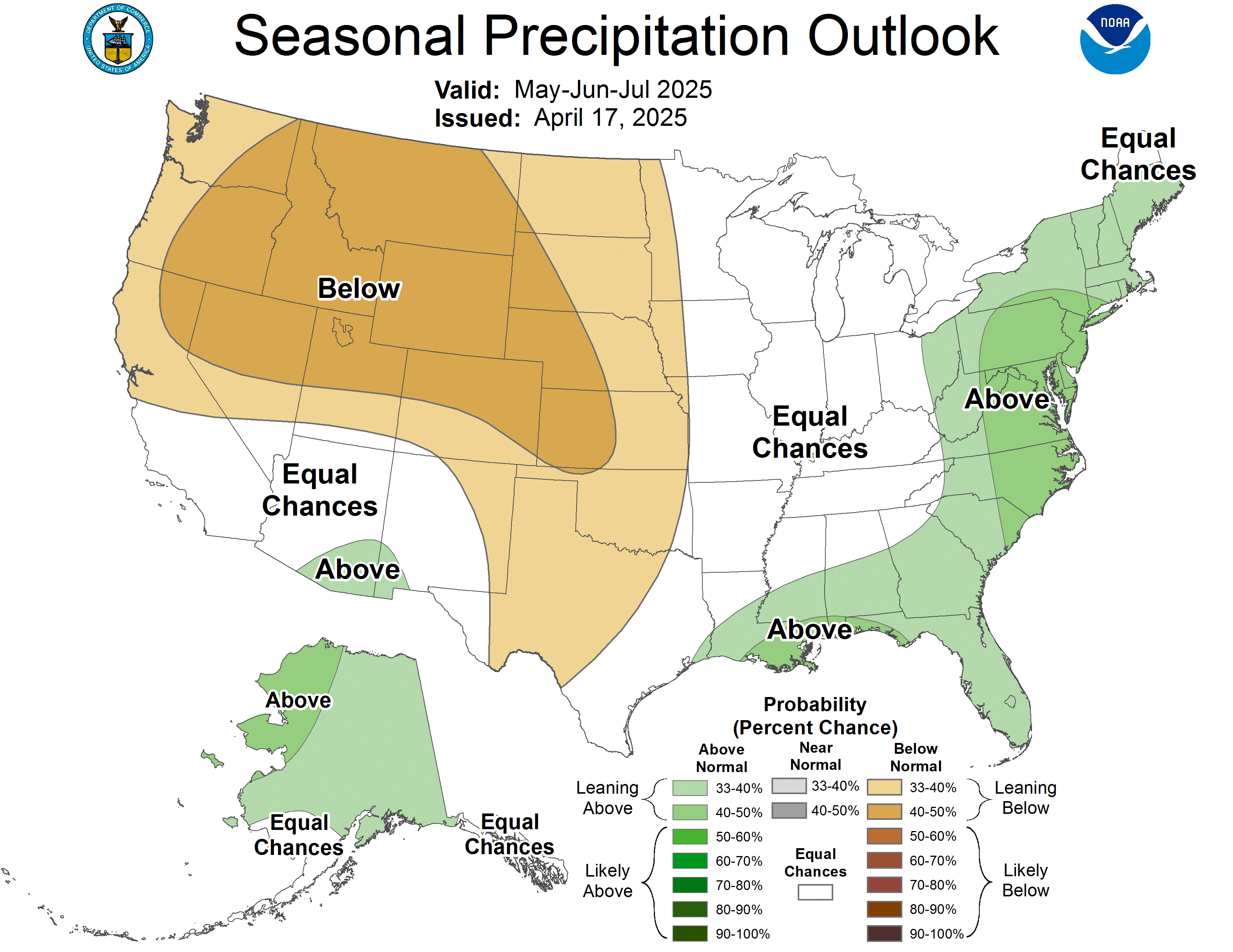
Long-range climatological forecasts are produced by the Climate Prediction Center (CPC), a branch of the National Weather Service. These include 8-14 day outlooks, monthly outlooks, and seasonal outlooks. |
||||||
|
Unlike regular "zone forecasts" issued by a local National Weather Service office, the climatological outlooks provide probability forecasts for both temperature and precipitation, divided into tercile groups: below normal, near normal, and above normal. For information about how to read the latest 8 to 14 day outlooks, for example, click here.
|
||||||
|
||||||
|
||||||
|
8-14 Day Outlook -- Issued daily by CPC For additional climatological prediction products, visit the CPC (Climate Prediction Center) website. |
||||||





 Local Radar
 Weather Map
 NWS Huntsville SitRep
 Follow us on X
 Follow us on Facebook
 Follow us on YouTube
 HUN RSS Feed