Huntsville, AL
Weather Forecast Office
| Lentzville to just west of Elkmont F1 Tornado Track | ||||||||||
 |
||||||||||
| Summary: | ||||||||||
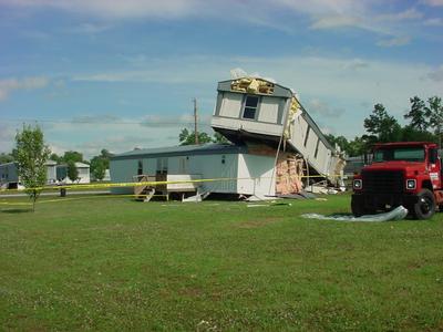
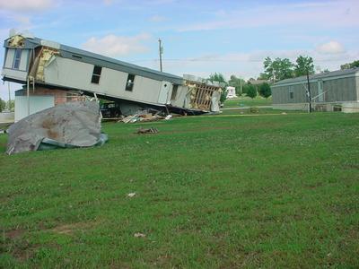
| A F1 tornado touched down in western Limestone County near Lentzville and raced east northeastward to just southwest of Elkmont. Several mobile homes were damaged or destroyed resulting in 3 minor injuries. In addition, numerous trees and power poles were knocked down. | ||||||||||
|
||||||||||
US Dept of Commerce
National Oceanic and Atmospheric Administration
National Weather Service
Huntsville, AL
320A Sparkman Drive
Huntsville, AL 35805
256-890-8503
Comments? Questions? Please Contact Us.


 Local Radar
 Weather Map