
Showers and thunderstorms will be possible from the northern Plains to the Gulf Coast on Monday. Thunderstorms with large hail and severe wind gusts are expected Monday afternoon and evening across parts of the central Plains. Read More >
|
||||||||||||||||
|
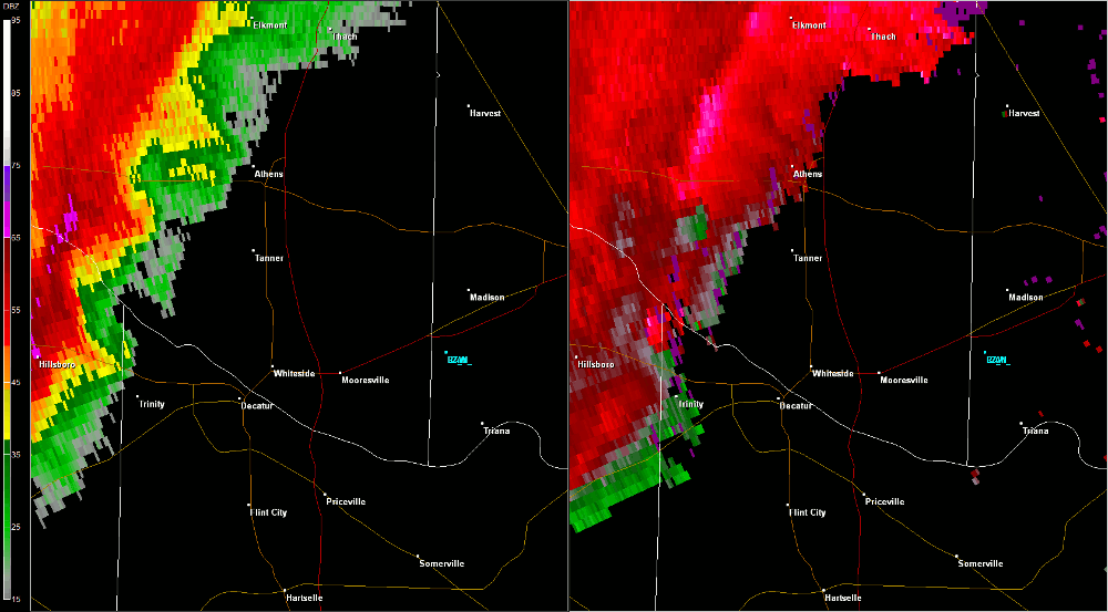
This tornado touched down in the Decatur Industrial Park to the west of Red Hat Road and tracked to the east-northeast, with a concentrated damage area including roof damage to an industrial building and numerous hardwood trees snapped 20 feet from the base. Minor roof damage to another industrial complex along the Tennessee River was noted along with numerous trees uprooted and lying pointing to the northeast. This tornado continued to track to the east-northeast across the Tennessee River snapping trees along County Road 45 and at Calhoun Community College. Pryor Field lost power at 11:28 AM CDT as the circulation passed over the airport and then the tornado dissipated between Pryor Field and Interstate 65. |
||||||||||||||||
Radar Data |
||||||||||||||||
|
||||||||||||||||


 Local Radar
 Weather Map