
Showers and thunderstorms will be possible from the northern Plains to the Gulf Coast on Monday. Thunderstorms with large hail and severe wind gusts are expected Monday afternoon and evening across parts of the central Plains. Read More >
|
||||||||||||||||
|
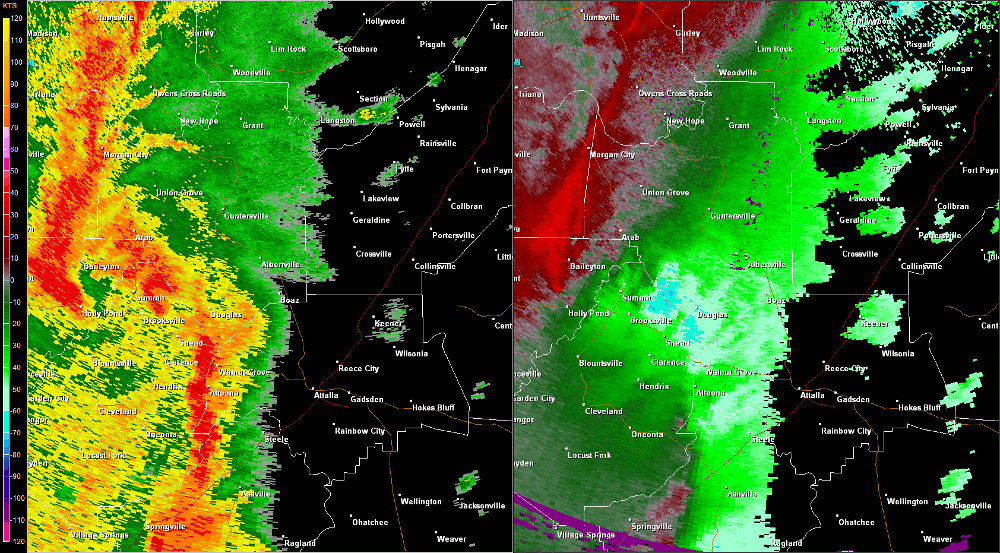
This fast moving tornado associated with a broad yet well-defined mesocale convective vortex touched down just inside Marshall County along County Road (CR) 14/Diamond Road and Red Hill Road. Large hardwood trees were found snapped and uprooted in a convergent pattern along Diamond Road/CR 14 as the tornado moved north-northeast. Significant roof damage to several chicken houses occurred along Red Hill Road just west of CR 14. The tornado appeared to lift just north of Brookline Ridge Road near the extreme south side of Guntersville Lake. |
||||||||||||||||
Radar Data |
||||||||||||||||
|
||||||||||||||||


 Local Radar
 Weather Map