
Showers and thunderstorms will be possible from the northern Plains to the Gulf Coast on Monday. Thunderstorms with large hail and severe wind gusts are expected Monday afternoon and evening across parts of the central Plains. Read More >
|
||||||||||||||||
|
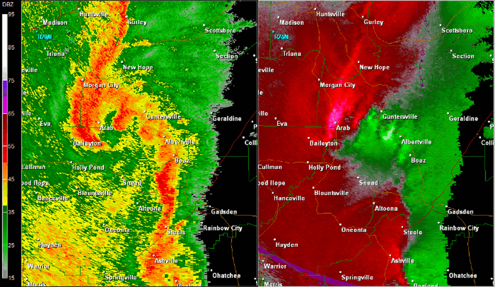
The first of three tornadoes found just south of Guntersville in central Marshall County initially touched down near the intersection of Pleasant Hill Road and Section Line Road (Highway 166). From there, the tornado moved northeast crossing Pleasant Grove Road, snapping and uprooting numerous hardwood and softwood trees along the path. At the intersection of Pleasant Hill Church Road and Community House Road, the steeple of Pleasant Hill Church was removed from the church and thrown about 100 feet. The porch columns were also removed and therefore the porch covering was damaged and sagging. Next door to the church, a residence sustained damage when the wooden front porch was removed and thrown behind the house about 100 feet as well. Otherwise, roof damage was incurred as large branches fell onto the house. In the field across Pleasant Hill Road, a wide swath of trees were snapped and uprooted. Judging by the area of trees damaged, the tornado was about 100 yards wide at this point. No further damage was found northeast of this intersection as the tornado lifted. |
||||||||||||||||
Radar Data |
||||||||||||||||
|
||||||||||||||||


 Local Radar
 Weather Map