
Showers and thunderstorms will be possible from the northern Plains to the Gulf Coast on Monday. Thunderstorms with large hail and severe wind gusts are expected Monday afternoon and evening across parts of the central Plains. Read More >
|
||||||||||||||||
|
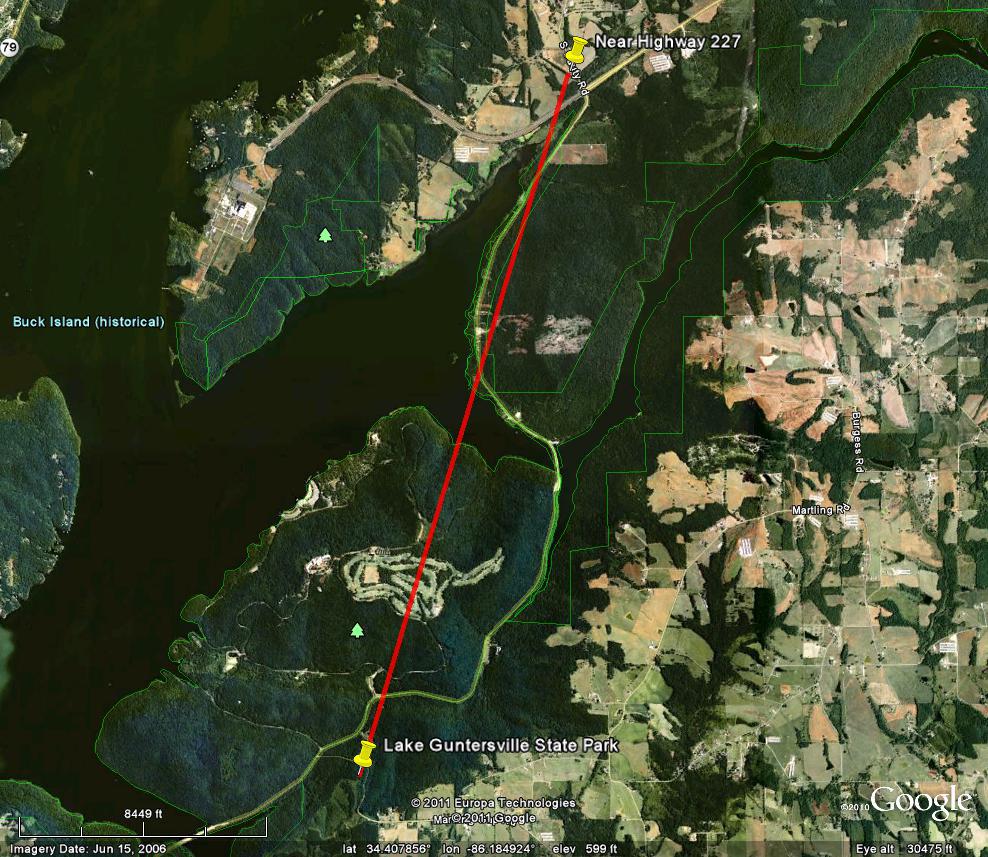
This short-lived tornado did most of its damage over portions of Lake Guntersville State Park, near the entrance and across the golf course. The tornado was separate from the EF-2 tornado responsible for the damage over the campground on the north side of the park. Many trees were snapped with a few larger pines uprooted. From the state park, the tornado continued briefly north-northeast, crossing Highway 227 before lifting near south Sauty Road and Highway 227. Damage along Highway 227 was mainly snapped trees. |
||||||||||||||||
|
||||||||||||||||


 Local Radar
 Weather Map