
Showers and thunderstorms will be possible from the northern Plains to the Gulf Coast on Monday. Thunderstorms with large hail and severe wind gusts are expected Monday afternoon and evening across parts of the central Plains. Read More >
|
||||||||||||||||
|
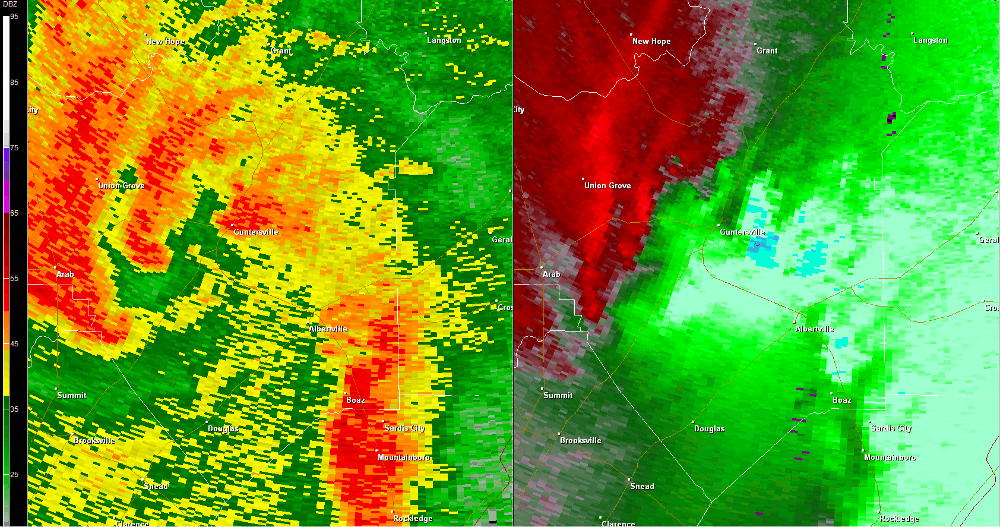
The tornado briefly touched down on Crest Hill Road off of Cathedral Caverns Highway on the south side of Grant Mountain. As the tornado skipped across the short path, several trees were snapped on Crest Hill Road. As it skipped northeast, two very large hardwood trees were snapped and uprooted on Edmonds Road. Minor roof damage was sustained to a house there, but had been repaired by the time the survey was conducted. The tornado lifted shortly thereafter and no additional damage was found northeast of this location. |
||||||||||||||||
Radar Data |
||||||||||||||||
|
||||||||||||||||


 Local Radar
 Weather Map