
Showers and thunderstorms will be possible from the northern Plains to the Gulf Coast on Monday. Thunderstorms with large hail and severe wind gusts are expected Monday afternoon and evening across parts of the central Plains. Read More >
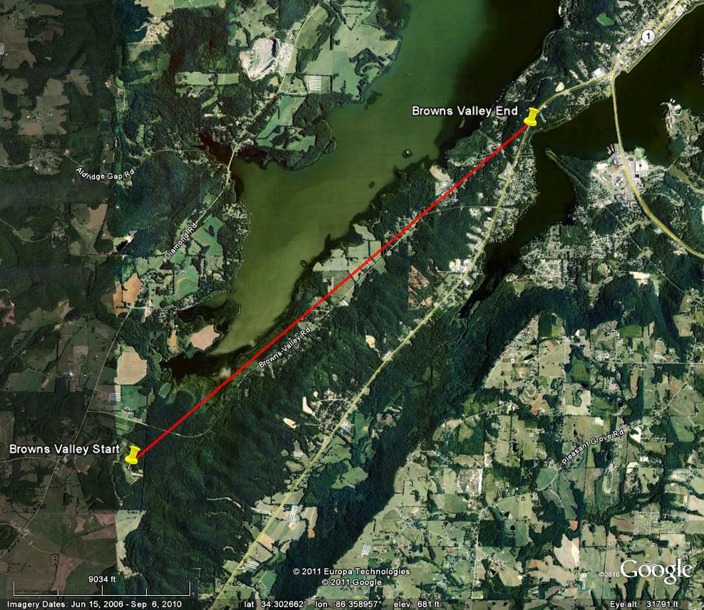
Marshall County (Browns Valley Rd to Hwy 79) EF-1
| Rating | EF-1 | Peak Wind | 95 mph |
| Path Length | 4.9 miles | Peak Path Width | 100 yards |
| Beginning Point | 34.2798, -86.3935 | End Point | 34.3273, -86.3290 |
| Start Time | 6:35 AM | End Time | 6:40 AM |
This tornado touched down along Browns Valley Road near the south end of Guntersville Lake and tracked northeast along Browns Valley Road and Creek Path Road before lifting near Highway 79. Initial damage seen was trees snapped and twisted along Browns Valley Road. However as the tornado crossed a neighborhood along Creek Path Road, more substantial damage occurred. Larger trees were uprooted and one house sustained significant roof loss. This tornado lifted near Highway 79 and Creek Path Road, as little additional damage was seen along this path.
Tornado Track Map |
|
|
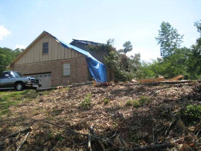 Structural Damage along Creek Path Road |
 Damage to Trees along Browns Valley Road and Creek Path Road |


 Local Radar
 Weather Map