National Weather Service United States Department of Commerce

Tropical Storm Imelda Forms; Another Round of Heavy Rain and Potential Flooding in the Southwest

Tropical Storm Imelda has formed near the Bahamas Sunday afternoon, and continues to bring heavy rainfall. The risk of significant wind impacts from Imelda along the Southeast coast are decreasing. Another round of showers and storms with a heavy rain and flash flood threat will continue in the Southwest through Monday morning. Read More >

Rating EF-1 Peak Wind 110 mph
Path Length 5.7 miles Peak Path Width 50 yards
Beginning Point 34.2575, -86.3088 End Point 34.3230, -86.2486
Start Time 6:30 AM End Time  6:40 AM

The second of three tornadoes found just south of Guntersville in central Marshall County initially touched down near the intersection of Section Line Road and Beck Road in the Lattiwood community.  From there, the tornado moved northeast along Oneonta Cutoff Road and eventually crossed Highway 205.  The tornado snapped numerous hardwood and softwood trees along the path and caused damage to homes as trees fell on residences.  Power poles were snapped as well.  Additional tree damage in a convergent pattern was found northeast of Highway 205 near the intersection of Brashers Chapel Road and Wyeth Mountain Road.  Here, several barns were completely destroyed and numerous outbuildings had most of the tin removed from the roof.  No further damage was found northeast of Wyeth Mountain Road where the barns were destroyed as the tornado lifted.
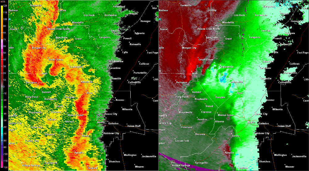
Radar Data

Hytop, AL Radar (HTX) radar loop of the EF-1 tornado track from 6 :30 - 6:40 am CDT.  The imagery on the left is reflectivity, while the imagery on the right is storm-relative velocity.  Click on the image to loop.
Hytop, AL Radar (HTX) radar loop of the EF-1 tornado track.  The imagery on the left is reflectivity, while the imagery on the right is storm-relative velocity.  Click on the image to loop.

Back to April 27 Survey Info