
Showers and thunderstorms will be possible from the northern Plains to the Gulf Coast on Monday. Thunderstorms with large hail and severe wind gusts are expected Monday afternoon and evening across parts of the central Plains. Read More >
|
||||||||||||||||
|
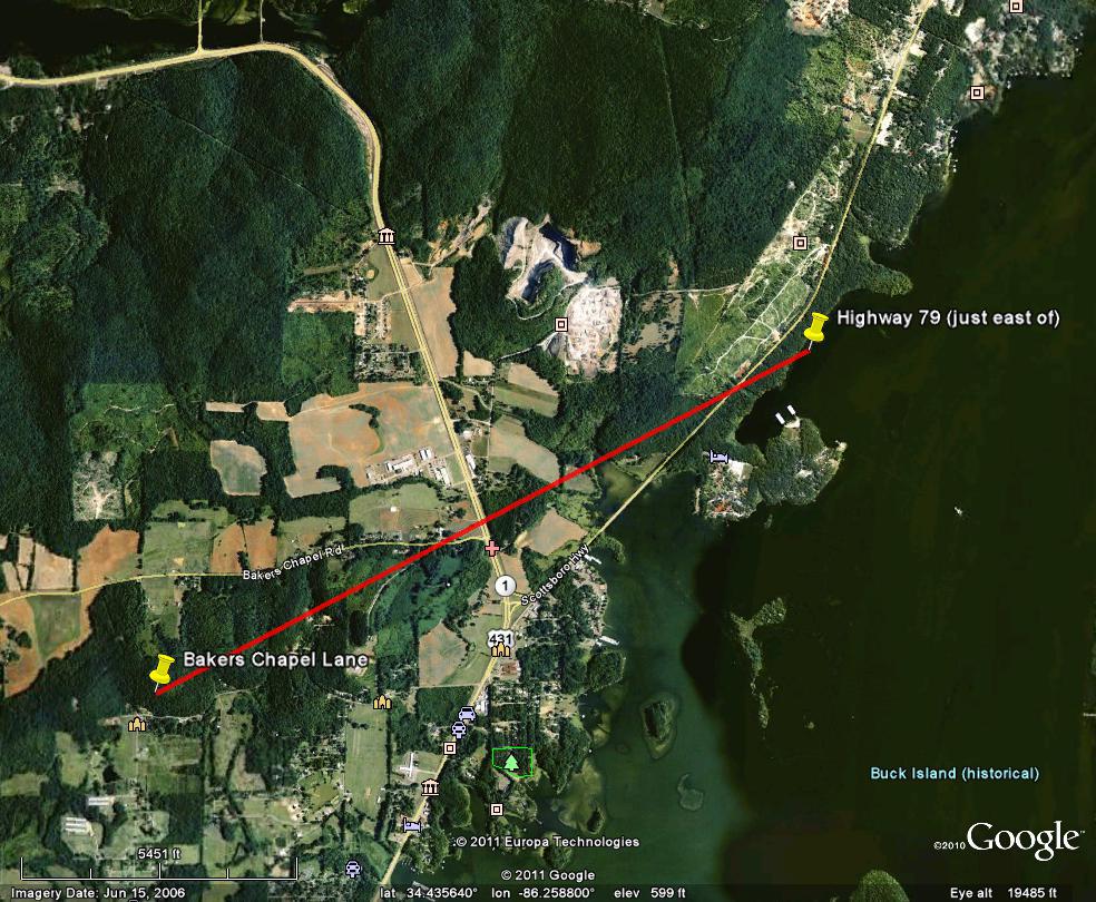
This weak tornado briefly touched down near Bakers Chapel Lane, just south of Bakers Chapel Road. The most significant damage was an area of uprooted trees along Bakers Chapel Road just west of Highway 431/1. The tornado continued northeast and crossed Highway 79 where a few tops of trees were snapped. Beyond this point, there was no other physical evidence of damage as the circulation quickly moved over Guntersville Lake, north of Newman Estate Road. |
||||||||||||||||
|
||||||||||||||||


 Local Radar
 Weather Map