
Showers and thunderstorms will be possible from the northern Plains to the Gulf Coast on Monday. Thunderstorms with large hail and severe wind gusts are expected Monday afternoon and evening across parts of the central Plains. Read More >
|
||||||||||||||||
|
||||||||||||||||
|
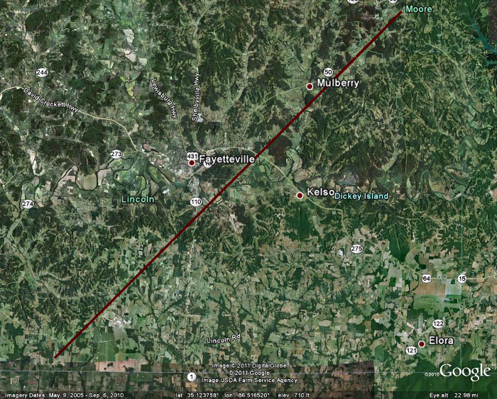
A tornado tracked across sections of Lincoln and Moore Counties on April 27th. The tornado started near Bates Lane in the Taft community where trees were uprooted and snapped, with some falling on a mobile home. The tornado continued to track east-northeast with many trees twisted and snapped along its path. Minor structural damage was also noted to many houses, with shingles blown off and damage sustained to car ports. Along Old Carmargo Road, an anchored mobile home was lifted up and rolled but the occupants were unharmed. In addition, several vehicles were damaged in this area. Near Highway 231, several power poles were snapped at the base and a roof was blown off a trailer. As the storm then tracked into Moore County, there was a wide swath of snapped and uprooted trees north of Lynchburg where hundreds of trees were leveled. Partial roof uplift to a few homes and damage to a church was also noted in this area. Along the far northern reaches of the county, north of the Motlow State Community College, a mobile home park sustained significant damage. Two mobile homes were thrown off their foundations, with one being rolled. The tornado finally lifted before reaching the county border. The EF-2 rating is based on power poles being snapped near the ground near the intersection of Highways 110 and 231, and the large swath of trees snapped in Moore County.
|
||||||||||||||||
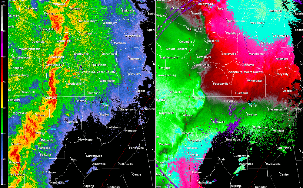
Radar Data |
||||||||||||||||
|
||||||||||||||||


 Local Radar
 Weather Map