
Showers and thunderstorms will be possible from the northern Plains to the Gulf Coast on Monday. Thunderstorms with large hail and severe wind gusts are expected Monday afternoon and evening across parts of the central Plains. Read More >
|
||||||||||||||||
|
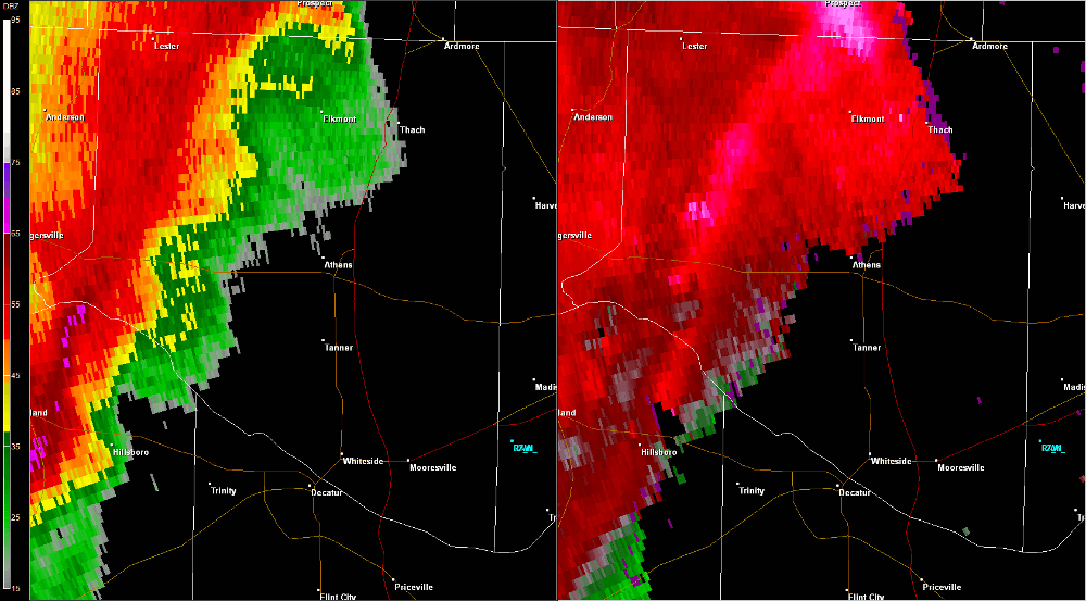
This tornado touched down near the intersection of County Road (CR) 24 and Batts Road around 11:15 AM CDT while embedded in a larger region of straight-line wind damage associated with a bow echo (line of storms). Numerous trees were downed and witnesses indicated a funnel that descended and lifted several times along the surveyed damage path. The tornado continued eastward moving parallel to Snake Road and CR 24, where a concentrated region of numerous large trees were uprooted and snapped. Several houses had shingles removed and damage to gutters and roof awnings in this area. The most notable damage occurred north of CR 24, between Zehner Road and Blackburn Road. The concentrated damage associated with this tornado dissipated near Brownsferry Road as a secondary circulation developed to the south of the tornado. |
||||||||||||||||
Radar Data |
||||||||||||||||
|
||||||||||||||||


 Local Radar
 Weather Map