
Showers and thunderstorms will be possible from the northern Plains to the Gulf Coast on Monday. Thunderstorms with large hail and severe wind gusts are expected Monday afternoon and evening across parts of the central Plains. Read More >
|
||||||||||||||||
|
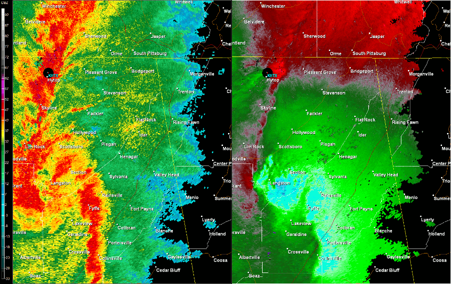
A tornado of EF-1 intensity produced wind speeds of up to 110 mph. The tornado touched down just south of Section, crossing State Highway 35, then traveling nearly parallel to State Highway 71, through Dutton, into southern portions of of Pisgah before crossing into far northern DeKalb County. The tornado uprooted and snapped numerous trees along its path, knocking out power in many locations. One fatality occurred in the Pisgah area associated with this tornado. The tornado took a very similar track to a violent tornado of EF-4 intensity later during the afternoon of the 27th. This made it very difficult to distinguish damage between the two tornadoes. Several eyewitnesses remarked about the morning tornado location and damages.
|
||||||||||||||||
Radar Data
|
||||||||||||||||
|
|


 Local Radar
 Weather Map