|
|
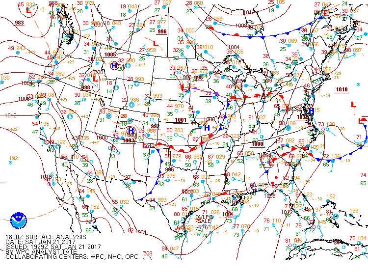
| Surface Analysis at noon on 01/21/2017 |
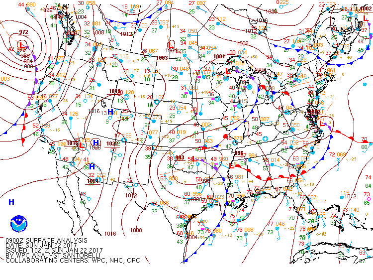
Surface Analysis at 3 AM on 01/22/2017 |
|
A very active storm pattern continued from January 21st through 23rd, 2017 across the southeastern U.S. This began with a stalled out frontal boundary draped along the coastal areas of southeastern Texas through southern Louisiana into southern Alabama at 6 AM on 1/21/2017. During the day on 1/21/2017, a strong area of low pressure developed in southeastern Alabama/west-central Georgia along this front. Significant instability near and south of this front combined with these dynamics to produce a serious outbreak of tornadoes and wind damage from near Mobile, AL northeast into southern/central Alabama and Georgia. Luckily, the Huntsville Forecast area was not unstable enough to receive any of this severe thunderstorm activity. Forcing behind the front did produce between 1/2 and 1 inches of rainfall though in locations near/east of I-65. This did not produce any flash flooding, but did help to saturated the soil ahead of a strong area of low pressure over Oklahoma and northwest Texas, that would affect the Huntsville Forecast Area overnight and through 1/22/2017.
|
|

|
|
| Surface Analysis at 3 AM on 01/22/2017 |
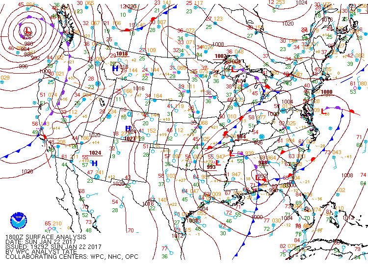
Surface Analysis at noon on 01/22/2017 |
|
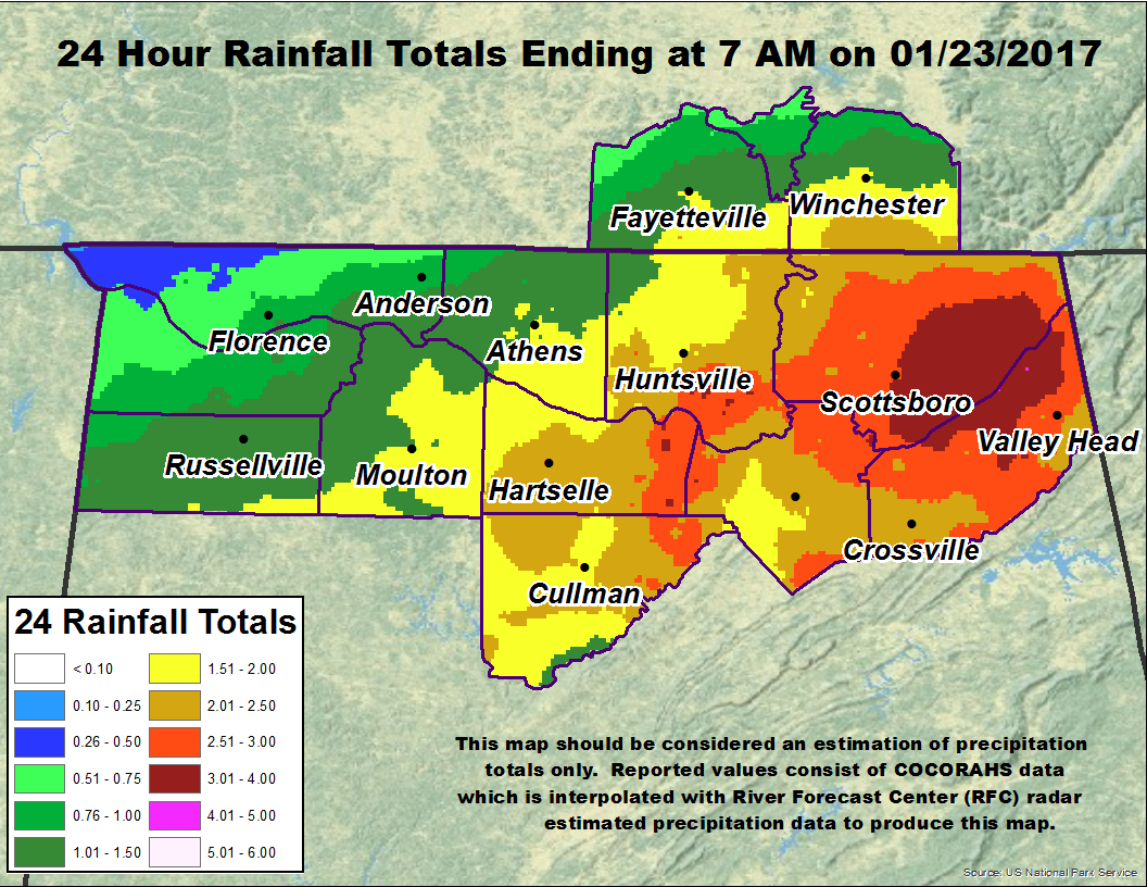
As you can see on the map above on the left, the warm front just south of the Huntsville Forecast Area remained very near that location or slightly further south through most of the morning hours in northern Alabama. However, a large and potent 993 mb surface low was approaching from the west as well. This low was very deep and had a strong upper low associated with it. As this moved east from Arkansas into and through northeastern Alabama, heavy rainfall of ~ 2.00 to 4.00 inches of rainfall occurred. This heavy rainfall was due to the very strong and deep lift that was persistent, accompanied by a moist thermodynamic sounding. By 6 AM on 1/22/2017, PW values (a measure of how saturated a atmospheric profile is) increased to over 1.00 inch (likely closer to 1.2-1.4 inches based on nearby Atlanta, GA sounding below). This coincided with some of the
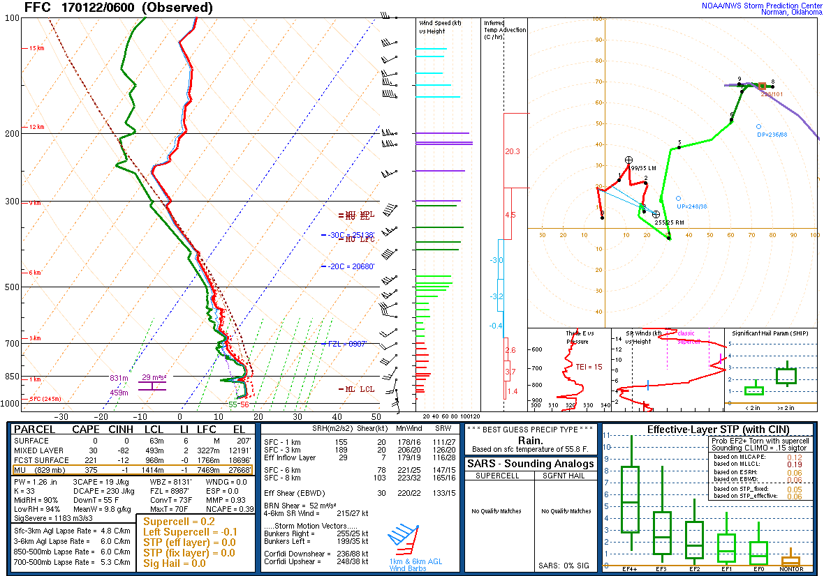
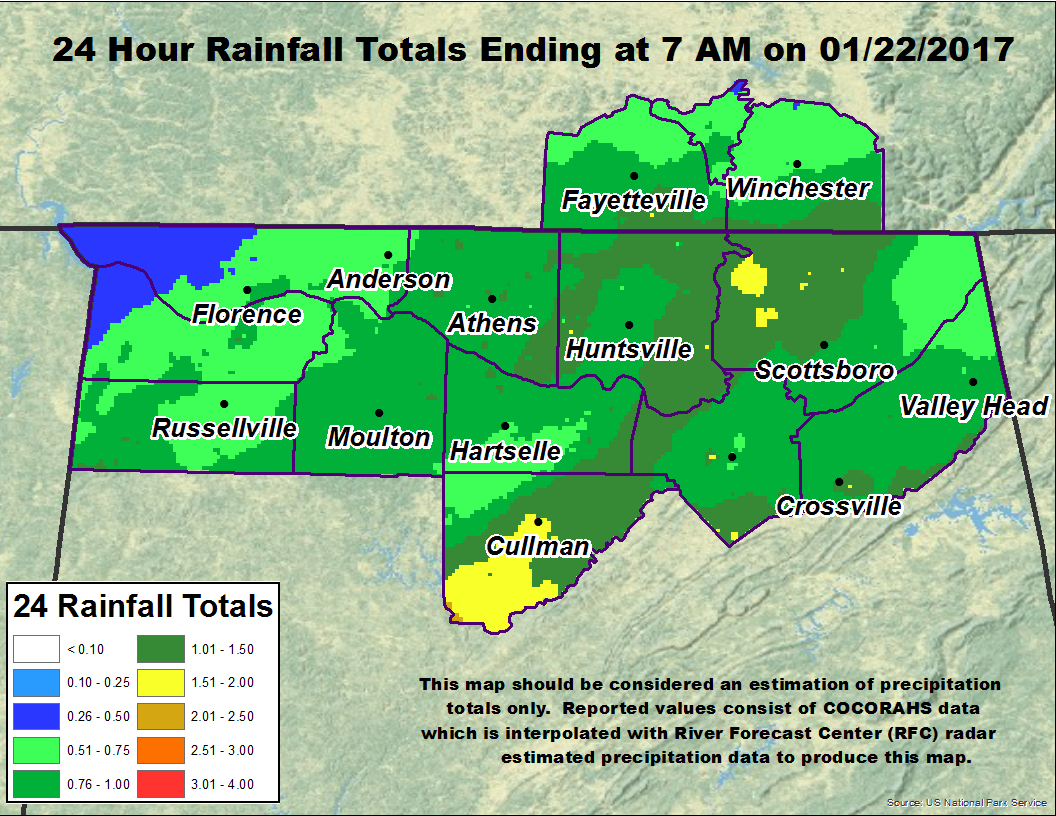
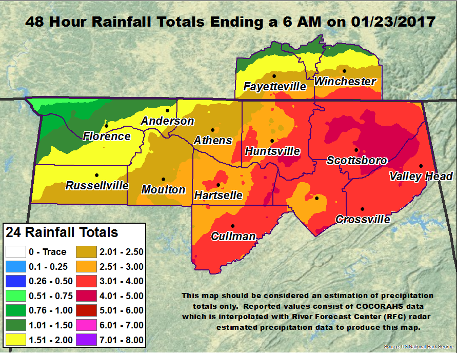
strongest lift over most of northern Alabama, as the surface low moved into northeastern Alabama by noon and a secondary occluded low developed to its west. Additional heavy rain did occur through the remainder of the day into the evening hours east of I-65. This was due to additional strong forcing with the secondary, occluded low as it continued to move east across northern Alabama and into Georgia. The atmosphere continued remain moist as this occurred as well, with PW values remaining around 3/4 of a inch or higher. The location of heavier rainfall amounts can be seen below.
|
|
|
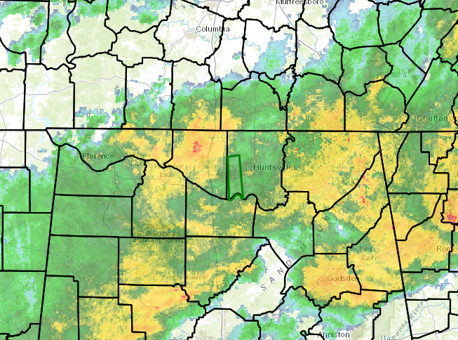
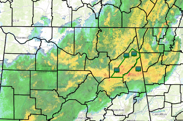
This caused some rivers to rise above flood stage and flash flood/river flood warnings to be issued due to the prolonged nature of the heavy rainfall and its runoff into the evening on 01/22/2017. Especially hard hit were Madison, Marshall, Jackson, and DeKalb counties. Broad aerial flood warnings were originally issued for a broad area of the Huntsville Forecast area, including most areas near and east of I-65. Green polygons in the images below are flash flood warnings issued by NWS Huntsville. These were mainly due to impacts from Big Will's Creek in eastern Dekalb county, AL and Indian Creek in southwest Madison county, AL, which were smaller creeks that experience flash flooding from this rainfall. Other locations along the Tennessee river experienced longer-term river flooding such as: Paint Rock River at Woodville.
|
|
|
|


 Local Radar
 Weather Map