| Hazard Type | Watch/Warning Name Criteria |
Advisory Name Criteria |
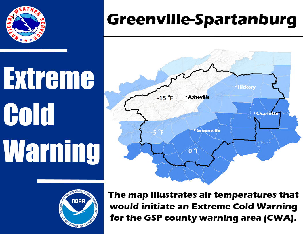
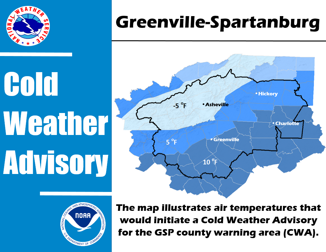
| Cold Weather | ||
| Heat | Excessive Heat Watch/Warning Heat Index 110 or greater |
Heat Advisory Heat Index 105 or greater but less than 110 |
| Wind (Non-Thunderstorm) | High Wind Watch/Warning Sustained winds higher than 40 mph and/or frequent gusts greater than 57 mph |
Wind Advisory |
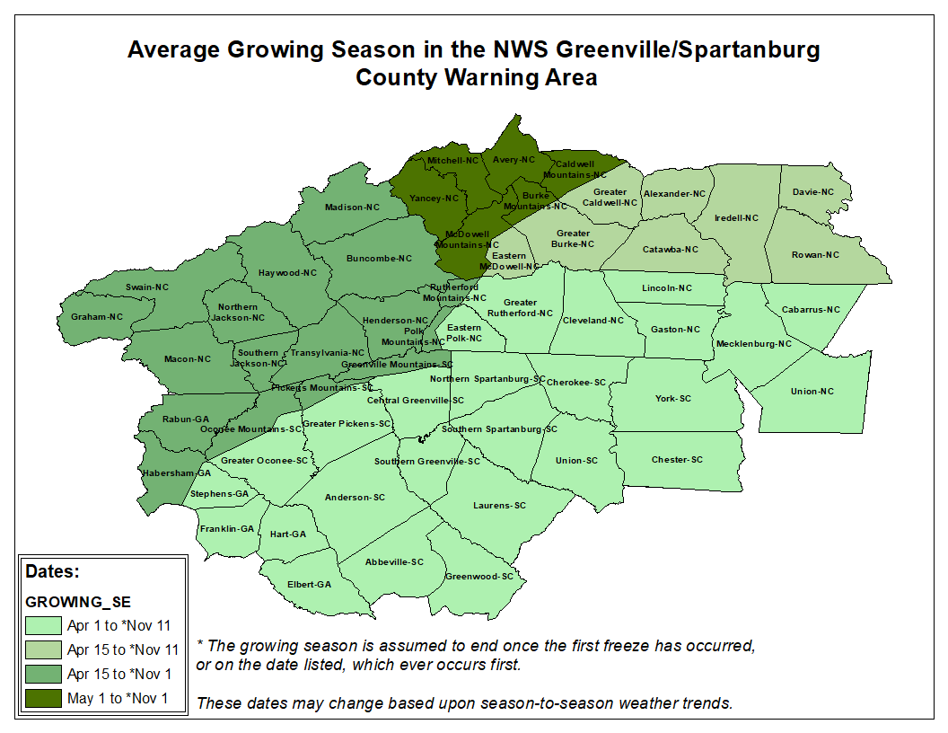
| Frost Freeze | Freeze Watch/Warning Low temperature of 32 degrees or less during the |
Frost Advisory Scattered to widespread frost is forecast during the Growing Season* |
| Fog | N/A | Dense Fog Advisory Fog causing widespread visibility of 1/4 mile or less |

