Tropical Depression Two is expected to gradually strengthen and could bring tropical storm conditions to the Florida Panhandle beginning late Monday. Areas of flash flooding will be possible through Thursday along the eastern and central Gulf Coast. Severe thunderstorms will develop and move along a cold front crossing the Upper Midwest Monday, and through the Ohio Valley/Mid-Atlantic on Tuesday. Read More >
Overview
|
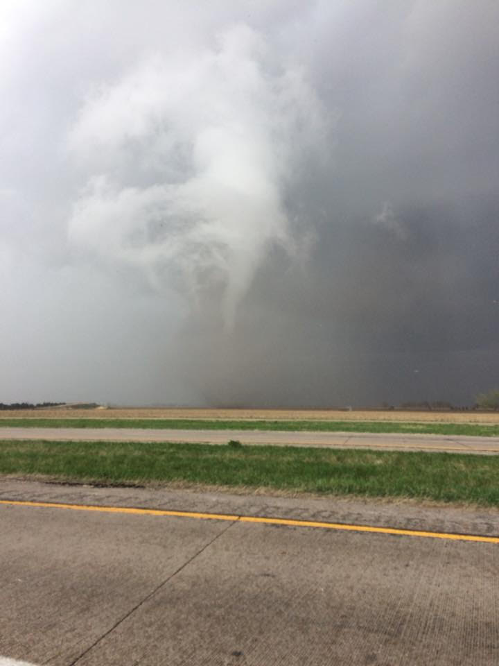
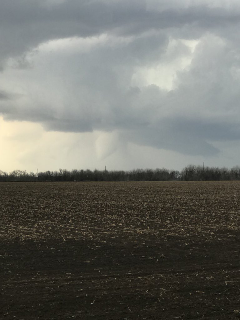
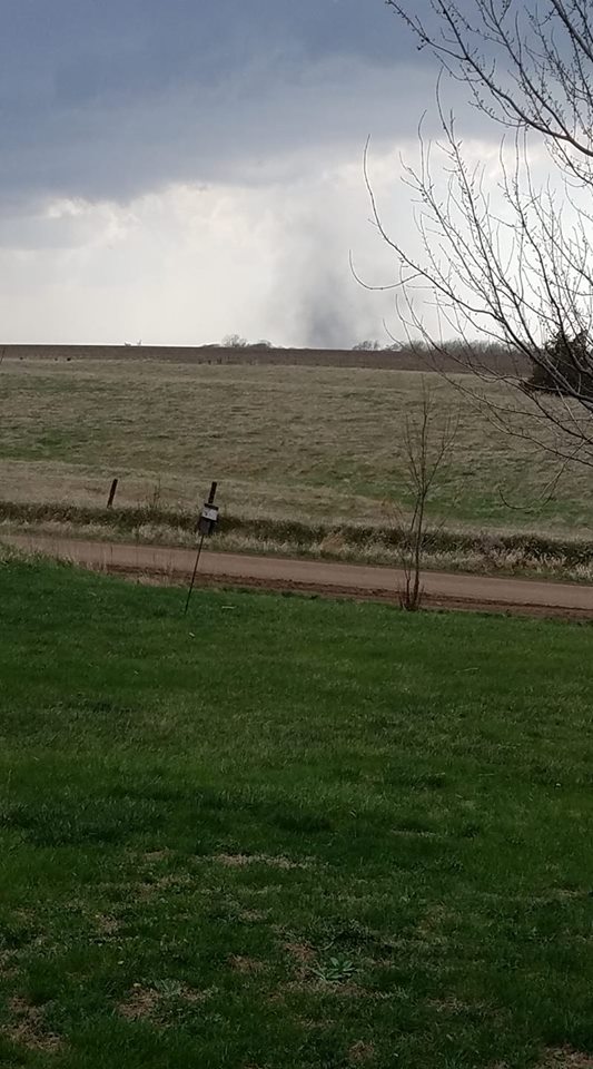
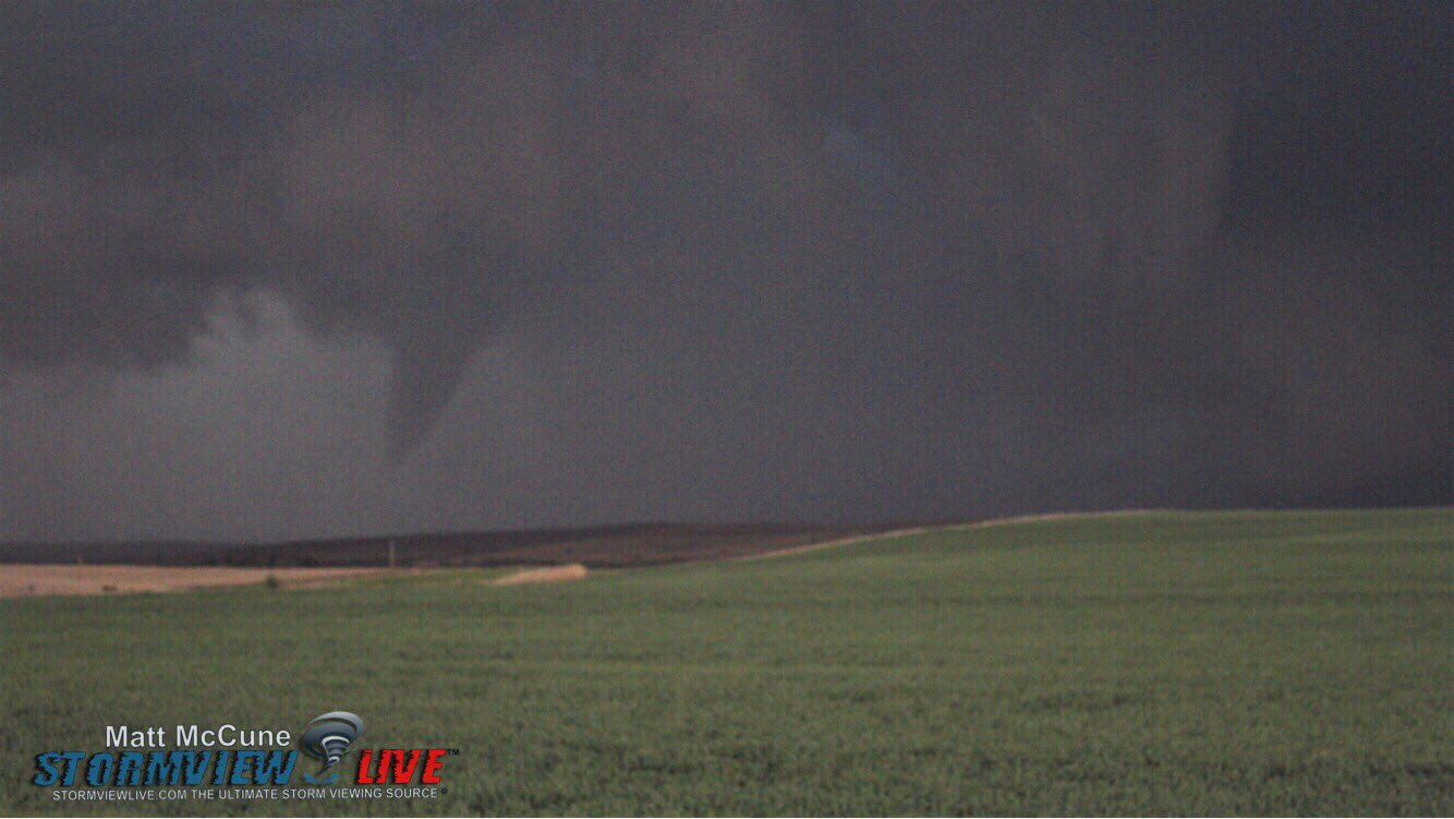
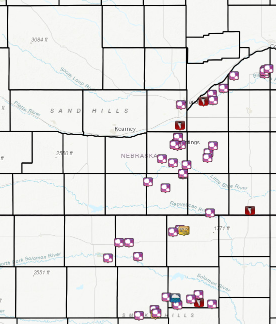
Scattered severe thunderstorms developed during the afternoon of Tuesday, May 1, 2018, near and southeast of a stationary front stretching from northern Kansas, northeast through central and east-central Nebraska. Storms continued through the evening as the front slowly progressed southeast. Hail was the main hazard from these storms, with some areas seeing large hail up to at least 2" in diameter. Additionally, several small, fairly weak tornadoes were observed across the area (all rated EF-0). This includes brief tornadoes near Doniphan, Phillips, and Chester in Nebraska and rural southern Mitchell County KS. Thunderstorms lingered across parts of southern Osborne and Mitchell counties well into the evening, leading to very heavy rainfall totals and flooded roadways. Some areas received 3-5" of rain over the course of several hours, including 5.18" at a personal weather station southeast of Tipton. |
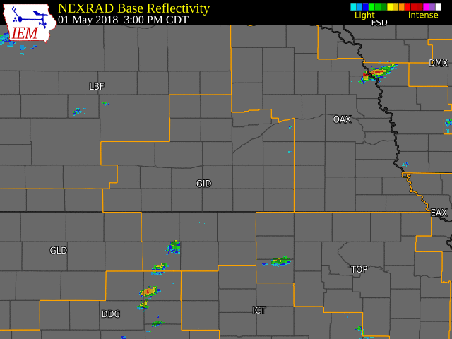 NWS Radar loop from 3:00-10:45 p.m. on May 1. The NWS Hastings coverage area is within the orange outlined area labeled "GID" . |
Tornadoes:
|
|
||||||||||
|
||||||||||
|
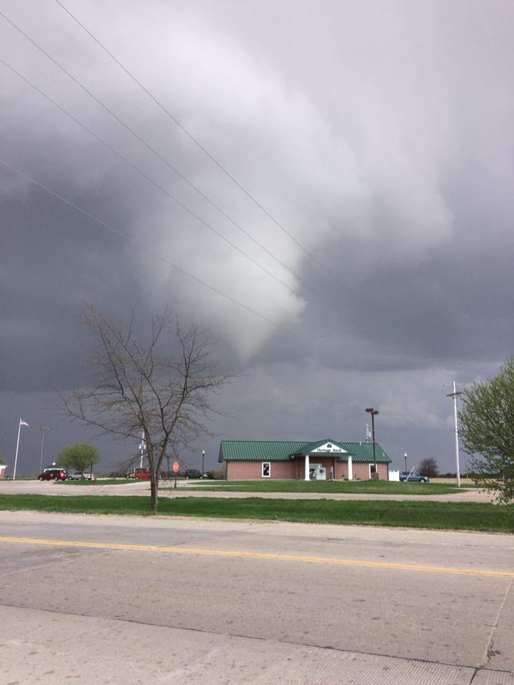
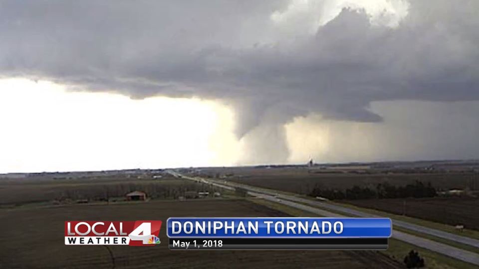
Doniphan, NE
Track Map 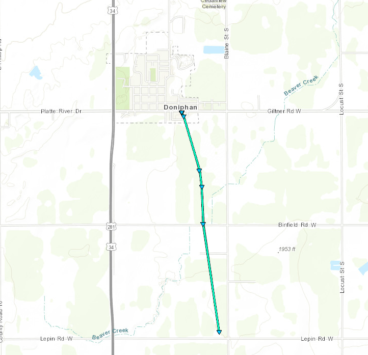 
|
||||||||||||||||||||||||||||||||
|
8 Miles West of Aurora, NE
Track Map 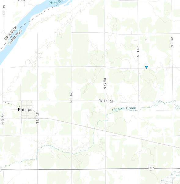
|
||||||||||||||||||||
|
2.5 Miles NNE of Chester, NE
Track Map 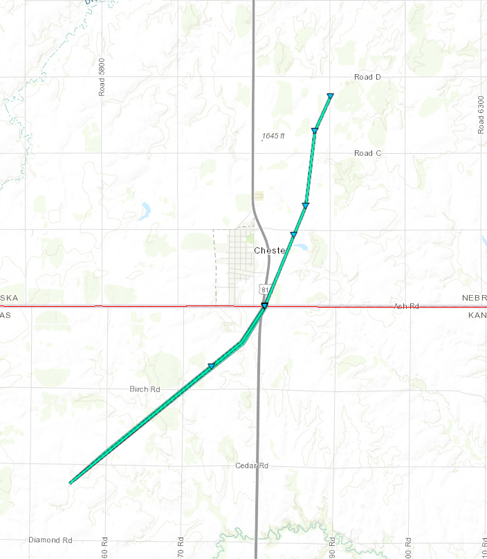
|
||||||||||||||||
|
South of Beloit, KS
Track Map 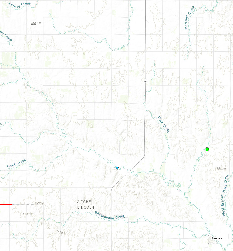
|
||||||||||||||||||
The Enhanced Fujita (EF) Scale classifies tornadoes into the following categories:
| EF0 Weak 65-85 mph |
EF1 Moderate 86-110 mph |
EF2 Significant 111-135 mph |
EF3 Severe 136-165 mph |
EF4 Extreme 166-200 mph |
EF5 Catastrophic 200+ mph |
 |
|||||
Wind & Hail:
Hail
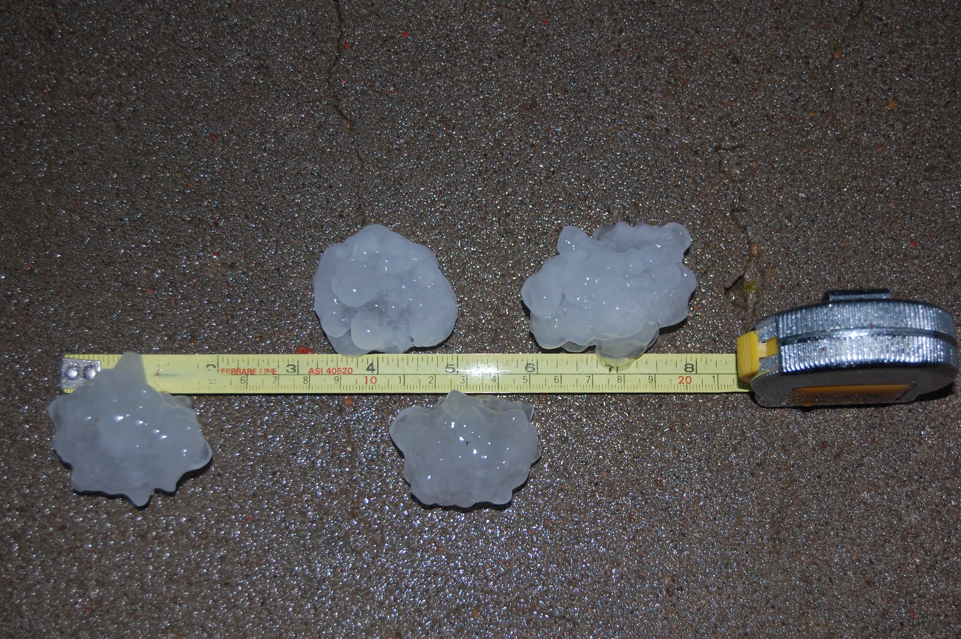
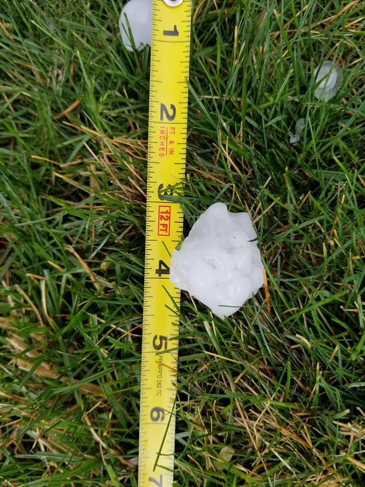
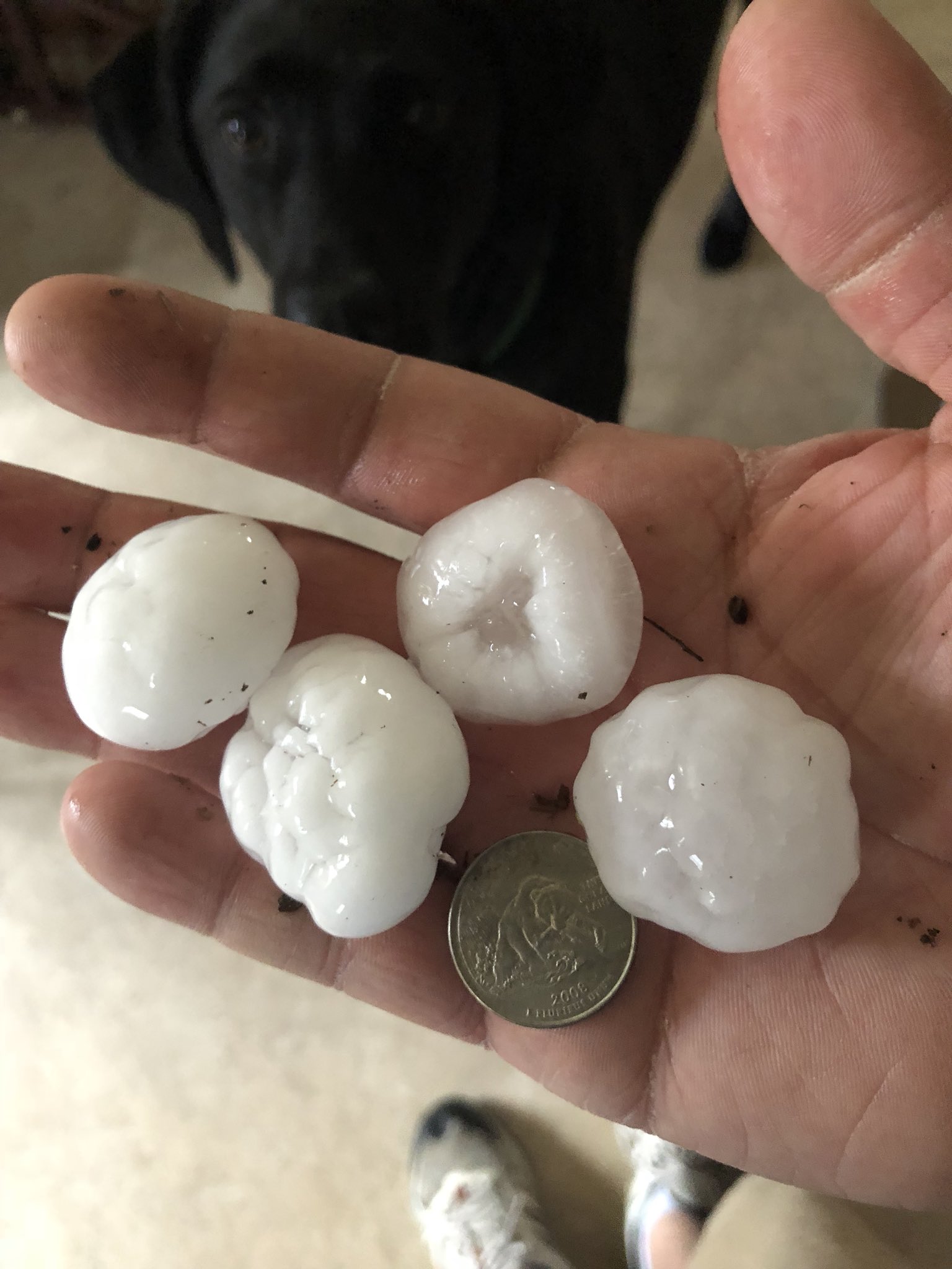
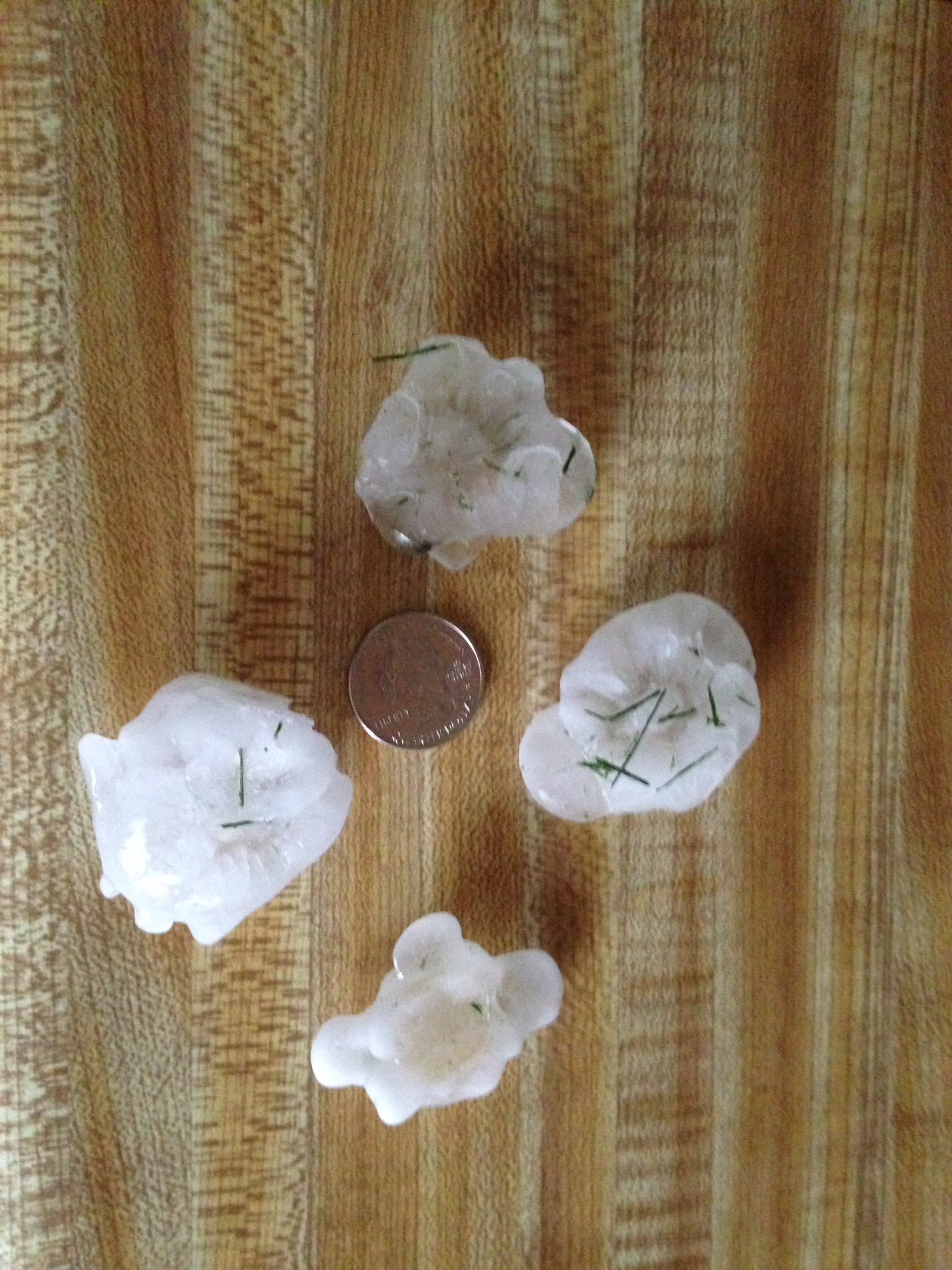
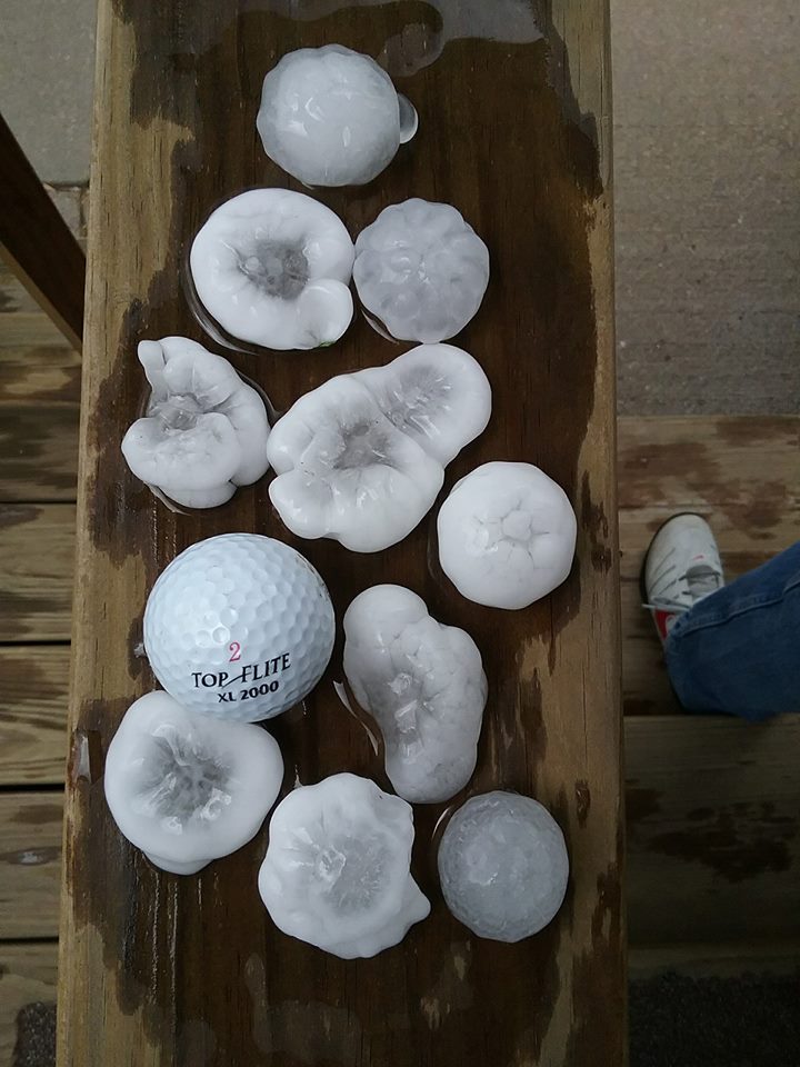
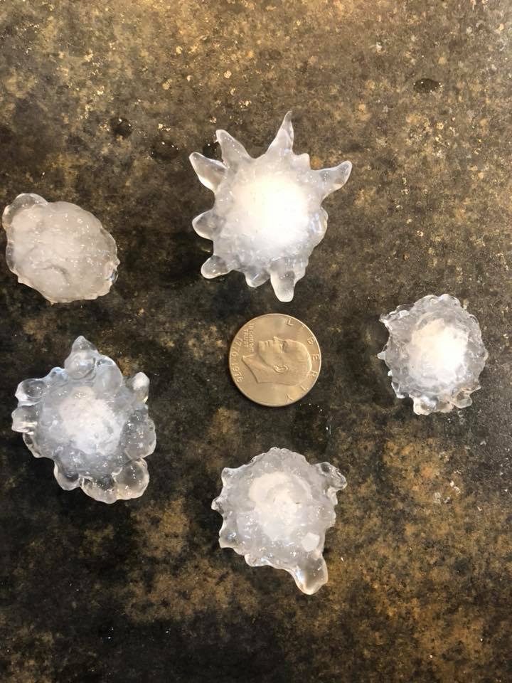
Large hail occurred over a large portion of the area. In general, hail was quarter to golf ball size, but there were a few reports as large as 2 inches in diameter. See the Storm Reports Tab for more specific information.
 |
 |
 |
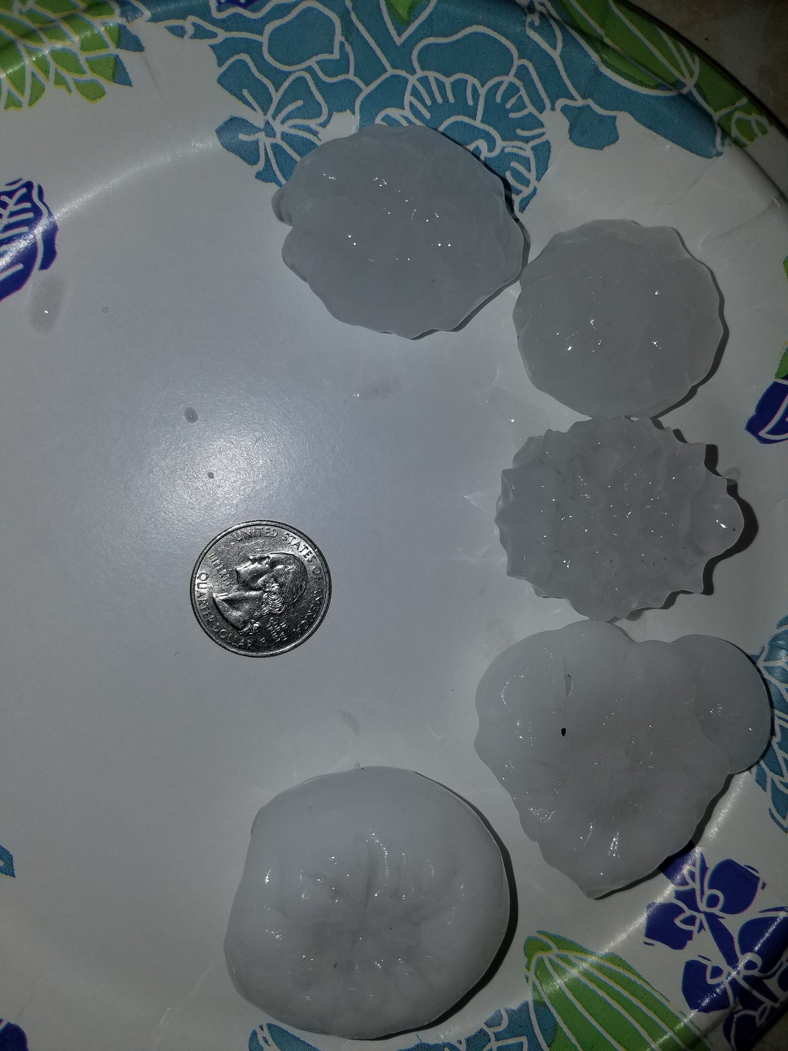 |
| Roseland, NE Photo by Erika Klein |
Shelby, NE Photo by Angela Pfannkuch |
Hastings, NE Photo by Eric W. |
Hastings, NE Photo by Jamy Schultz |
 |
 |
|
 |
| Hastings, NE Photo by Jim Iverson |
Hastings, NE Photo by Marty McCune |
10 Miles SSW of Beloit, KS Photo by Mike Jordan |
3 Miles East of Pauline, NE Photo by Ron Pavelka |
Wind
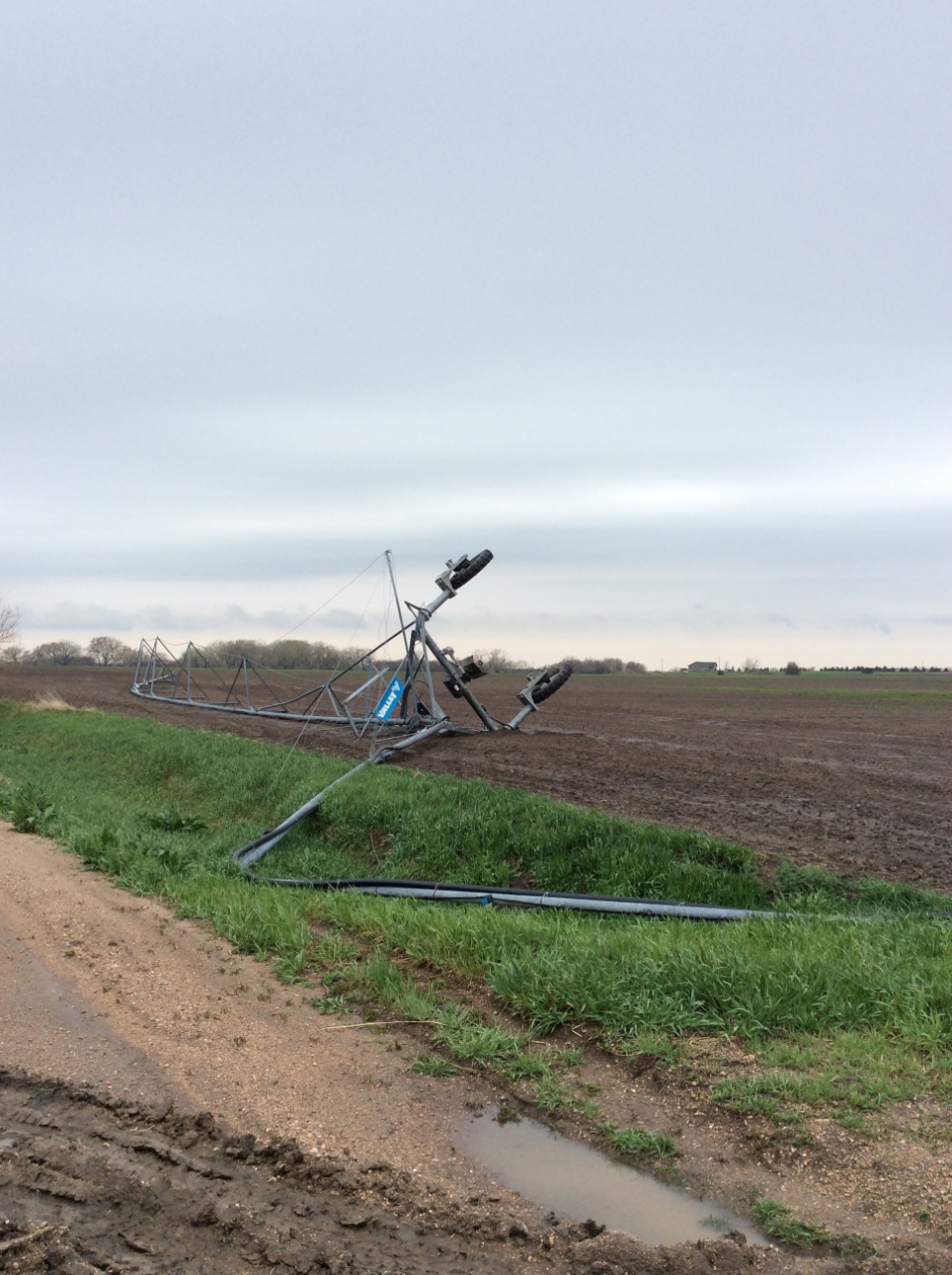
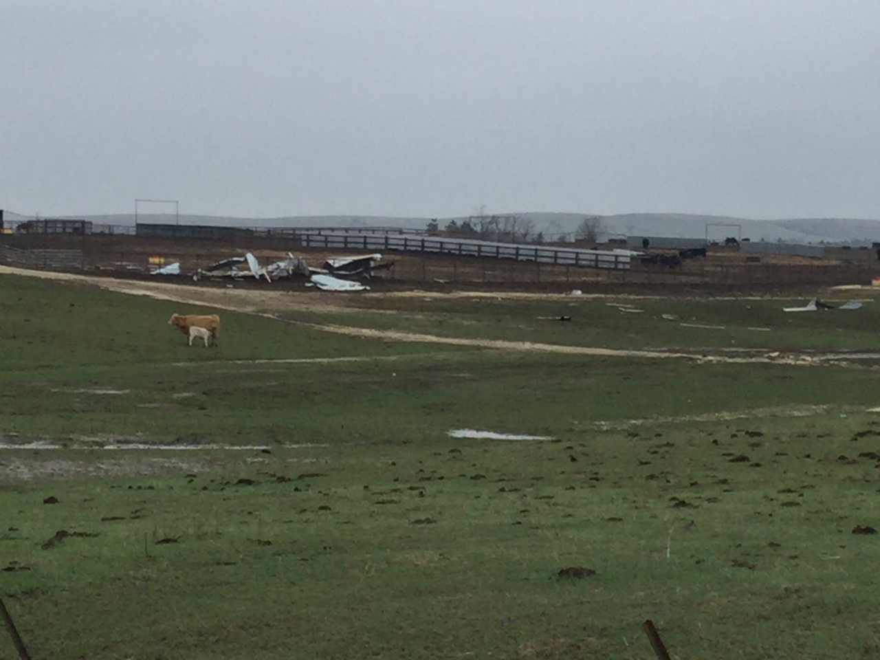
While damaging winds were not common, a few areas received damage caused by straight-line winds. The most significant straight-line wind damage appeared to occur over parts of north-central Kansas.
 |
 |
 |
 |
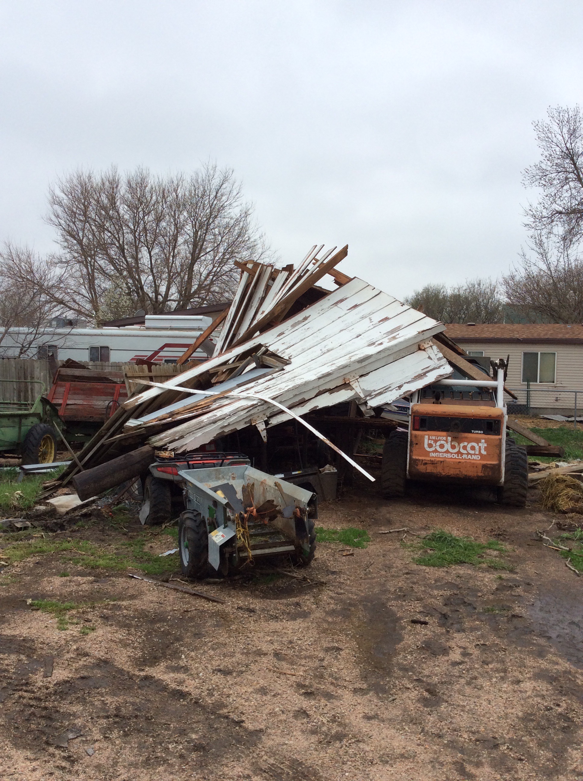
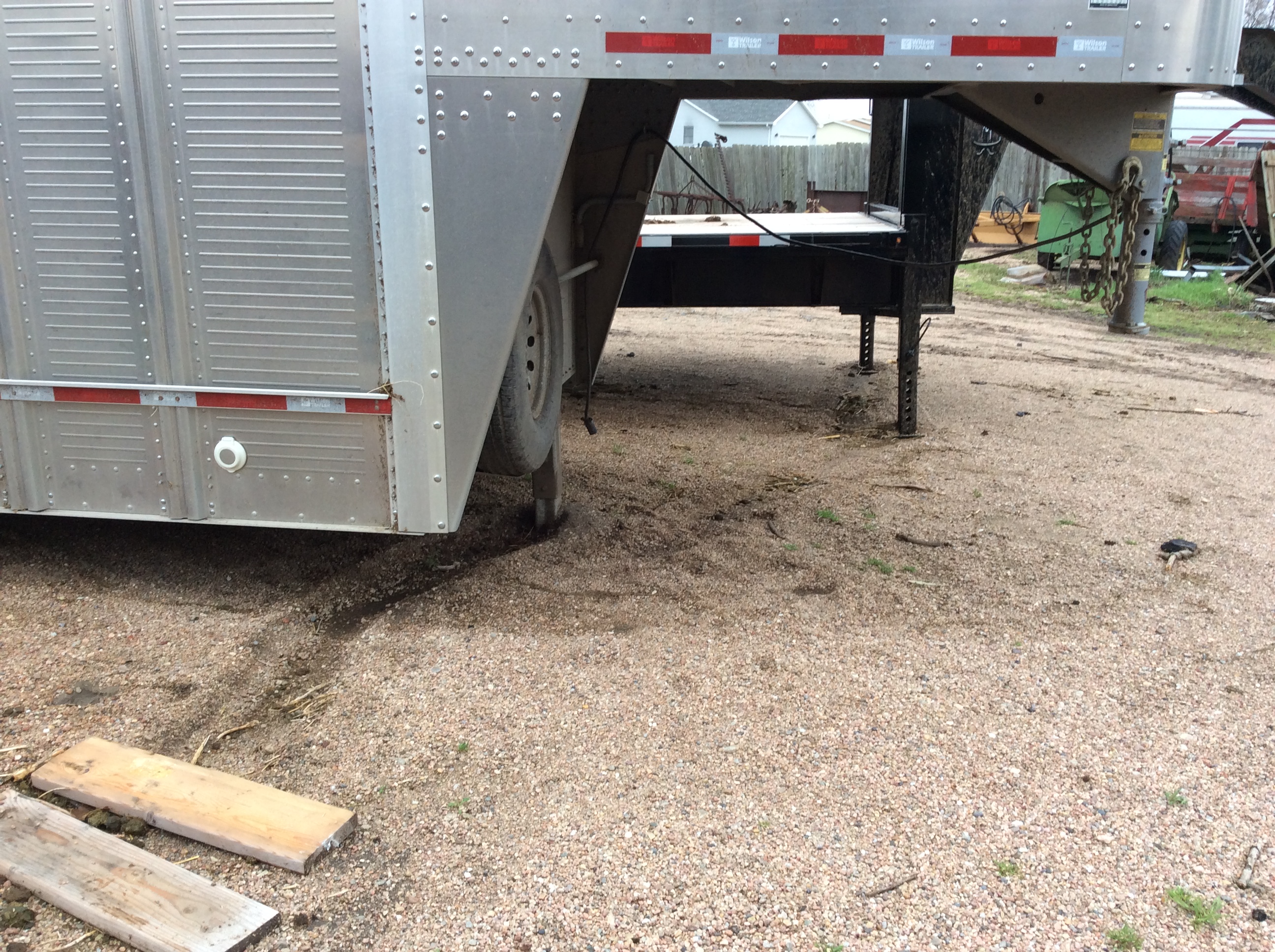
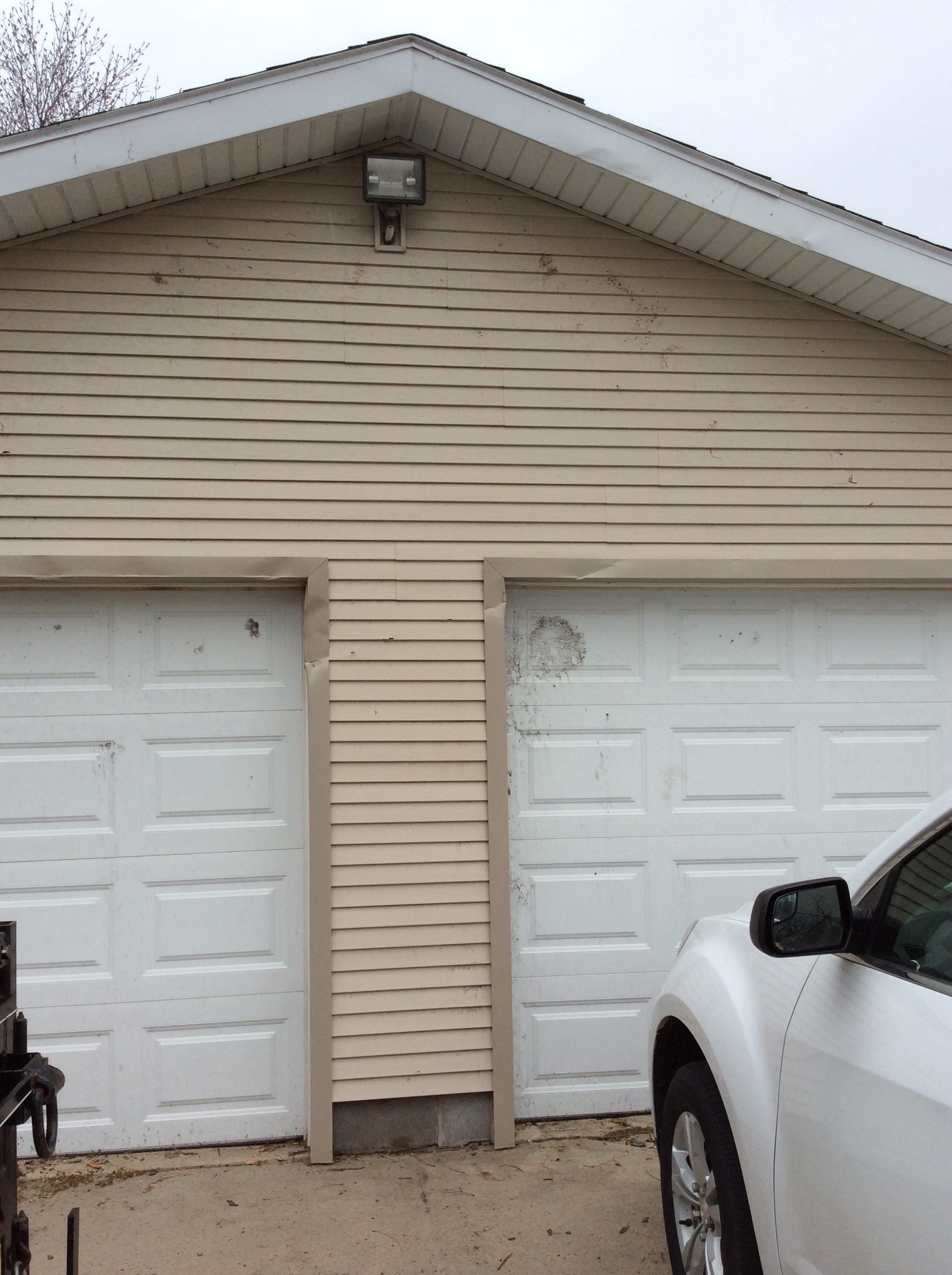
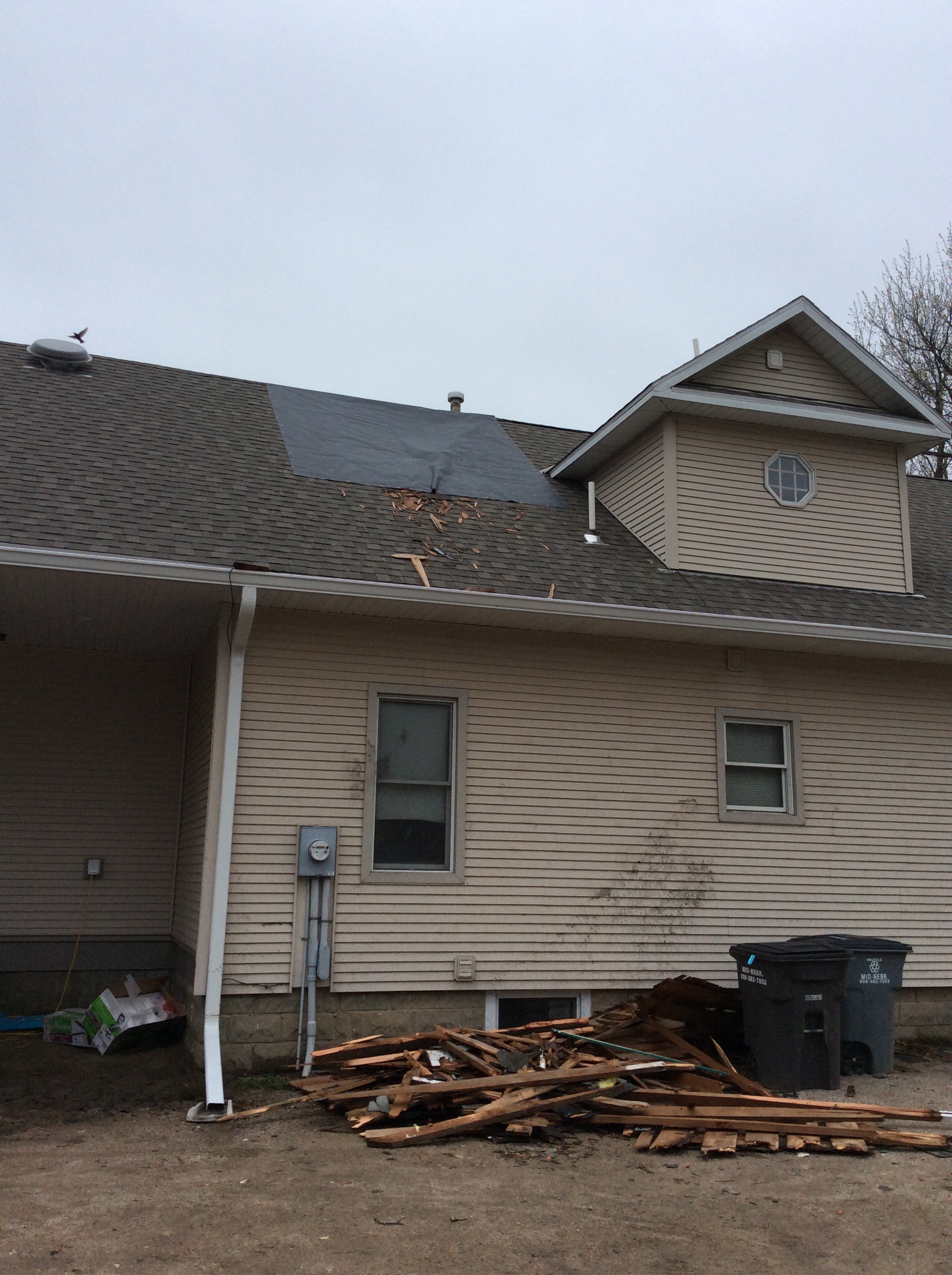
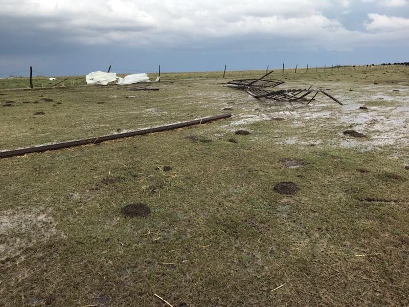
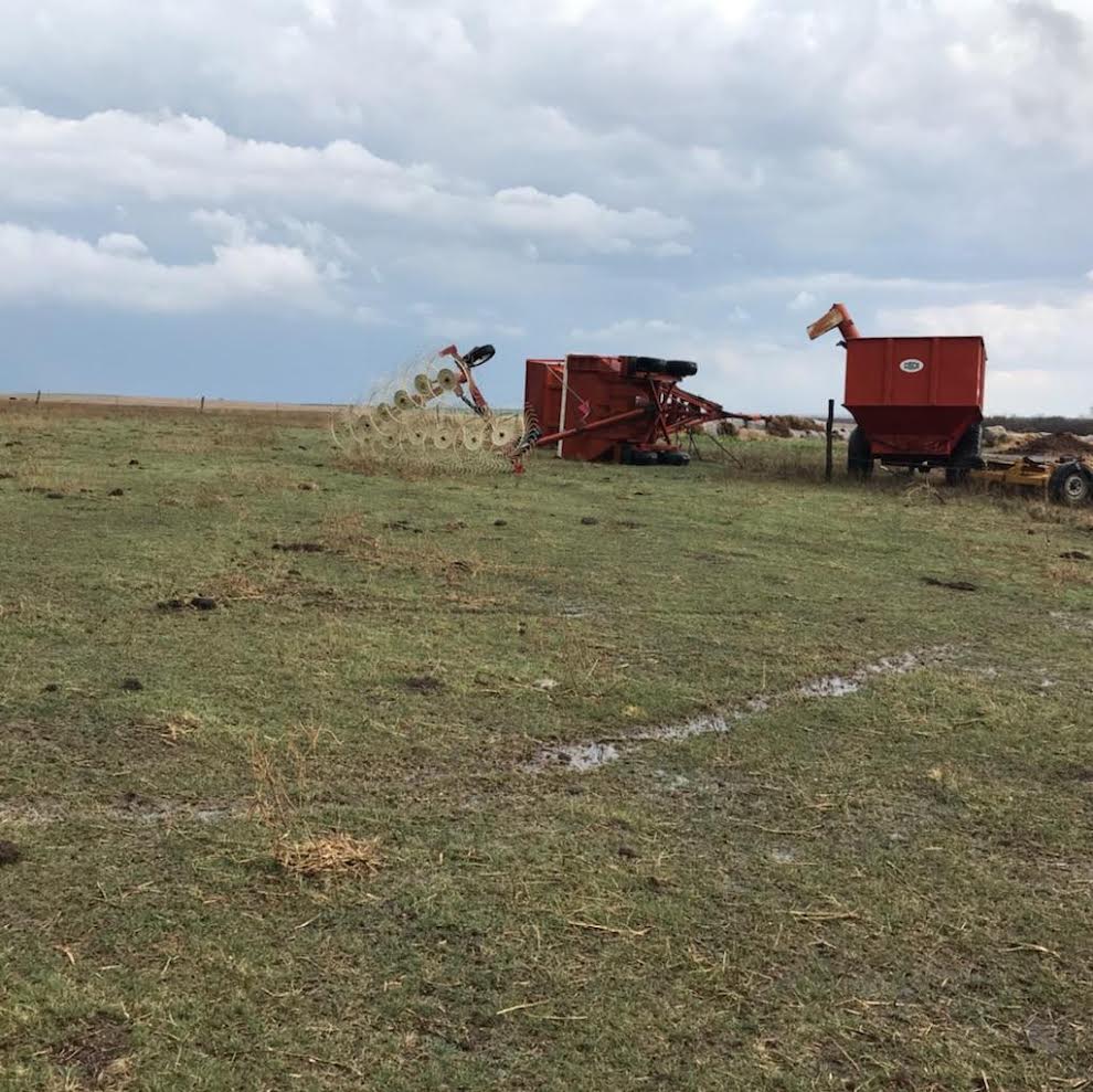
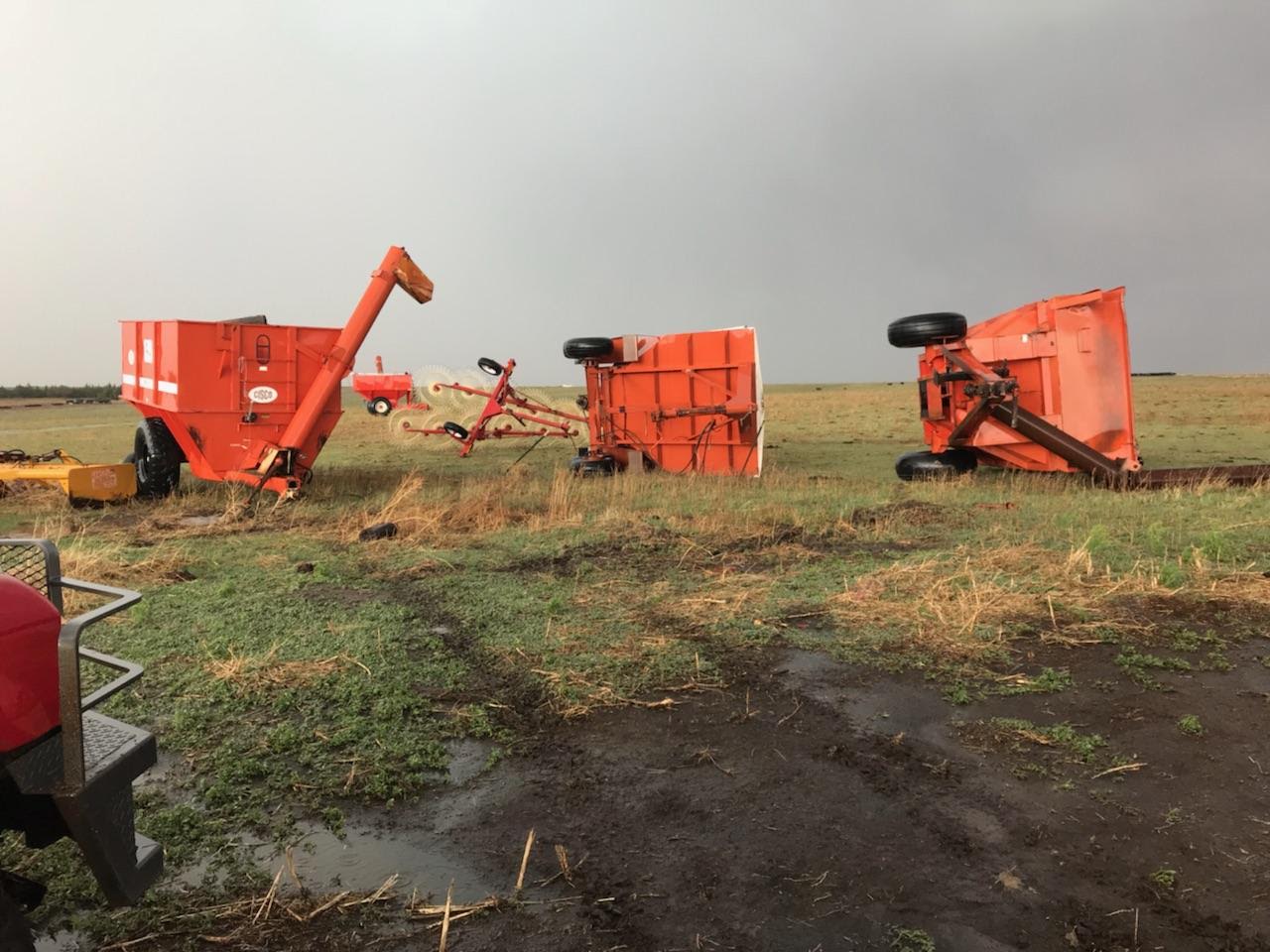
| 6 Miles NE of Luray, KS NWS Damage Survey |
6 Miles NE of Luray, KS ​NWS Damage Survey |
6 Miles NE of Luray, KS ​NWS Damage Survey |
6 Miles NE of Luray, KS ​NWS Damage Survey |
Flooding
Very heavy rain occurred over portions of Osborne and Mitchell counties where thunderstorms lingered late into the evening. 3-5"+ was observed across this area, leading to flooded roads.
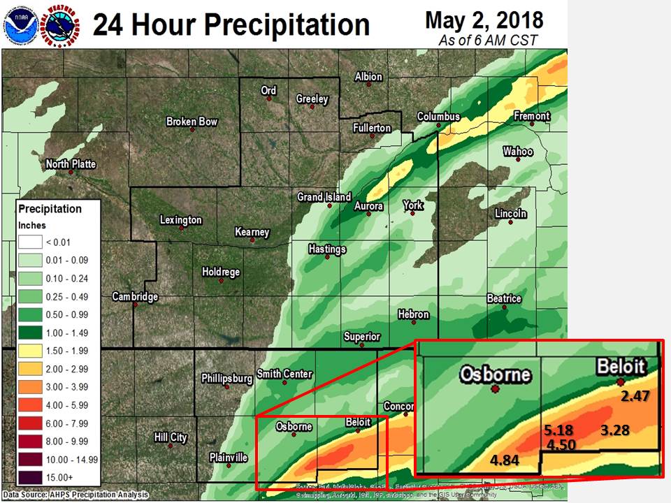 |
Heavy Rain Reports (24-hr)
|
Storm Reports
|
Large Hail Reports (golf ball size and larger)
Severe Wind Reports
|
|
 |
Media use of NWS Web News Stories is encouraged! Please acknowledge the NWS as the source of any news information accessed from this site. |
|