Tropical Depression Two is expected to gradually strengthen and could bring tropical storm conditions to the Florida Panhandle beginning late Monday. Areas of flash flooding will be possible through Thursday along the eastern and central Gulf Coast. Severe thunderstorms will develop and move along a cold front crossing the Upper Midwest Monday, and through the Ohio Valley/Mid-Atlantic on Tuesday. Read More >
Fort Worth/Dallas, TX
Weather Forecast Office
|
|
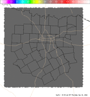
4 Panel Display | Animated Loop Significant Tornado (SigTor) A composite index that includes 0-6 km bulk wind shear, 0-1 km storm-relative helicity, surface based CAPE, surface parcel CIN, and surface parcel LCL height. Values greater than 1 are indicative of increased potential of significant tornadoes. The contours are the Lifted Condensation Level or LCL. A lower LCL typically increases tornadic risk because it is indicative of air parcel acceleration occurring closer to the surface.
|
Current Hazards
National Outlooks
Tropical
Local Storm Reports
Storm Reports (Graphical)
Submit Storm Report
Tornado Warnings
Severe Thunderstorm Warnings
Flash Flood Warnings
Forecasts
Forecast Discussion
Graphical Forecast
Aviation Forecasts
Fire Weather
Hazard Planner
N. Texas Convective Parameters
US Dept of Commerce
National Oceanic and Atmospheric Administration
National Weather Service
Fort Worth/Dallas, TX
3401 Northern Cross Blvd.
Fort Worth, TX 76137
817.429.2631
Comments? Questions? Please Contact Us.