Fort Worth/Dallas, TX
Weather Forecast Office
|
|
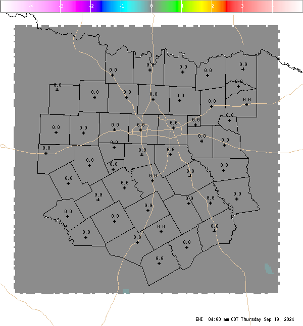
4 Panel Display | Animated Loop EHI The Energy Helicity Index (EHI) is a number which represents the combination of instability and storm relative helicity. Our calculation uses mixed layer CAPE (surface to 3000ft average parcel) and 0-3 km storm relative helicity. Values greater than 2 or 3 have been correlated to cyclonic supercells with increased tornadic potential. Negative values are indicative of an environment favorable for anti-cyclonic (left moving) supercells, but tornadoes associated with anti-cyclonic supercells are extremely rare. |
Current Hazards
National Outlooks
Tropical
Local Storm Reports
Storm Reports (Graphical)
Submit Storm Report
Tornado Warnings
Severe Thunderstorm Warnings
Flash Flood Warnings
Forecasts
Forecast Discussion
Graphical Forecast
Aviation Forecasts
Fire Weather
Hazard Planner
N. Texas Convective Parameters
US Dept of Commerce
National Oceanic and Atmospheric Administration
National Weather Service
Fort Worth/Dallas, TX
3401 Northern Cross Blvd.
Fort Worth, TX 76137
817.429.2631
Comments? Questions? Please Contact Us.