Sioux Falls, SD
Weather Forecast Office
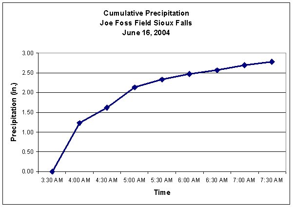
Rainfall Accumulation measured at Sioux Falls - Joe Foss Field
in the early morning on June 16 2004
|
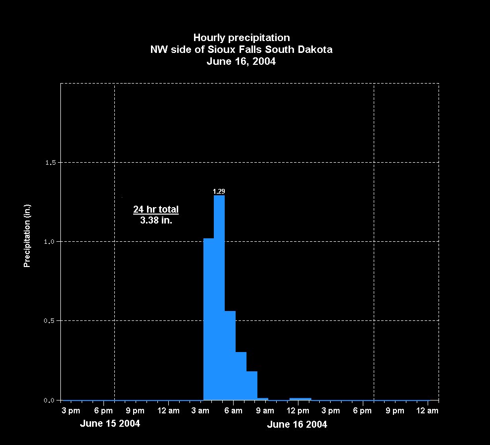
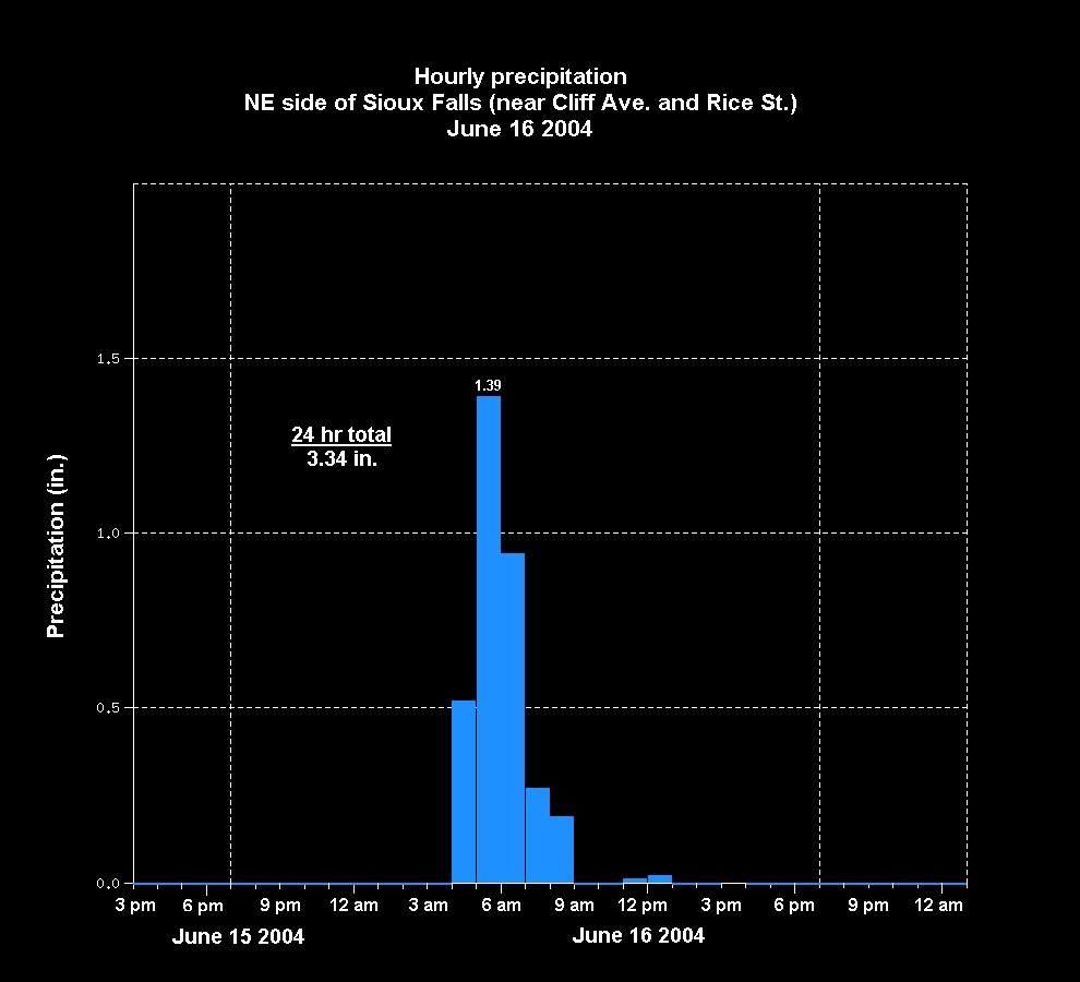
Hourly Rainfall |
|
|---|---|
 |
|
|
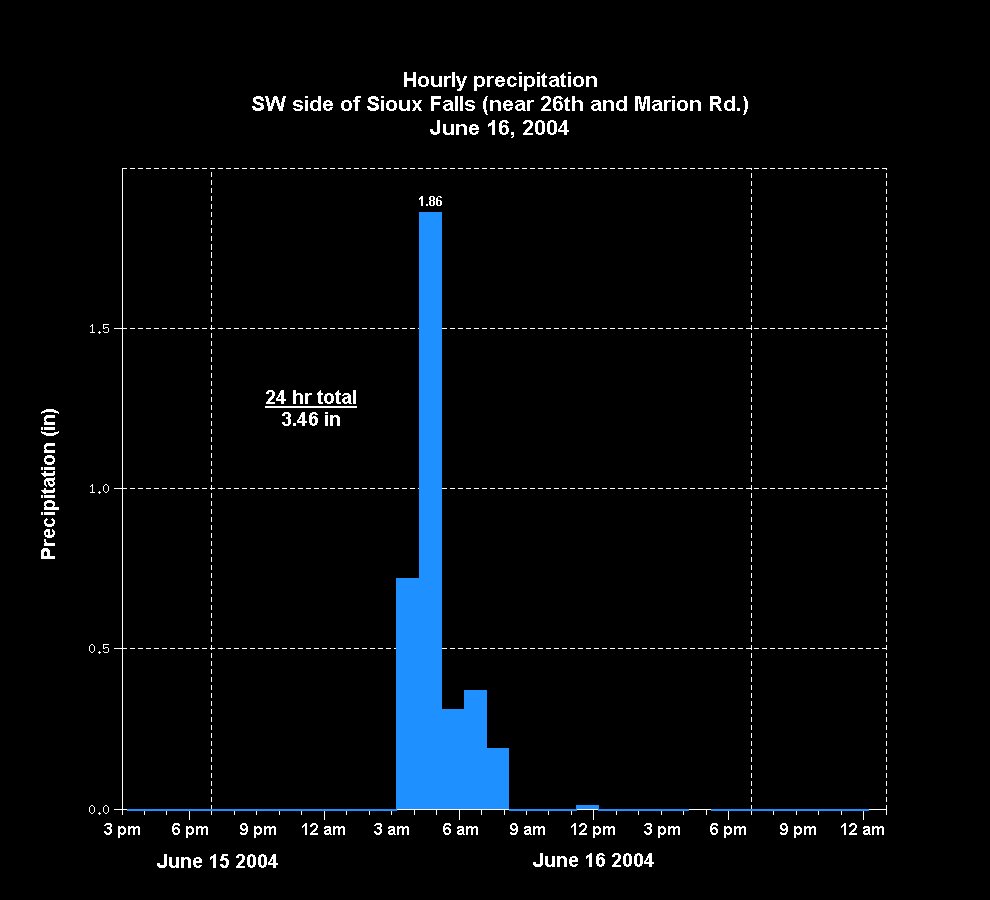
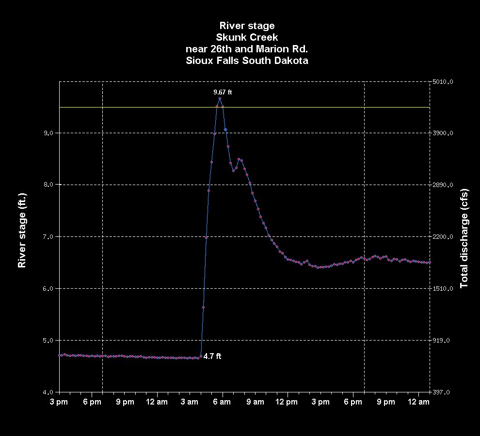
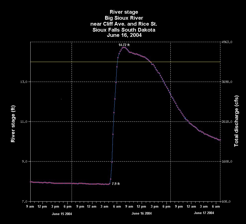
Hourly Rainfall (left) and River Stage (right) |
|
|---|---|
 |
 |
| Hourly Rainfall (left) and River Stage (right) Big Sioux River at North Cliff Avenue (click images to enlarge) |
|
|---|---|
 |
 |
| Radar Estimated Precipitation (click images to enlarge) |
|
|---|---|
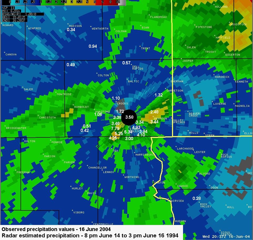 Storm Total Precipitation |
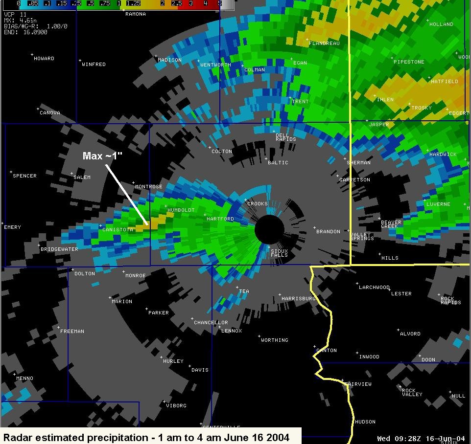 3-hour Precipitation: 1 am to 4 am |
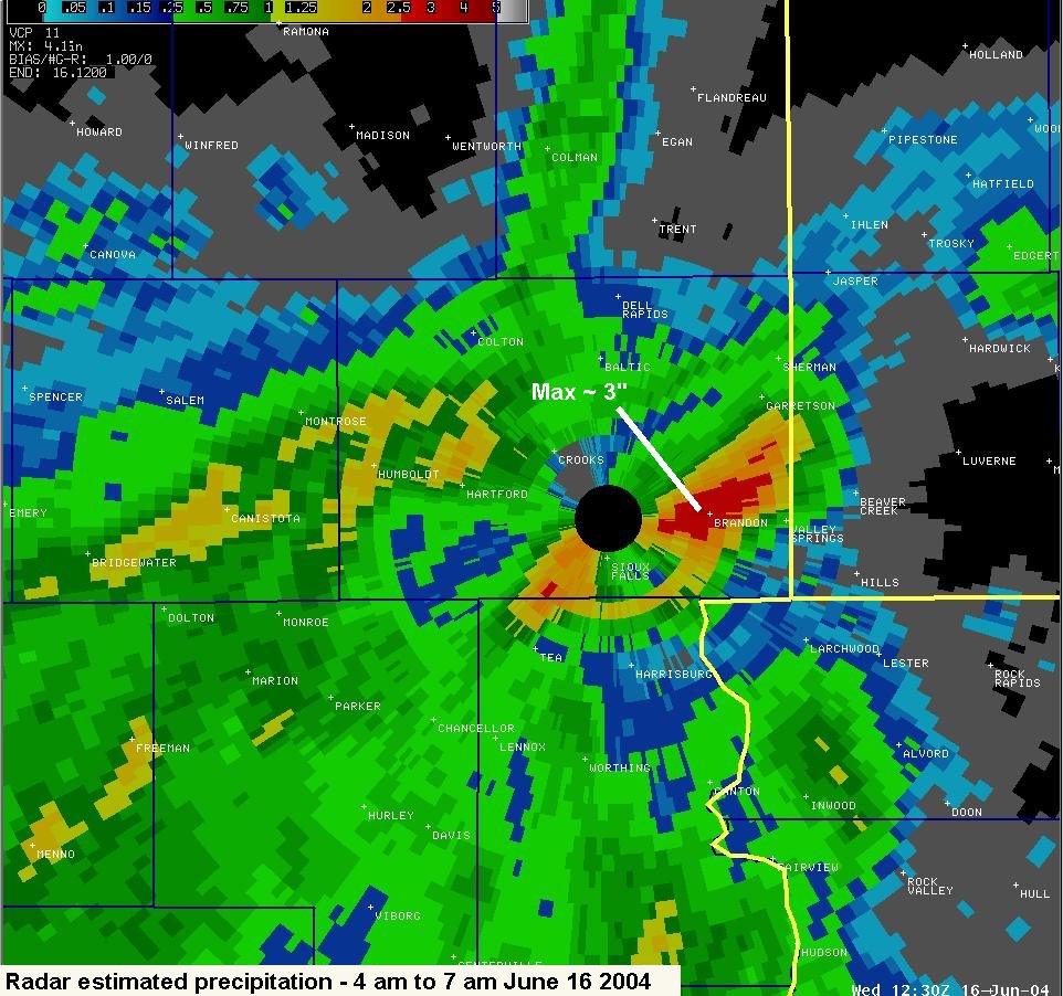 3-hour Precipitation: 4 am to 7 am |
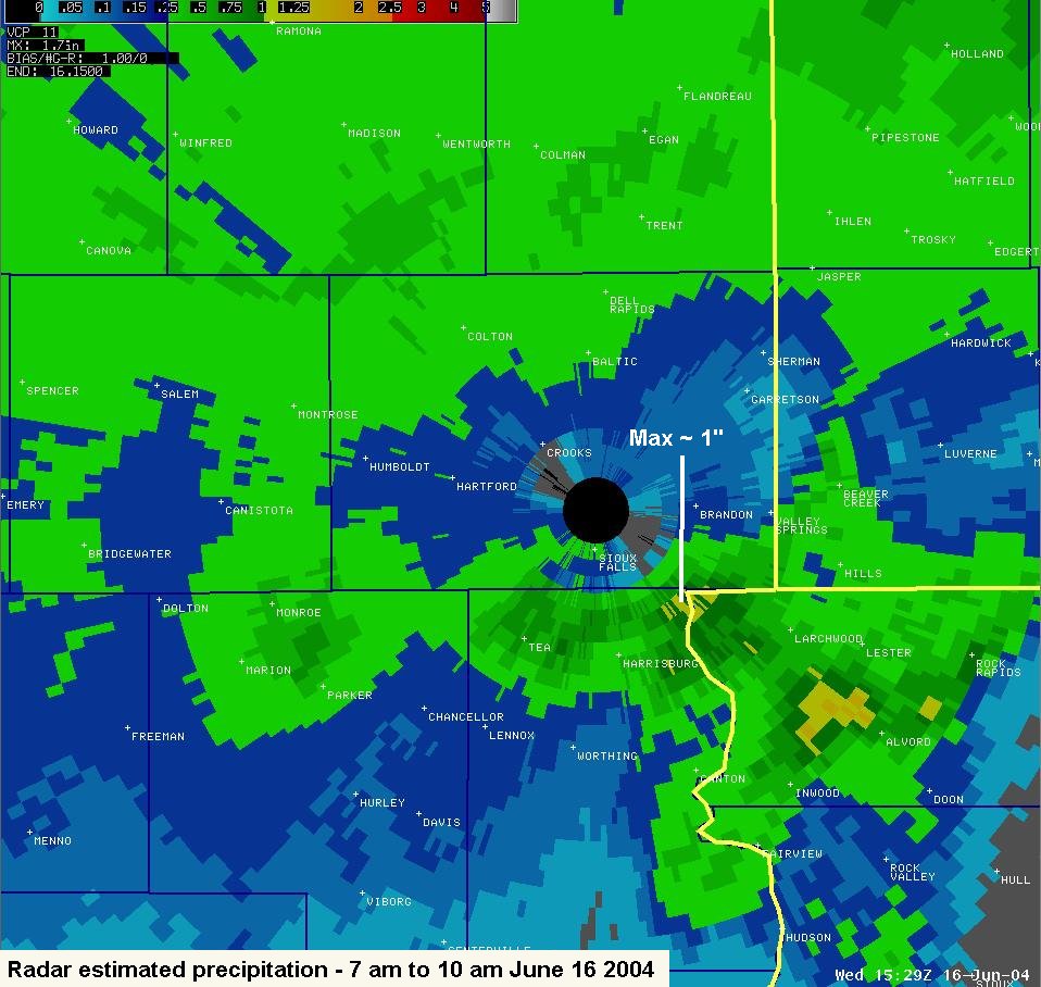 3-hour Precipitation: 7 am to 10 am |
Popular Pages
Past Weather Events
Regional Weather Roundup
Daily Temp/Precip
Hazardous Weather
Local Climate Archives
Climate Graphs and Data
Seasonal
EvapoTranspiration
Fire Weather
Grassland Fire Danger
Flooding (River)
Summer Weather
Travel Forecasts
Winter Weather
Winter Preparedness
Forecast Snowfall Graphic
Winter Temp Climatology
US Dept of Commerce
National Oceanic and Atmospheric Administration
National Weather Service
Sioux Falls, SD
26 Weather Lane
Sioux Falls, SD 57104-0198
605-330-4247
Comments? Questions? Please Contact Us.


 Weather Story
 Weather Map
 Local Radar