Overview
|
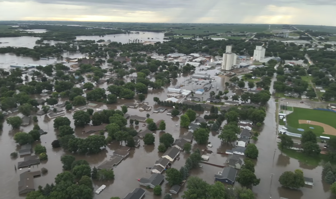
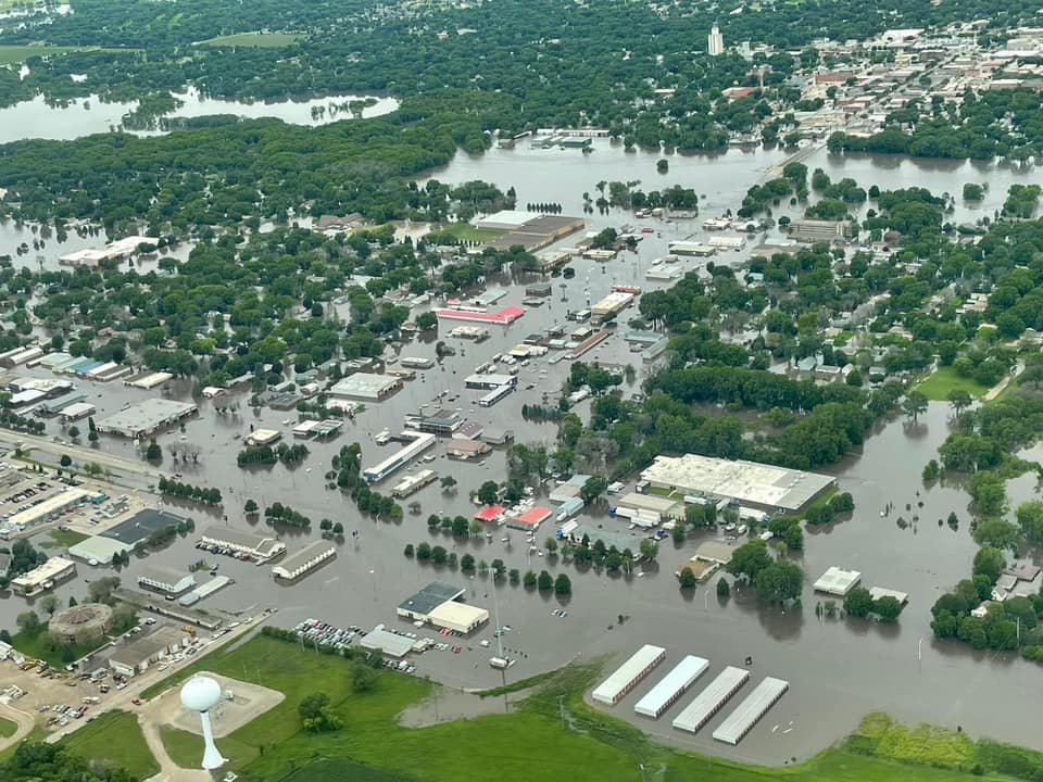
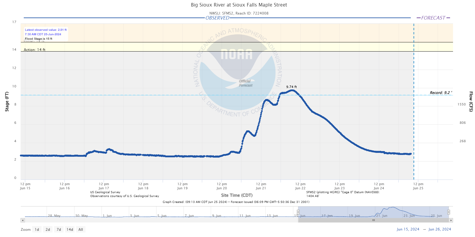
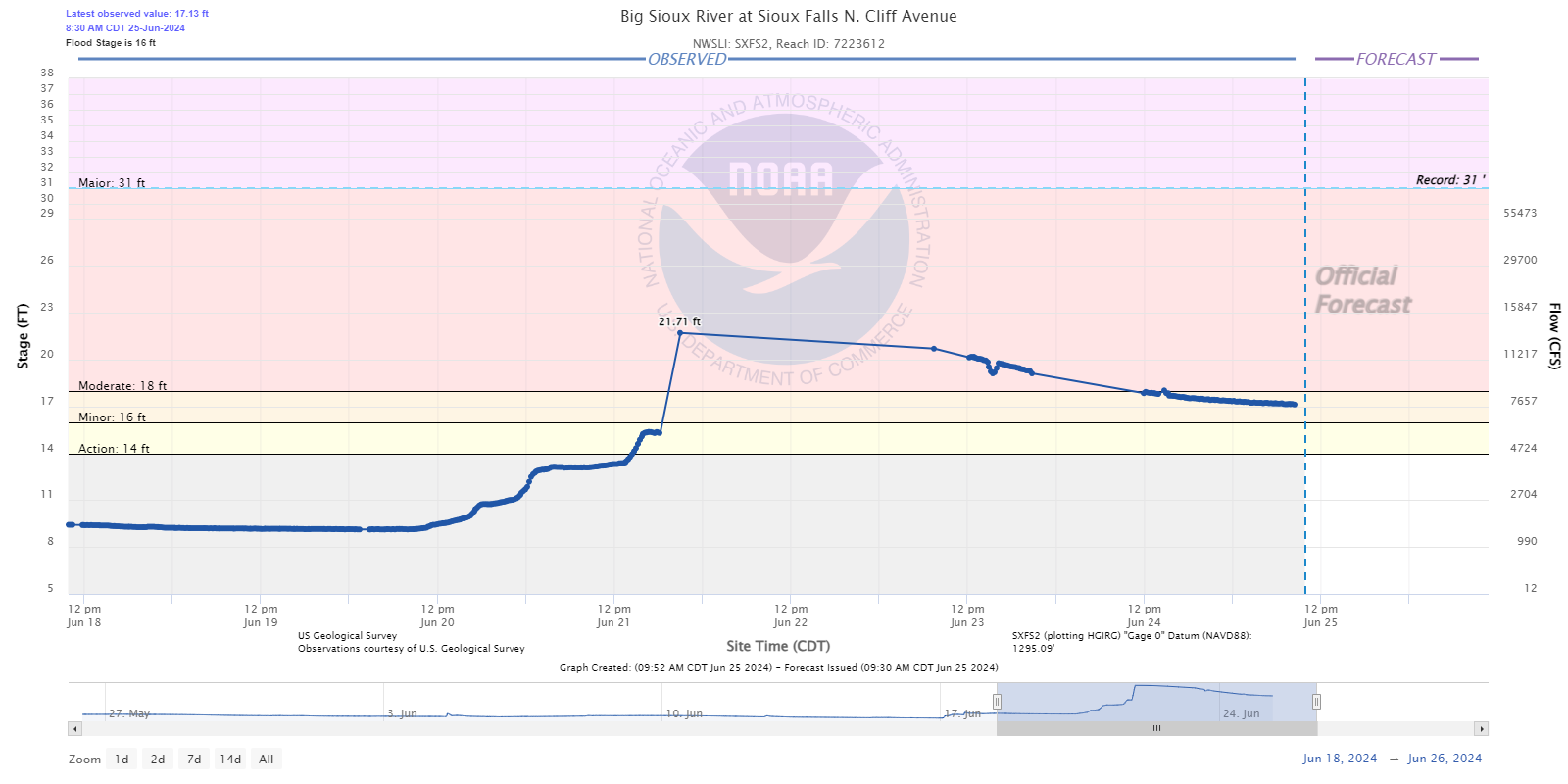
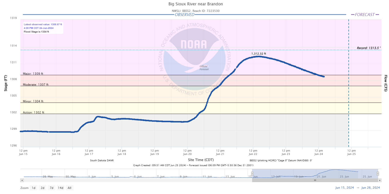
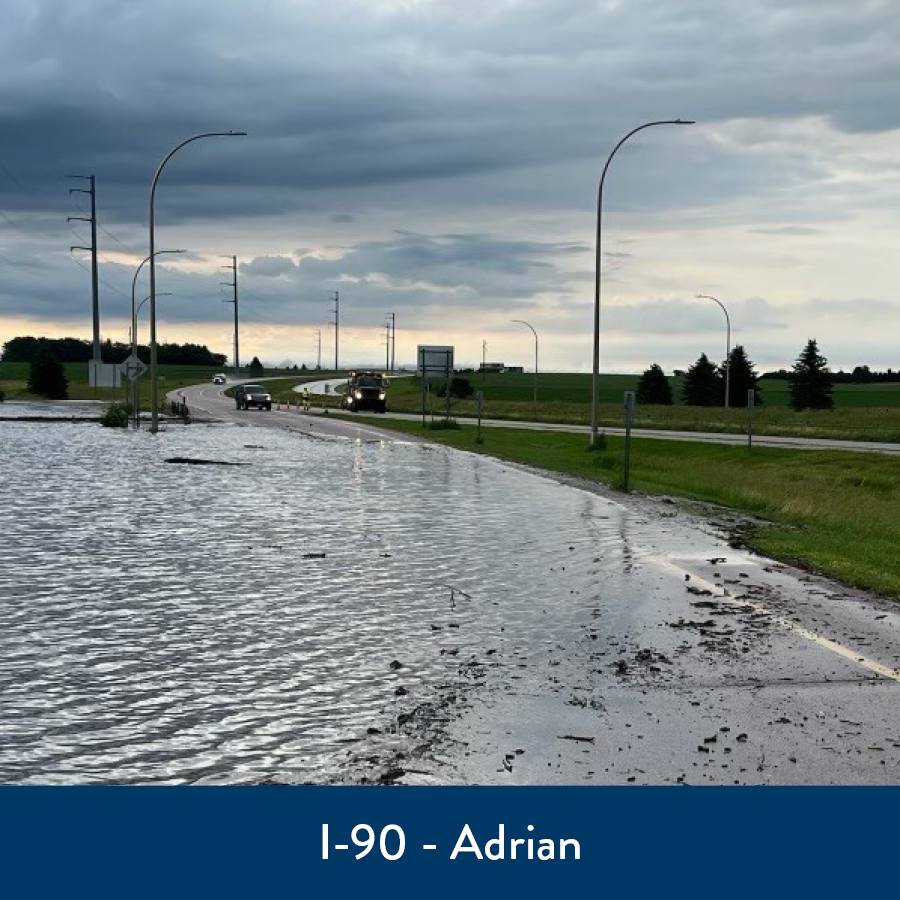
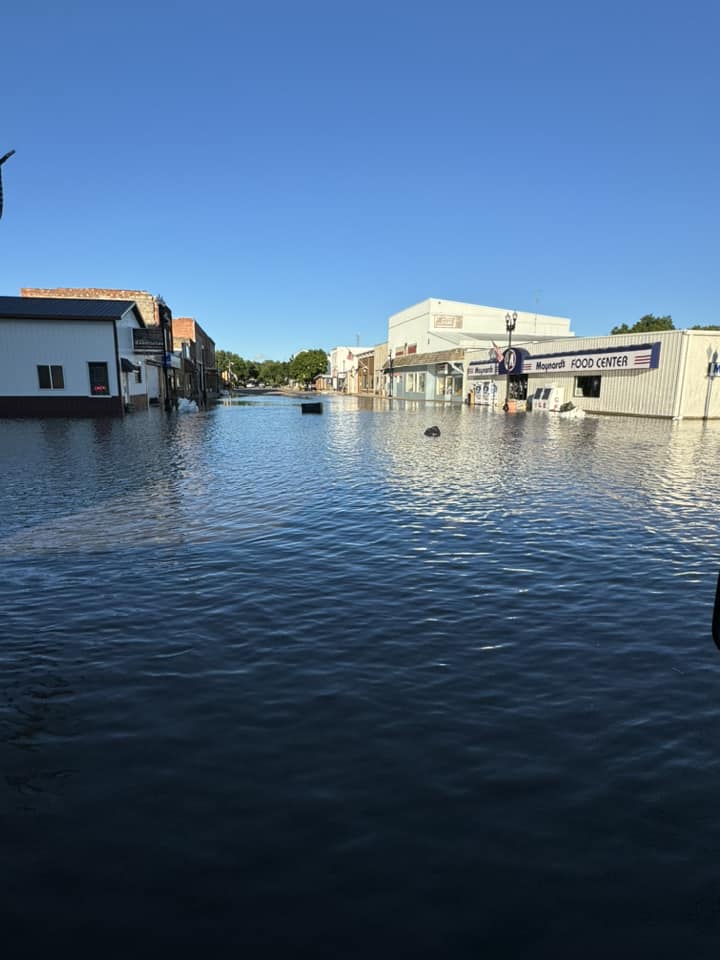
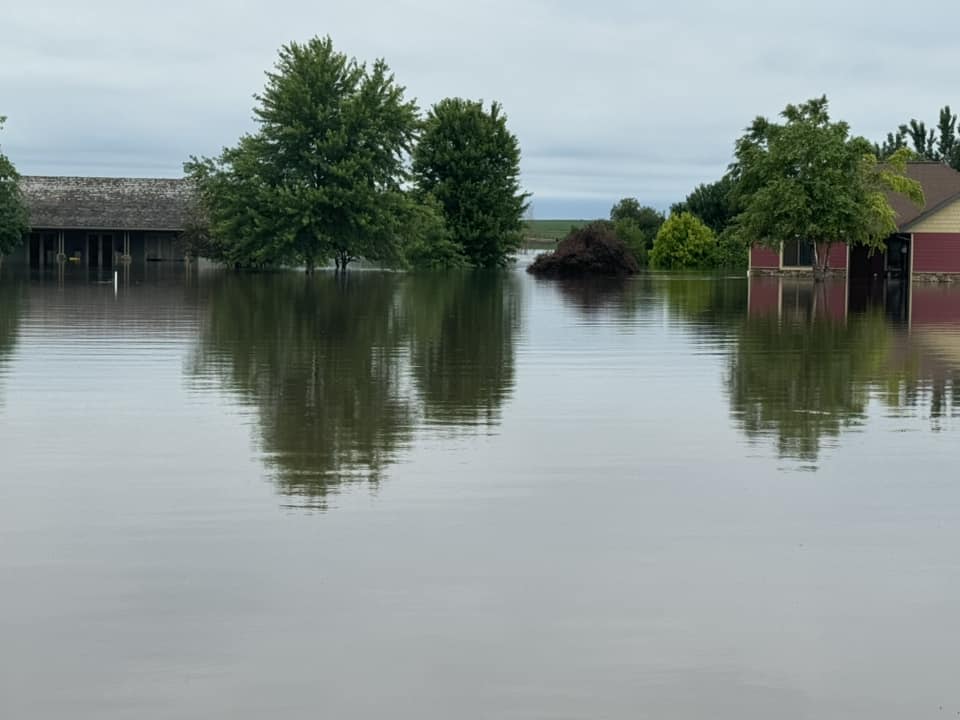
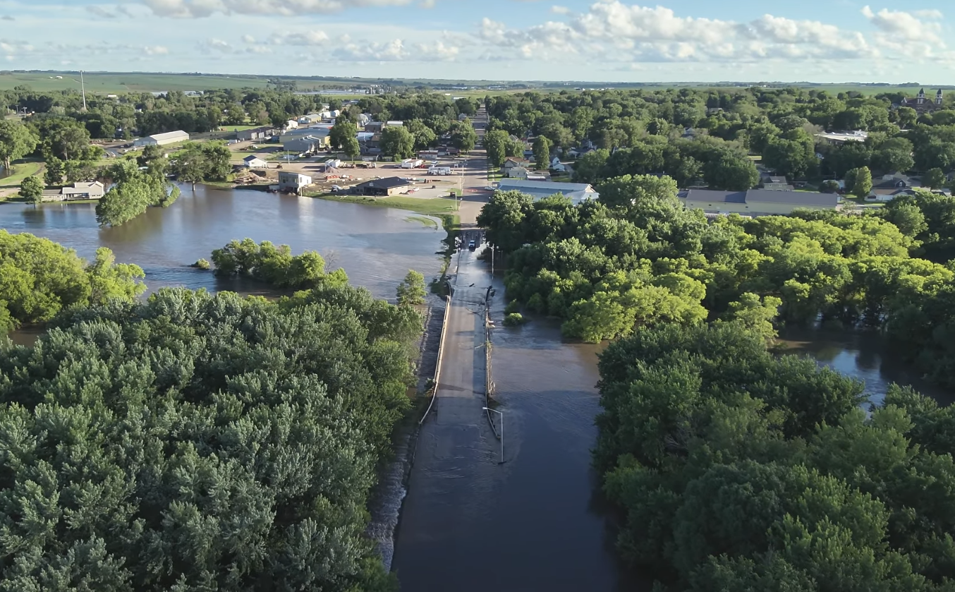
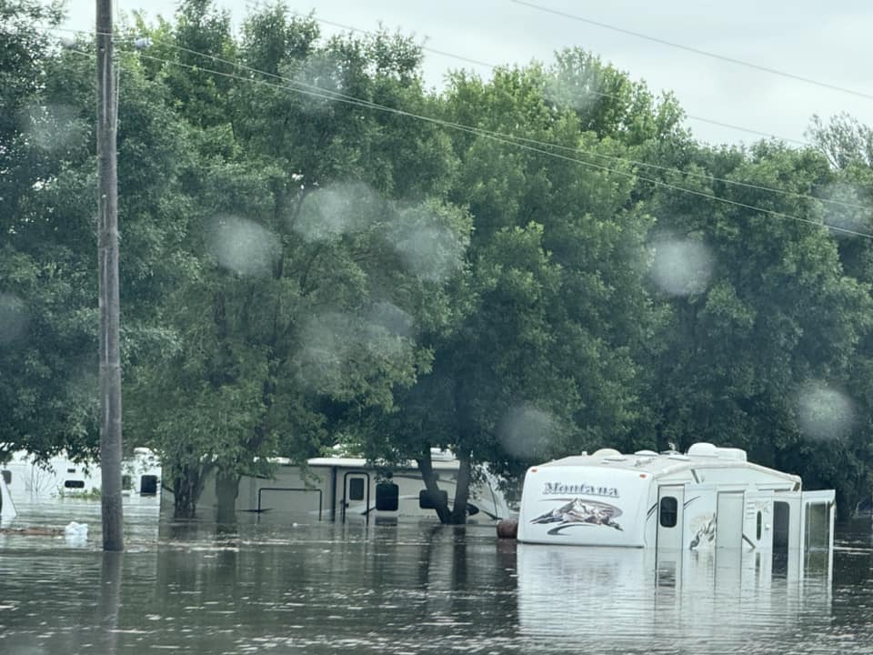
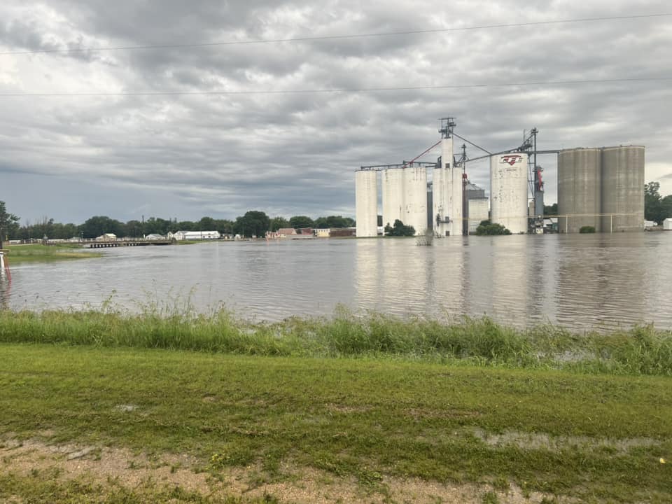
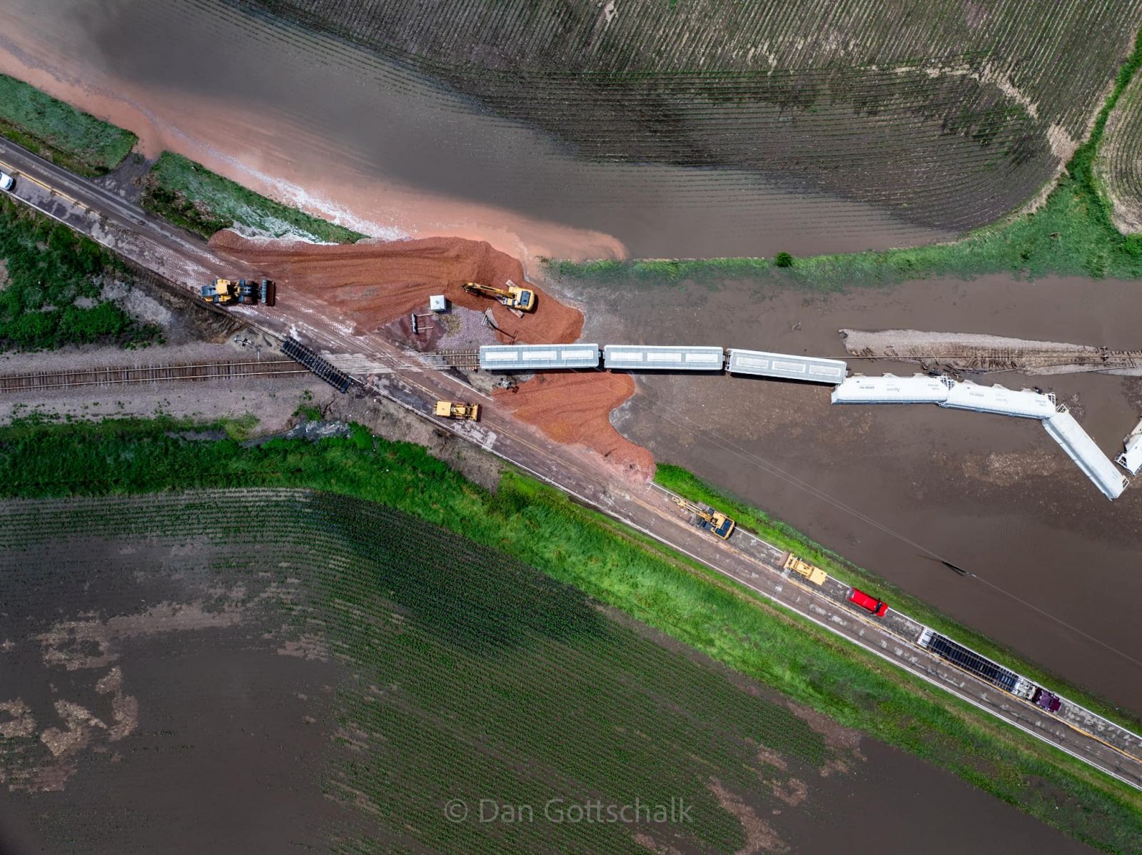
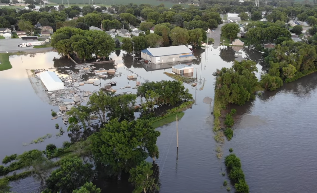
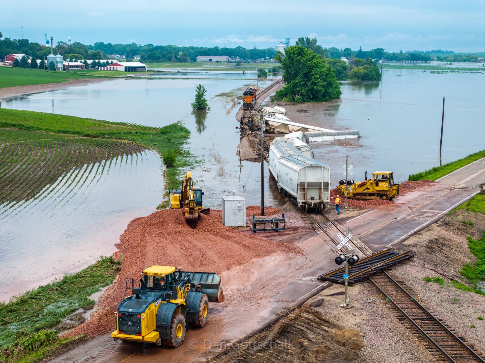
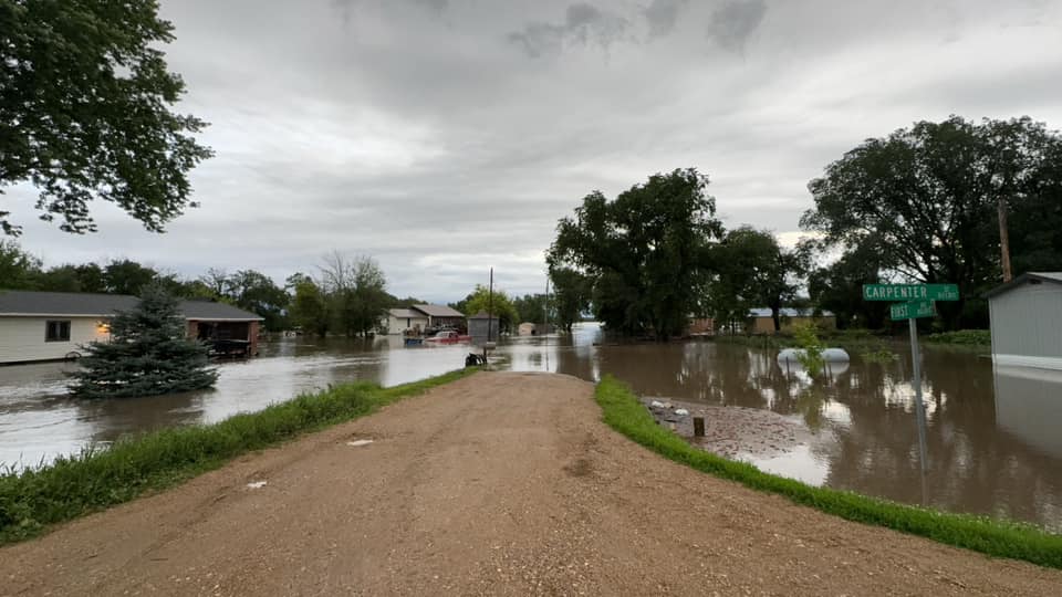
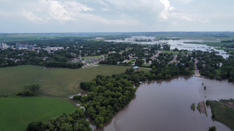
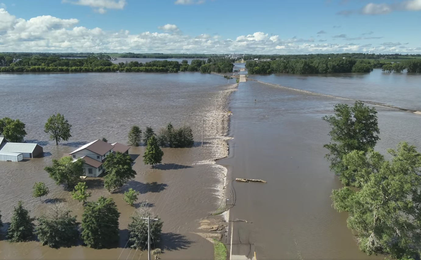
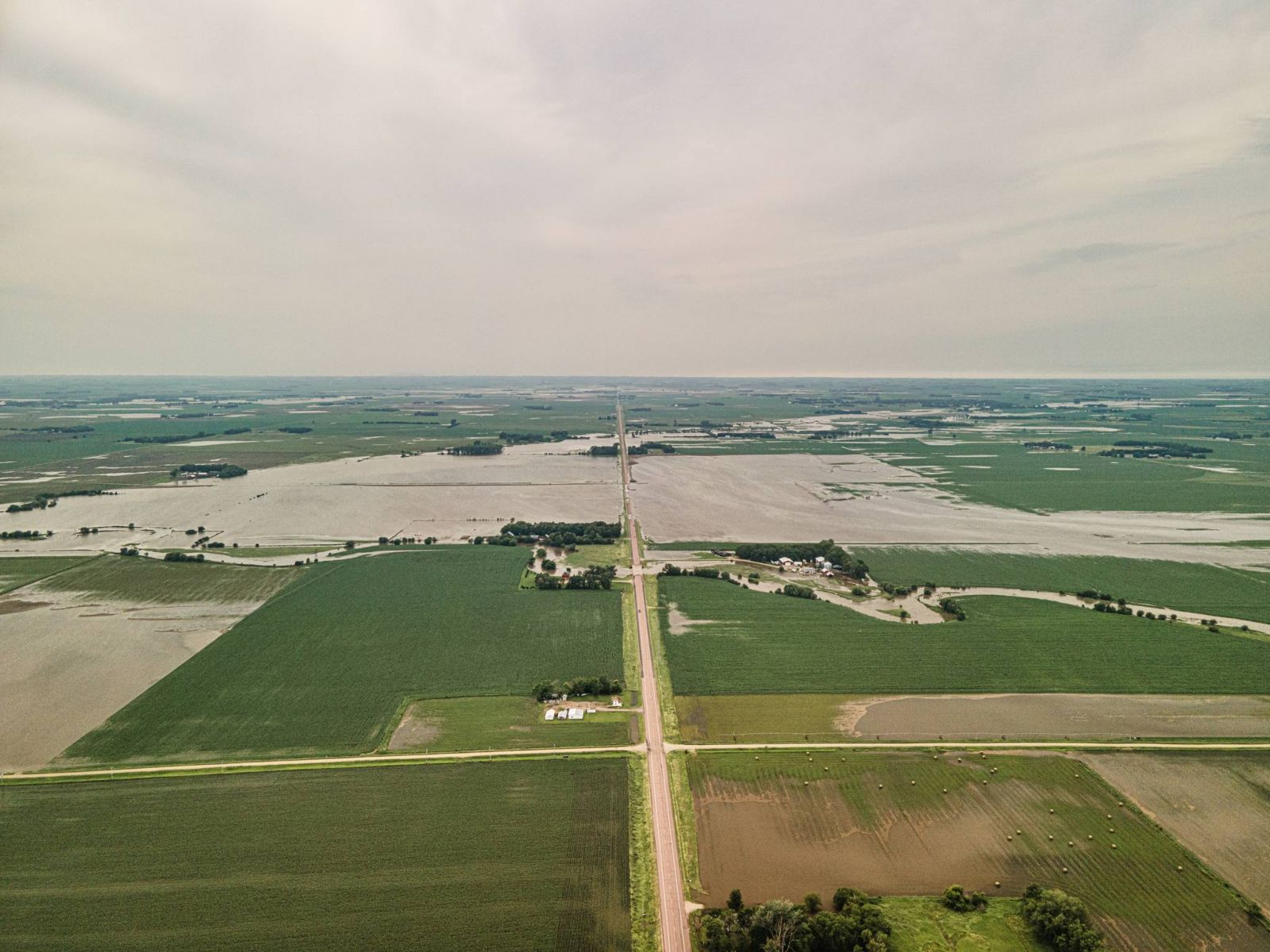
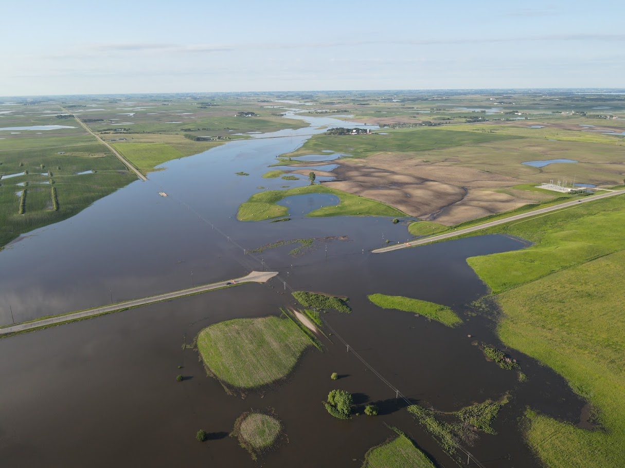
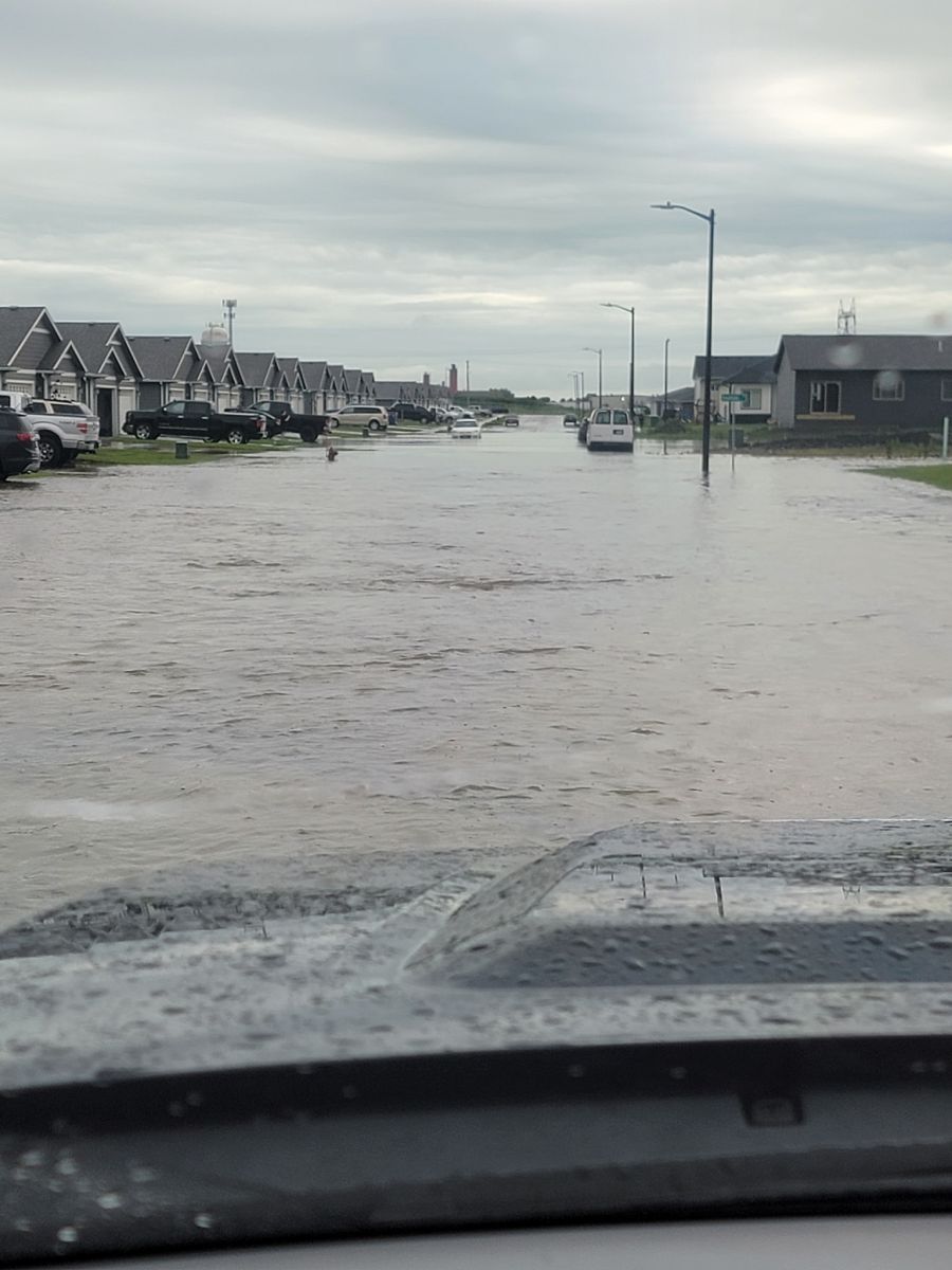
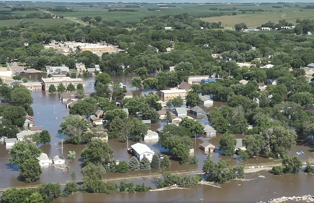
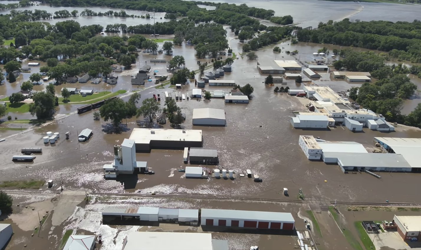
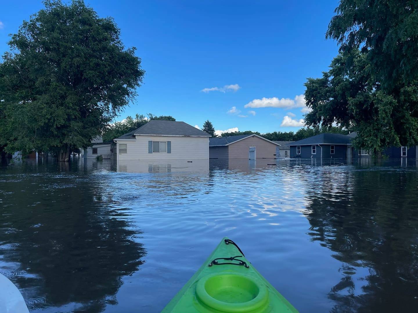
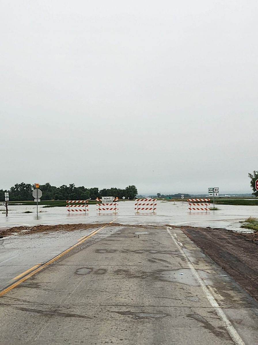
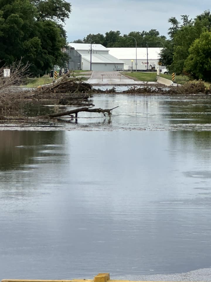
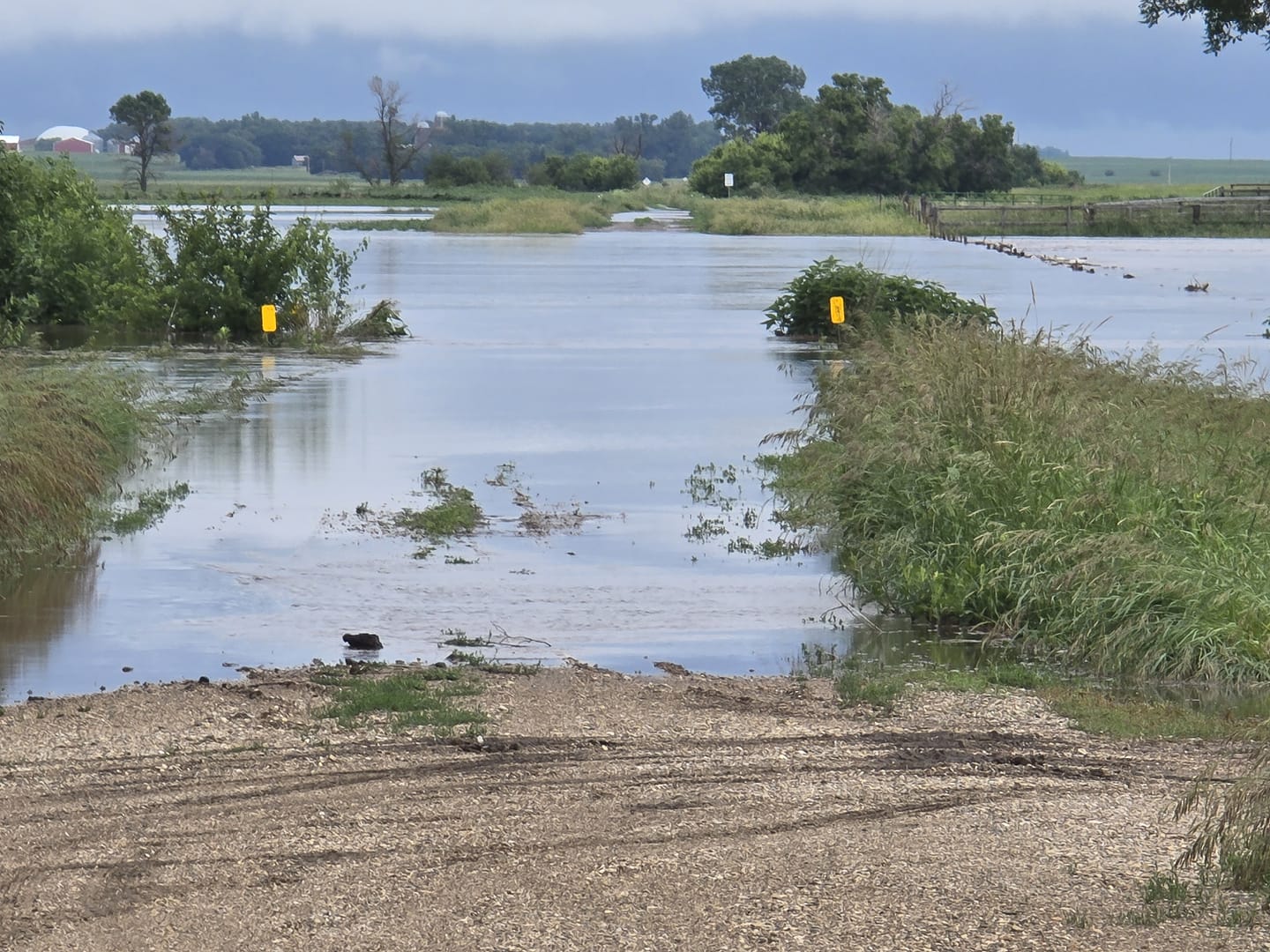
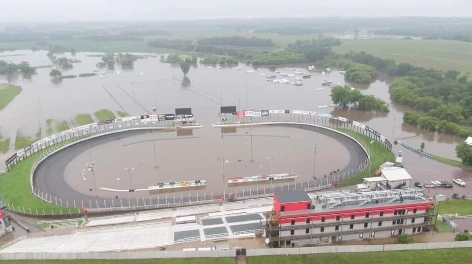
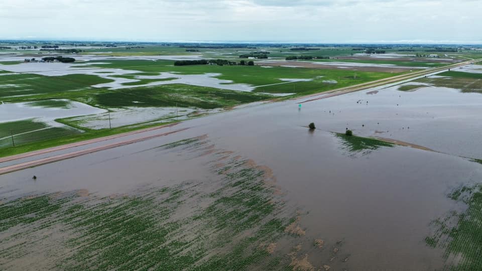
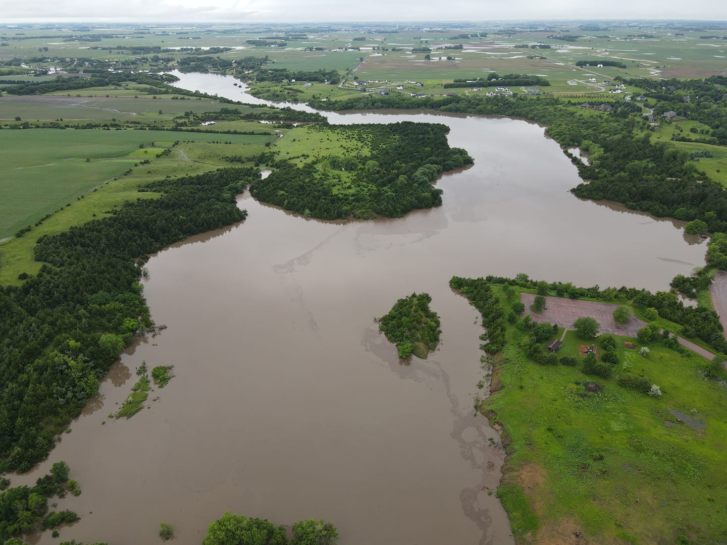
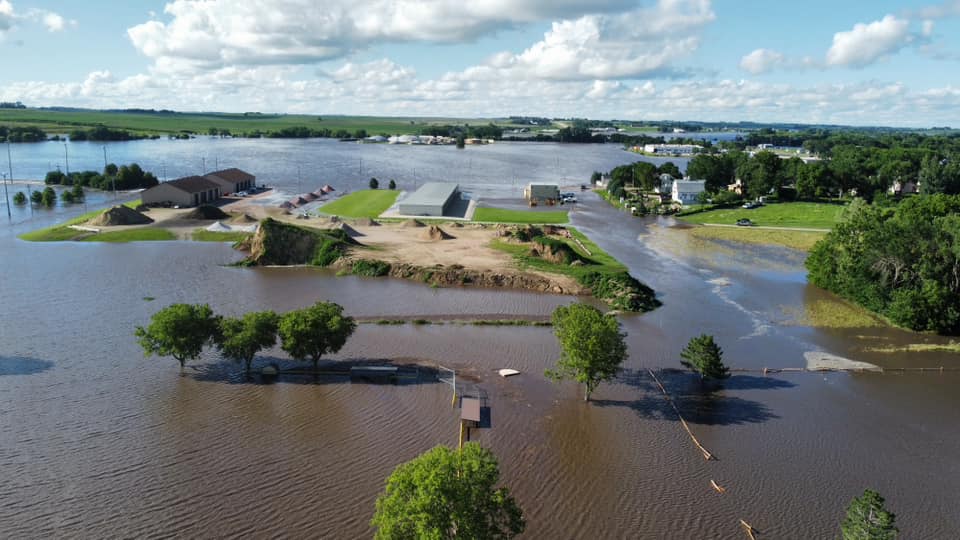
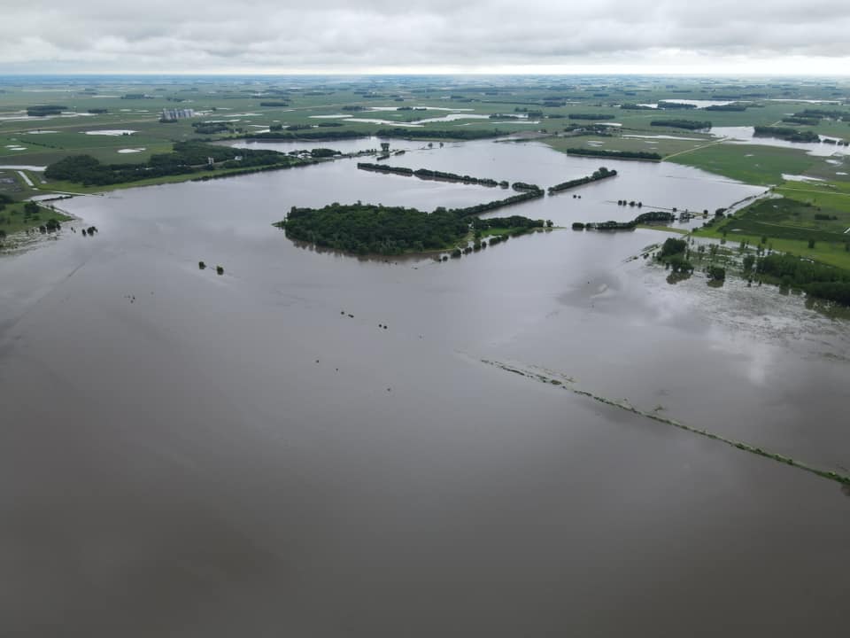
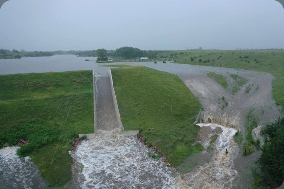
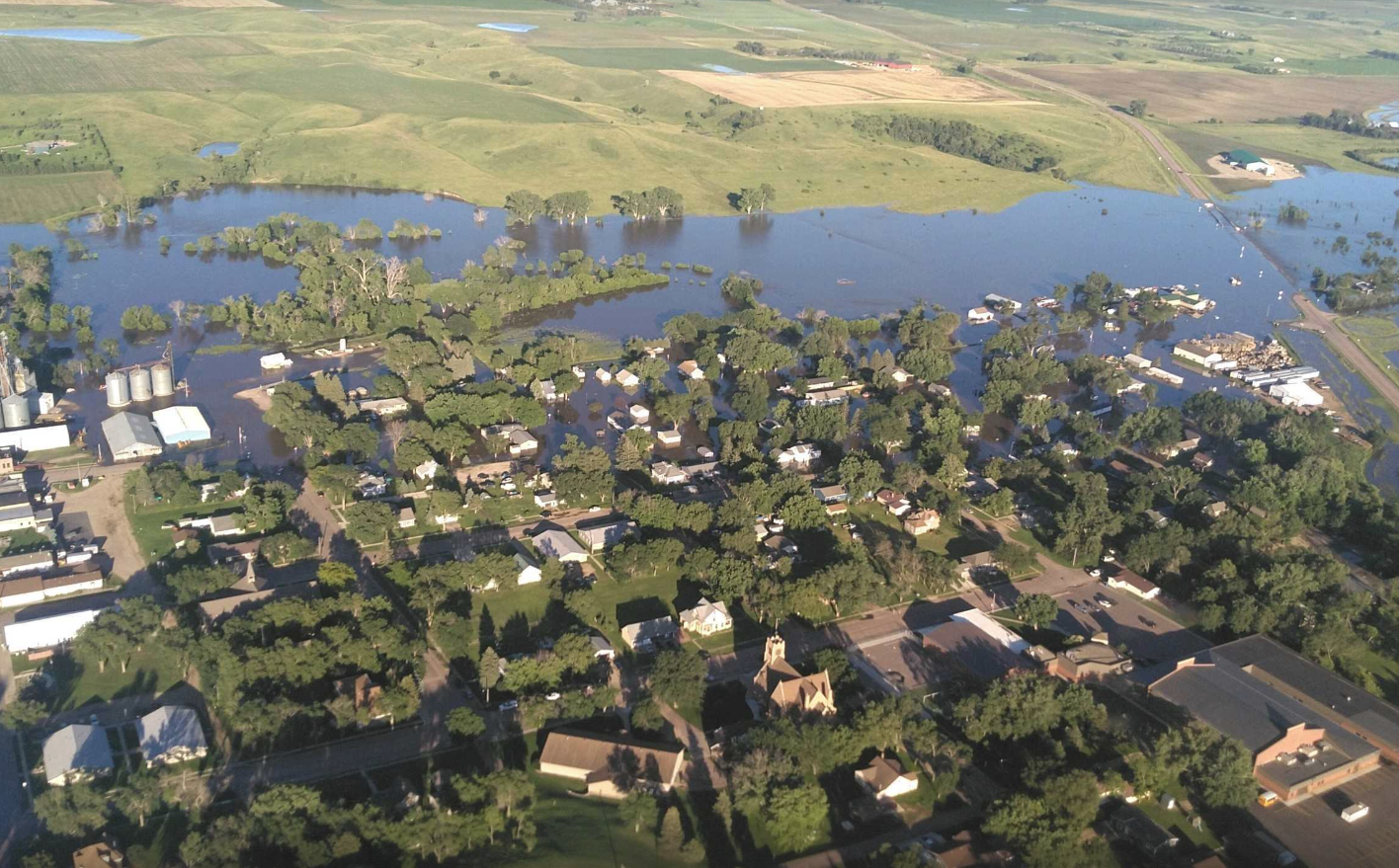
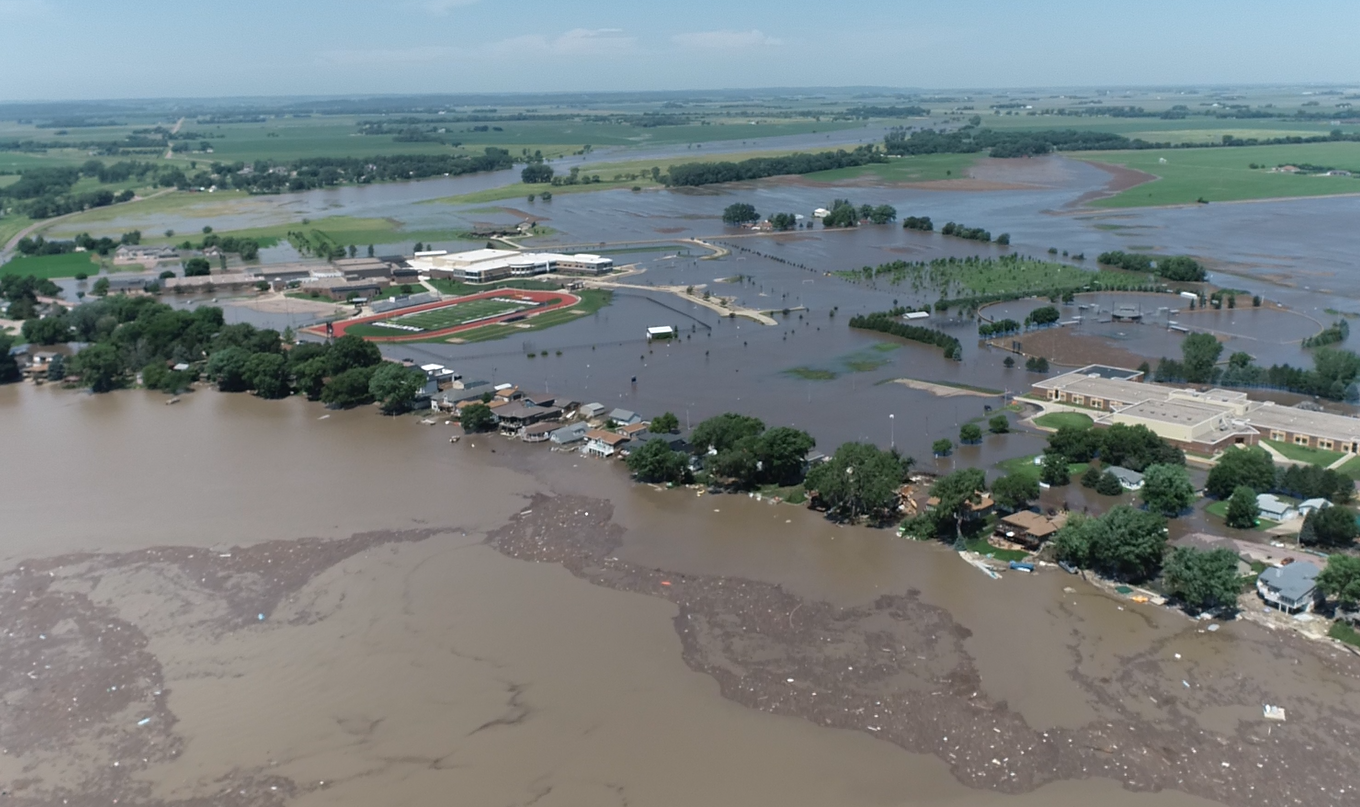
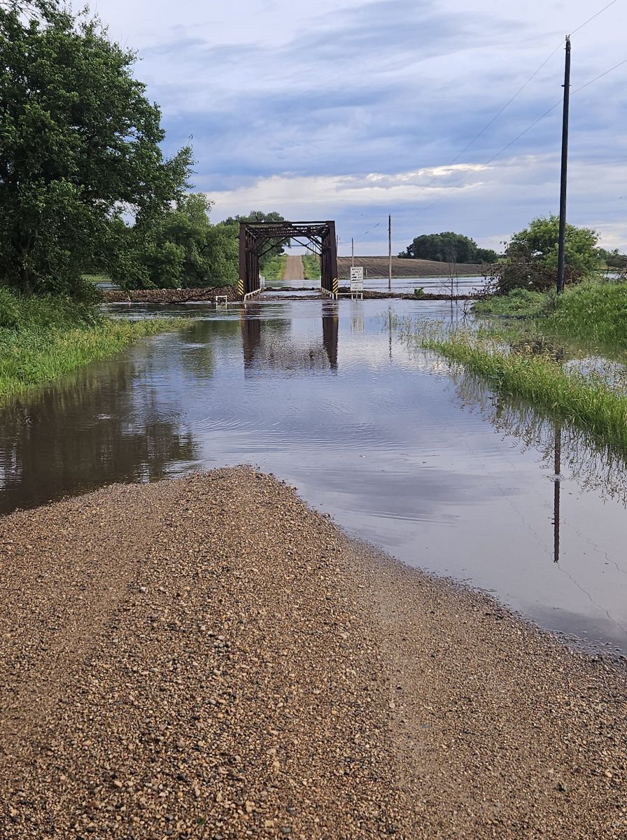
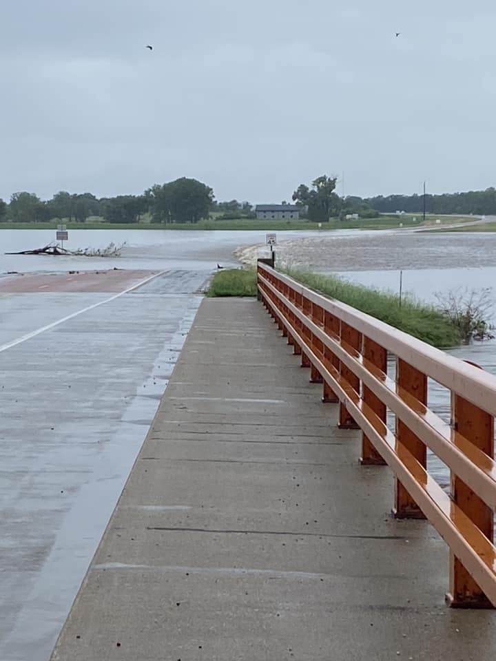
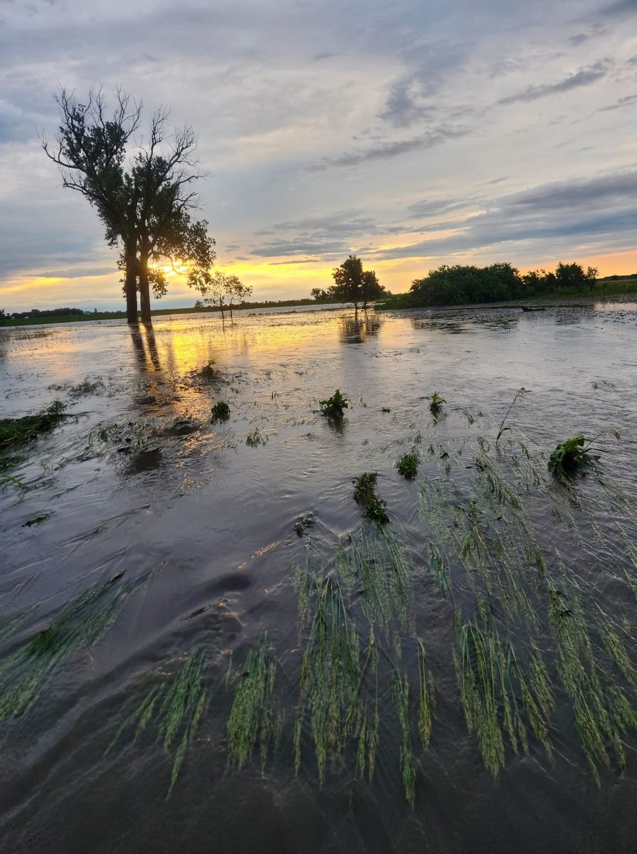
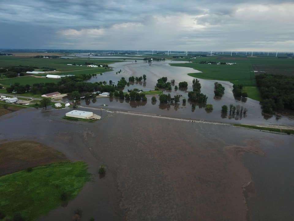
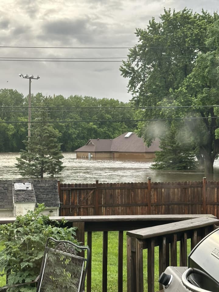
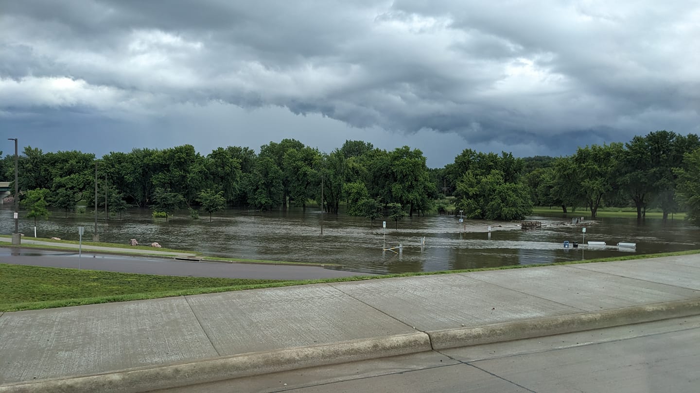
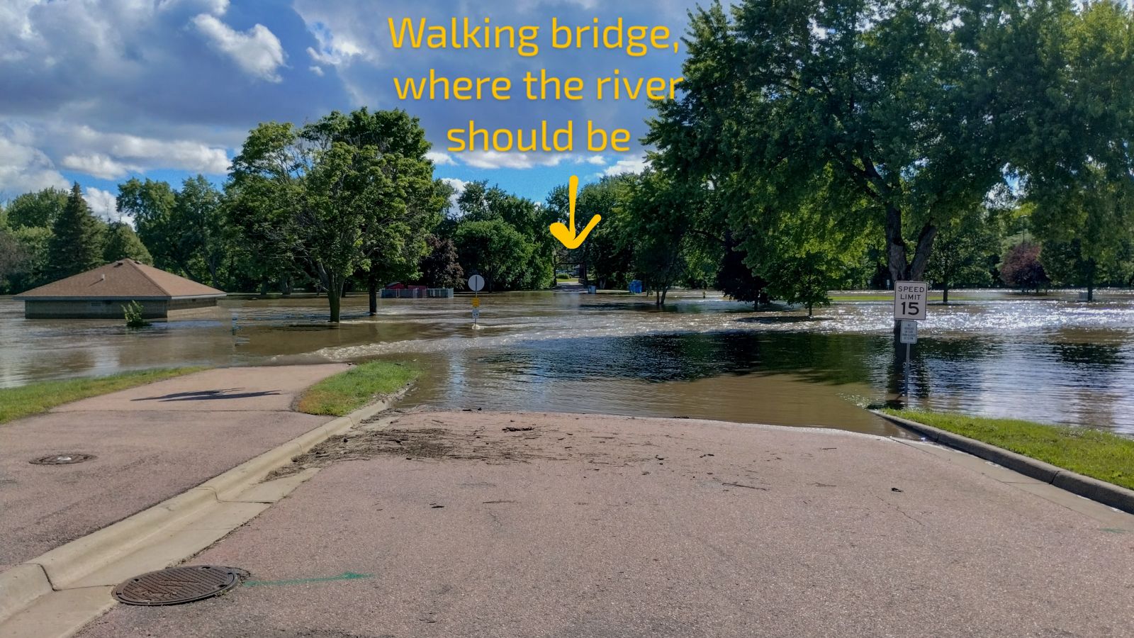
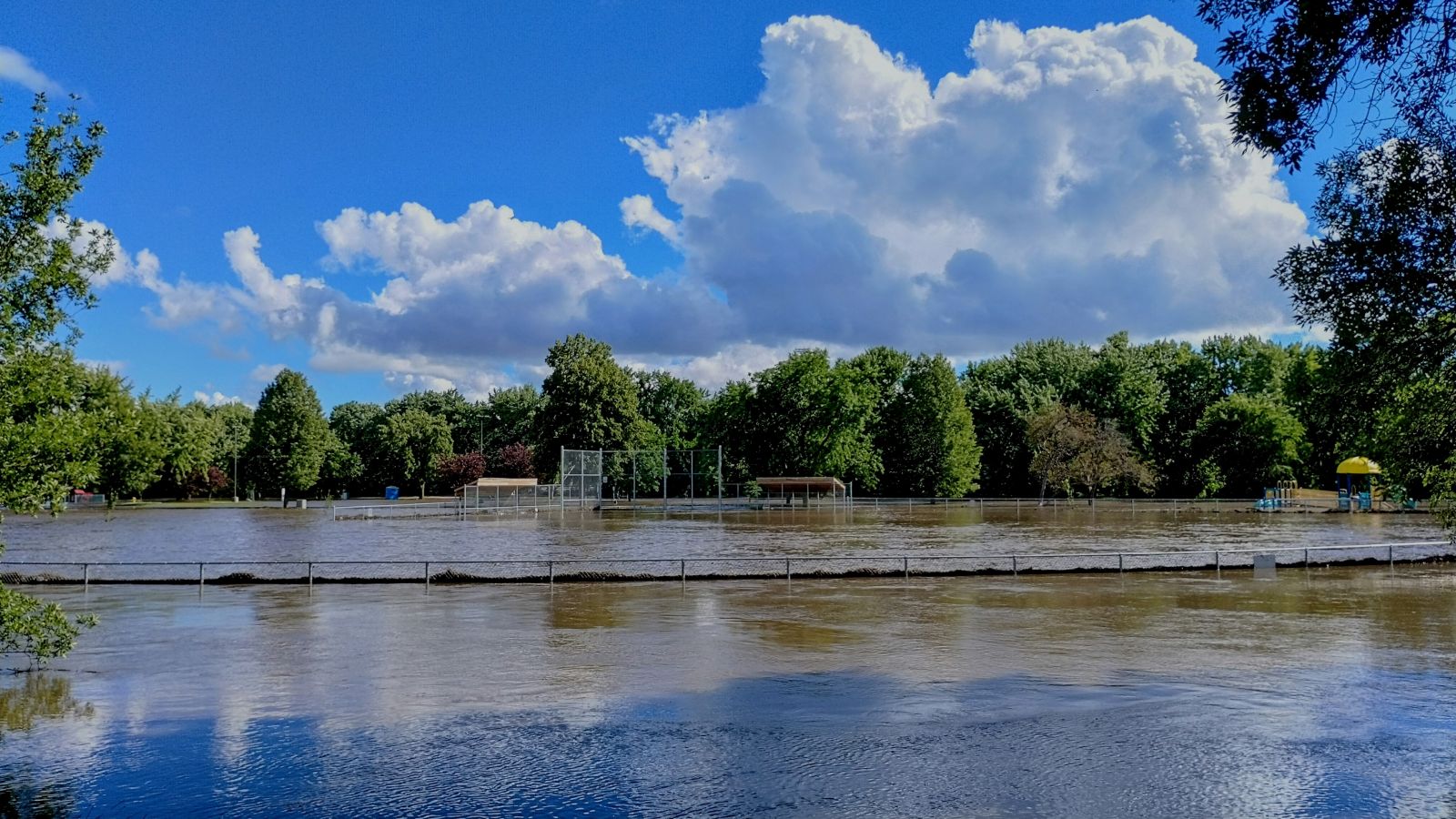
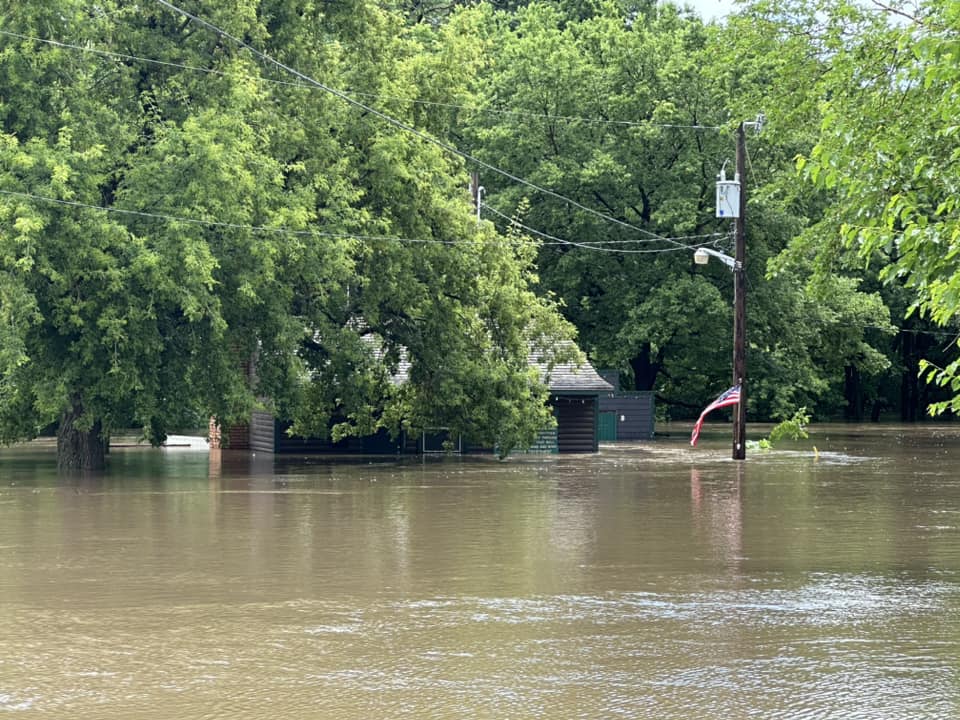
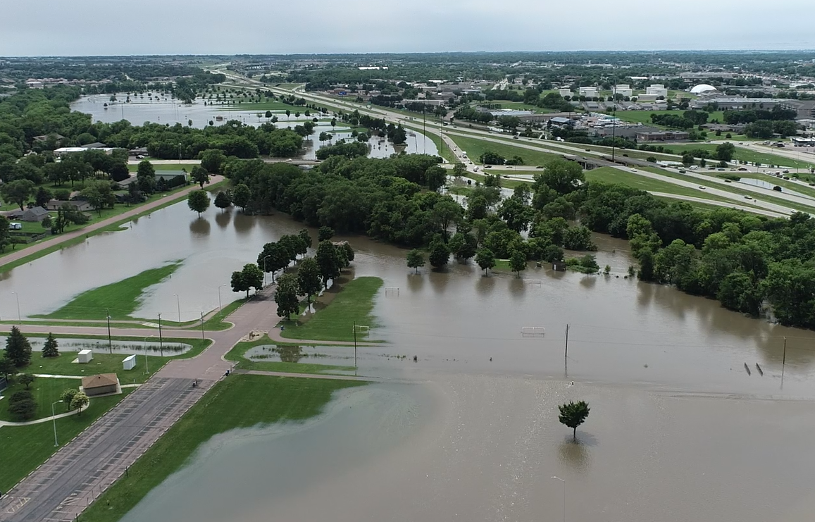
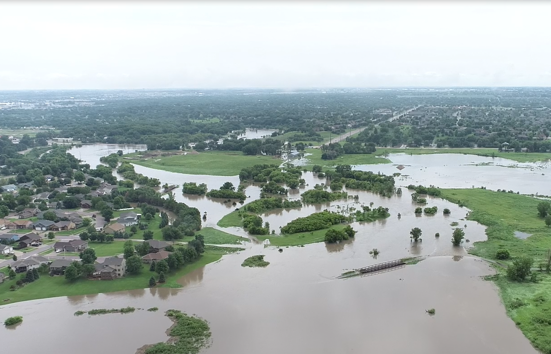
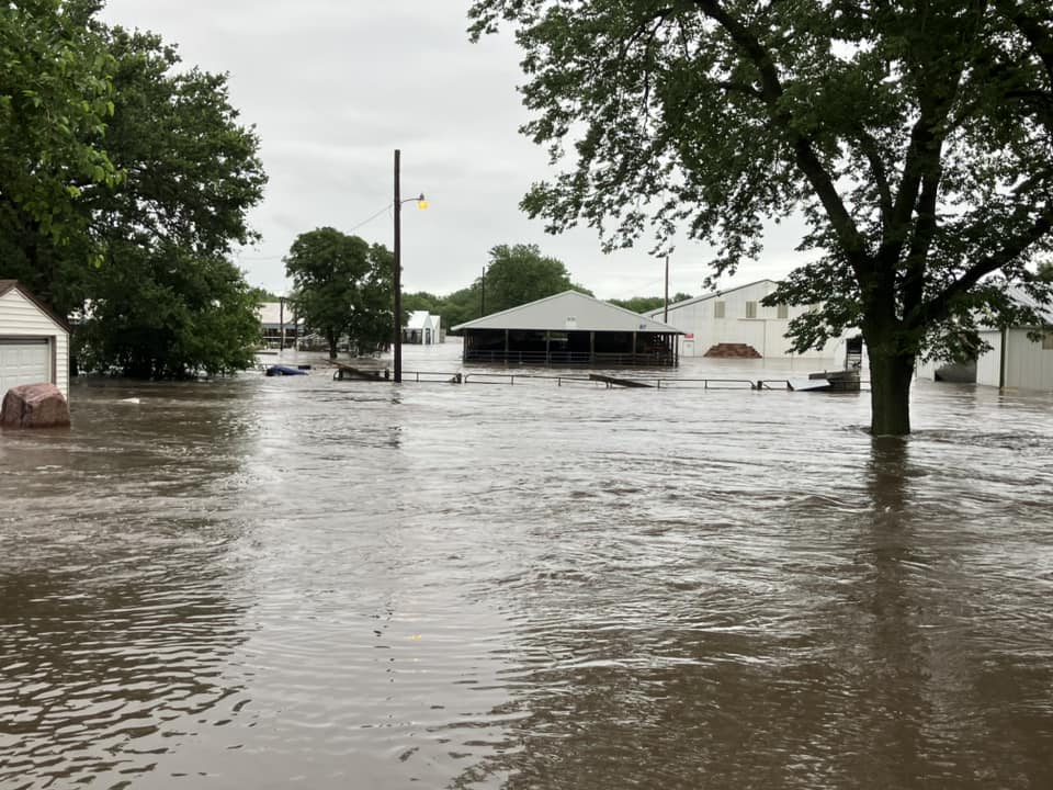
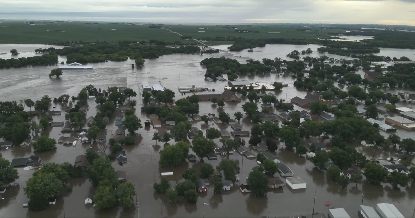
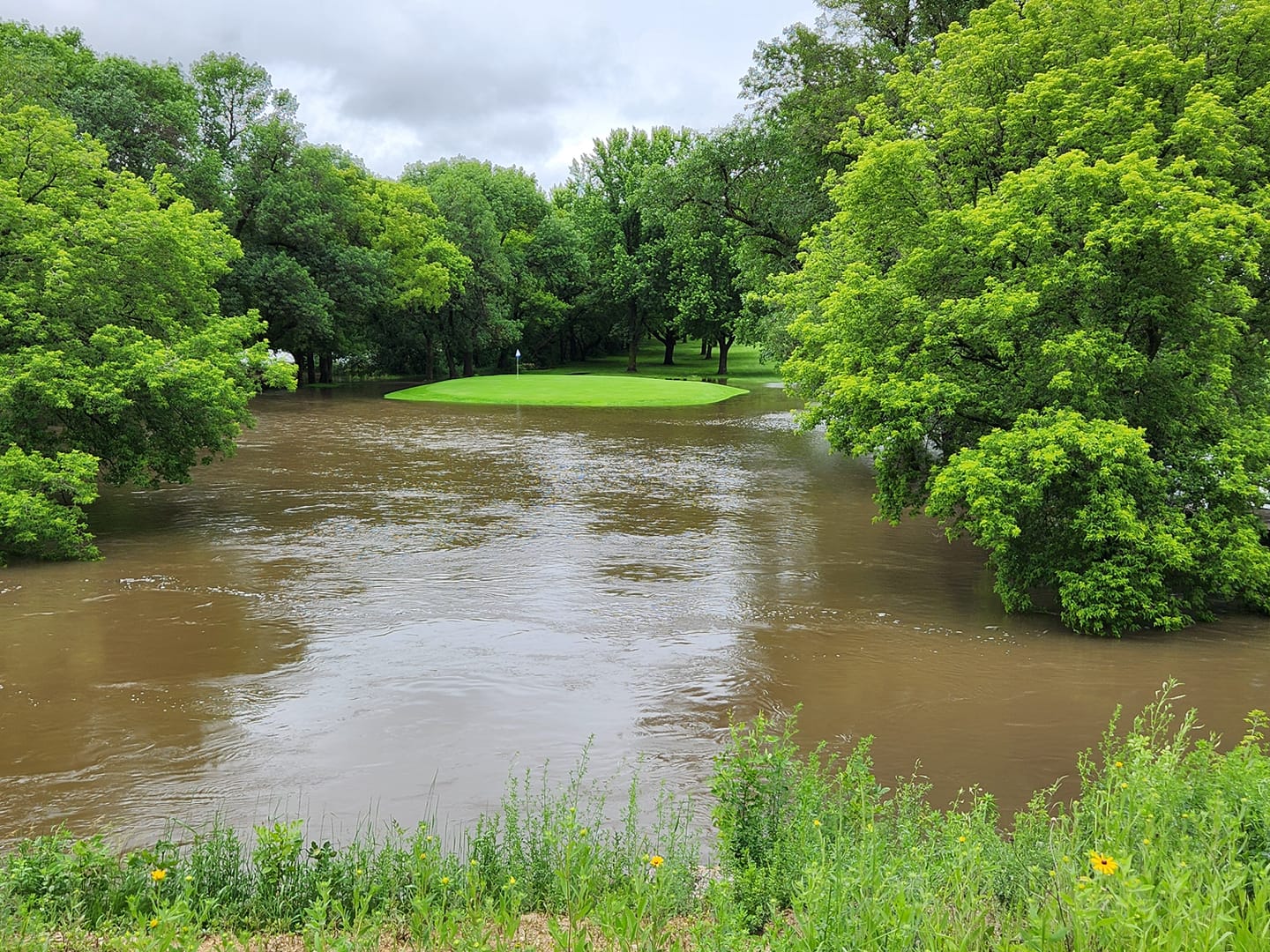
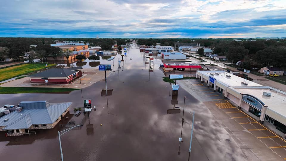
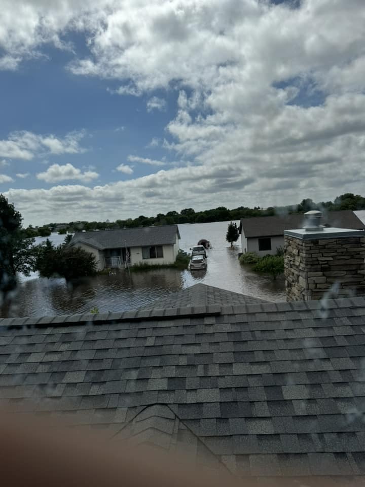
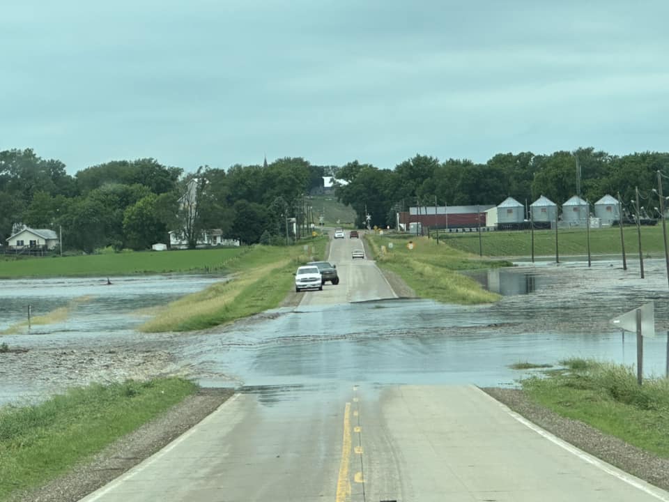
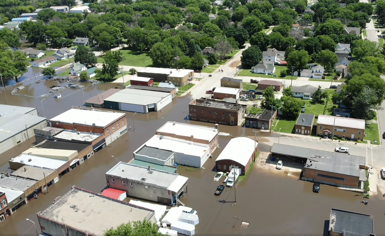
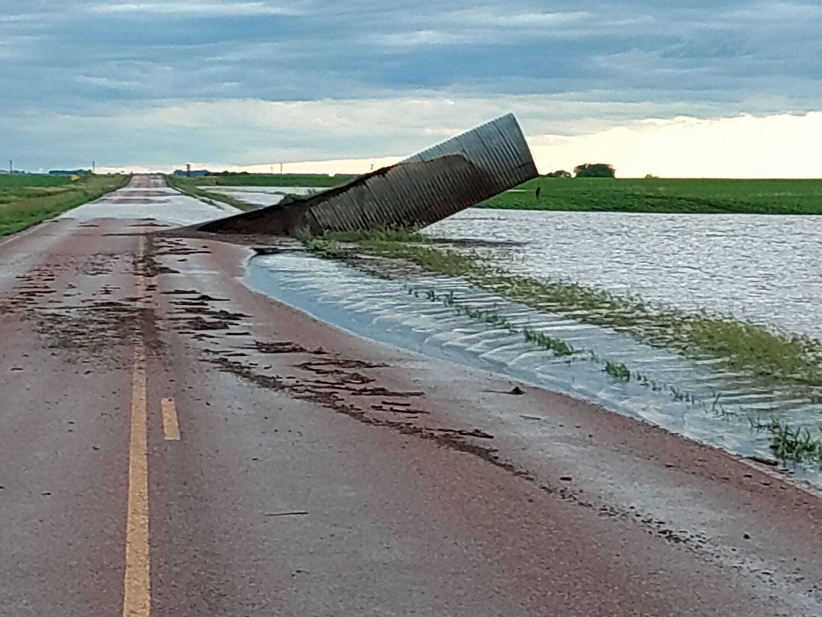
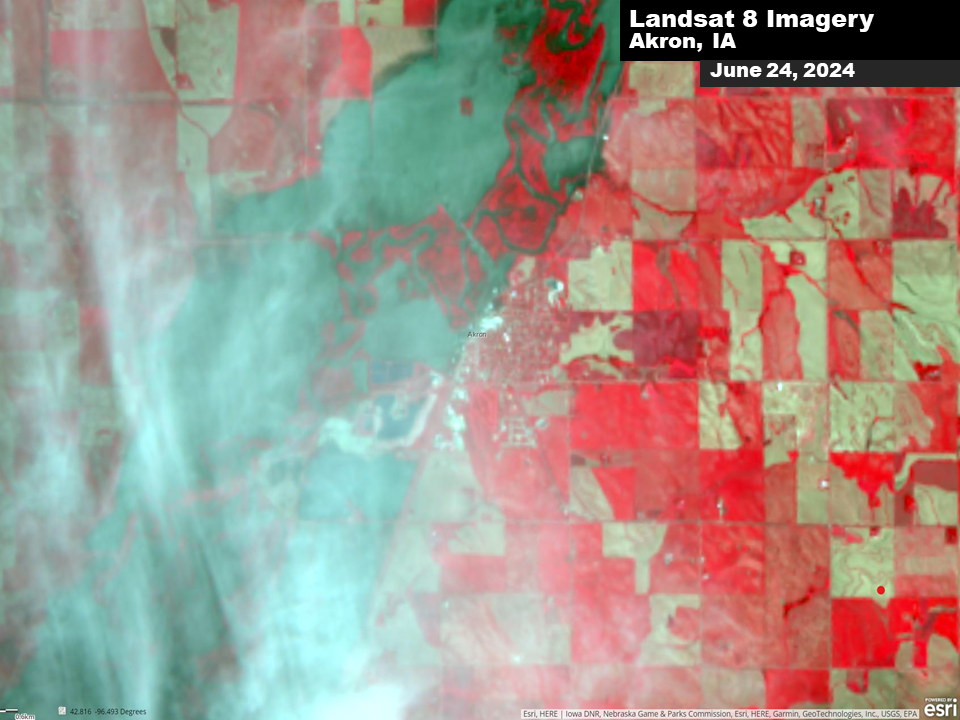
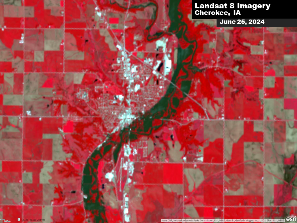
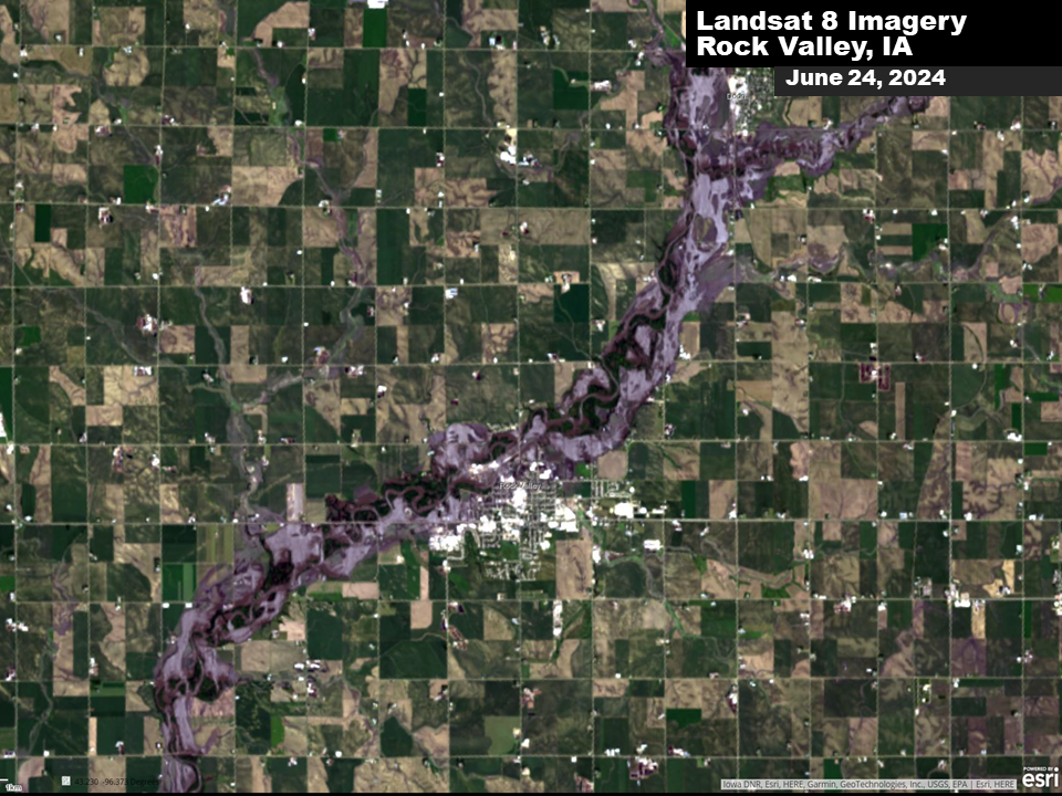
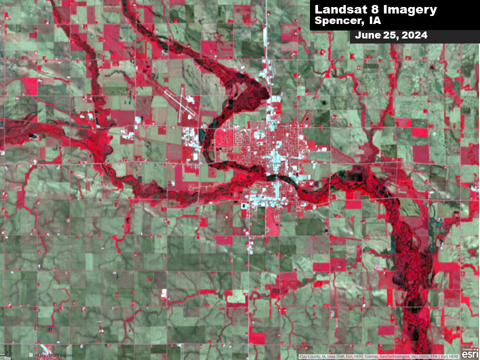
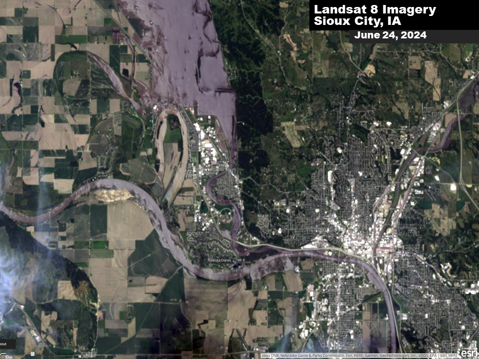
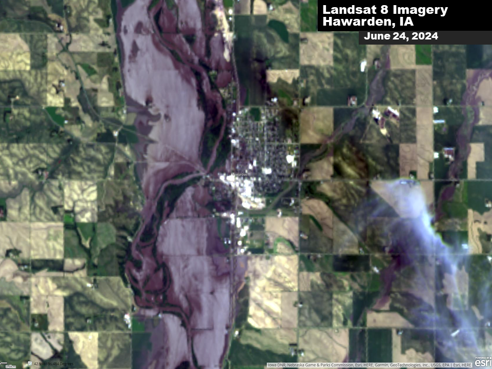
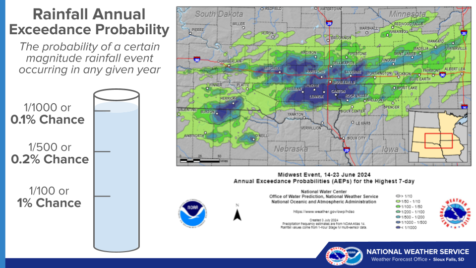
A multi-day heavy rainfall event led to widespread heavy rain across the region. Rainfall totals over a three-day period exceeded 2 inches in nearly all areas, with widespread totals between 5 and 10". In pockets of southeastern South Dakota and northwest Iowa, rain totals between 10 and 20" were reported. These rainfall amounts exceed the 0.2-0.1% (500-1000 year) Annual Exceedance Probability in some areas. The rapid onset of heavy rainfall created significant flash flooding during the evening and overnights of June 20th and again on June 21st. As rainfall reached area streams and rivers, record flooding was observed at 25 river points, leading to widespread devastating flooding. This resultant flooding resulted in over 300 homes and businesses being destroyed and thousands more receiving damage. Unfortunately, 3 fatalities also occurred from the flooding. Additional impacts included the closure of both major interstates (I-29 and I-90) along with countless other federal, state, and county highways. Numerous swift water rescues and evacuations occurred through the event. While many cities were impacted, more widespread flooding took place in the communities of Rock Rapids, Rock Valley, Hawarden, Spencer, Sioux Rapids and Cherokee in Iowa, Windom and Jackson in Minnesota, and Sioux Falls, Canton, and McCook Lake in South Dakota.
|
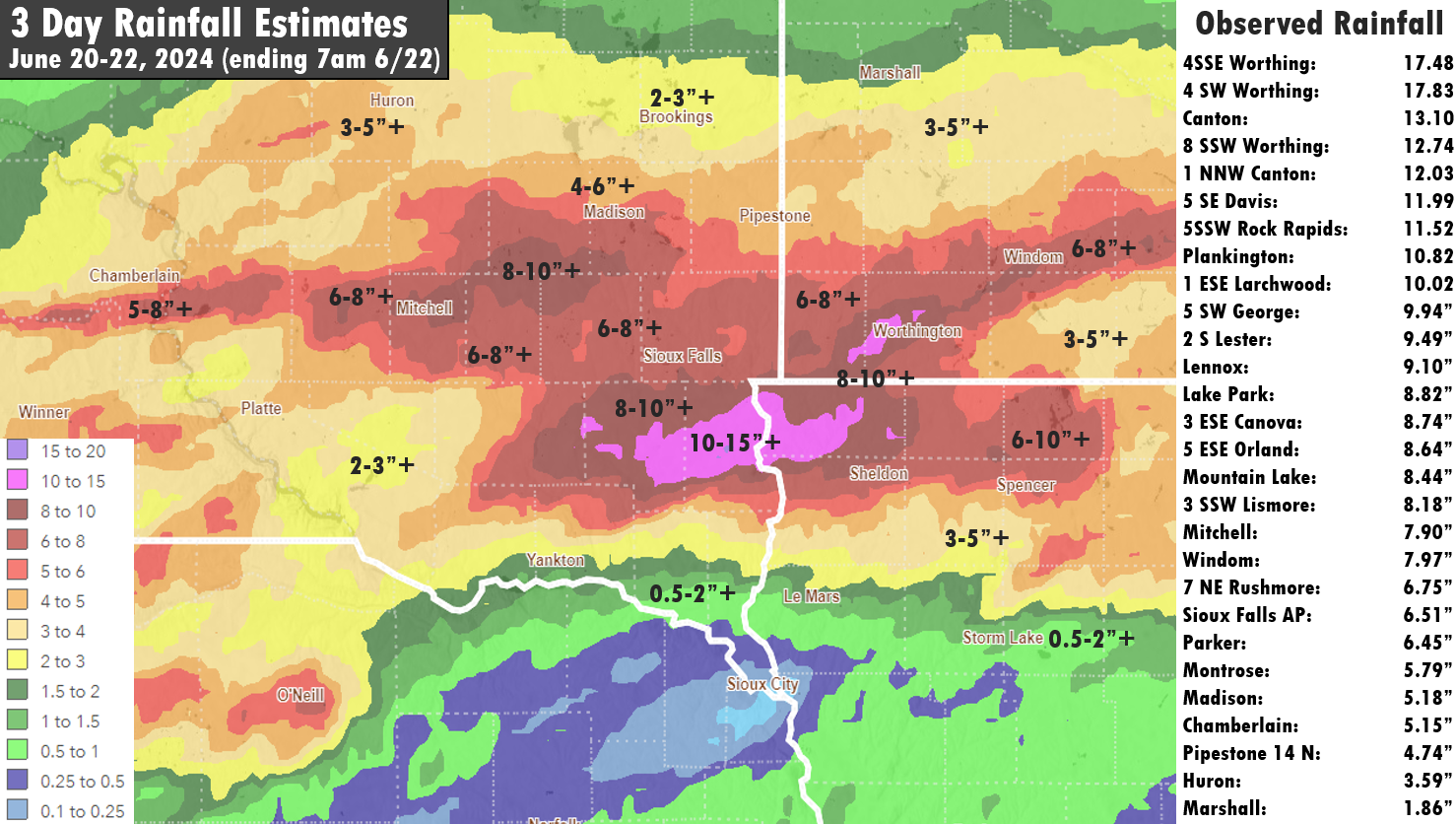 Three Day Rainfall - June 20-22, 2024 |
 |
 |
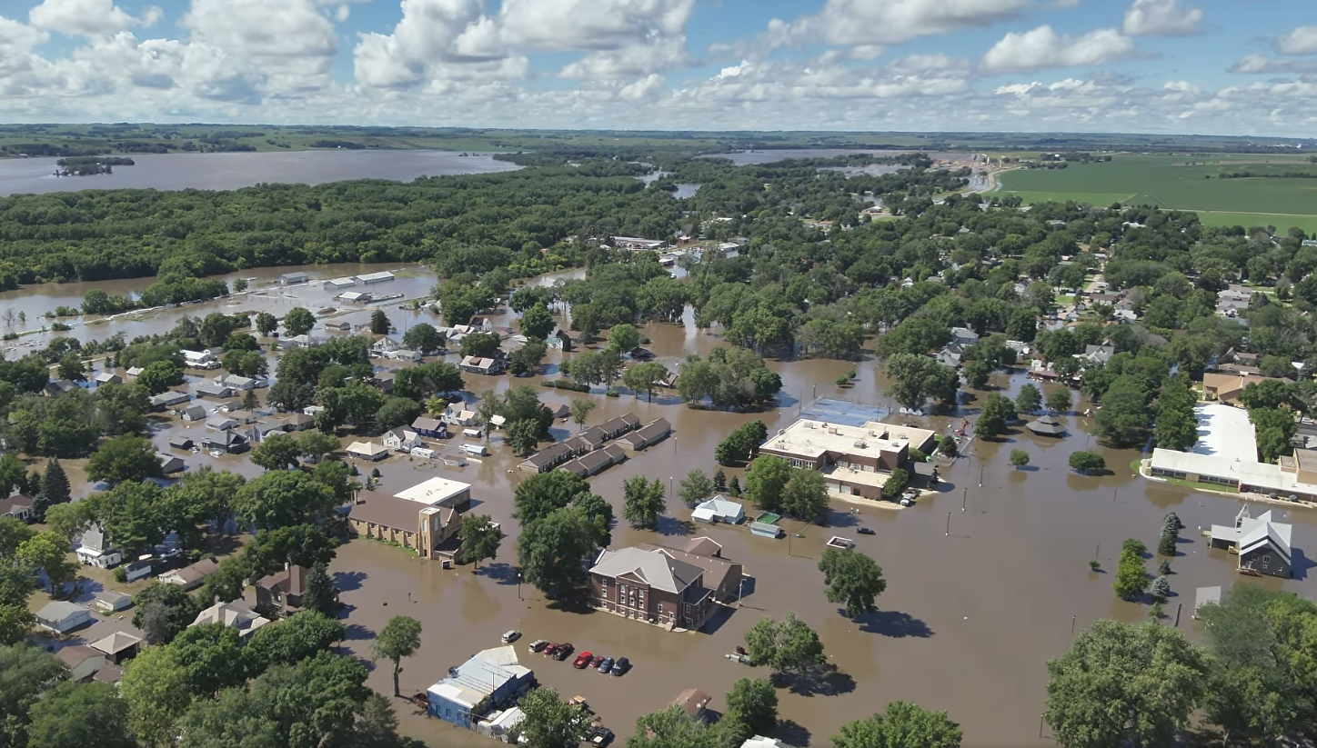 |
| Rock Valley (Credit: Sioux County Sheriff) | Spencer, IA (Credit: Shawn Steemke) | Hawarden, IA (Credit: Sioux County Sheriff) |
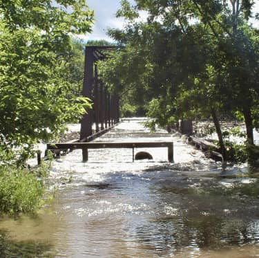
Flooding
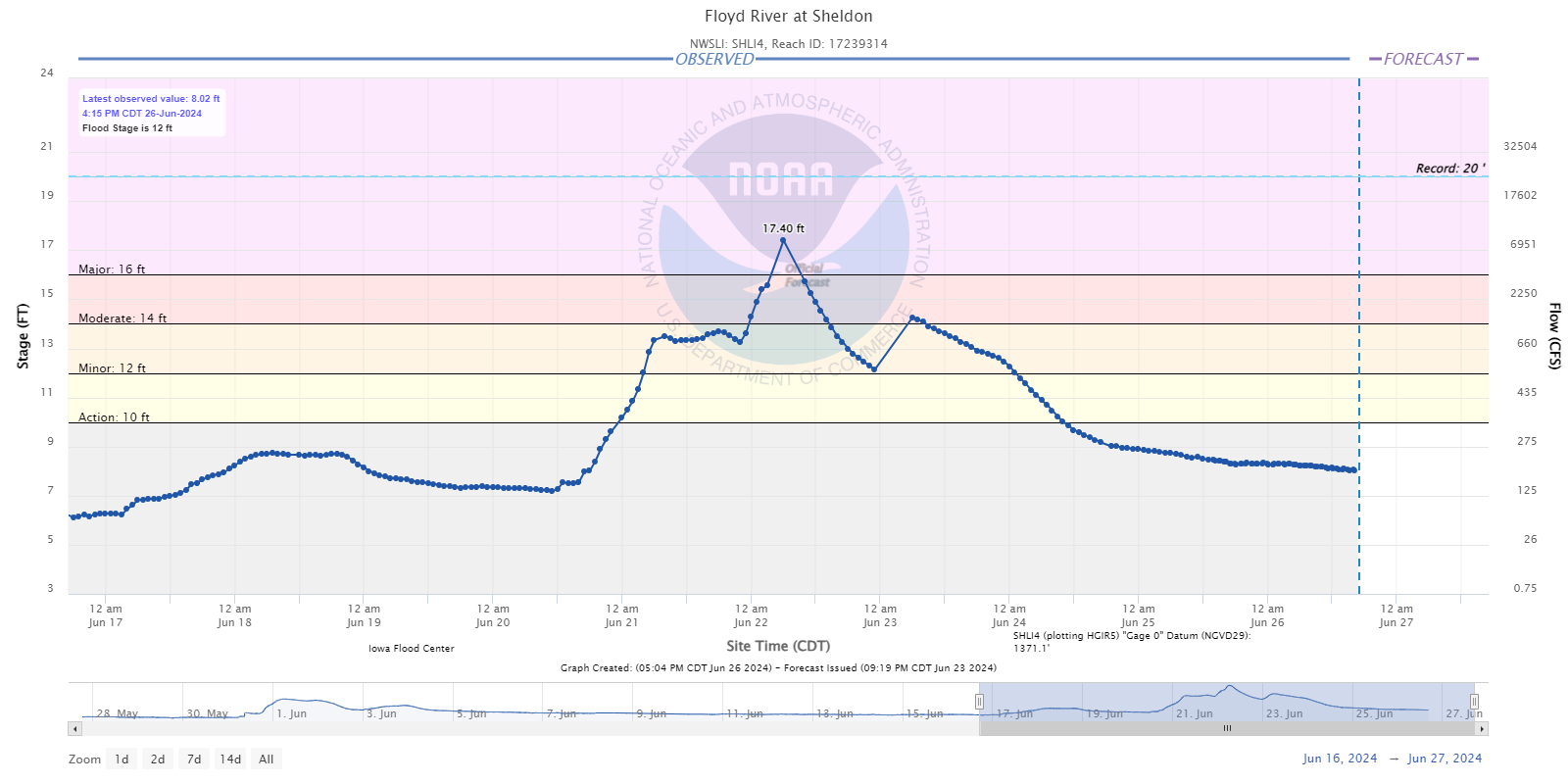
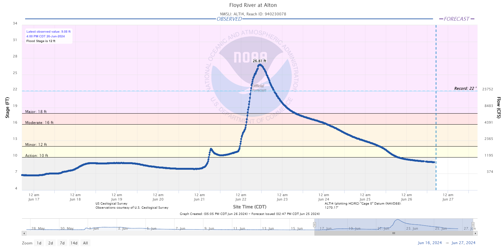
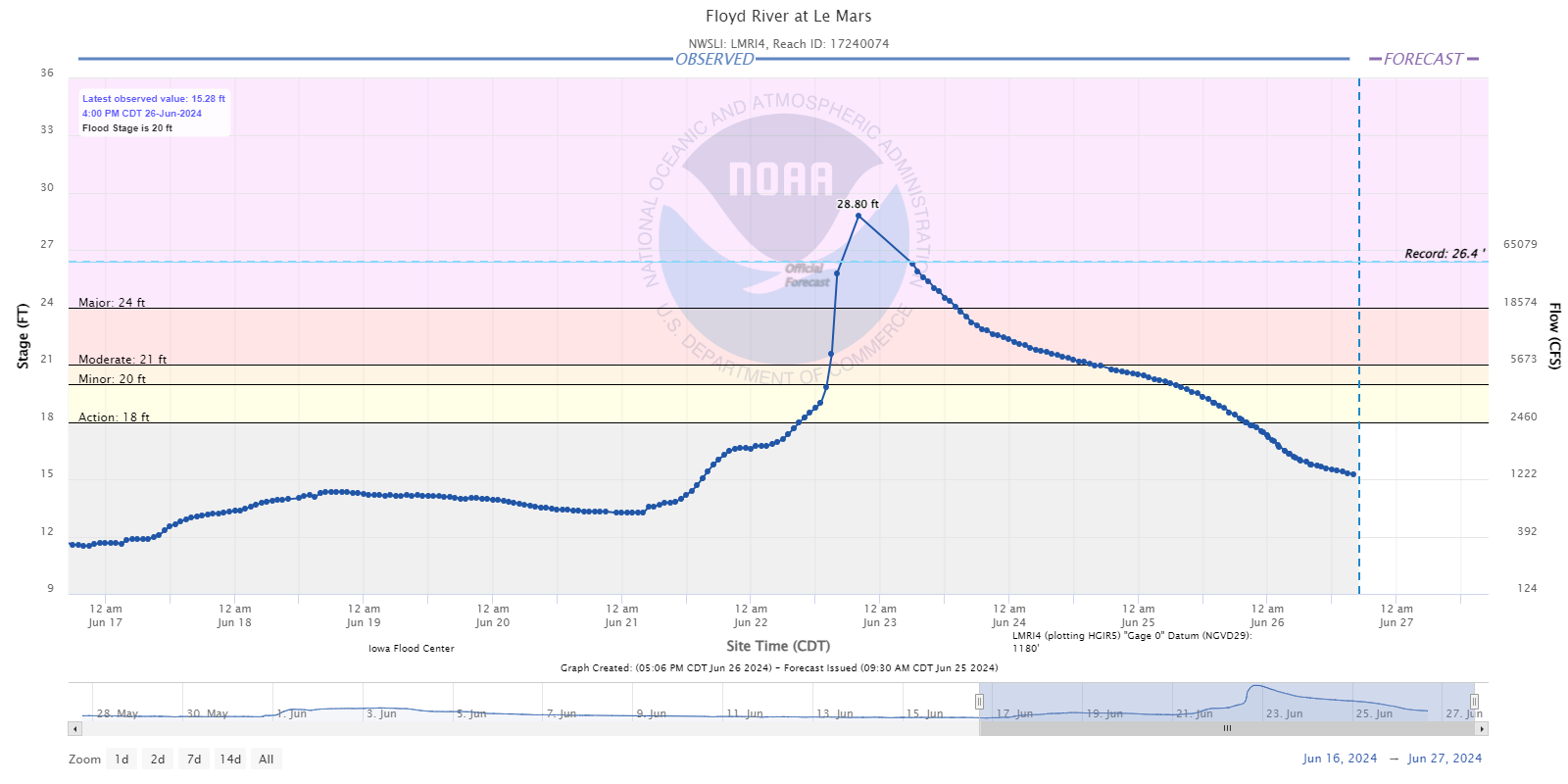
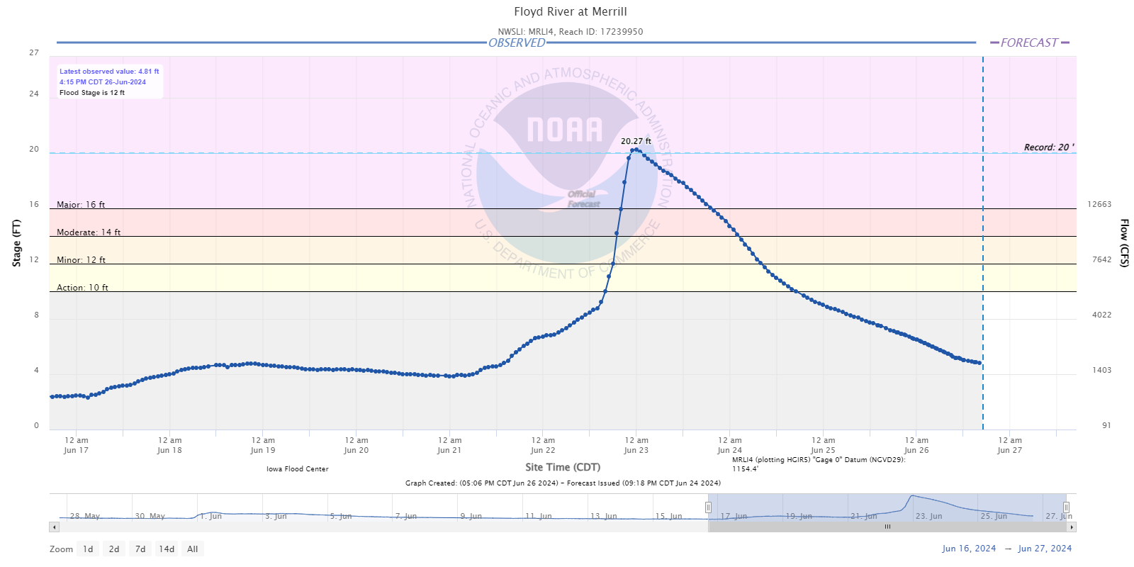
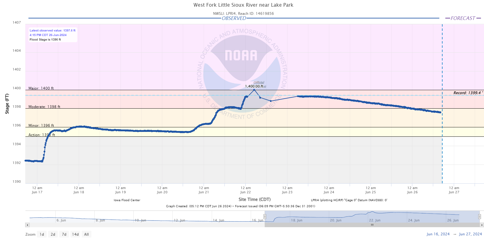
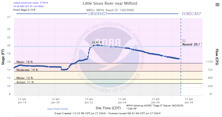
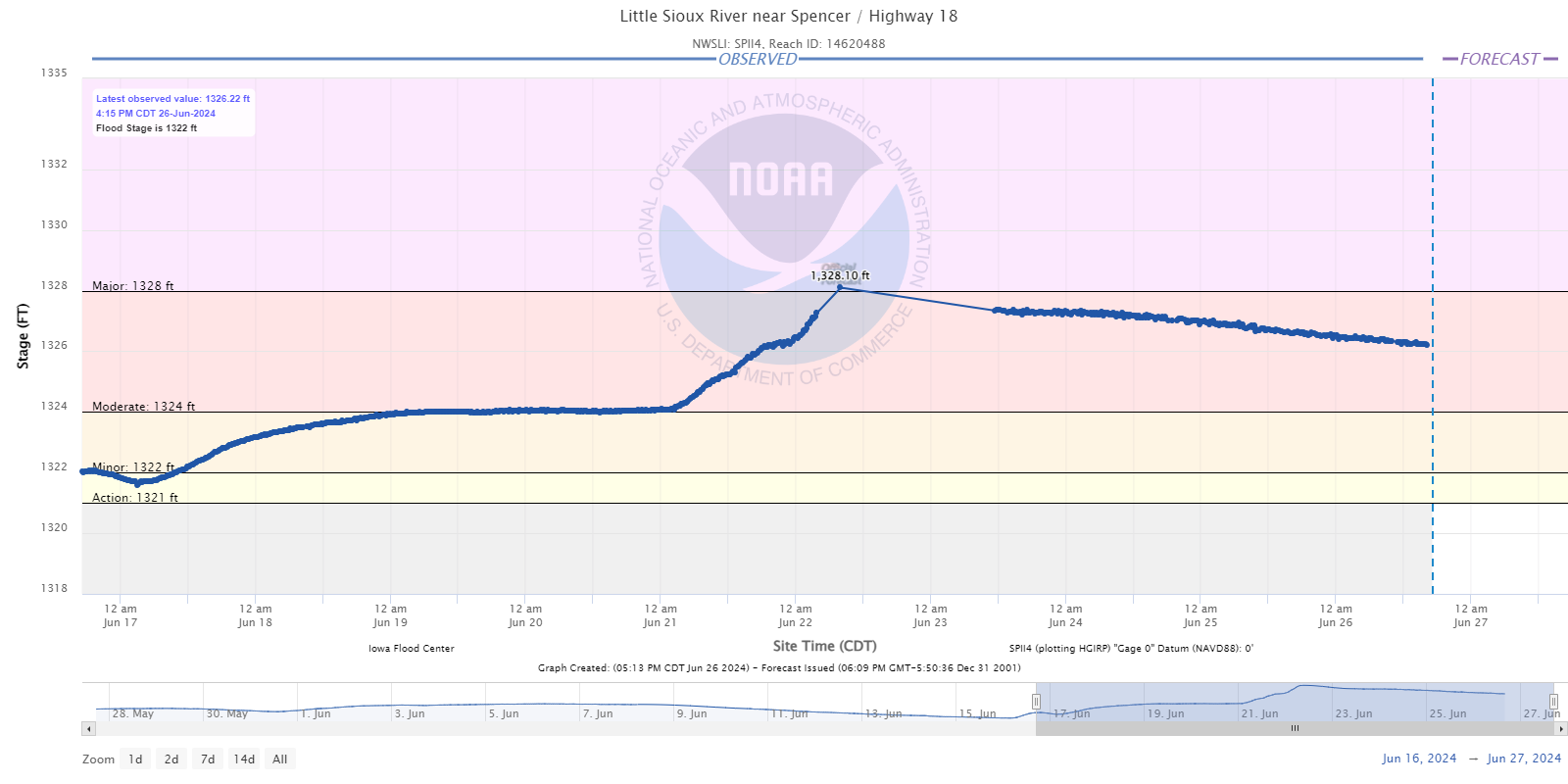
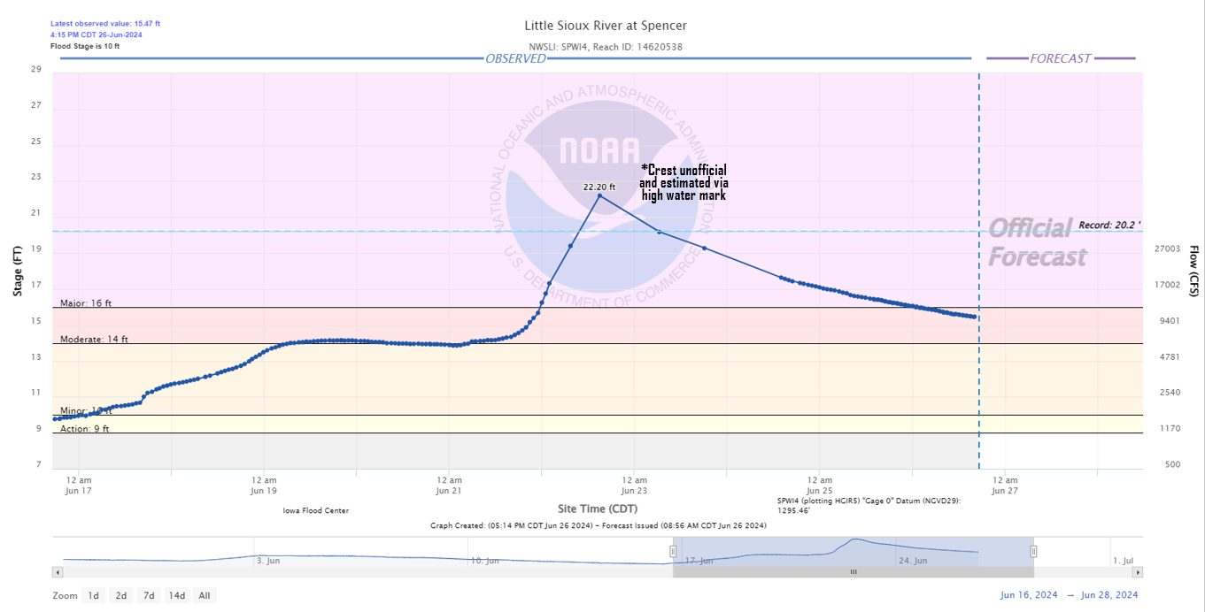
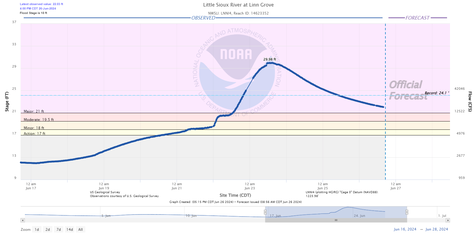
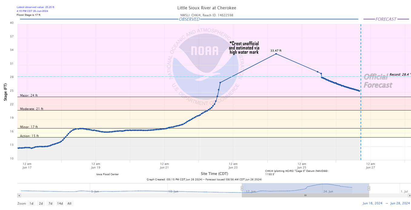
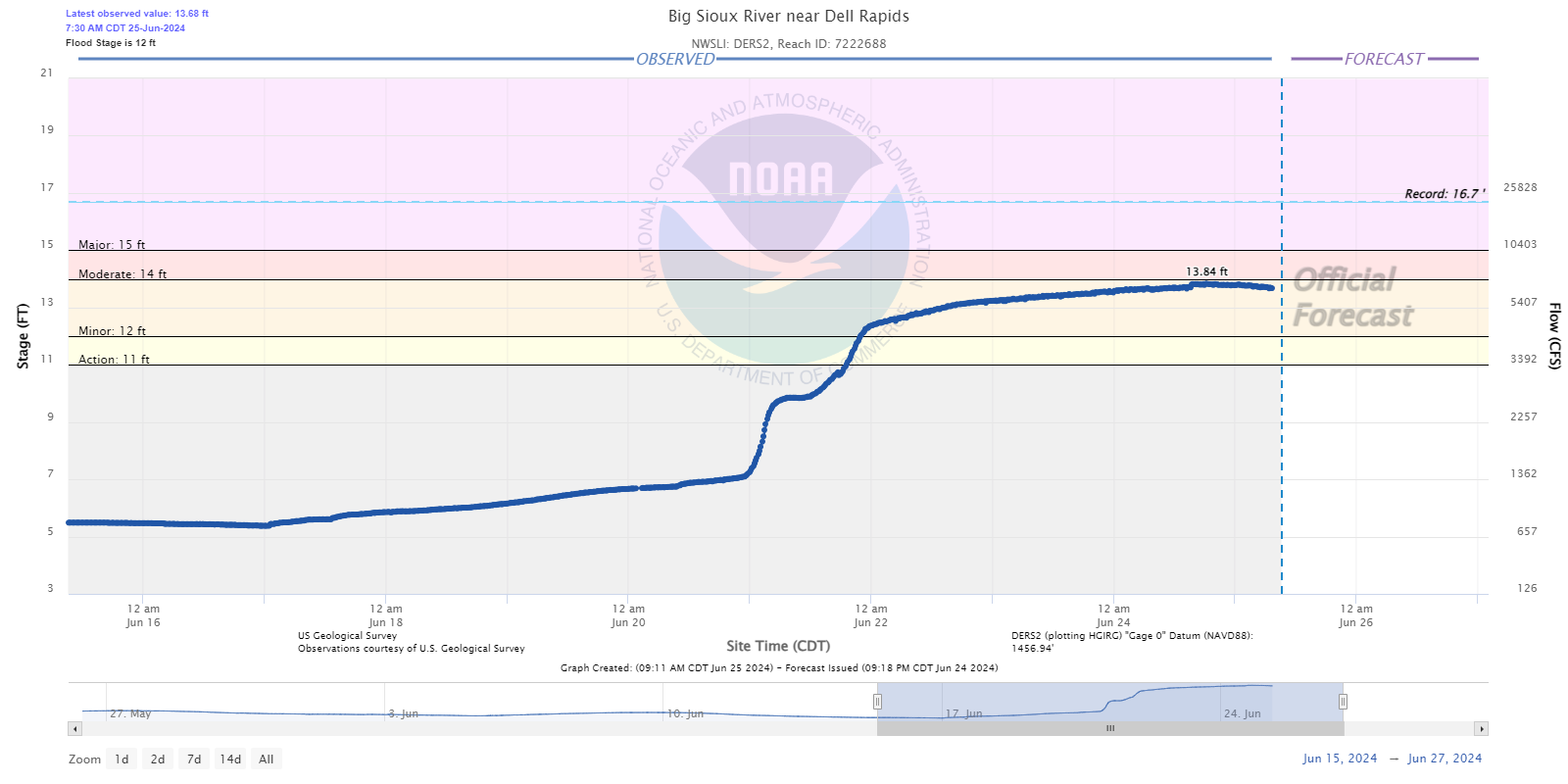
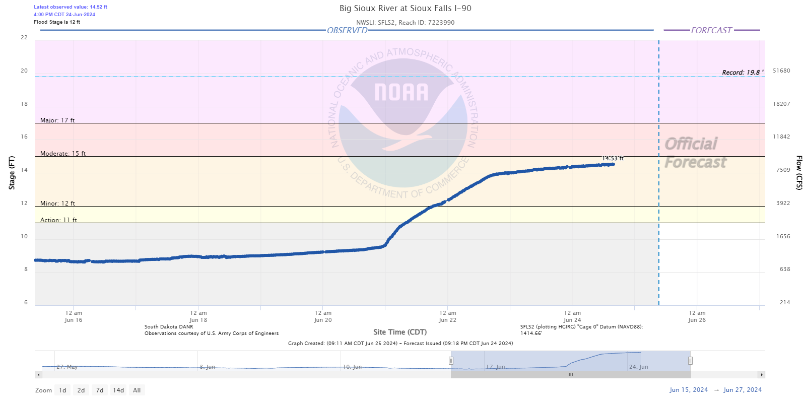
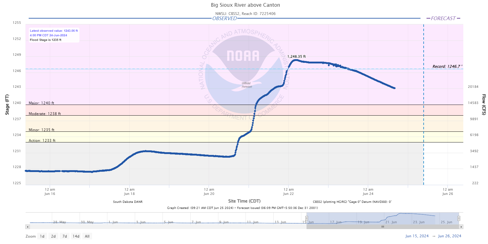
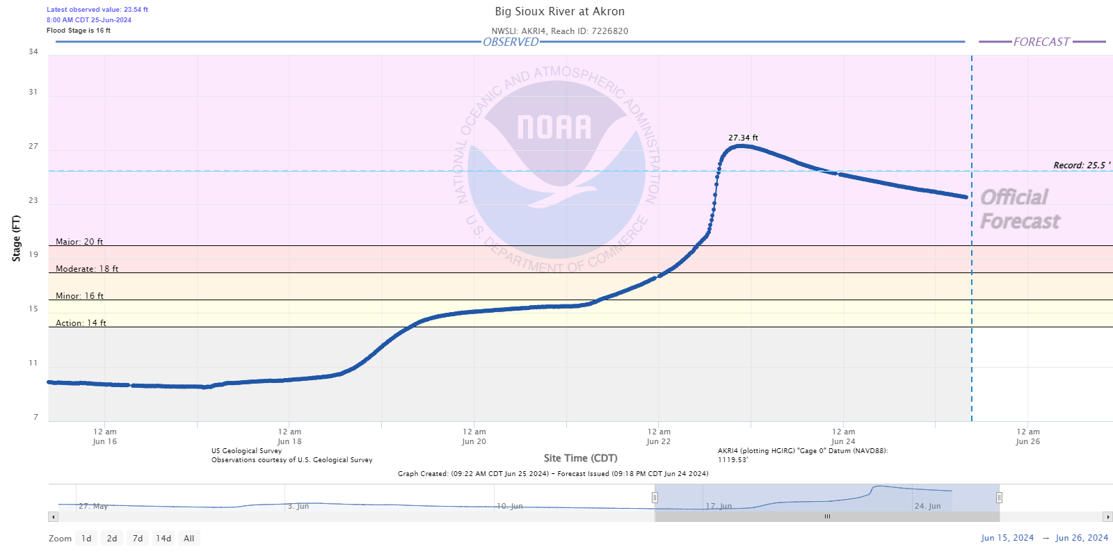
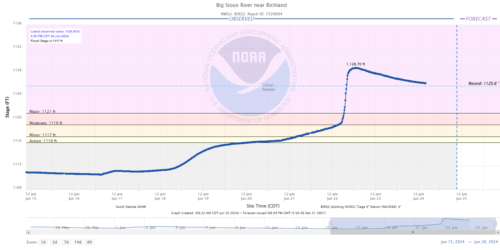
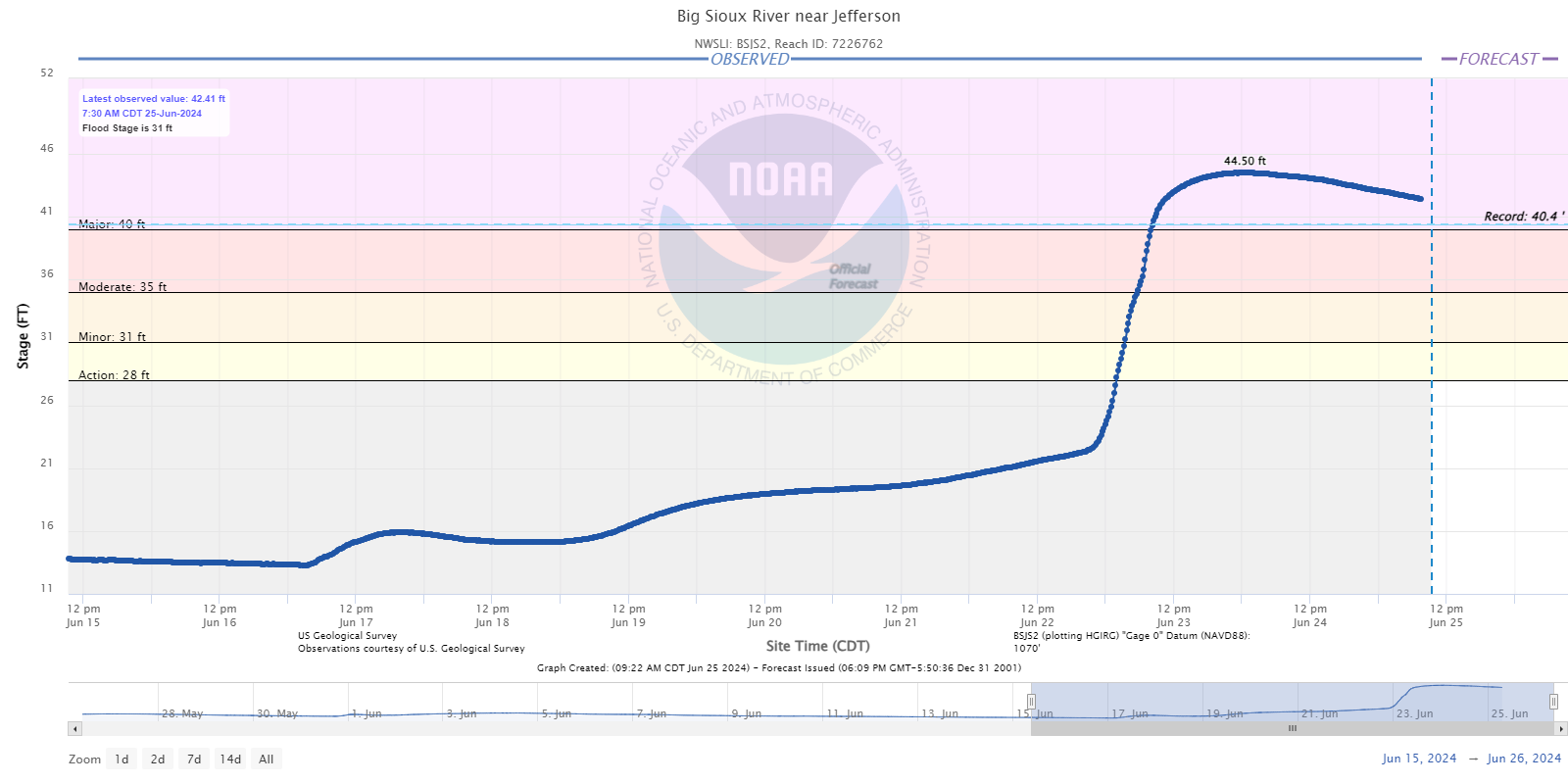
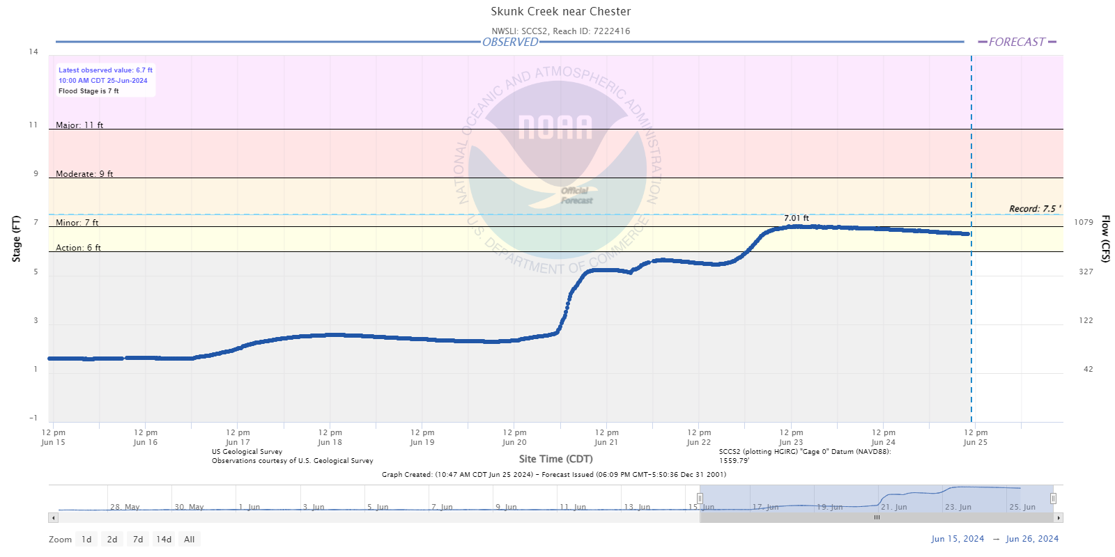
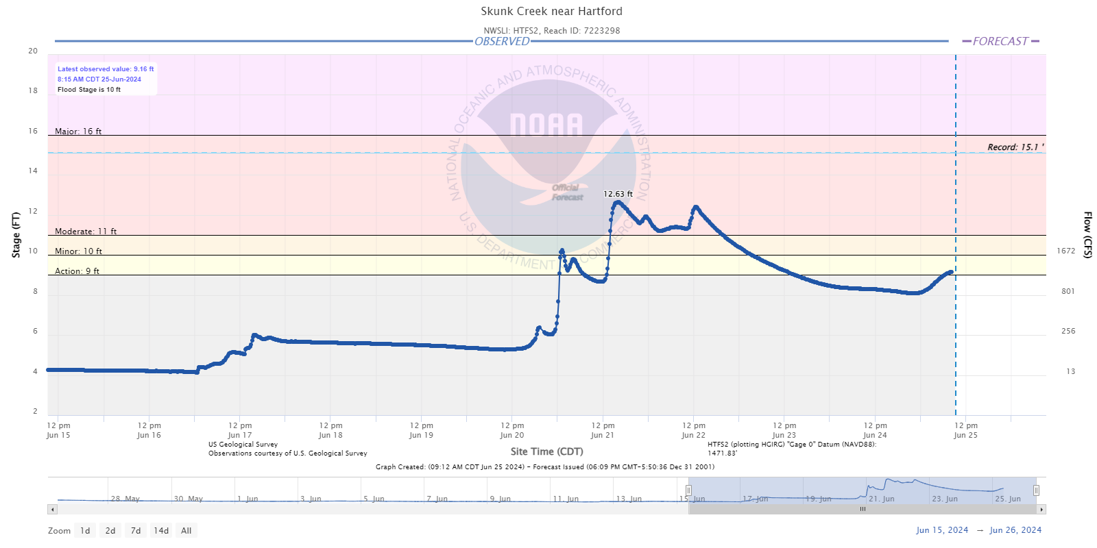
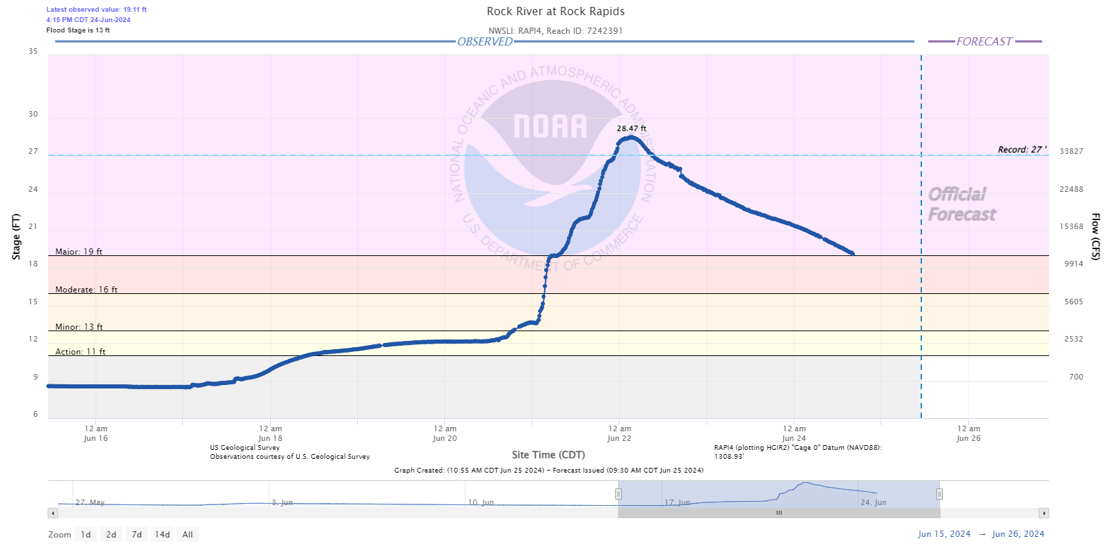
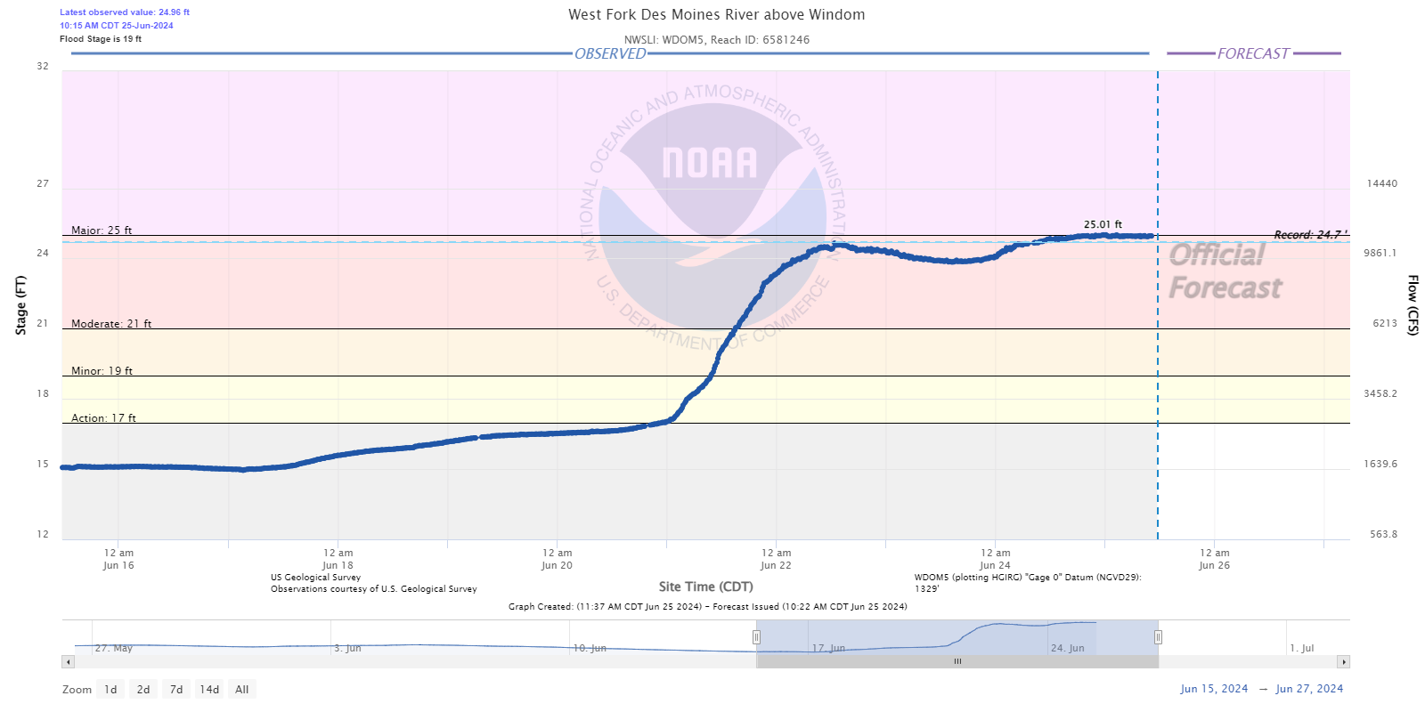
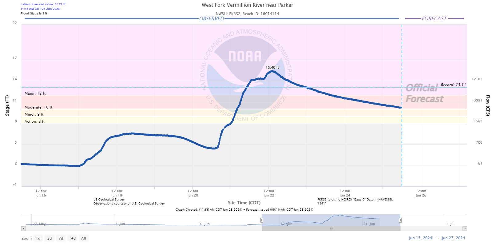
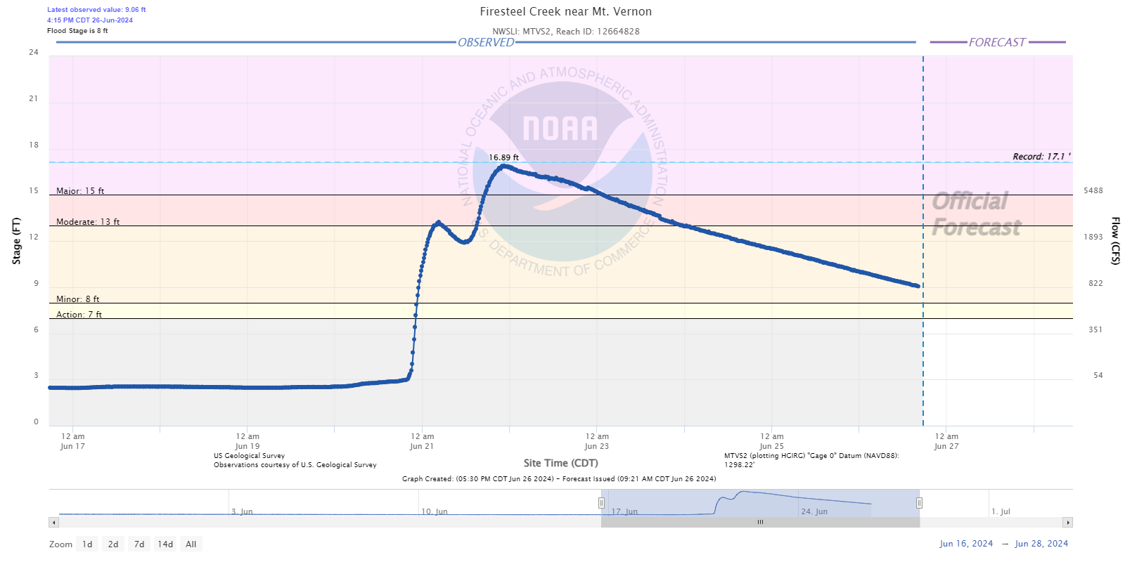
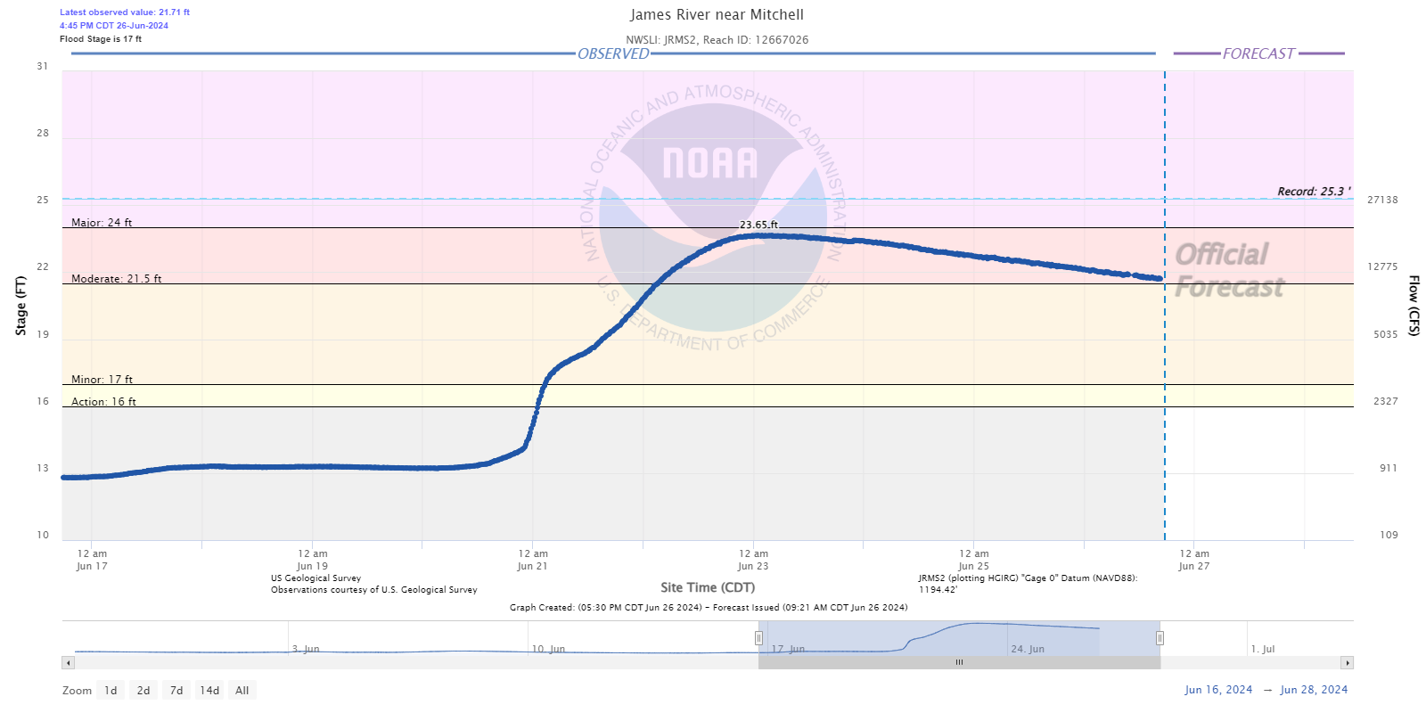
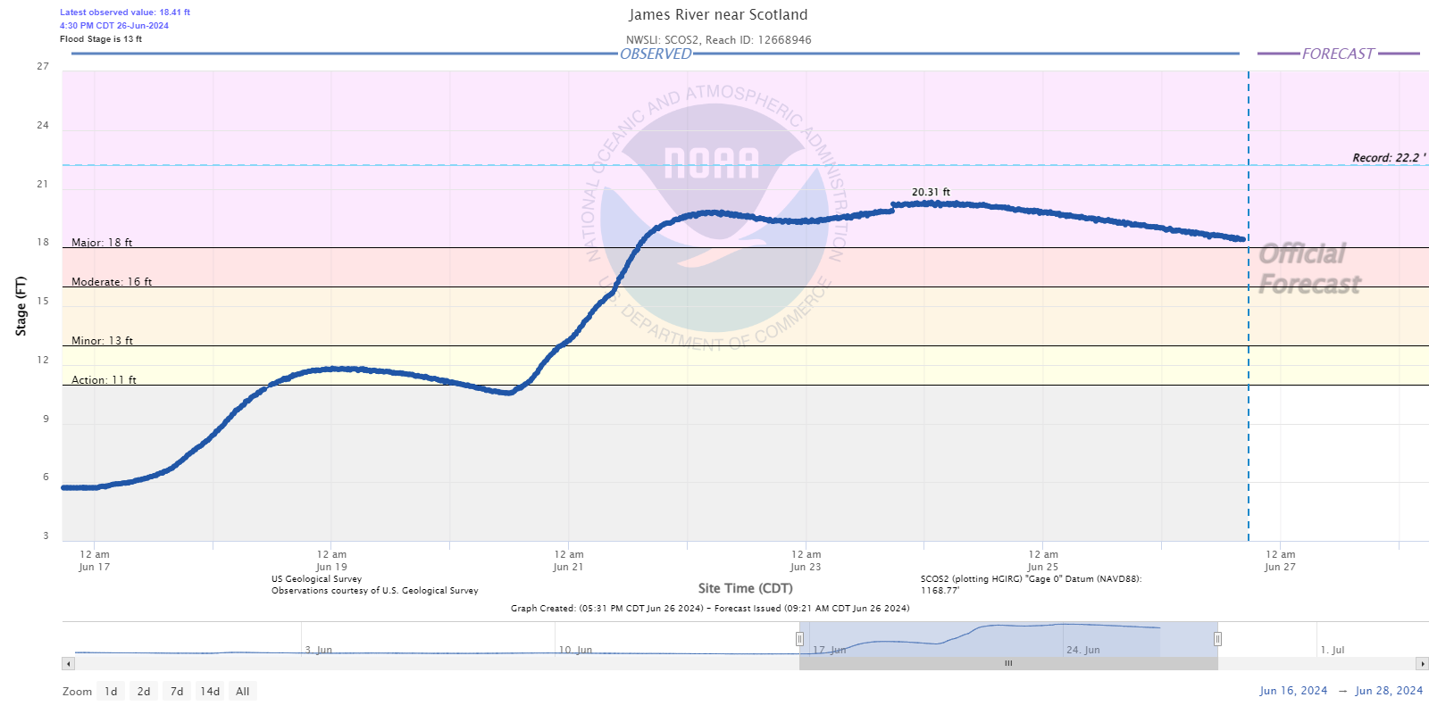
Widespread Major to Record flooding was observed in many locations with some locations breaking the previous record crest value by several feet. The crest value on the Little Sioux River at both Spencer and Cherokee was estimated via high water mark due to data outages from the river gauge.
.png) |
.png) |
|
New River Flood Records |
|
Hydrographs - Floyd River
 |
 |
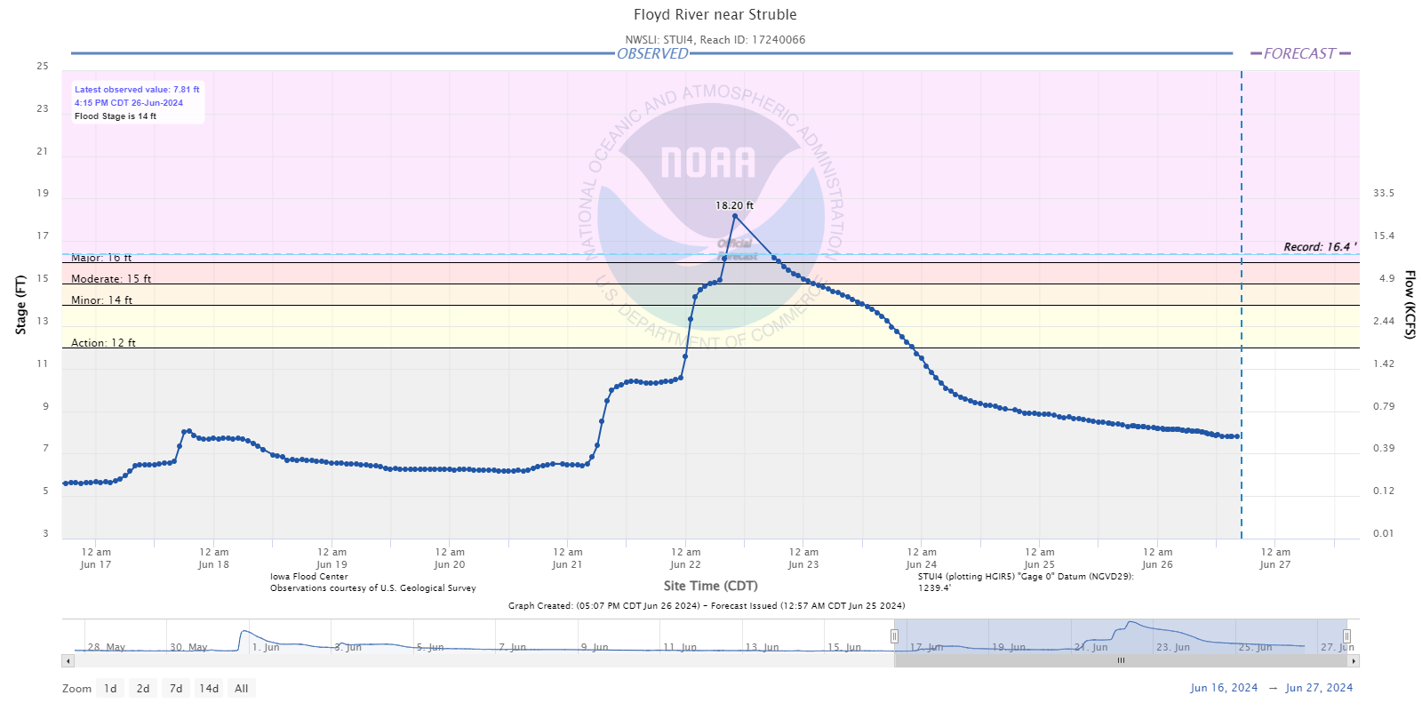 |
| Sheldon, IA | Alton, IA | near Struble, IA |
 |
 |
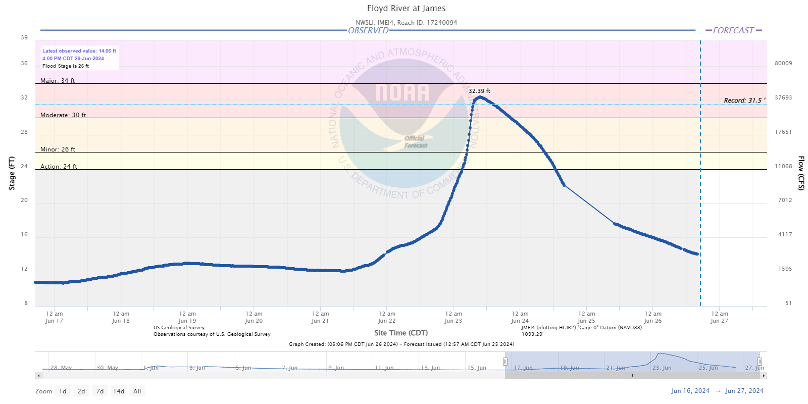 |
| Le Mars, IA | Merrill, IA | James, IA |
Hydrographs - Little Sioux River
 |
 |
 |
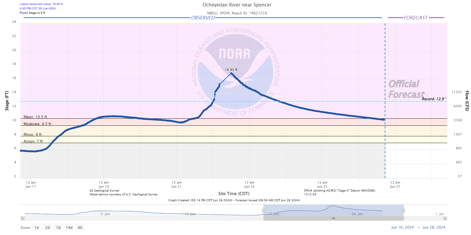 |
| West Fork near Lake Park, IA | Milford, IA | near Spencer, IA / Hwy 18 | Ocheyedan near Spencer, IA |
 |
 |
 |
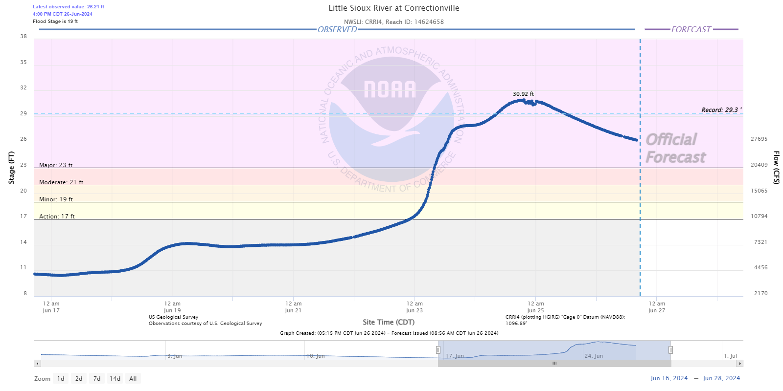 |
| Spencer, IA | Linn Grove, IA | Cherokee, IA | Correctionville, IA |
Hydrographs - Big Sioux River
 |
 |
 |
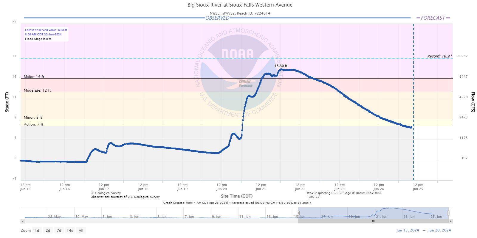 |
| Dell Rapids, SD | Sioux Falls at I-90 | Sioux Falls at Maple Street | Sioux Falls at Western Ave |
 |
 |
 |
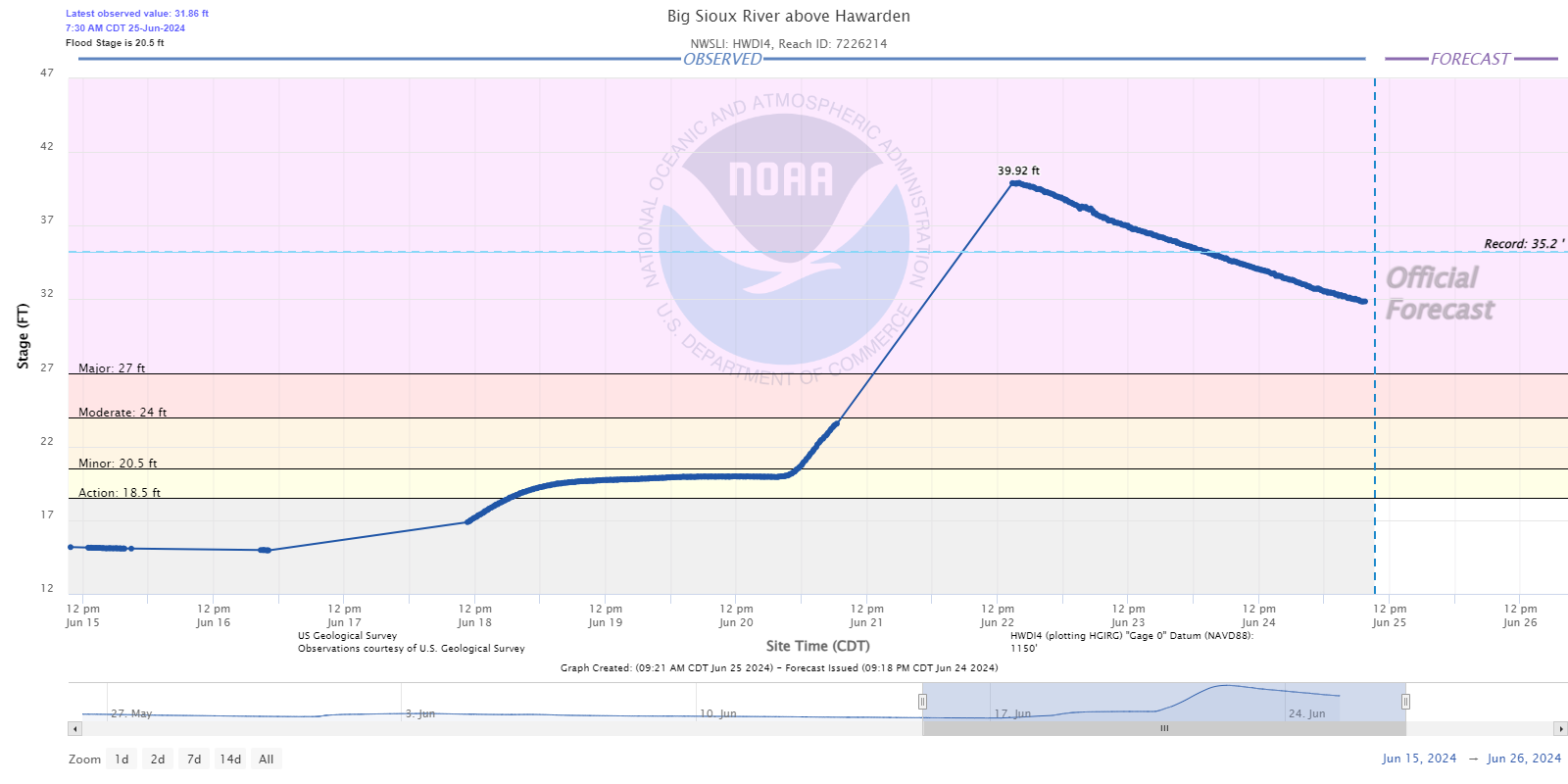 |
| Sioux Falls at North Cliff Ave | Brandon, SD | above Canton, SD | near Hawarden, IA |
 |
 |
 |
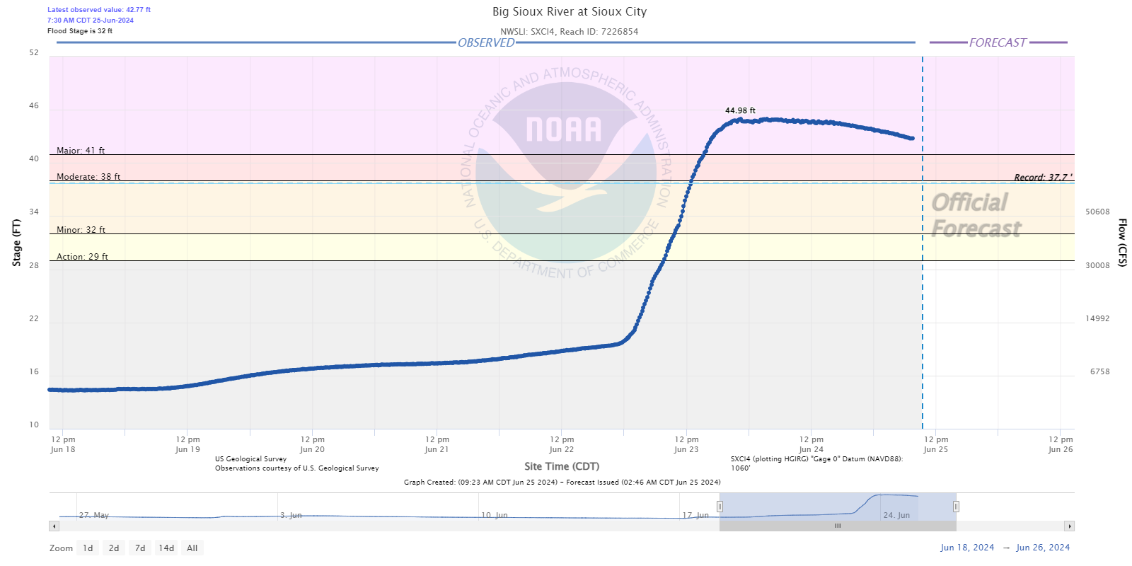 |
| Akron, IA | Richland, SD | Jefferson, SD | Sioux City, IA |
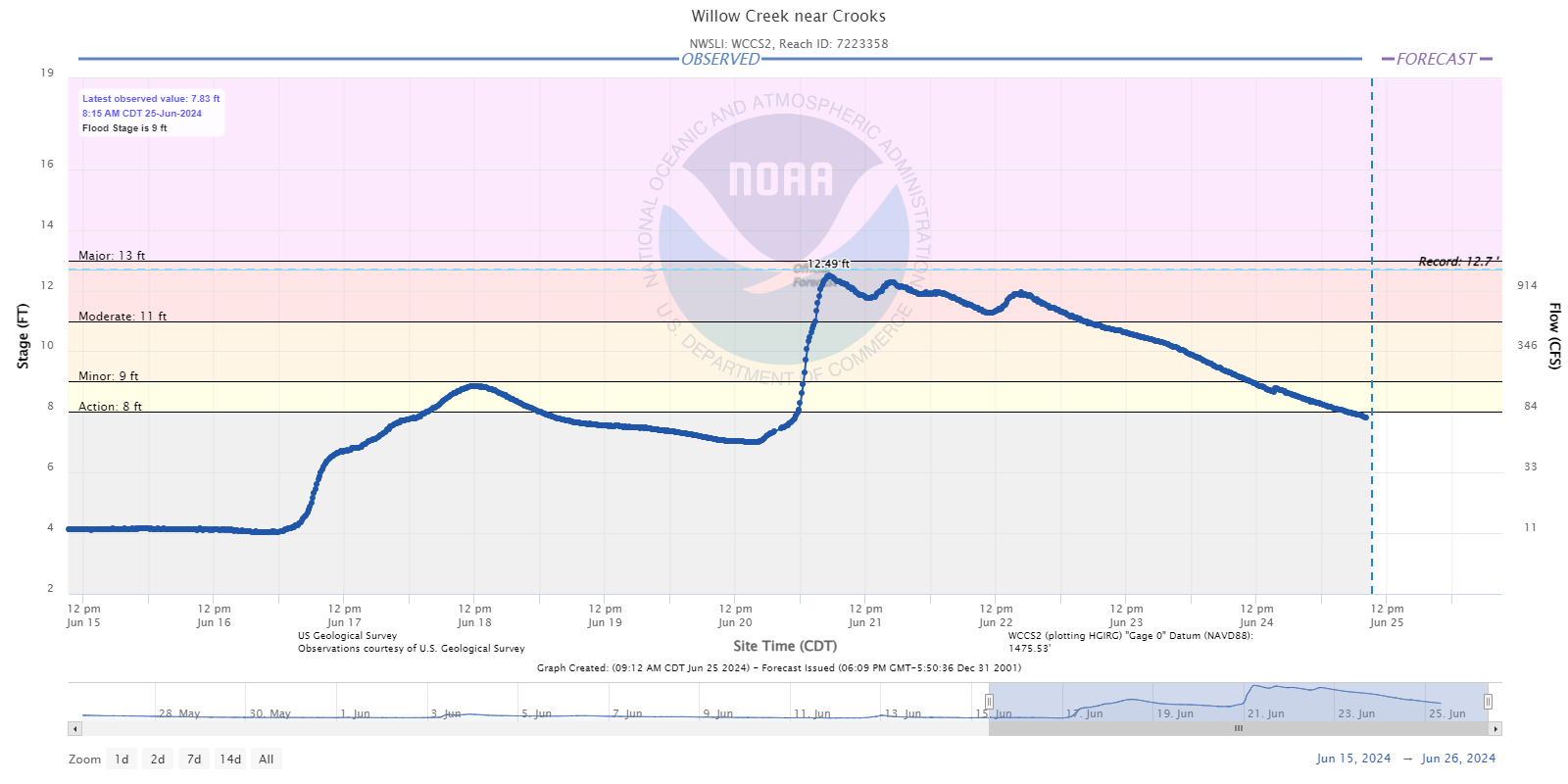
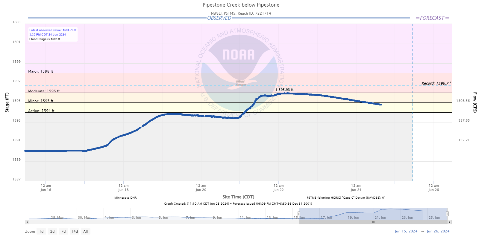
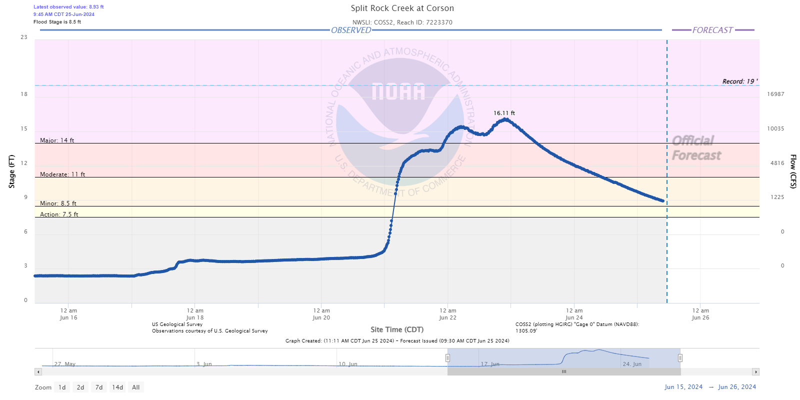
Hydrographs - Tributary Creeks to the Big Sioux River (Skunk/Willow/Pipestone/Split Rock)
 |
 |
 |
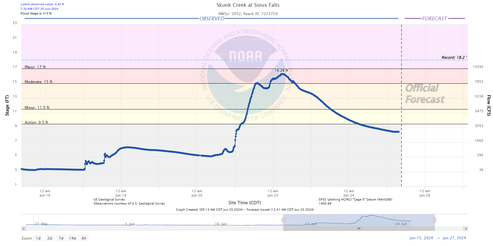 |
| Skunk Creek near Chester, SD | Skunk Creek near Hartford, SD | Willow Creek near Crooks, SD | Sioux Falls, SD |
 |
 |
%20at%20Canton.png) |
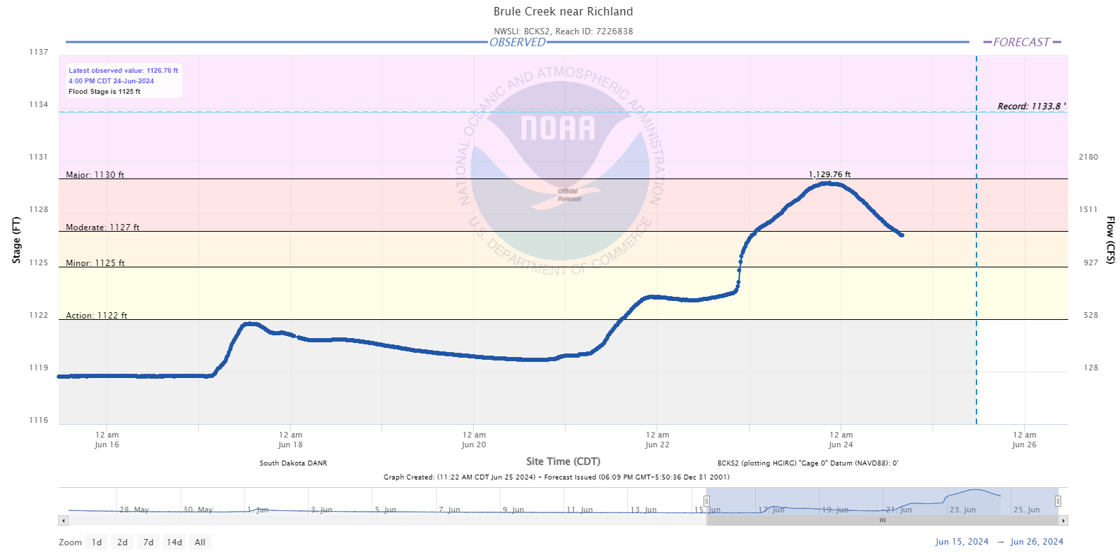 |
| Pipestone Creek below Pipestone, MN | Split Rock Creek at Corson, SD | Beaver Creek at Canton, SD | Brule Creek near Richland, SD |
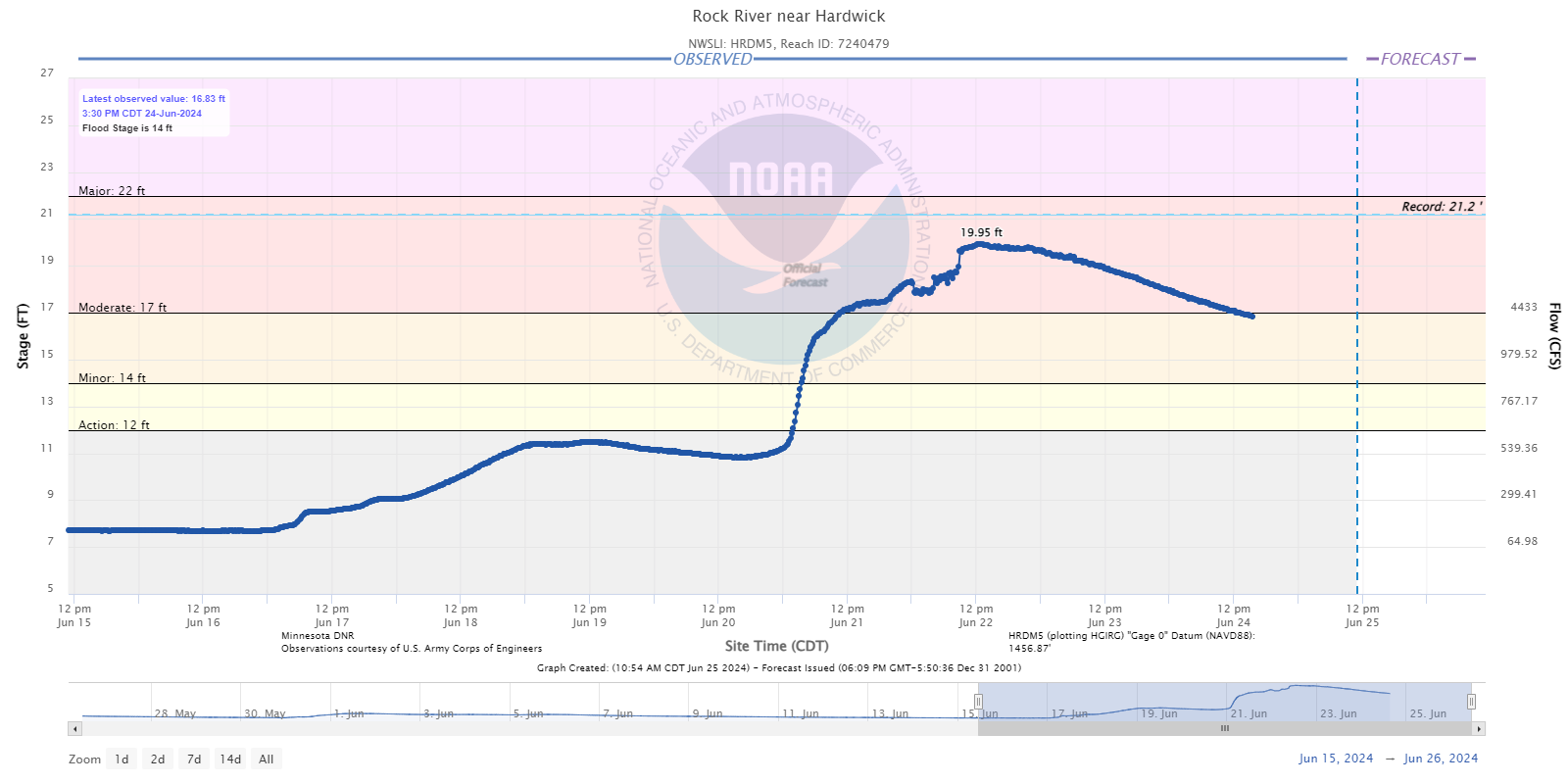
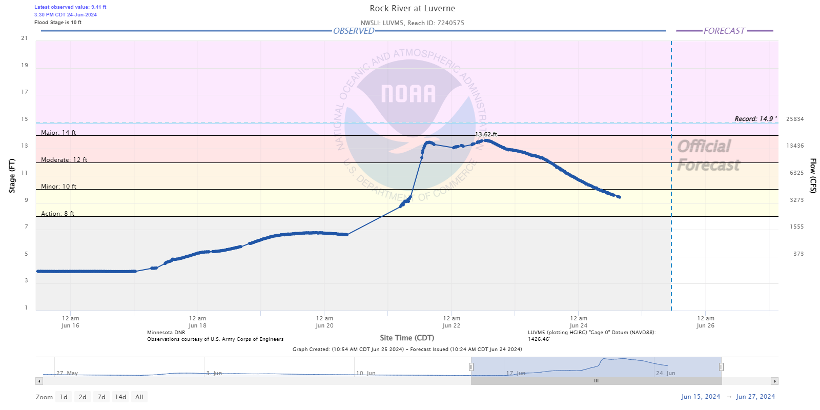
Hydrographs - Rock River
 |
 |
 |
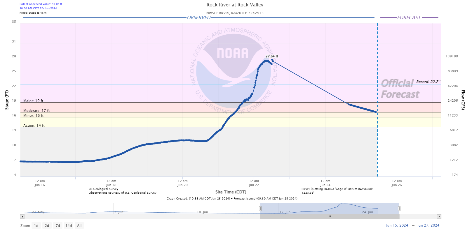 |
| Hardwick, MN | Luverne, MN | Rock Rapids, IA | Rock Valley, IA |
Hydrographs - West Fork Des Moines River
 |
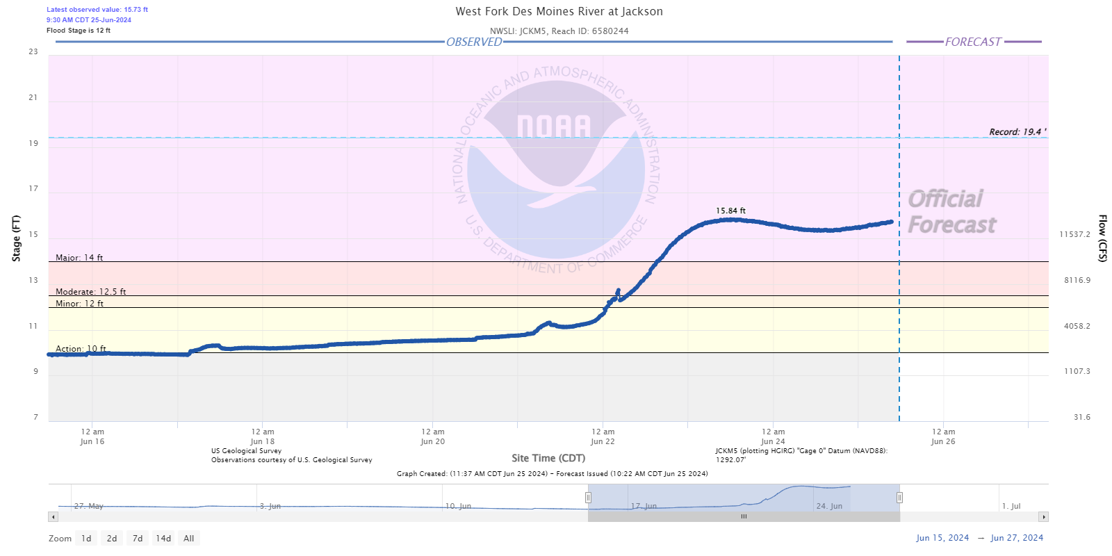 |
| Windom, MN | Jackson, MN |
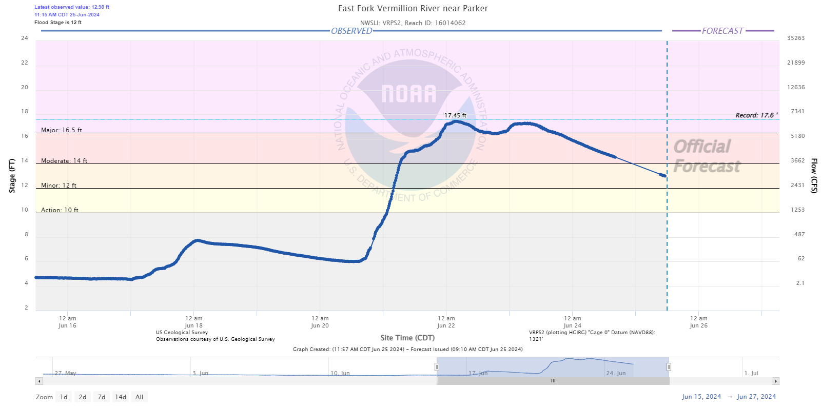
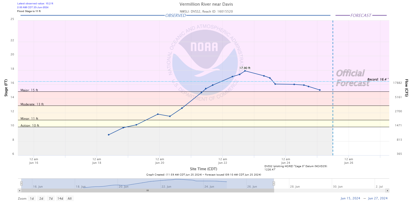
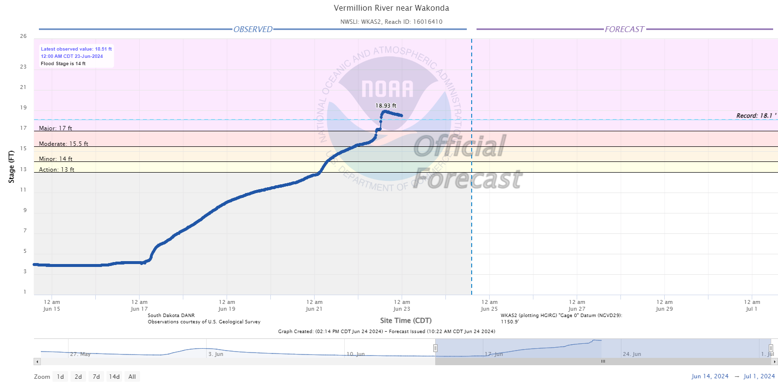
Hydrographs - Vermillion River
 |
 |
 |
 |
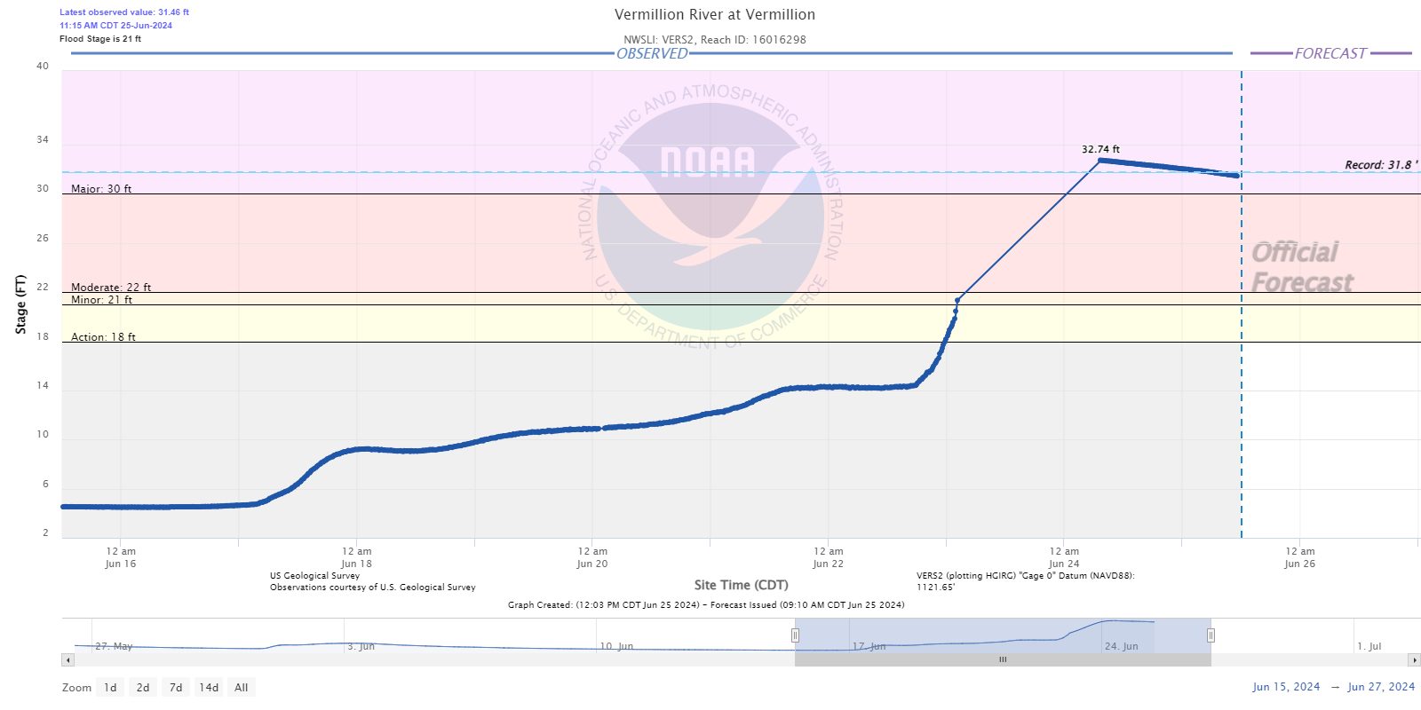 |
| West Fork near Parker, SD | East Fork near Parker, SD | Davis, SD | Wakonda, SD | Vermillion, SD |
Hydrographs - James River
 |
 |
%20near%20Freeman.png) |
 |
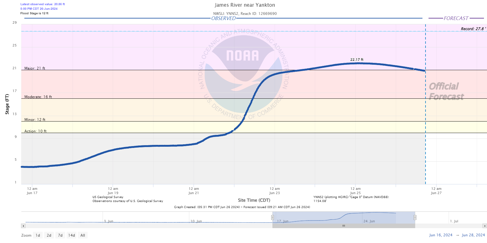 |
| Firesteel Creek - Mt. Vernon, SD | Mitchell, SD | Wolf Creek - Freeman, SD | Scotland, SD | Yankton, SD |
Hydrographs - Missouri River
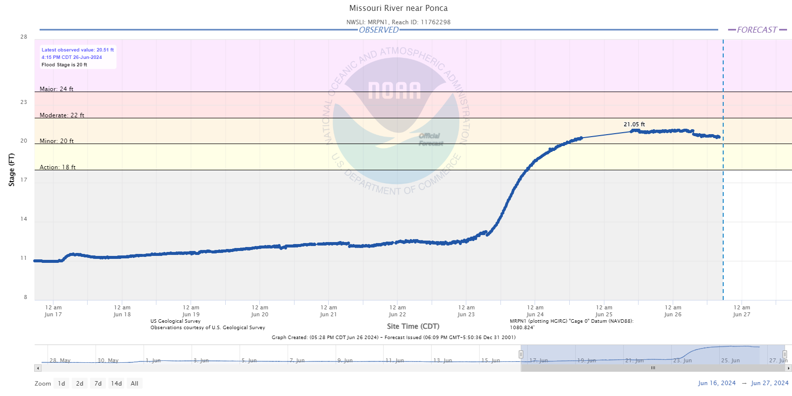 |
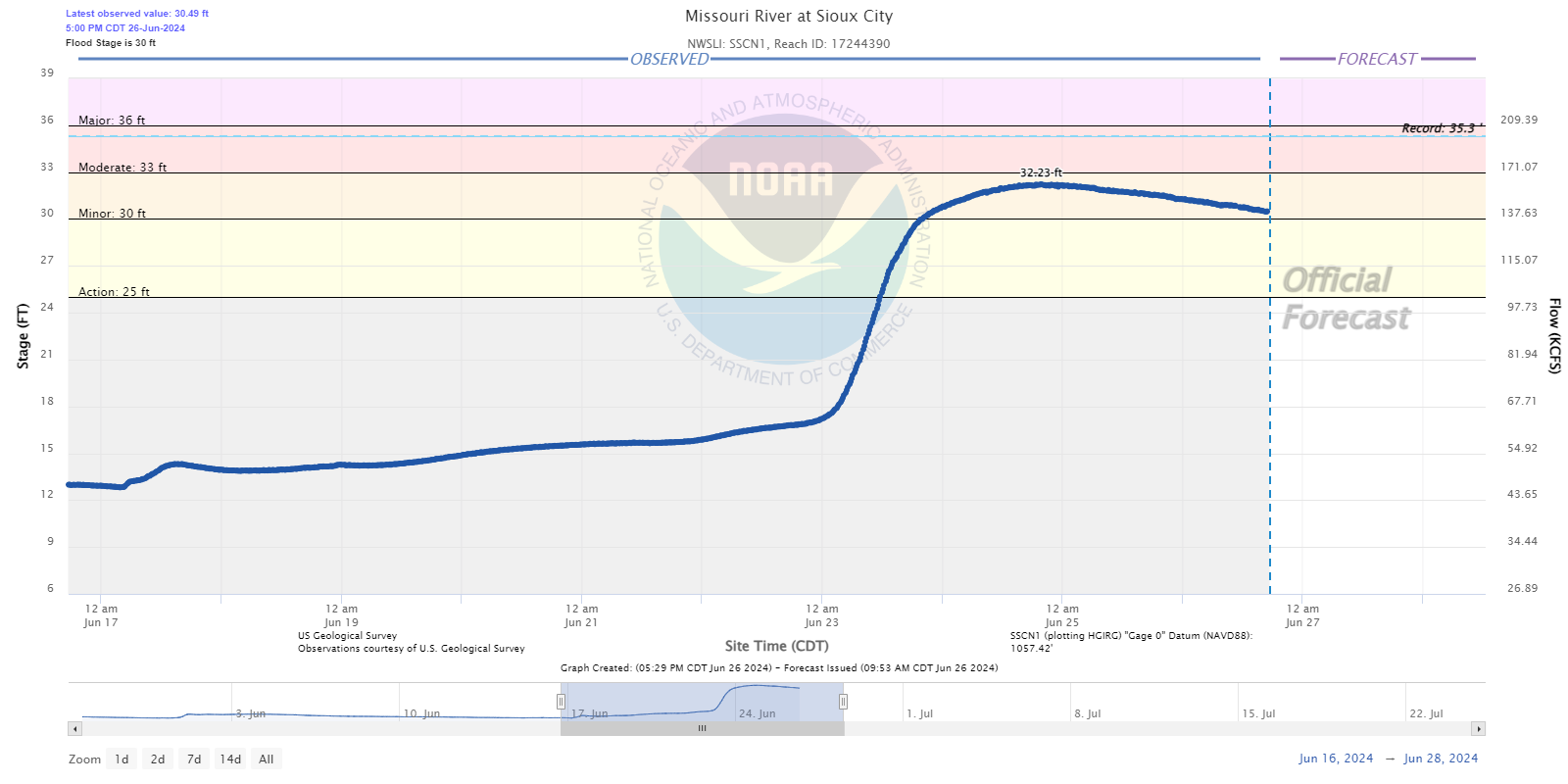 |
| Ponca, NE | South Sioux City, NE |
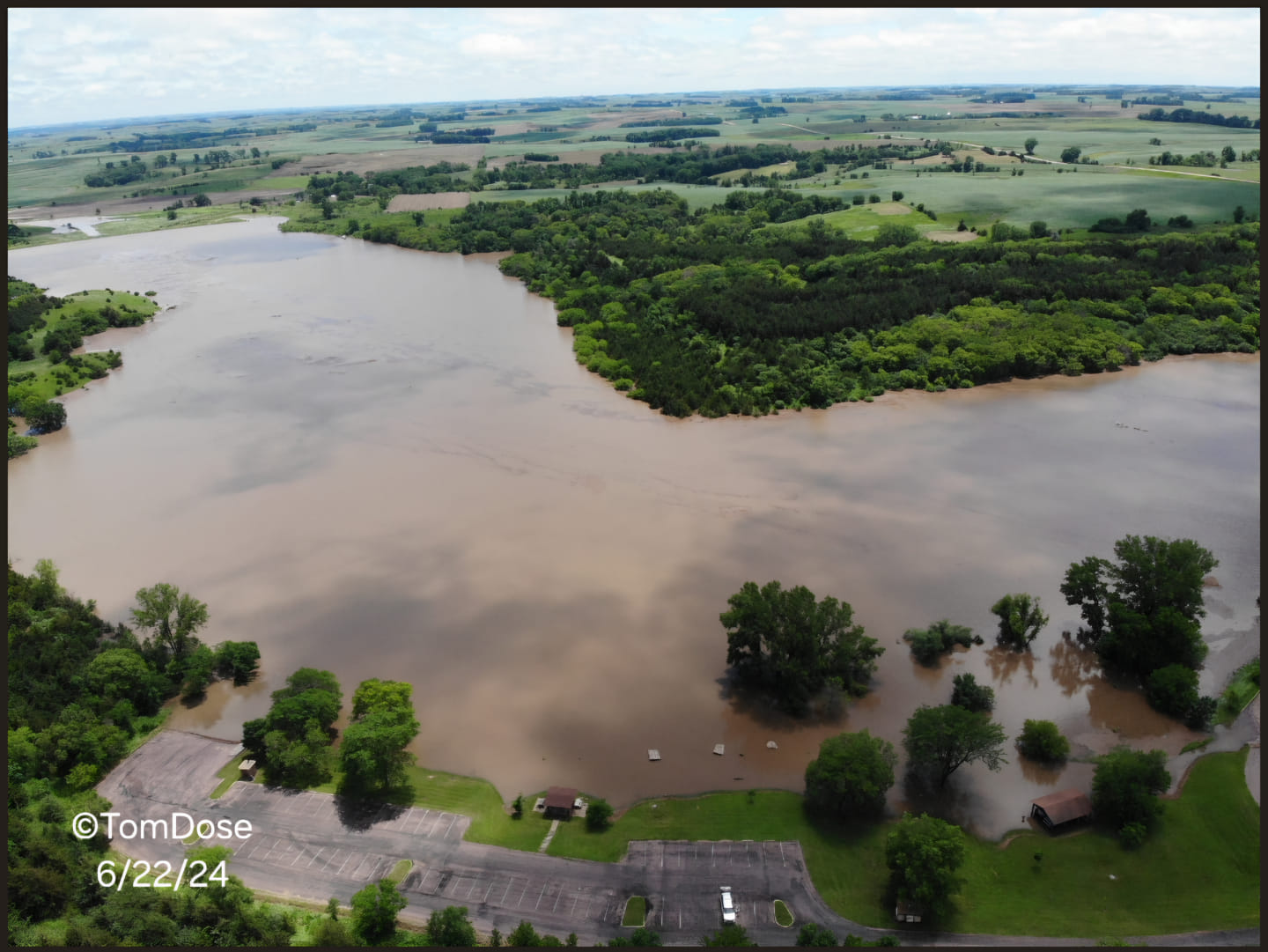
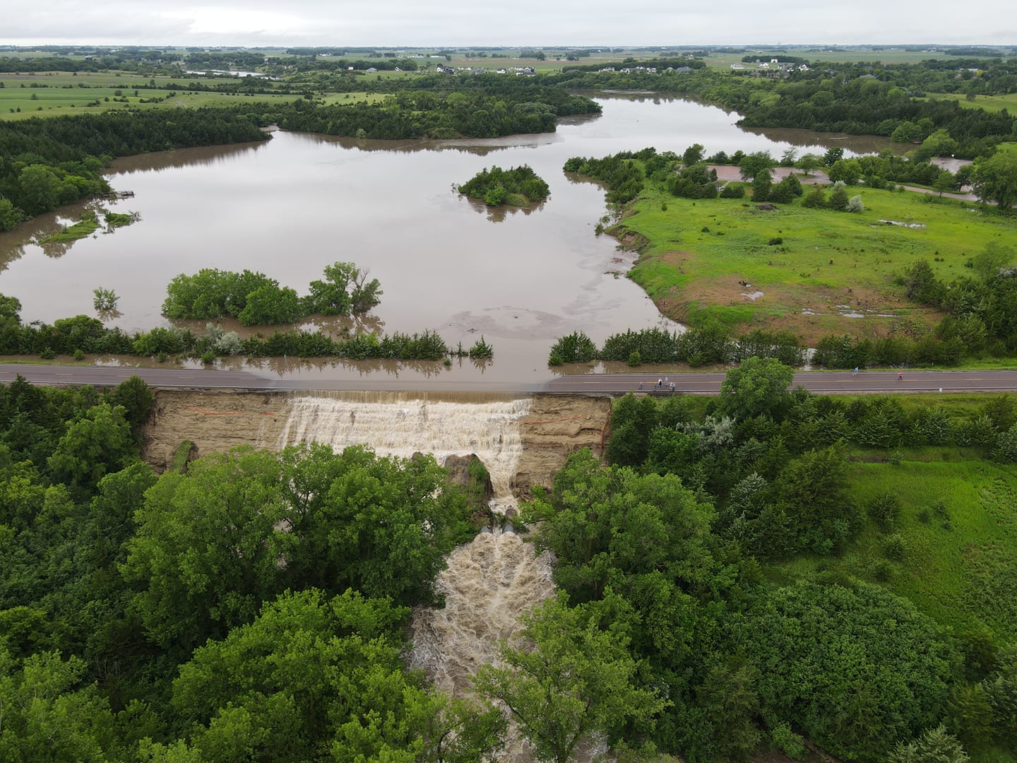
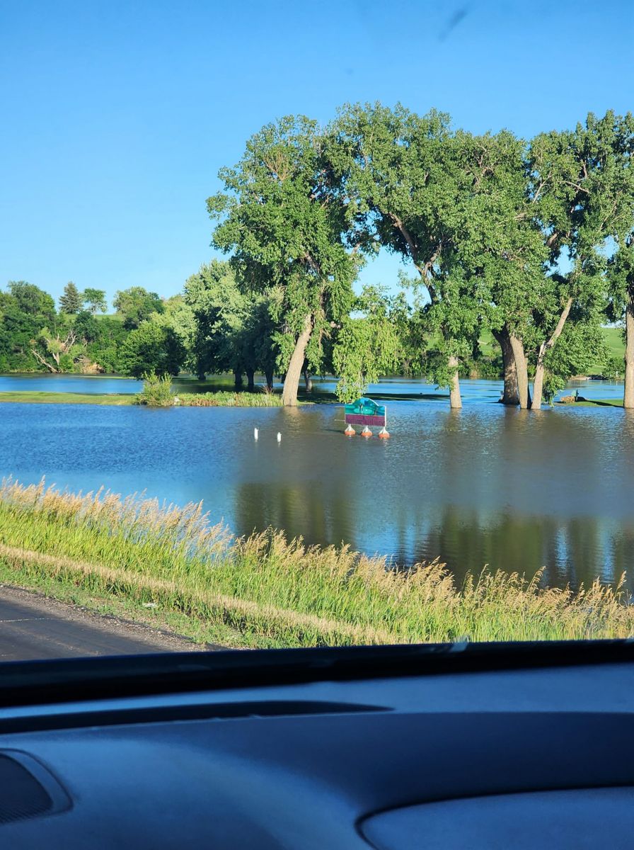
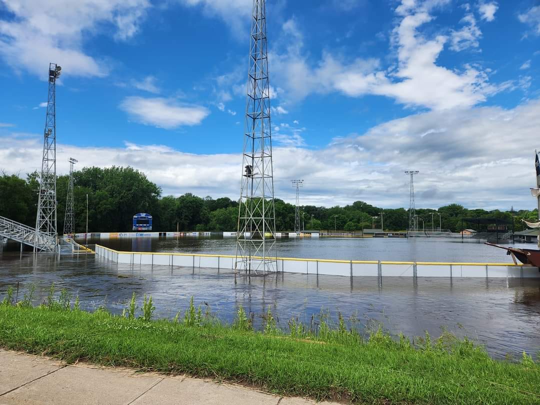
Photos & Video
Flooding Photos
 |
 |
 |
 |
| I-90 At Adrian (Credit: MNDOT) |
Akron, IA (Credit: Chris Pierce) |
Akron, IA (Credit: Megan Hulleman) |
Alton, IA (Credit: Sioux County Sheriff) |
 |
 |
 |
 |
| I-90 At Alton, IA (Credit: Michelle Coacher Bostinelos) |
Ashton, IA (Credit:Caitlin Thong Vanh) |
South of Alvord, IA (Credit: Dan Gottschalk) |
South of Alvord, IA (Credit: Dan Gottschalk) |
 |
 |
 |
 |
| South of Alvord, IA (Credit: Dan Gottschalk) |
Beliot, IA (Credit: Morgan Koerselman) |
Brandon, SD (Credit: Eric Van Donge) |
Beaver Creek near Canton, SD (Credit: Byron Ostrom) |
|
 |
 |
 |
| Correctionville, IA (Credit: Woodbury County Sheriff) |
Doon, IA (Credit: Sioux County Sheriff) |
Davis, SD (Credit: Lukas Potgieter) |
Dickinson County, IA (Credit: Dickinson County Emergency Management) |
 |
 |
 |
 |
| Harrisburg, SD (Credit: Evan Jones) |
Hawarden, IA (Credit: Sioux County Sheriff) |
Hawarden, IA (Credit: Sioux County Sheriff) |
Hawarden, IA (Credit: Sarah Topete) |
 |
 |
 |
 |
| Intersection of Hwys 44 & 81 (Credit: Kelly Schmidt Blair) |
Hospers, IA (Credit: Susan Budden) |
southwest of Hurley, SD (Credit: Shawn Oaks) |
Huset's Speedway - Brandon, SD (Credit: djonesfilmz) |
 |
 |
 |
 |
| I-29 near Mile Marker 60 (Credit: Ryan Oswald) |
Klondike Bridge at Iowa/South Dakota border (Credit: Katie Stricker) |
Lake Lakota south of Canton, SD (Credit: Tom & Brianna Dose) |
Lake Alvin near Harrisburg, SD (Credit: Eric Van Donge) |
 |
 |
 |
 |
| Lake Alvin near Harrisburg, SD (Credit: Eric Van Donge) |
Le Mars, IA (Credit: Nathan Vrieze) |
Mountain Lake, MN (Credit" Mountain View Drones) |
near Menno, SD (Credit: Michele Huber) |
 |
 |
 |
 |
| Montrose, SD (Credit: McCook County EM) |
McCook Lake, SD (Credit: City of Sioux Falls) |
McCook Lake, SD (Credit: City of Sioux Falls) |
O'Brien/Cherokee County Line (Credit: Shane Whitney) |
 |
 |
 |
 |
| Hwy 44 near Parker, SD (Credit: Emily Houska) |
near Parker, SD (Credit: Carrie Forrest) |
Paullina, IA (Credit: Cristie Tewes) |
Riverdale Park in Sioux Falls, SD (Credit: Donna Murphy) |
 |
 |
 |
 |
| Rotary Park in Sioux Falls, SD (Credit: Cierra Dirkson-Chapin) |
Cherry Rock Park entrance in eastern Sioux Falls, SD | Cherry Rock Park ball field in eastern Sioux Falls, SD |
Spencer Dog Park entrance in southern Sioux Falls, SD |
 |
 |
 |
 |
| Falls Park in Sioux Falls, SD (Credit: Heather Sargent Kroontje) |
Leif Erikson Camp in Sioux Falls, SD (Credit: Heather Sargent Kroontje) |
Sioux Falls, SD (Credit: City of Sioux Falls) |
Sioux Falls, SD (Credit: City of Sioux Falls) |
 |
 |
 |
 |
| Rock Rapids, IA (Credit: Hailey Olson) |
Rock Valley, IA (Credit: Sioux County Sheriff) |
Rock Valley, IA (Credit: Sioux City Fire & Rescue) |
Slayton, MN (Credit: Kate Harmsen) |
 |
 |
 |
 |
| Spencer, IA (Credit: Russ Mitchell) |
Spencer, IA (Credit: Eric Johannsen) |
Spencer, IA (Credit: Kianna Seidel) |
Struble, IA (Credit: Brooke Berkenpas) |
 |
 |
 |
 |
| Sioux Rapids, IA (Credit: Buena Vista County Emergency Management) |
Turner County, SD (Credit: Turner County Emergency Management) |
Tyndall, SD (Credit: Marcia Tallman) |
Windom, MN (Credit: Laurie Murphy) |
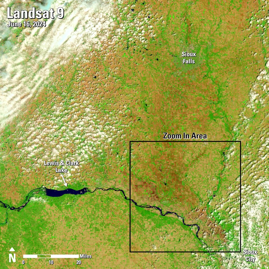
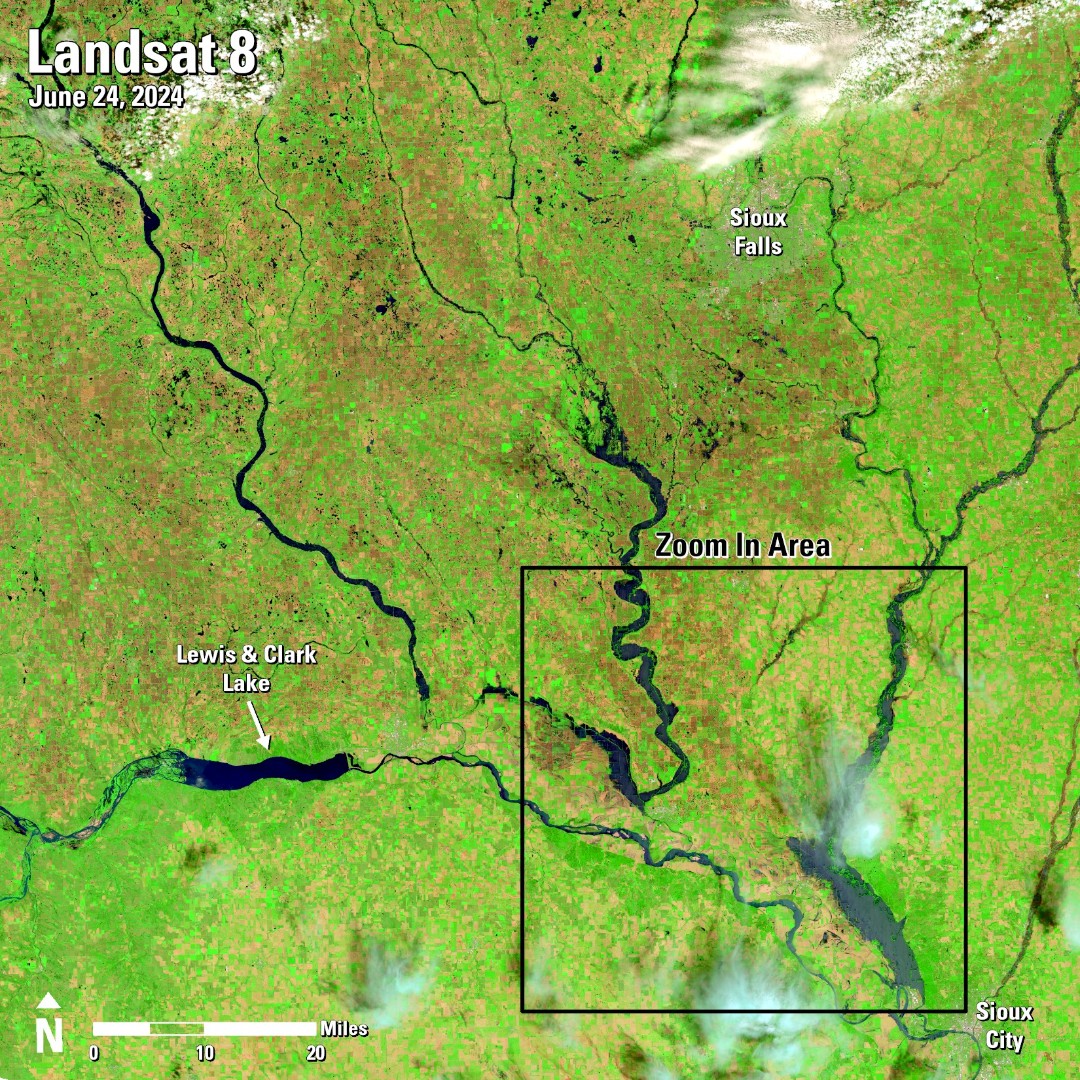
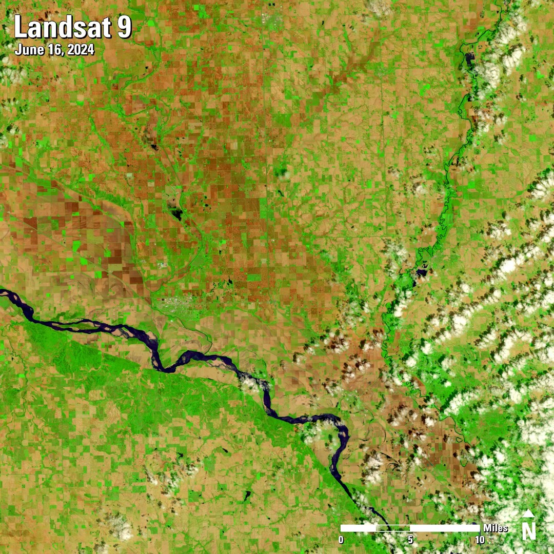
Before and After Comparison Photos from Landsat Satellite
| Before Flooding (Date of image below photo) | After Flooding (Date of image below photo) |
 |
 |
 |
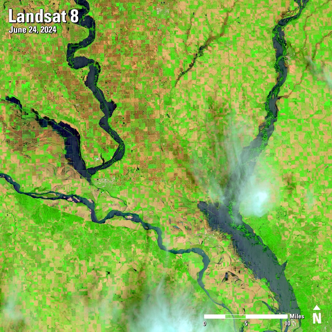 |
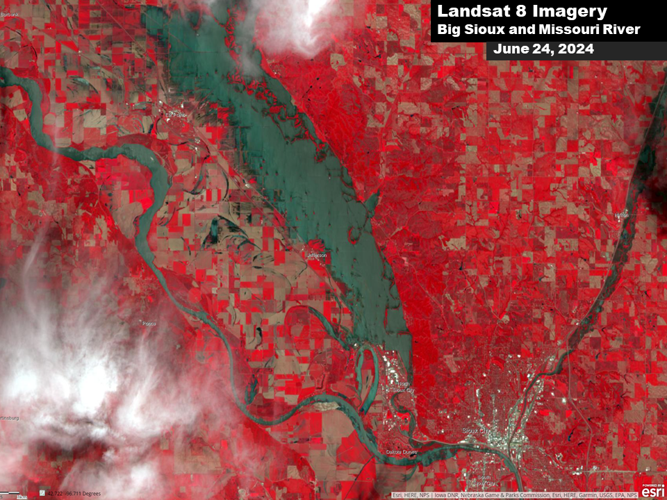
Before and After Comparison Photos from the Landsat 8 Satellite
 |
 |
 |
 |
| Landsat 8 View SE McCook Lake (Credit: USGS Landsat 8) |
Landsat 8 View Akron, IA (Credit: USGS Landsat 8) |
Landsat 8 View Cherokee, IA (Credit: USGS Landsat 8) |
Landsat 8 View SE South Dakota (Credit: USGS Landsat 8) |
 |
 |
 |
 |
| Landsat 8 View Rock Valley (Credit: USGS Landsat 8) |
Landsat 8 View Spencer, IA (Credit: USGS Landsat 8) |
Landsat 8 View Sioux City Area (Credit: USGS Landsat 8) |
Landsat 8 View Hawarden, IA (Credit: USGS Landsat 8) |
Radar
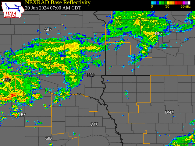
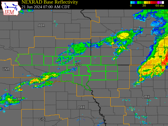
Radar Loops Across the Event
 |
 |
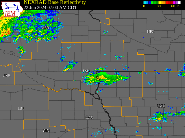 |
| Radar Loop - June 20-21, 2024 | Radar Loop - June 21-22, 2024 | Radar Loop - June 22, 2024 |
Rain Reports
| Station: | 3-day Rainfall 6/20-6/22 | Historic Rank | Record 3-day Rainfall | Probability of Occurrence in any given year* | Normal Monthly June Rainfall | June 2024 MTD Rainfall (as of 6/24) |
| Canton SD 4WNW | 12.02” | 2nd | 13.16” June 14-16, 2014 |
<0.10% | 4.66” | 15.64” |
| Mitchell SD | 8.55” | 1st | Previous 7.08” Sept 10-12, 2019 |
0.20% | 3.51” | 12.07” |
| Menno SD | 7.33” | 1st | Previous 7.06” Aug 18-20, 1937 |
0.50% | 3.64” | 10.59” |
| Sioux Falls SD | 6.70” | 2nd | 7.71” June 14-16, 2014 |
1% | 4.23” | 10.80” |
| Windom MN | 9.16” | 2nd | 9.36” Sept 23-25, 2010 |
0.50% | 4.73” | 13.68” |
| Rock Valley IA | 8.70” | 1st | Previous 7.05” Sept 18-20, 2018 |
0.50% | 4.60” | 12.86” |
| Sibley IA | 8.61” | 3rd | 9.34” June 18-20, 1954 |
1% | 4.88” | 14.15” |
| Sheldon IA | 7.22” | 4th | 10.05” July 14-16, 1900 |
2% | 4.67” | 12.24” |
| Spirit Lake IA | 6.69” | 4th | 8.09” Sept 13-15, 2004 |
n/a | 4.77” | 15.57” |
| Sanborn IA | 6.85” | 3rd | 7.80” Sept 19-21, 2018 |
3% | 4.86” | 12.06” |
| Spencer IA | 6.49” | 4th | 7.29” Sept 13-15, 2004 |
4% | 4.60” | 10.45” |
* Probability of Occurrence based roughly on 3-day ARI from Precipitation Frequency Estimates
|
||||||||||||||||||||||||||||||||||||||||||||||||||||||||||||||||||||||||||||||||||||||||||||||||||||||||||||||||||||||||||||||||||||||||||||||||||||||||||||||||||||||||||||||||||||||||||||||||||||||||||||||||||||||||||||||||||||||||||||||||||||||||||||||||||||||||||||||||||||||||||||||||||||||||||||||||||||||||||||||||||||||||||||||||||||||||||||||||||||||||||||||||||||||||||||||||||||||||||||||||||||||||||||||||||||||||||||||||||||||||||||||||||||||||||||||||||||||||||||||||||||||||||||||||||||||||||||||||||||||||||||||||||||||||||||||||||||||||||||||||||||||||||||||||||||||||||||||||||||||||
| Three Day Rainfall Totals - June 20-22, 2024 | ||||||||||||||||||||||||||||||||||||||||||||||||||||||||||||||||||||||||||||||||||||||||||||||||||||||||||||||||||||||||||||||||||||||||||||||||||||||||||||||||||||||||||||||||||||||||||||||||||||||||||||||||||||||||||||||||||||||||||||||||||||||||||||||||||||||||||||||||||||||||||||||||||||||||||||||||||||||||||||||||||||||||||||||||||||||||||||||||||||||||||||||||||||||||||||||||||||||||||||||||||||||||||||||||||||||||||||||||||||||||||||||||||||||||||||||||||||||||||||||||||||||||||||||||||||||||||||||||||||||||||||||||||||||||||||||||||||||||||||||||||||||||||||||||||||||||||||||||||||||||
|
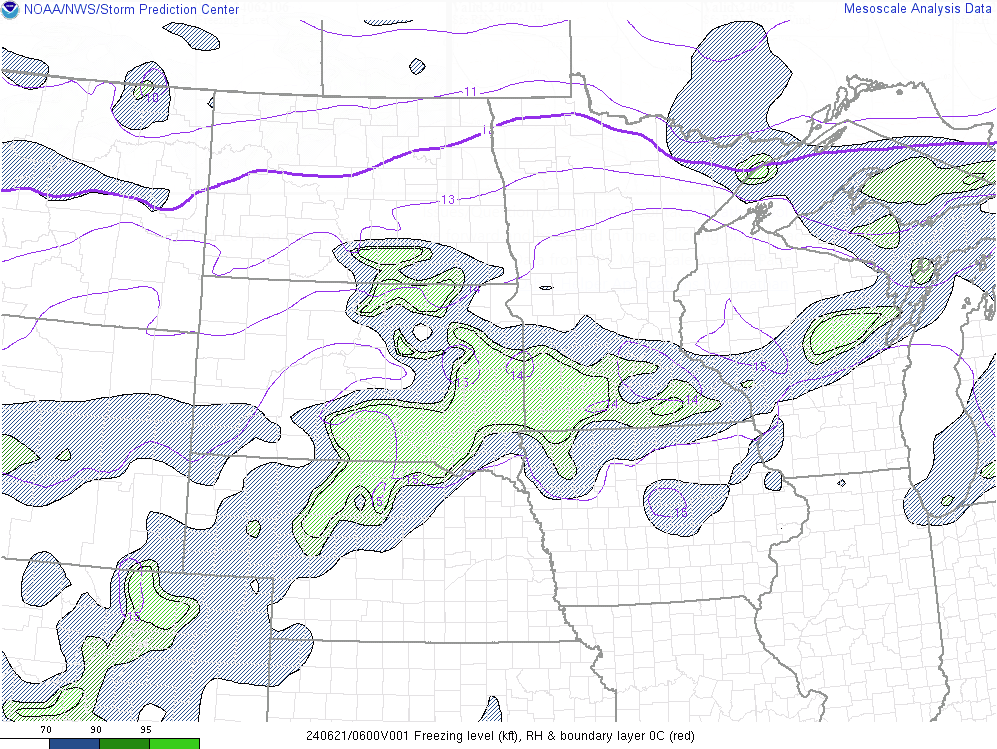
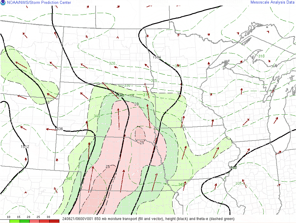
Environment
 |
 |
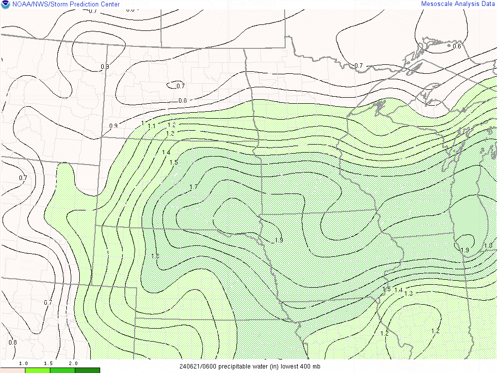 |
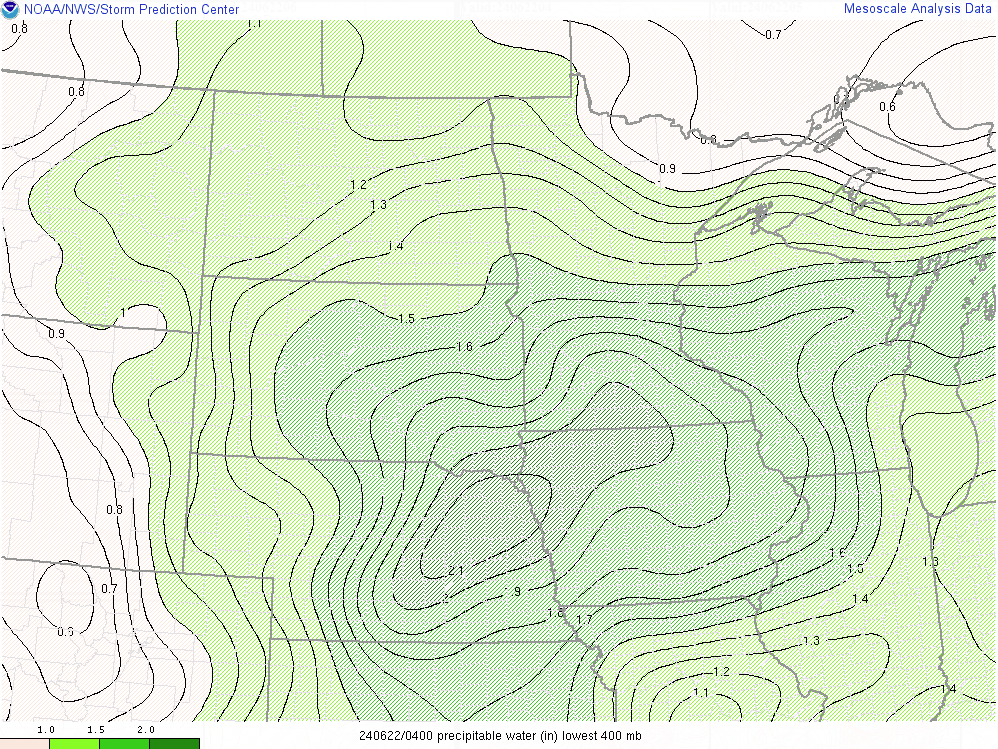
| 1am June 21st Freezing Level | 1am June 21st Moisture Transport | 1am June 21st Precipitable Water |
 |
 |
 |
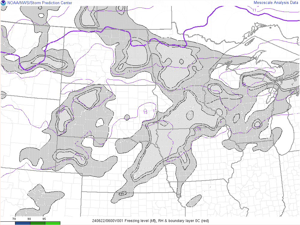
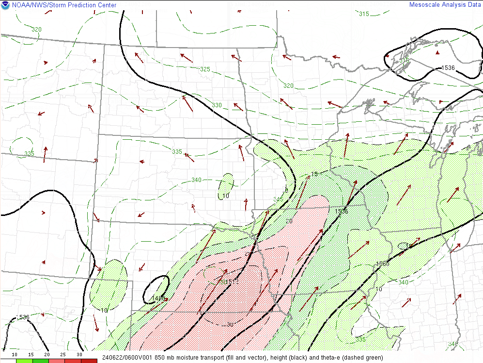
| 1am June 22nd Freezing Level | 1am June 22nd Moisture Transport | 1am June 22nd Precipitable Water |
Additional Information
The Forecast
 |
 |
 |
|
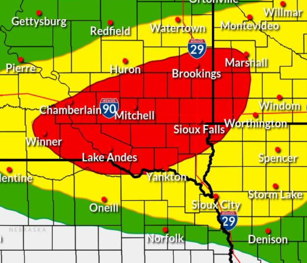
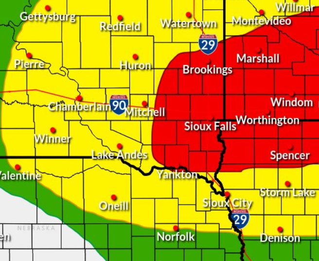
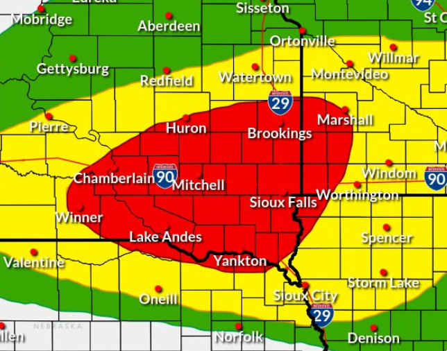
WPC Day 1 Excessive Rainfall Outlook [Red shaded area indicates a Moderate- level 3 out of 4 risk] |
WPC Day 2 Excessive Rainfall Outlook [Red shaded area indicates a Moderate- level 3 out of 4 risk] |
WPC Day 1 Excessive Rainfall Outlook UPDATE Issued 6/20 pm [Red shaded area indicates a Moderate- level 3 out of 4 risk] |
 |
 |
 |
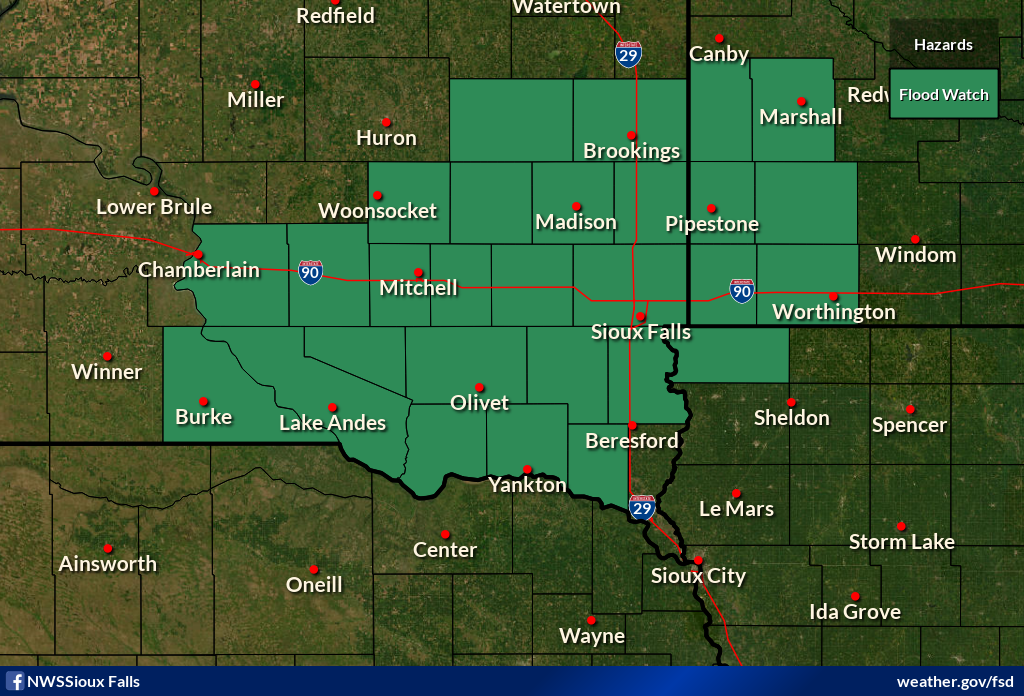
| Flood Watch for Flash Flooding Issued 6/20 am (valid 8am 6/20 through 8am 6/21) |
Flood Watch for Flash Flooding Issued 6/20 pm (valid time extended through 7am 6/21) |
Flood Watch for Flash Flooding Issued 6/21 am (continues through 7am 6/22) |
 |
 |
 |
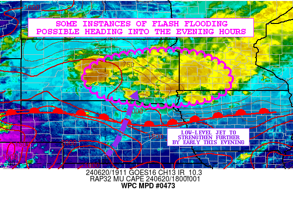
| Mesoscale Precipitation Discusion Issued 216 pm June 20. 2024 |
Mesoscale Precipitation Discusion Issued 800 pm June 20. 2024 |
Mesoscale Precipitation Discusion Issued 1223 am June 21. 2024 |
 |
 |
 |
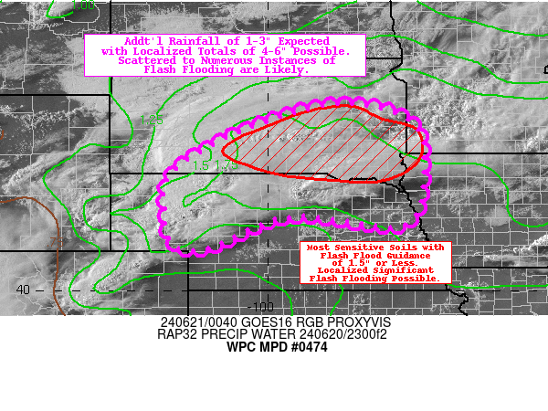
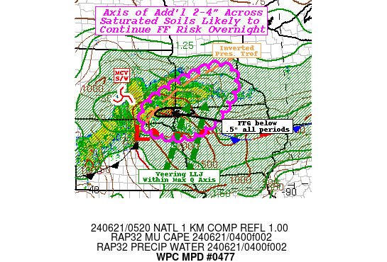
| Mesoscale Precipitation Discusion Issued 1005 am June 21. 2024 |
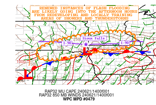
Mesoscale Precipitation Discusion Issued 352 pm June 21. 2024 |
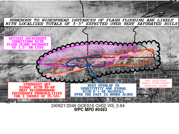
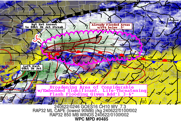
Mesoscale Precipitation Discusion Issued 953 pm June 21. 2024 |
 |
||
| Annual Exceedance Probability |
Summaries from other NWS Offices
 |
Media use of NWS Web News Stories is encouraged! Please acknowledge the NWS as the source of any news information accessed from this site. |
|


 Weather Story
 Weather Map
 Local Radar