Overview
|
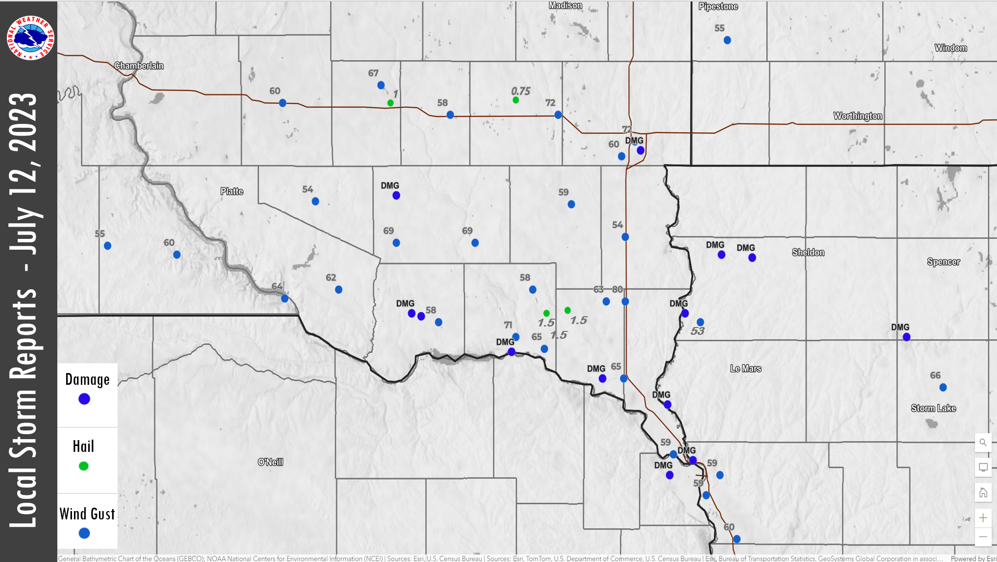
A line of severe storms moved across southeastern South Dakota, northeastern Nebraska and northwestern Iowa. While there were a few reports of 1 to 1.5 inch, A hail, damaging winds were the primary threat with this line of storms. Damaging winds gusting up to 75 mph downed some trees and power lines across the area. Locally heavy rainfall also occurred with these storms.
|
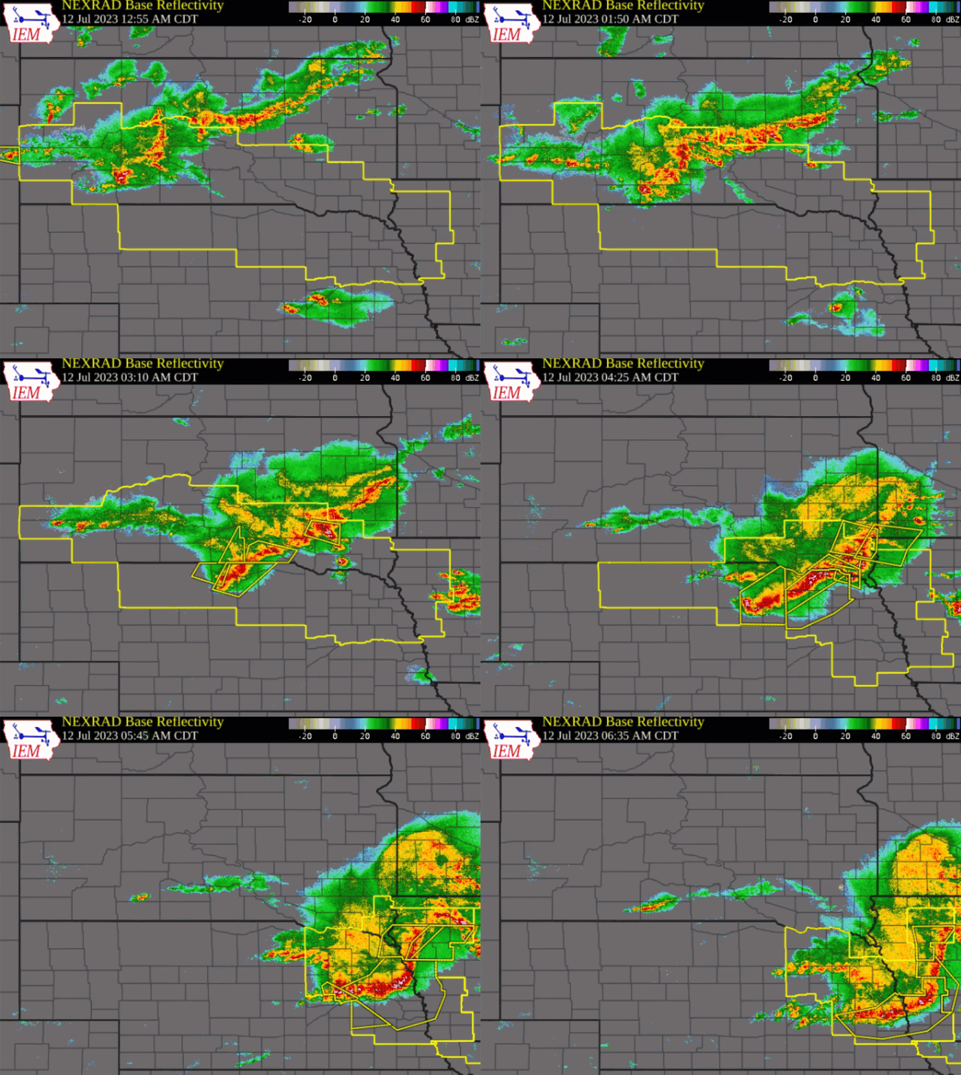 Radar Loop of Storms Moving Through the Tri State Area |
Wind & Hail:
Wind
A squall line developed over western and central South Dakota late in the evening of July 11. These storms moved into southeastern South Dakota after midnight and expanded southward into northeastern Nebraska. The storms moved southeast through the evening
 |
 |
 |
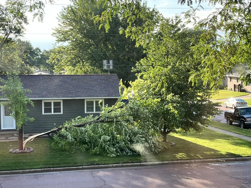 |
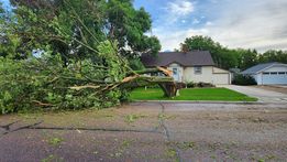
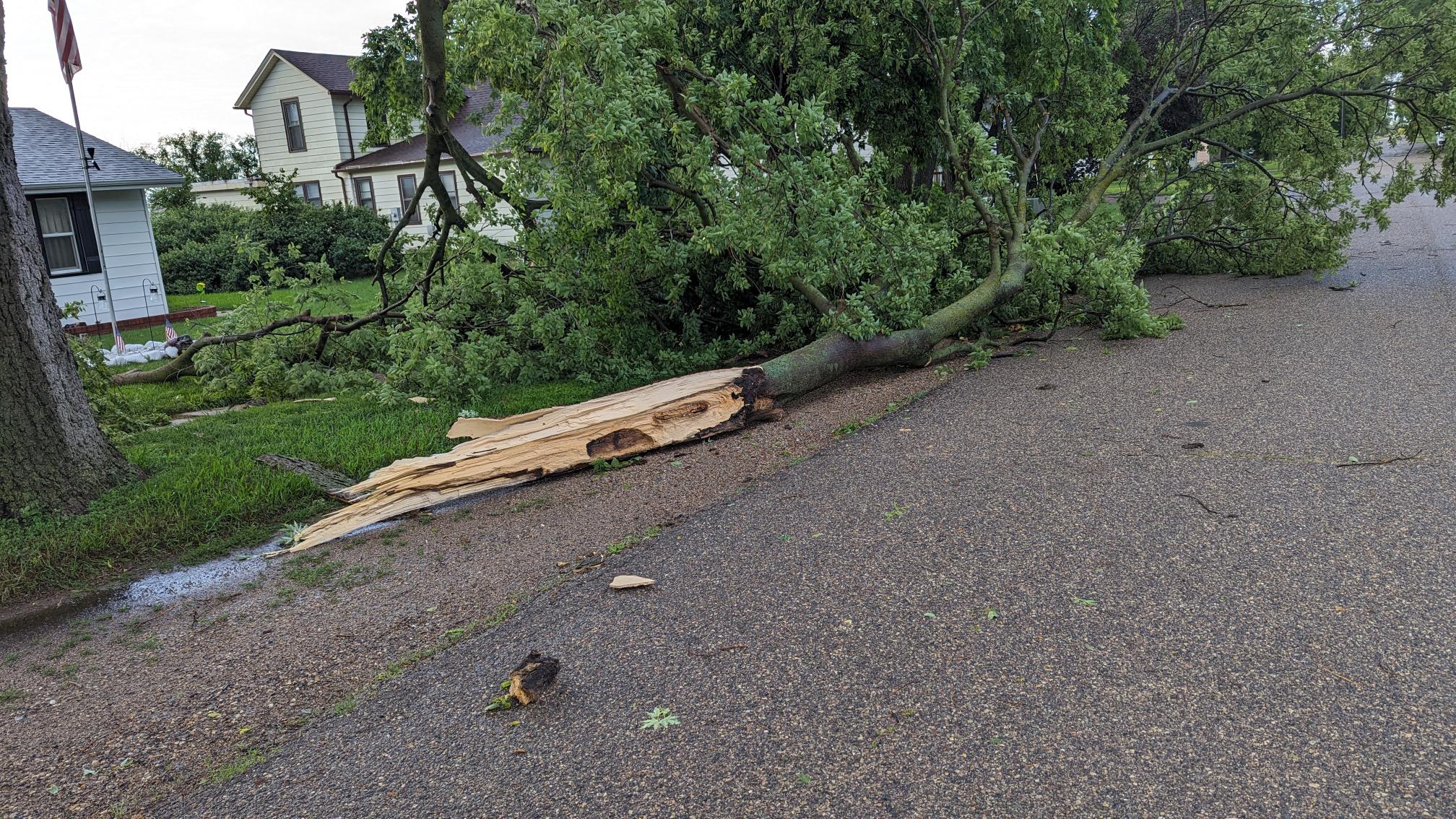
| Tree snapped near the base of the trunk in Parkston, SD. Photo courtesy of Melodie Kittock. | Large branch down from damaging winds in Sioux Falls. Photo courtesy of @CozyBrew | Large branch broken off a tree in Tyndall, SD from damaging winds. Photo courtesy of Eric Elsberry. | A tree was split in half at the trunk in Yankton, SD. Photo courtesy of Cathy Walz. |
Hail
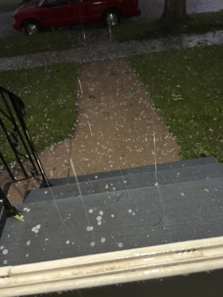
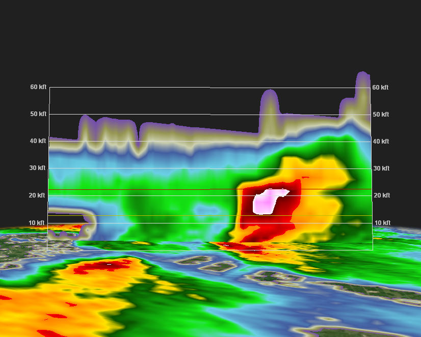
While winds of 60 to 75 mph were the primary hazard with these storms, a couple of thunderstorms developed ahead of the squall line. One of these storms produced around 1 inch hail in the Mitchell area. Another storm developed north of Yankton and produced up to 1.5 inch hail from near Volin to Wakonda South Dakota.
 |
 |
 |
| Photo of ping pong size (1.5 inch) hail that fell in Wakonda, South Dakota. Photo courtesy of Phil Hesssman. | Photo of up to quarter size hail falling in Mitchell, SD. Photo courtesy of Janette Wilson. | Photo of up to nickle size hail falling in Salem, SD. Photo courtesy of James Petree. |
Radar
 |
 |
 |
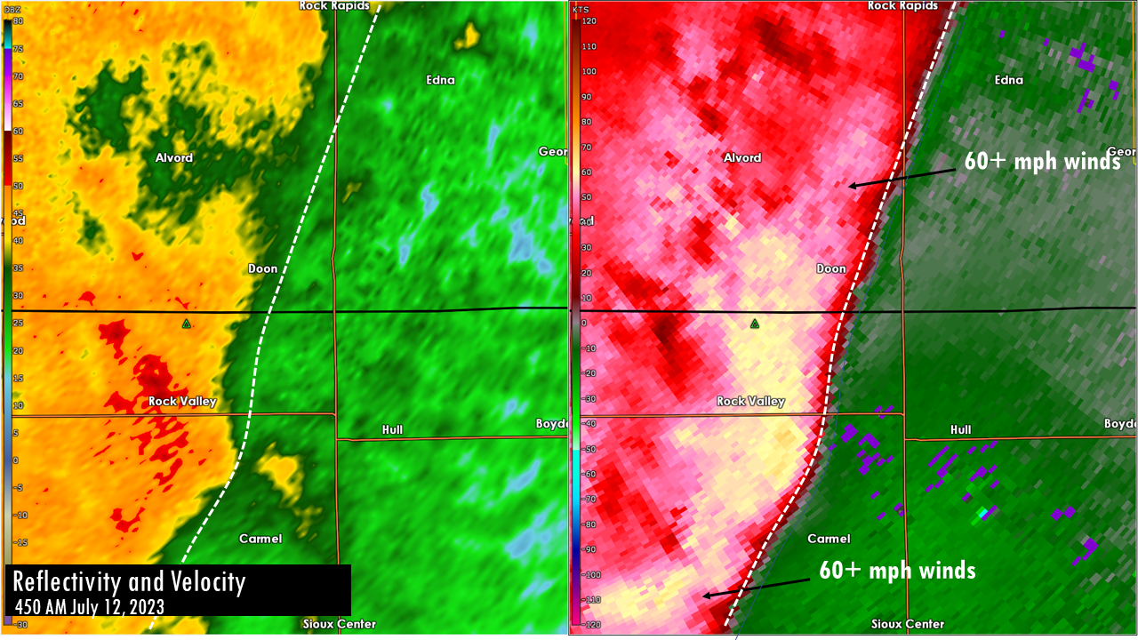 |
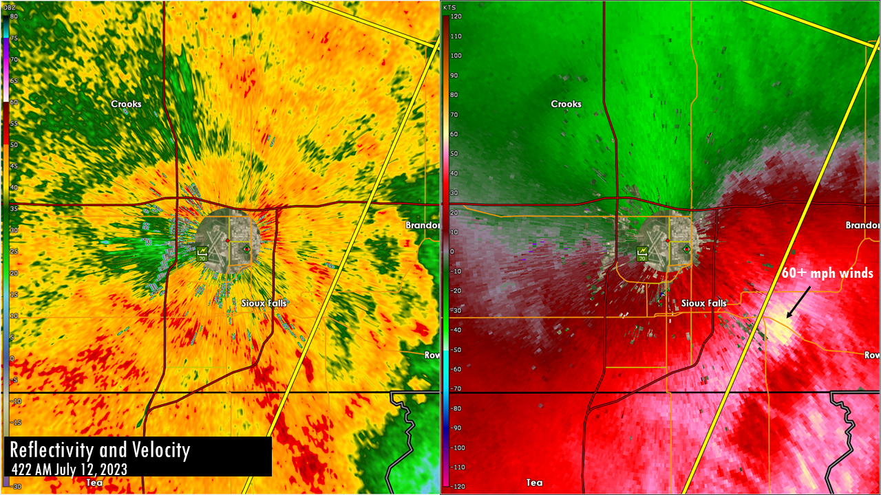
| Radar loop of the squall line moving through the area early in the morning of July 12. | A cross-section of the thunderstorm as it approaches Wakonda, South Dakota. The white colors are indicative of large hail that is developing when the storm is still 5-10 miles west of Wakonda. | Radar reflectivity and velocity as storms moved through Sioux Falls producing 60+ mph winds. Time of 450 AM July 12, 2023 | Radar reflectivity and velocity as storms moved through Hull, IA producing 60+ mph winds. Time of 450 AM July 12, 2023 |
Storm Reports
Severe Weather Reports July 12, 2023 (click to enlarge image) |
 |
|
..TIME... ...EVENT... ...CITY LOCATION... ...LAT.LON... 0230 AM Hail 1 ESE Salem 43.72N 97.37W
0236 AM Tstm Wnd Gst 5 W Plankinton 43.71N 98.58W Mesonet station 214 SD RWIS Plankinton. 0241 AM Tstm Wnd Gst 1 ESE Dallas 43.23N 99.49W Mesonet station 307 SD RWIS Dallas. 0248 AM Tstm Wnd Gst 3 SE Loomis 43.77N 98.07W Via personal weather station. 0301 AM Tstm Wnd Gst 6 NNE Herrick 43.20N 99.13W Via personal weather station. 0302 AM Hail 2 SSE Mitchell 43.71N 98.02W Report from mPING: Quarter (1.00 in.). 0311 AM Tstm Wnd Gst 3 S Corsica 43.38N 98.41W Mesonet station 304 SD RWIS Corsica. 0320 AM Tstm Wnd Gst 4 ENE Alexandria 43.67N 97.71W Mesonet station 213 SD RWIS Alexandria. 0324 AM Tstm Wnd Dmg Parkston 43.40N 97.99W Tree snapped one foot above ground. Report 0328 AM Tstm Wnd Gst 2 WSW Pickstown 43.05N 98.57W Mesonet station 244 SD RWIS Ft. Randall Dam. 0331 AM Tstm Wnd Gst Wagner 43.08N 98.29W Via multiple personal weather stations 0336 AM Tstm Wnd Gst 2 NW Tripp 43.24N 97.99W Mesonet station 26 SD RWIS Tripp. 0341 AM Tstm Wnd Gst Menno 43.24N 97.58W Via personal weather station. 0343 AM Hail 3 NNW Volin 43.00N 97.21W Pictures via social media. 0349 AM Tstm Wnd Dmg 3 WNW Tyndall 43.00N 97.91W An empty cattle truck was tipped over. Time 0350 AM Tstm Wnd Gst 3 SE Montrose 43.67N 97.15W Mesonet station 18 SD RWIS Montrose. 0350 AM Tstm Wnd Dmg Tyndall 42.99N 97.86W Large tree limbs down in Tyndall. Time 0351 AM Tstm Wnd Gst 5 S Freeman 43.28N 97.42W Mesonet station 163 SD RWIS Freeman. 0355 AM Hail Wakonda 43.01N 97.10W Report via social media. 0358 AM Tstm Wnd Gst 5 ESE Tyndall 42.97N 97.77W Mesonet station 179 SD RWIS Tyndall. 0401 AM Tstm Wnd Gst 3 ESE Parker 43.37N 97.08W Mesonet station 310 SD RWIS Parker. 0405 AM Tstm Wnd Gst 2 E Mayfield 43.08N 97.28W Via personal weather station. 0412 AM Tstm Wnd Gst 5 W Sioux Falls 43.53N 96.82W Via personal weather station. 0413 AM Tstm Wnd Gst 3 NNW Sioux Falls 43.58N 96.75W ASOS station KFSD Sioux Falls Airport. 0413 AM Tstm Wnd Gst 2 NE Yankton 42.92N 97.37W AWOS station KYKN Yankton Municipal Airport. 0414 AM Tstm Wnd Dmg 1 S Yankton 42.87N 97.39W Tree down. Report via social media. 0415 AM Tstm Wnd Dmg 1 NE Sioux Falls 43.55N 96.72W Large branches a few trees down across the 0417 AM Tstm Wnd Gst 2 WSW Gayville 42.88N 97.22W Mesonet station 197 SD RWIS Gayville. 0420 AM Tstm Wnd Gst 2 N Trosky 43.92N 96.27W Mesonet station MN154 U.s.75 - Trosky - Mp 0425 AM Tstm Wnd Gst 5 SSW Worthing 43.26N 96.80W Mesonet station 176 SD RWIS Davis. 0426 AM Tstm Wnd Gst 6 SSE Centerville 43.04N 96.90W Mesonet station BFMS2 Beresford 7 WSW (SD 0430 AM Tstm Wnd Gst 3 SSW Beresford 43.04N 96.80W Mesonet station 16 SD RWIS Beresford. 0437 AM Tstm Wnd Dmg Vermillion 42.78N 96.92W Several large branches snapped. Report via 0439 AM Tstm Wnd Gst 6 E Vermillion 42.78N 96.81W Via personal weather station. 0445 AM Tstm Wnd Dmg Hawarden 43.00N 96.49W Trees down in Hawarden. Report via social 0447 AM Tstm Wnd Dmg Rock Valley 43.20N 96.30W Power lines and large branches down. Winds 0452 AM Tstm Wnd Gst 4 ESE Hawarden 42.97N 96.41W Mesonet station DVI08070 Hawarden. 0455 AM Tstm Wnd Dmg 5 SSE Westfield 42.69N 96.58W Tree reported down across Hwy 12. 0458 AM Tstm Wnd Dmg Hull 43.19N 96.14W Corrects previous tstm wnd dmg report from 0514 AM Tstm Wnd Gst 3 WSW North Sioux City 42.52N 96.55W Via personal weather station. 0514 AM Tstm Wnd Dmg Jackson 42.45N 96.57W Tree roughly 30 feet tall and 12 inch in 0524 AM Tstm Wnd Dmg 3 W Sioux City 42.50N 96.45W Wires down across the west side of Sioux 0526 AM Tstm Wnd Gst 2 SW Sergeant Bluff 42.38N 96.38W ASOS station KSUX Sioux Gateway Airport. 0528 AM Tstm Wnd Gst 4 NNE Sergeant Bluff 42.45N 96.31W Via personal weather station. 0535 AM Tstm Wnd Gst Sloan 42.23N 96.22W
0600 AM Rain 1 SE Vermillion 42.77N 96.91W Cocorahs station SD-CY-10 Vermillion 1.4 SE. 0615 AM Tstm Wnd Dmg Peterson 42.92N 95.34W Trees and large branches down in town. 0628 AM Tstm Wnd Gst 2 NE Truesdale 42.75N 95.15W Mesonet station RSLI4 Storm Lake. 1037 AM Rain Freeman 43.35N 97.43W Rainfall from overnight storms. |
 |
Media use of NWS Web News Stories is encouraged! Please acknowledge the NWS as the source of any news information accessed from this site. |
 |