Overview
|
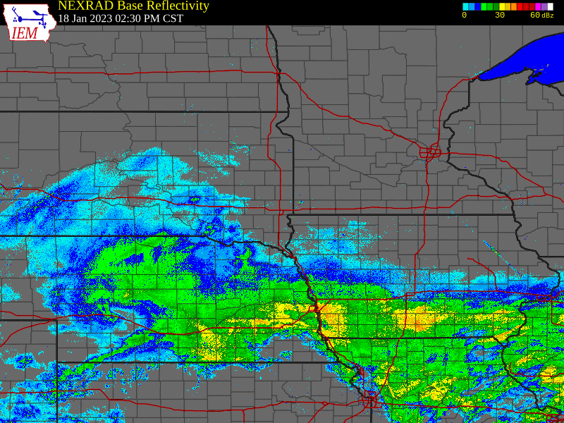
A fast moving storm system began moving through the region during the afternoon of Wednesday, January 18th. Snowfall intensified during the evening and overnight hours, and ended during the morning of Thursday, January 19th. |
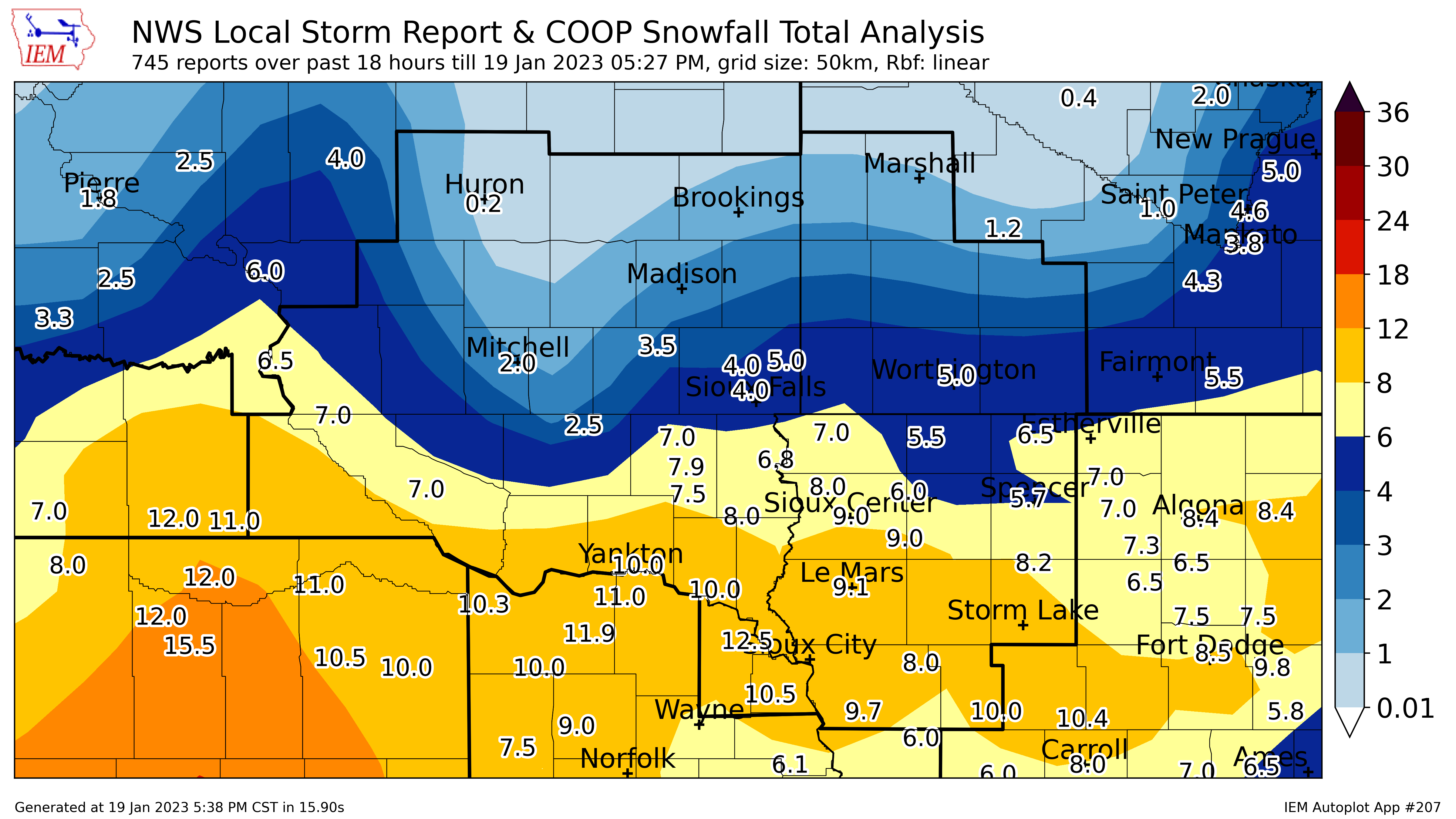
 Storm Total Snowfall |
Snow/Ice
 |
||||||||||||||||||||||||||||||||||||||||||||||||||||||||||||||||||||||||||||||||||||||||||||||||||||||||||||||||||||||||||||||||||||||||||||||||||||||||||||||||||||||||||||||||||||||||||||||||||||||||||||||||||||||||||||||||||||||||||||||||||||||||||||||||||||||||||||||||||||||||||||||||||||||||||||||||||||||||||||||||||||||||||||||||||||||||||||||||||||||||||||||||||||||||||||||||||||||||||||||||||||||||||||||||||||||||||||||||||||||||||||||||||||||||||||||||||||||||||||||||||||||||||||||||||||
|
||||||||||||||||||||||||||||||||||||||||||||||||||||||||||||||||||||||||||||||||||||||||||||||||||||||||||||||||||||||||||||||||||||||||||||||||||||||||||||||||||||||||||||||||||||||||||||||||||||||||||||||||||||||||||||||||||||||||||||||||||||||||||||||||||||||||||||||||||||||||||||||||||||||||||||||||||||||||||||||||||||||||||||||||||||||||||||||||||||||||||||||||||||||||||||||||||||||||||||||||||||||||||||||||||||||||||||||||||||||||||||||||||||||||||||||||||||||||||||||||||||||||||||||||||||
Records
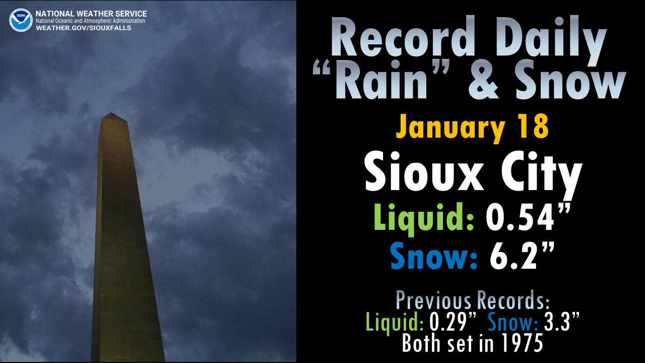 |
| Records Set During This Winter Storm |
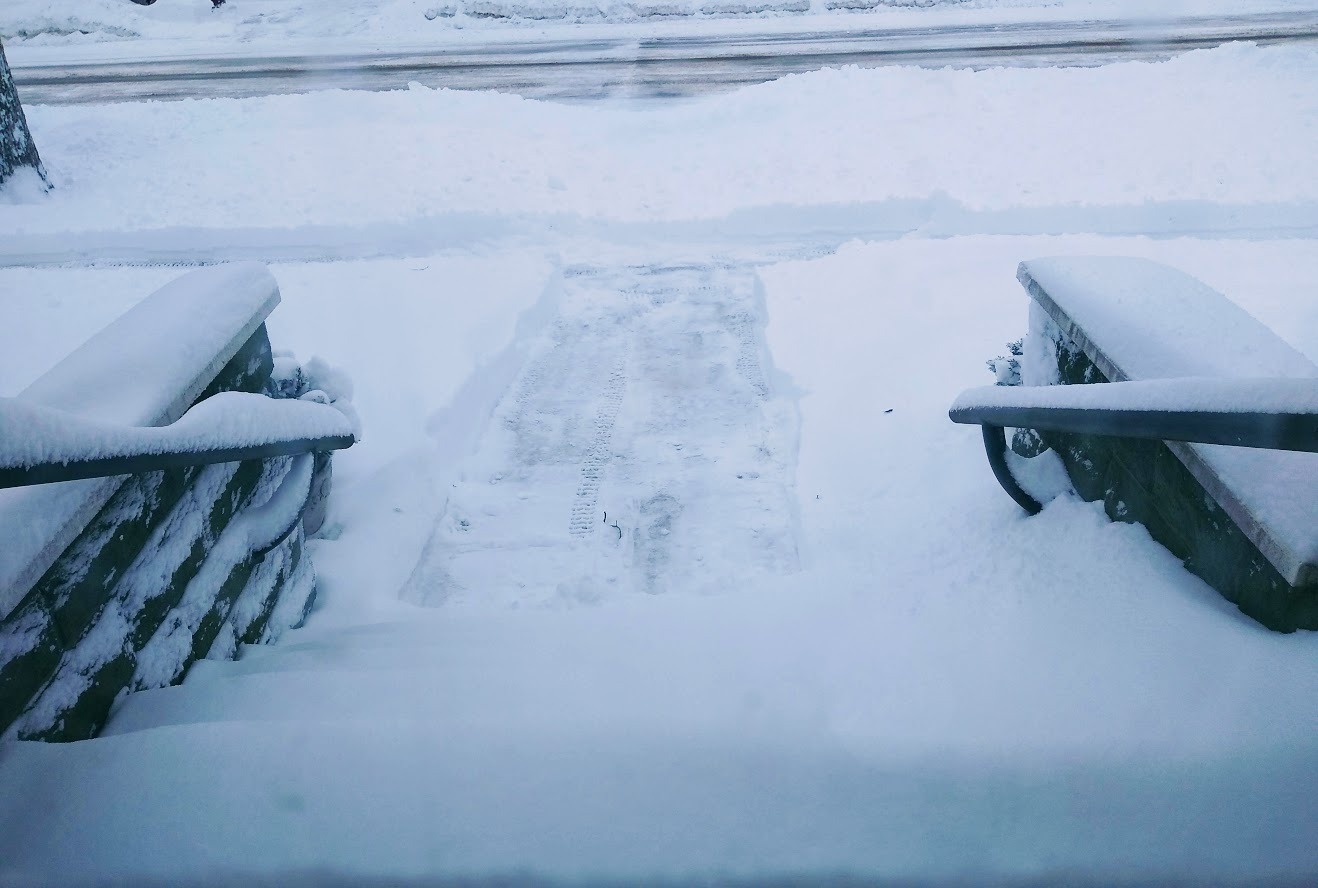
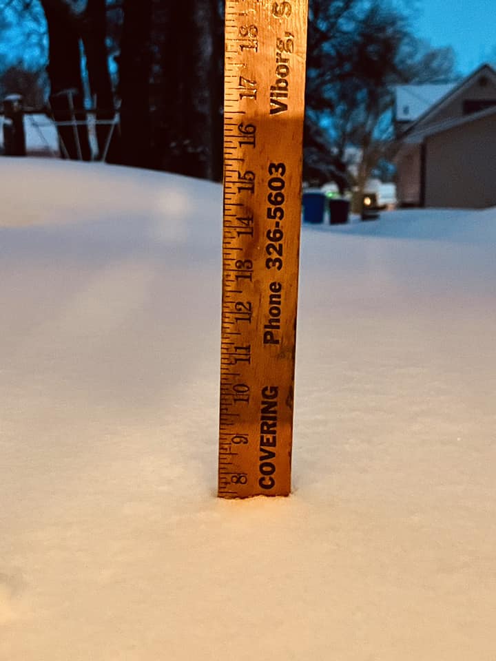
Photos & Video
Here's a look at photos from the event.
 |
 |
 |
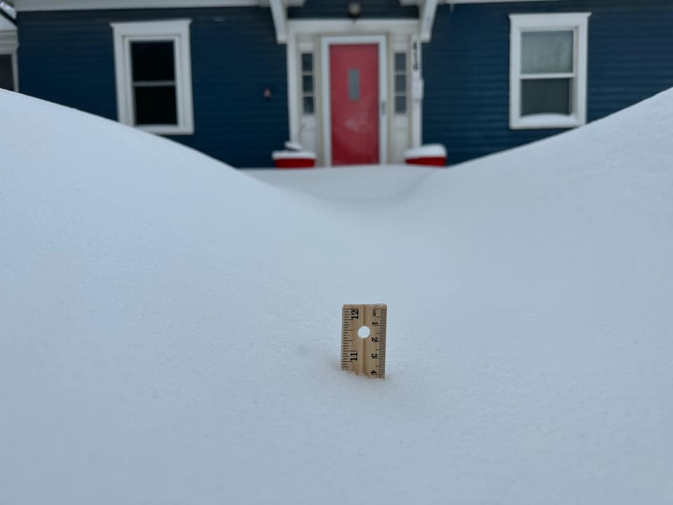 |
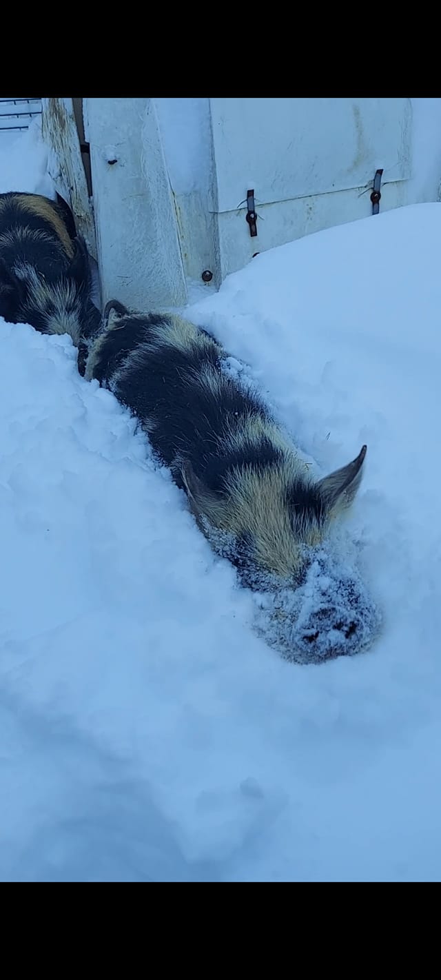
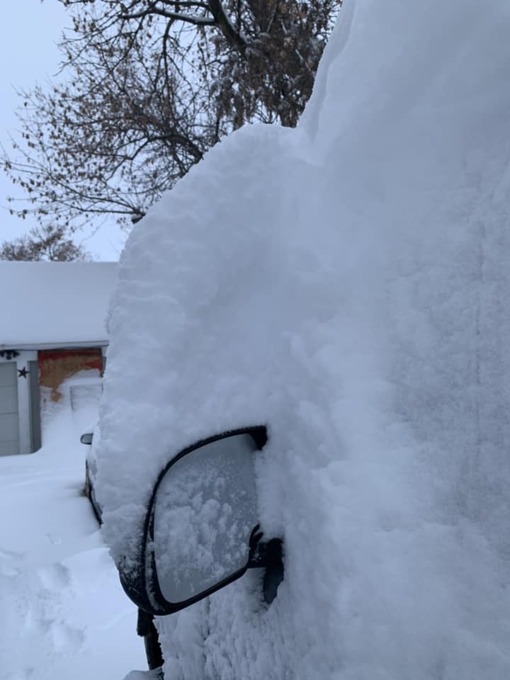
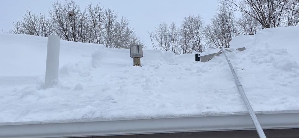
| Sioux Center (Andy Wing) |
Hull, IA (Becka LaFrenz) |
Davis (Cinda Wilson) |
Vermillion (Derek Bradley Zomer) |
 |
 |
||
| Sioux Falls (Mike Eastman) |
Viborg (Paul Christensen) |
Caption (source) |
Caption (source) |
Radar
|
| Regional Radar - January 18-19, 2023 |
 |
Media use of NWS Web News Stories is encouraged! Please acknowledge the NWS as the source of any news information accessed from this site. |
|


 Weather Story
 Weather Map
 Local Radar