Overview
|
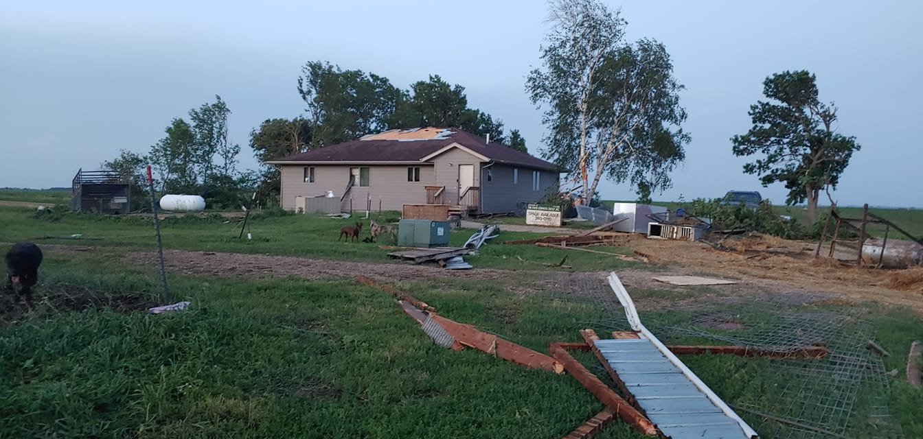
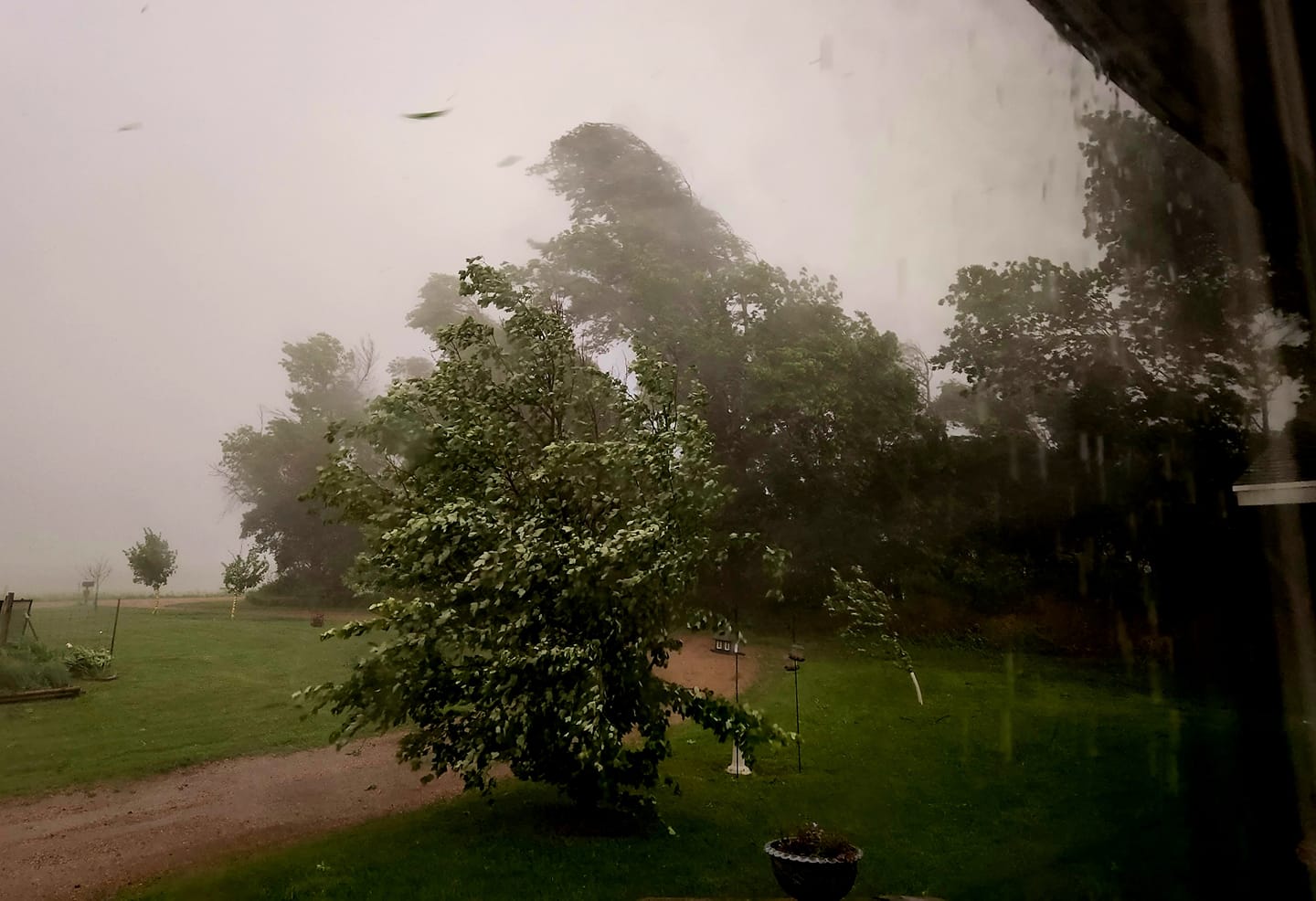
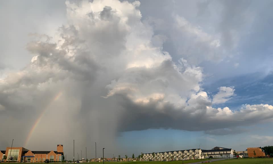
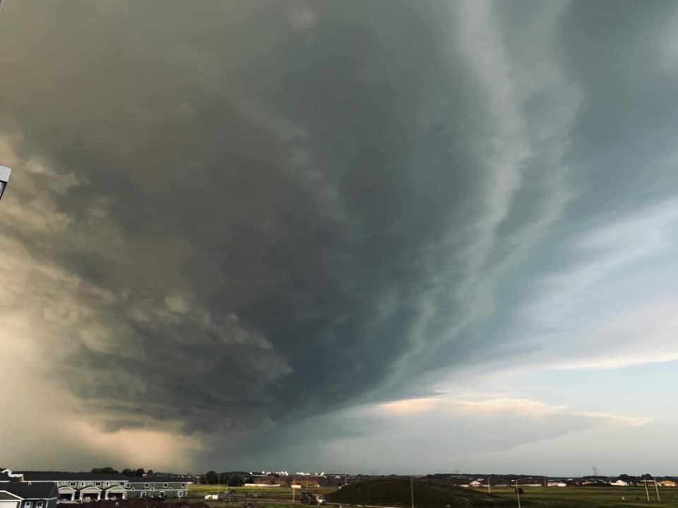
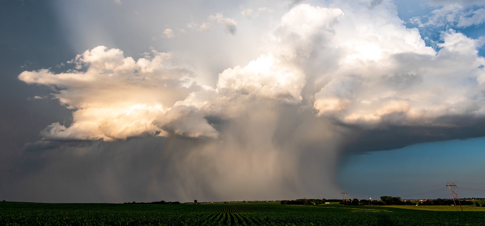
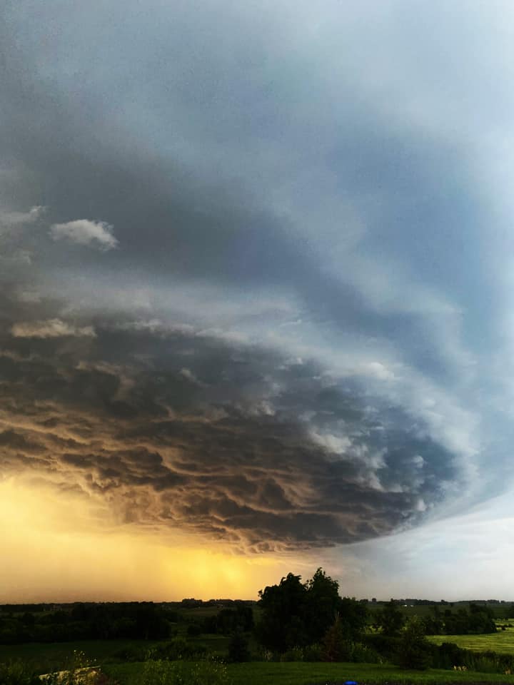
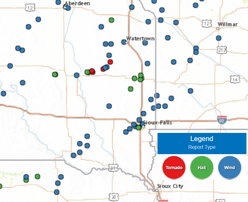
Scattered storms ahead of a cold front produced areas of wind damage and isolated large hail from southeast South Dakota into southwest Minnesota on the evening of June 20, 2022. Wind gusts as high as 60 to 80 mph were reported, with the highest measured gust of 82 mph recorded at the Sioux Falls airport. There were also a couple tornadoes near/northeast of Iroquois South Dakota, along with additional large hail, from a second complex of storms which moved across central and northeast South Dakota. |
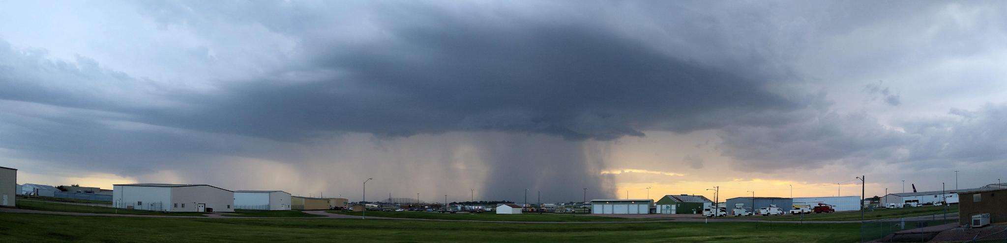 Severe thunderstorm approaching the Sioux Falls Airport, where 82 mph wind gusts were later recorded. |
Tornadoes:
|
Tornado - North-Northeast of Iroquois, SD
Track Map 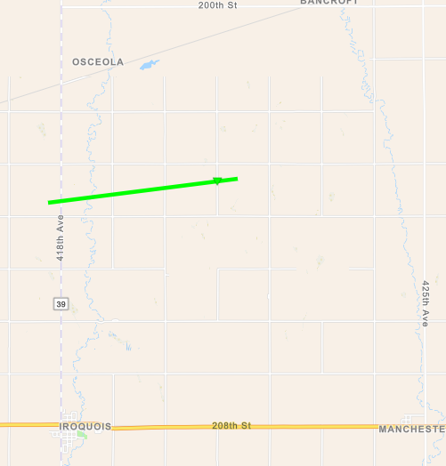 
Downloadable KMZ File |
||||||||||||||||
|
Tornado - 5 Miles ENE of Yale, SD
Track Map 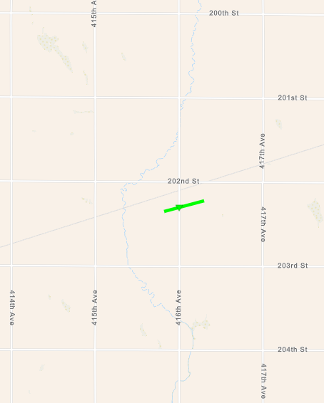
Downloadable KMZ File |
||||||||||||||||||
The Enhanced Fujita (EF) Scale classifies tornadoes into the following categories:
| EF0 Weak 65-85 mph |
EF1 Moderate 86-110 mph |
EF2 Significant 111-135 mph |
EF3 Severe 136-165 mph |
EF4 Extreme 166-200 mph |
EF5 Catastrophic 200+ mph |
 |
|||||
Wind & Hail:
Wind
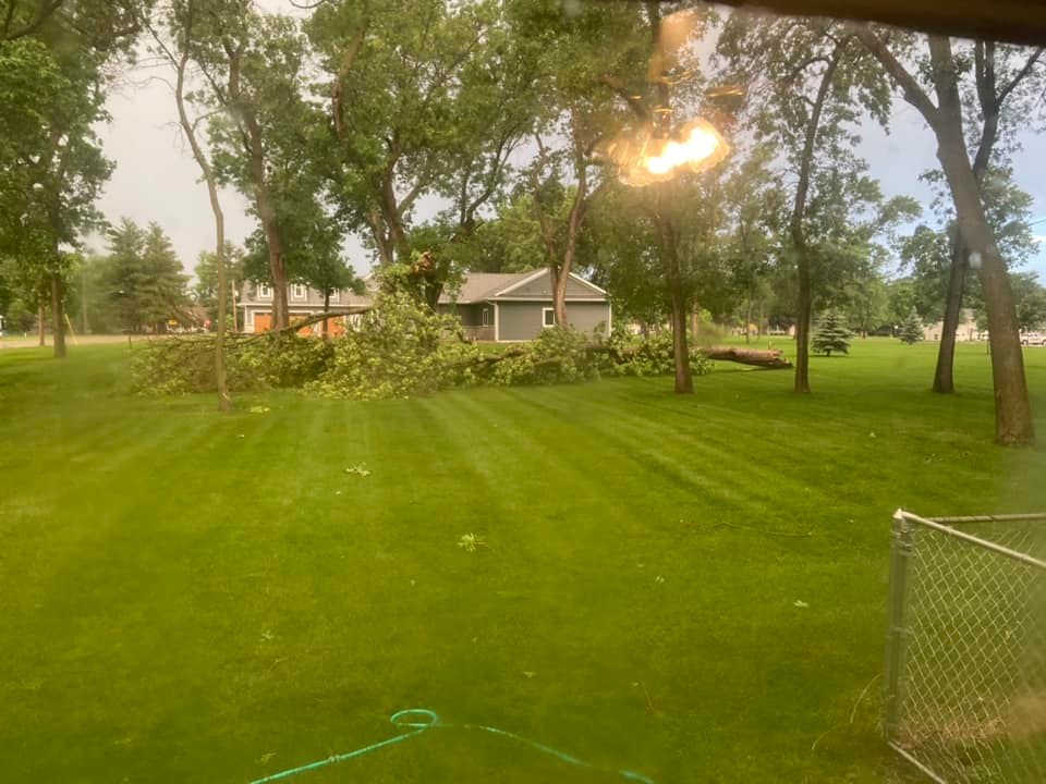
Scattered wind damage occurred from localized downburst winds of 60-80 mph. The strongest measured wind was 82 mph at the Sioux Falls Airport at 821 pm CDT. Several customers lost power for a few hours Monday evening, but it appears that damage in the city was isolated. A second complex produced a couple of brief tornadoes east of Huron, which snapped power poles and produced minor crop damage.
 |
 |
 |
 |
| Northwest of Parker, SD (courtesy of Jennica Wilcox) |
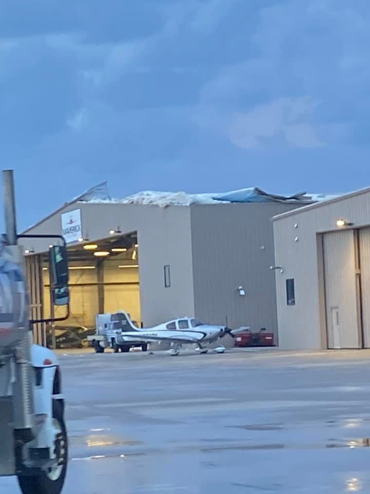
Damage to hangar at the Sioux Falls airport. (courtesy of Lindsey Berge Beauchene) |
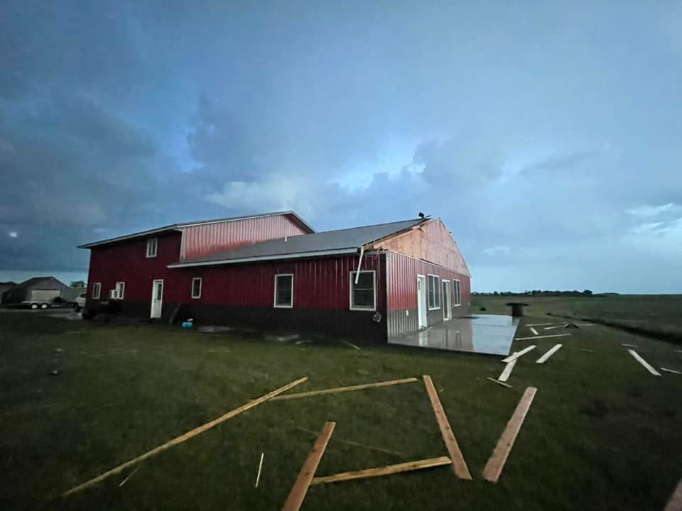
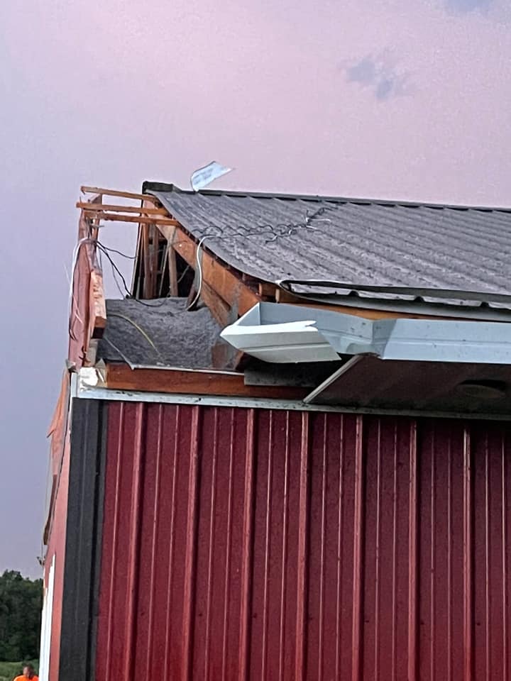
Metal building damage near Edgerton, MN (courtesy of Megan Van Dyke) |
|
 |
 |
 |
 |
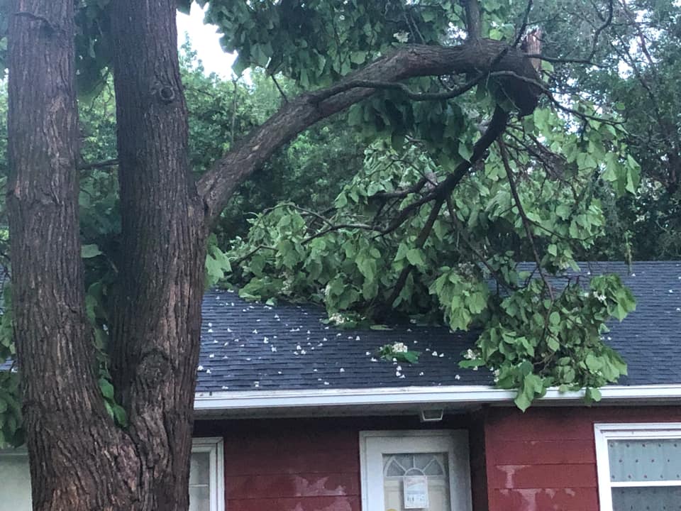
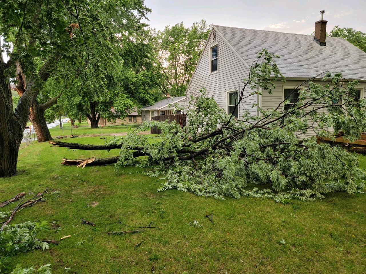
| Large tree limb on roof east of Sioux Falls airport. (Courtesy of Crystal Hanson) |
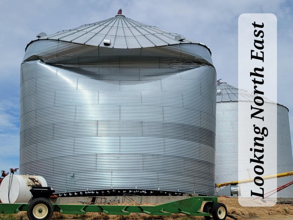
Grain bin damage in Woodstock, MN (courtesy of Val Kas) |
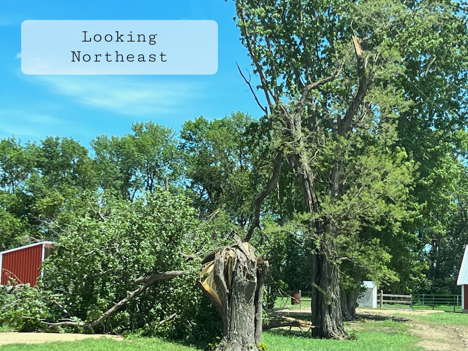
Tree damage in Woodstock, MN (courtesy of City of Woodstock) |
Tree damage in Woodstock, MN (courtesy of City of Woodstock) |
 |
 |
 |
 |
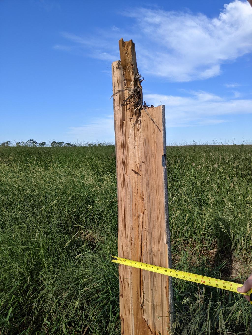
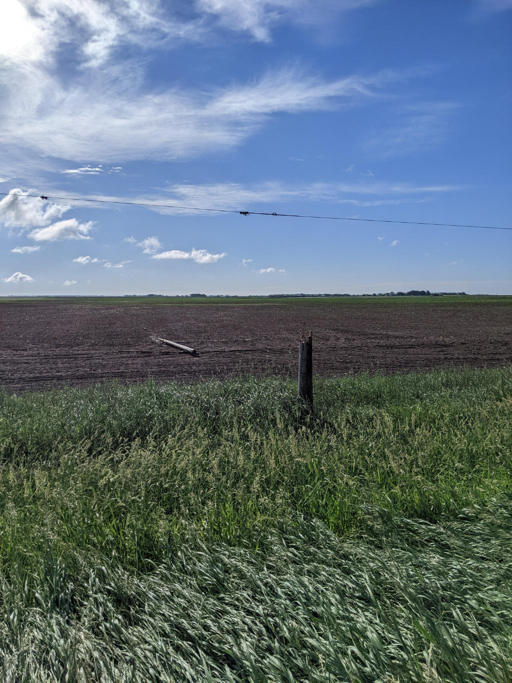
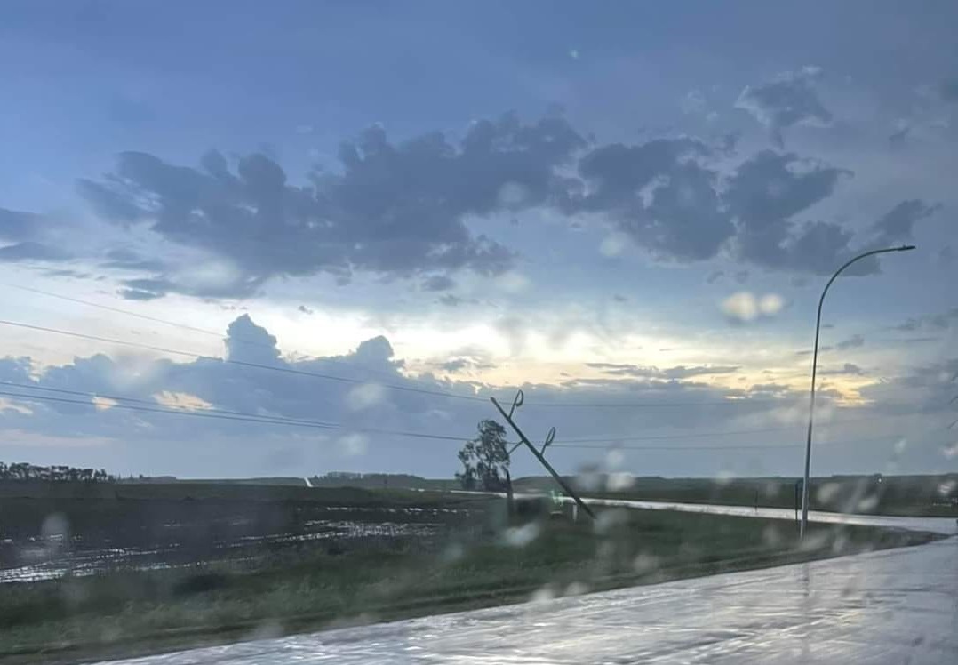
| Power pole snapped by brief tornado north of Iroquois in far eastern Beadle County. | Tree damage in Pipestone (courtesy of Jami Tibbs) |
Trees bending in the storm northwest of Jasper, MN (courtesy of Tara Baker) |
|
 |
 |
 |
 |
| Tree damage just east of Sioux Falls Airport (courtesy of Tricia) |
Tree damage west of Jasper, MN (courtesy of Pam Shellum) |
Snapped power pole between Jasper & Edgerton MN (courtesy of Michael Prins) |
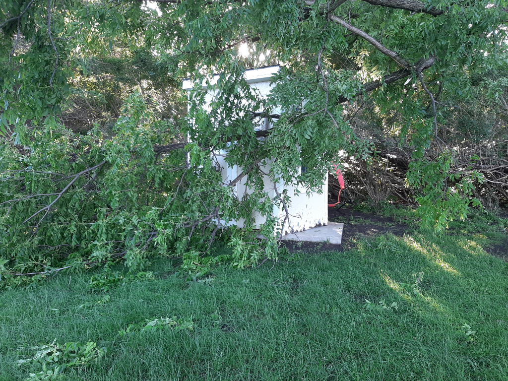
Tree damage & garden shed pushed across cement slab (courtesy of Kim Bosma |
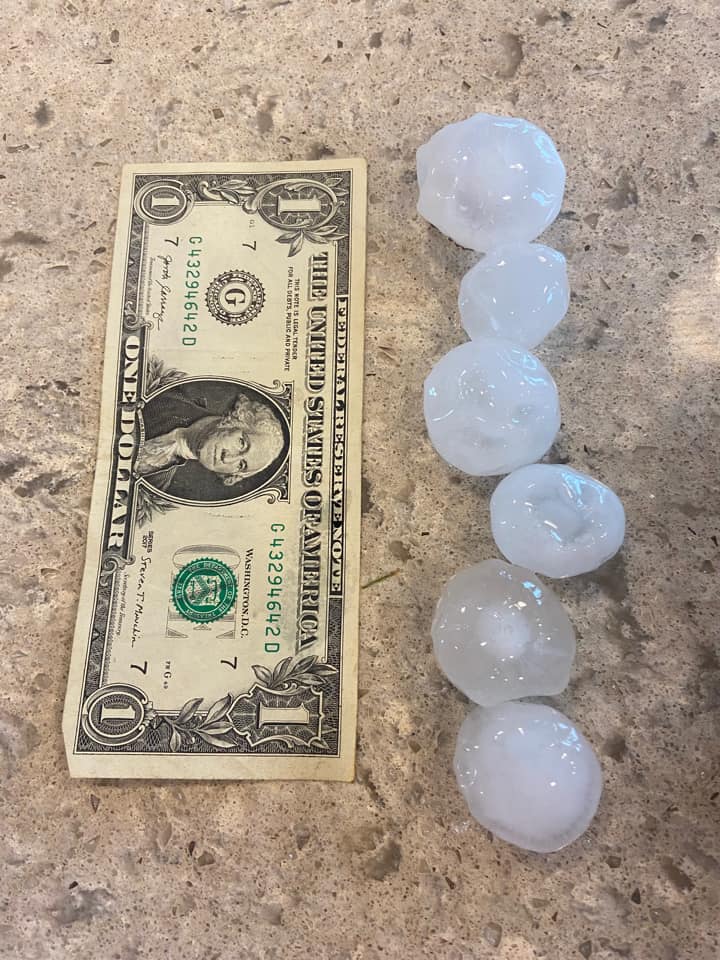
Hail
Insert summary here.
 |
 |
 |
|
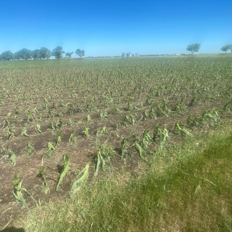
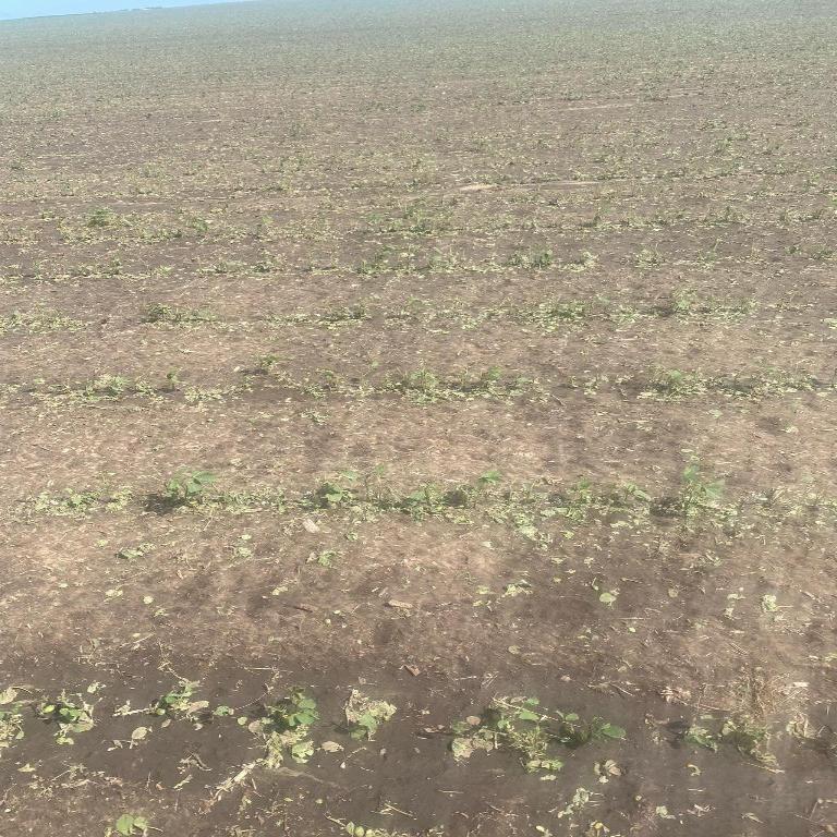
| Young corn & bean crops damaged by wind-driven hail near Yale, SD. (courtesy of Tom Moeding) |
Large hail south of Volga, SD (courtesy of Dan Howell) |
Caption | |
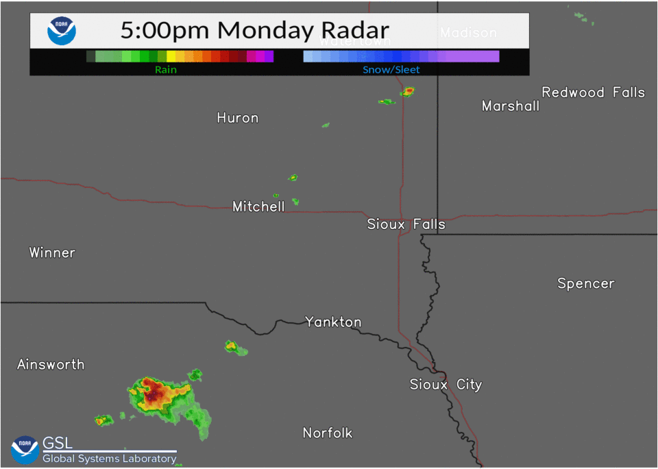
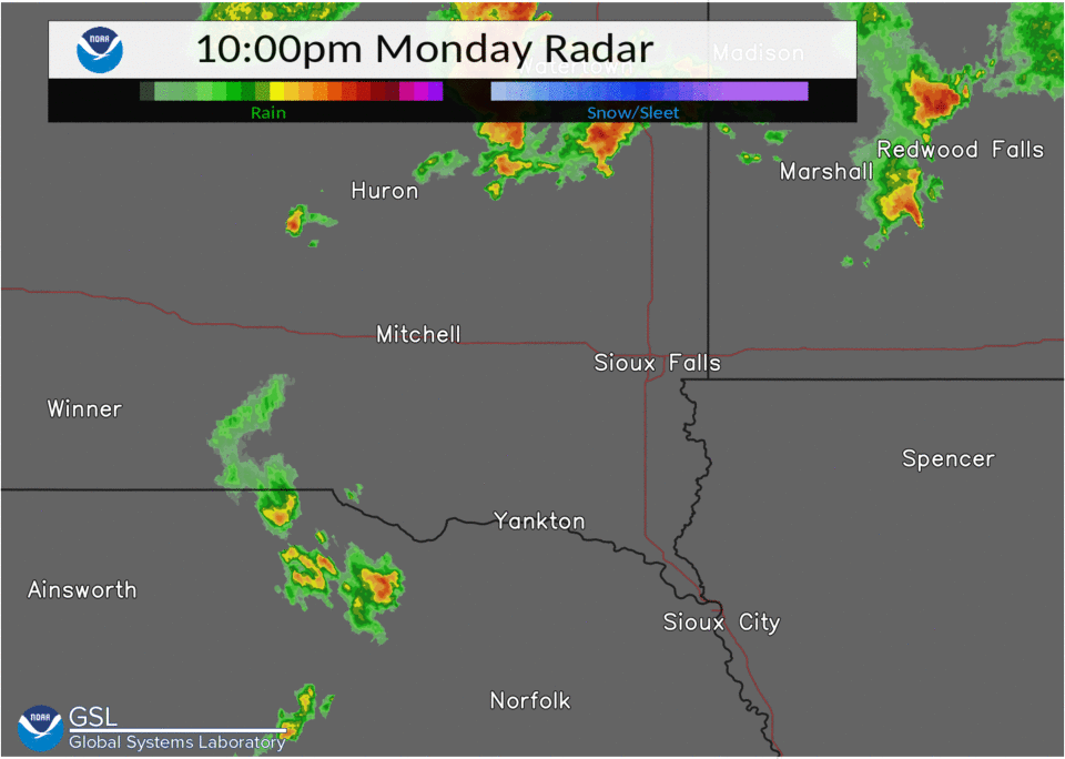
Radar & Warnings
Header
 |
 |
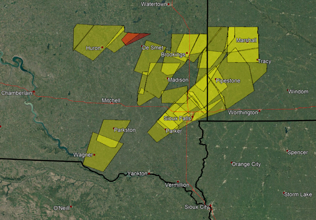 |
| Radar Loop: 5pm to 10pm CDT June 20, 2022 | Radar Loop: 10pm June 20 to 2am CDT on June 21, 2022 | Map of Severe Thunderstorm (yellow) and Tornado (red) warnings issued by NWS Sioux Falls on June 20, 2022 |
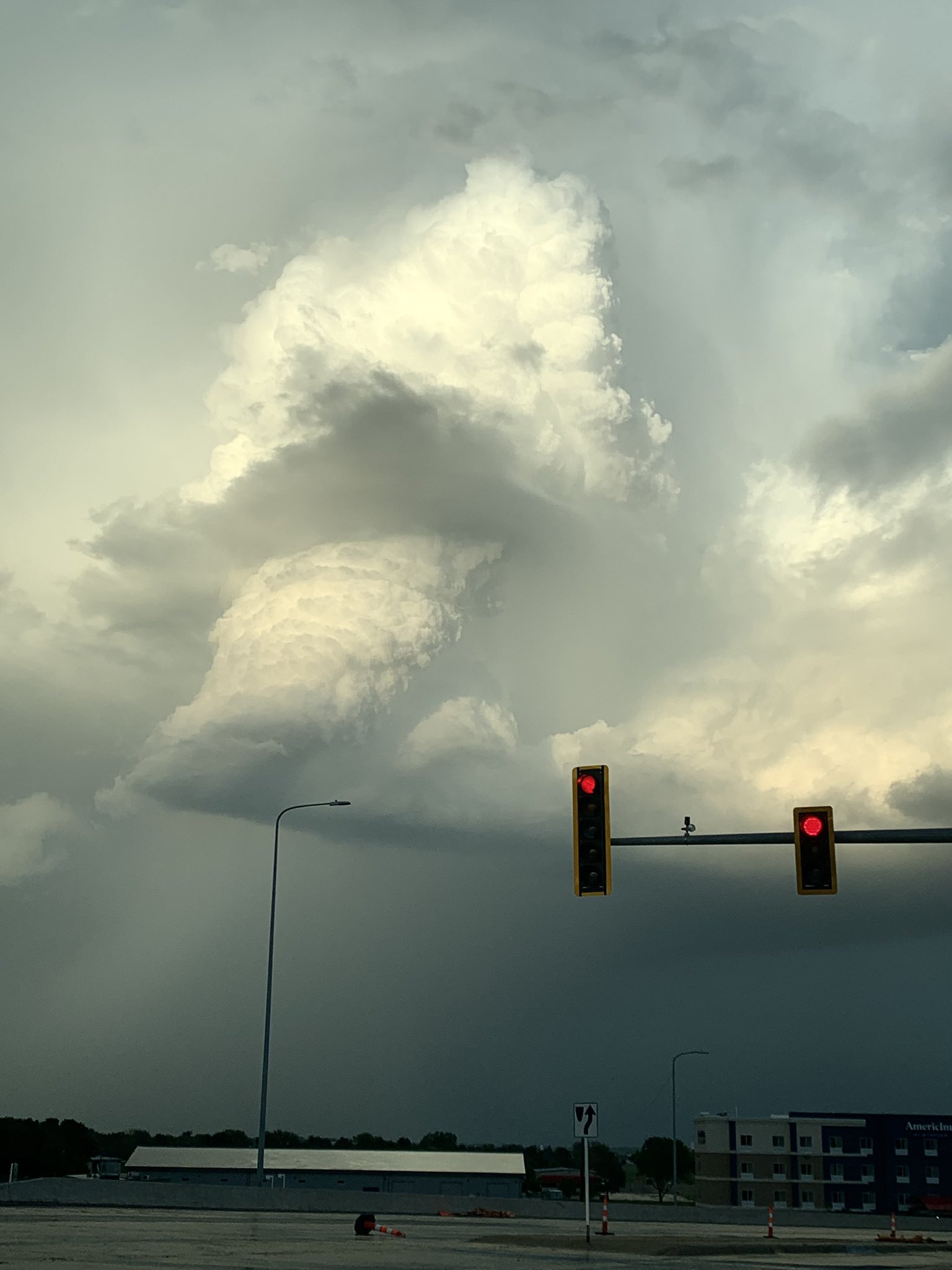
Storm Photos
 |
 |
 |
 |
| Storm from southwest Sioux Falls. (courtesy of Holly SongHawk) |
Storm from southeast Sioux Falls. (courtesy of Susan Love) |
Backside of storm in north Sioux Falls (courtesy of Mark De Bruin) |
|
 |
 |
 |
| Backside of severe storm after it moved through Sioux Falls. (courtesy of Travis Gallipo) |
Storm from Valley Springs (courtesy of Megan Williams Sievers) |
|
Storm Reports
PRELIMINARY LOCAL STORM REPORT...SUMMARY
NATIONAL WEATHER SERVICE SIOUX FALLS SD
507 PM CDT TUE JUN 21 2022
..TIME... ...EVENT... ...CITY LOCATION... ...LAT.LON...
..DATE... ....MAG.... ..COUNTY LOCATION..ST.. ...SOURCE....
..REMARKS..
0558 PM HAIL NUNDA 44.16N 97.02W
06/20/2022 E0.88 INCH LAKE SD TRAINED SPOTTER
0558 PM TSTM WND DMG WAGNER 43.08N 98.30W
06/20/2022 CHARLES MIX SD PUBLIC
LARGE PINE TREE BLOWN OVER, SEVERAL LARGE
BRANCHES ALSO BLOWN DOWN.
0610 PM TSTM WND DMG DELMONT 43.27N 98.16W
06/20/2022 DOUGLAS SD PUBLIC
ROOF TORN OFF OF SCHOOL.
0610 PM TSTM WND GST 6 NNE DANTE 43.13N 98.16W
06/20/2022 M58 MPH CHARLES MIX SD MESONET
0618 PM TSTM WND GST 2 NW TRIPP 43.24N 97.99W
06/20/2022 M70 MPH HUTCHINSON SD MESONET
REPORT FROM SD RWIS SITE.
0623 PM HAIL VOLGA 44.33N 96.93W
06/20/2022 M0.88 INCH BROOKINGS SD PUBLIC
REPORT FROM SOCIAL MEDIA.
0624 PM TSTM WND DMG 1 SSW PARKSTON 43.39N 97.99W
06/20/2022 HUTCHINSON SD PUBLIC
A TRAINED WEATHER SPOTTER REPORTED A LARGE
TREE GOING DOWN JUST SOUTH OF PARKSTON. THE
DELMONT SCHOOL ALSO LOST ITS ROOF.
0629 PM HAIL 1 WNW BROOKINGS 44.31N 96.80W
06/20/2022 E1.00 INCH BROOKINGS SD EMERGENCY MNGR
0630 PM HAIL 5 N BROOKINGS 44.38N 96.79W
06/20/2022 M1.00 INCH BROOKINGS SD TRAINED SPOTTER
EXTENDED PERIOD OF DIME TO QUARTER SIZE
HAIL.
0633 PM HAIL 1 NNE BROOKINGS 44.33N 96.77W
06/20/2022 E1.50 INCH BROOKINGS SD PUBLIC
REPORT VIA SOCIAL MEDIA.
0700 PM TSTM WND DMG CANOVA 43.88N 97.50W
06/20/2022 MINER SD TRAINED SPOTTER
THIS TRAINED SPOTTER REPORTED SOME 2 - 4
INCH TREE BRANCHES DOWN NEAR DOWNTOWN CANOVA
AROUND 7 PM.
0704 PM TSTM WND DMG 4 SSE FLANDREAU 43.99N 96.56W
06/20/2022 MOODY SD TRAINED SPOTTER
THIS TRAINED SPOTTER REPORTED 2 - 3 INCH
DIAMETER TREE LIMBS BEING DOWN IN HIS
BACKYARD.
0710 PM TSTM WND DMG 7 WNW PIPESTONE 44.05N 96.43W
06/20/2022 PIPESTONE MN TRAINED SPOTTER
THIS TRAINED SPOTTER REPORTED MULTIPLE 2
INCH TREE BRANCHES DOWN NEAR HIS HOUSE AND
PEA SIZED HAIL.
0730 PM TSTM WND GST 5 NNE PARKER 43.46N 97.12W
06/20/2022 E50 MPH TURNER SD TRAINED SPOTTER
NUMEROUS SMALL TWIGS DOWN.
0730 PM TSTM WND DMG 4 WSW WALL LAKE 43.51N 97.03W
06/20/2022 MINNEHAHA SD PUBLIC
A TRAINED SPOTTER REPORTED LARGE COTTONWOOD
TREE LIMBS BEING DOWN.
0742 PM TSTM WND DMG 3 S HARTFORD 43.58N 96.95W
06/20/2022 MINNEHAHA SD PUBLIC
TRAILER BLOWN OFF THE ROAD. REPORTED VIA
SOCIAL MEDIA.
0744 PM TSTM WND GST 3 S HARTFORD 43.58N 96.95W
06/20/2022 M73 MPH MINNEHAHA SD MESONET
0744 PM TSTM WND GST 3 ENE WALL LAKE 43.55N 96.91W
06/20/2022 M58 MPH MINNEHAHA SD PUBLIC
REPORTED BY PERSONAL WEATHER STATION.
0754 PM TSTM WND GST 1 SW CROOKS 43.66N 96.82W
06/20/2022 M63 MPH MINNEHAHA SD MESONET
0800 PM TSTM WND DMG 1 ENE BALTIC 43.76N 96.73W
06/20/2022 MINNEHAHA SD PUBLIC
LARGE BRANCH BROKEN IN EASTERN BALTIC.
REPORT FROM SOCIAL MEDIA.
0812 PM HAIL 5 W SIOUX FALLS 43.54N 96.83W
06/20/2022 U0.75 INCH MINNEHAHA SD PUBLIC
REPORT FROM MPING: DIME (0.75 IN.).
0814 PM HAIL 5 W SIOUX FALLS 43.53N 96.84W
06/20/2022 E1.00 INCH MINNEHAHA SD PUBLIC
REPORT FROM MPING: QUARTER (1.00 IN.).
0821 PM TSTM WND GST 3 NNW SIOUX FALLS 43.58N 96.75W
06/20/2022 M82 MPH MINNEHAHA SD ASOS
ASOS STATION KFSD SIOUX FALLS AIRPORT.
0823 PM TSTM WND DMG 3 N SIOUX FALLS 43.59N 96.74W
06/20/2022 MINNEHAHA SD PUBLIC
PORTION OF THE ROOF OF A HANGAR WAS REMOVED.
0825 PM TSTM WND DMG 7 N SHERMAN 43.85N 96.50W
06/20/2022 MOODY SD PUBLIC
LARGE TREE BRANCH BROKEN OFF. REPORT FROM
SOCIAL MEDIA, TIME ESTIMATED FROM RADAR.
0825 PM TSTM WND DMG 3 NW BRANDON 43.62N 96.61W
06/20/2022 MINNEHAHA SD PUBLIC
CORRECTS PREVIOUS TSTM WND DMG REPORT FROM 3
NW BRANDON. LARGE TREE BRANCH BLOWN DOWN.
PHOTOS AND REPORT FROM SOCIAL MEDIA. TIME
ESTIMATED BY RADAR.
0834 PM TSTM WND GST 2 N JASPER 43.88N 96.39W
06/20/2022 E70 MPH PIPESTONE MN TRAINED SPOTTER
WIND GUSTS AT LEAST 70 MPH.
0850 PM HAIL 5 S WESSINGTON 44.39N 98.70W
06/20/2022 M1.75 INCH BEADLE SD TRAINED SPOTTER
0851 PM TSTM WND GST 1 SE TROSKY 43.88N 96.24W
06/20/2022 E60 MPH PIPESTONE MN TRAINED SPOTTER
SEVERAL BRANCHES DOWN.
0902 PM TSTM WND GST 1 SE TAUNTON 44.59N 96.05W
06/20/2022 M68 MPH LYON MN MESONET
REPORT FROM MNDOT RWIS SITE.
0906 PM TSTM WND GST 1 SE TAUNTON 44.59N 96.05W
06/20/2022 M68 MPH LYON MN MESONET
68 MPH WIND CONTINUED UNTIL 906 PM AT MNDOT
RWIS LOCATION.
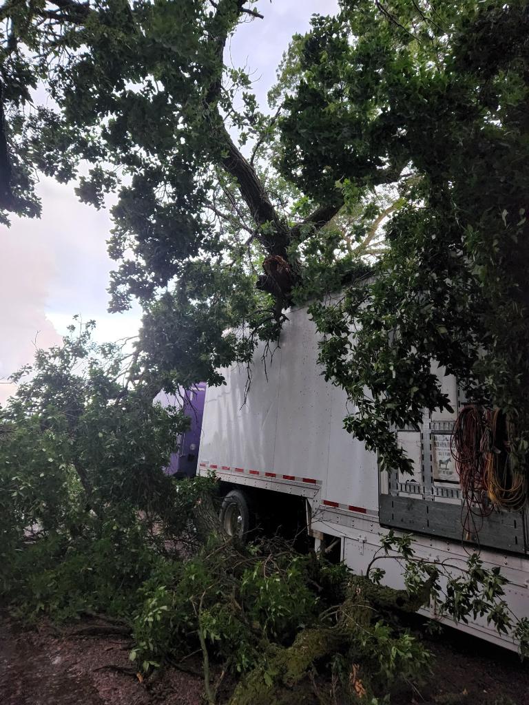
0907 PM TSTM WND DMG WOODSTOCK 44.01N 96.10W
06/20/2022 PIPESTONE MN TRAINED SPOTTER
SEVERAL TREES DOWN INCLUDING ONE ON A POWER
LINE AND ONE ON A TRUCK.
0913 PM TSTM WND GST 2 NNW HURON 44.38N 98.23W
06/20/2022 M65 MPH BEADLE SD OFFICIAL NWS OBS
0926 PM TSTM WND GST 1 NNW COTTONWOOD 44.62N 95.68W
06/20/2022 M73 MPH LYON MN MESONET
FROM PERSONAL WEATHER STATION NEAR
COTTONWOOD.
0929 PM HAIL YALE 44.43N 97.99W
06/20/2022 E1.00 INCH BEADLE SD TRAINED SPOTTER
A FEW SHINGLES ALSO REMOVED FROM GARAGE.
0930 PM HAIL 1 SE YALE 44.42N 97.97W
06/20/2022 E1.75 INCH BEADLE SD PUBLIC
WIND DRIVEN HAIL DAMAGED BUILDINGS AND
CROPS.
0930 PM TORNADO 4 NNW IROQUOIS 44.43N 97.87W
06/20/2022 BEADLE SD FIRE DEPT/RESCUE
RELAYED REPORT THROUGH EMERGENCY MANAGER.
0930 PM TSTM WND DMG 4 N CURRIE 44.13N 95.67W
06/20/2022 MURRAY MN PUBLIC
LARGE TREE SPLIT IN HALF NEAR LAKE SHETEK.
PHOTOS AND REPORT FROM SOCIAL MEDIA. TIME
ESTIMATED FROM RADAR.
0931 PM TORNADO 5 ENE YALE 44.45N 97.89W
06/20/2022 BEADLE SD TRAINED SPOTTER
TRAINED SPOTTER SAW A BRIEF TORNADO THAT
BROKE 4 POWER POLES AS IT CROSSED 416TH AVE.
0945 PM TORNADO 6 E BANCROFT 44.48N 97.63W
06/20/2022 KINGSBURY SD TRAINED SPOTTER
A TRAINED SPOTTER SAW A BRIEF TOUCHDOWN IN
AN OPEN FARM FIELD.
0950 PM TSTM WND DMG 8 W ERWIN 44.50N 97.59W
06/20/2022 KINGSBURY SD PUBLIC
SEVERAL LARGE BRANCHES DOWN AND DAMAGE TO
OUTBUILDINGS.
0953 PM TSTM WND DMG 6 WNW ERWIN 44.51N 97.55W
06/20/2022 KINGSBURY SD TRAINED SPOTTER
4 TREES SNAPPED AND 2 DOORS BLOWN OFF
OUTBUILDINGS.
&&
$$
 |
Media use of NWS Web News Stories is encouraged! Please acknowledge the NWS as the source of any news information accessed from this site. |
|


 Weather Story
 Weather Map
 Local Radar