Overview
|
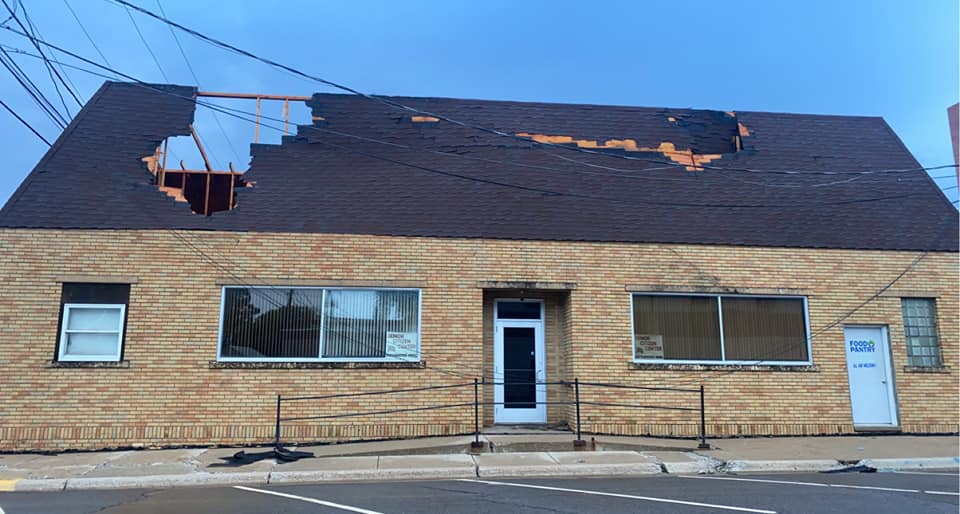
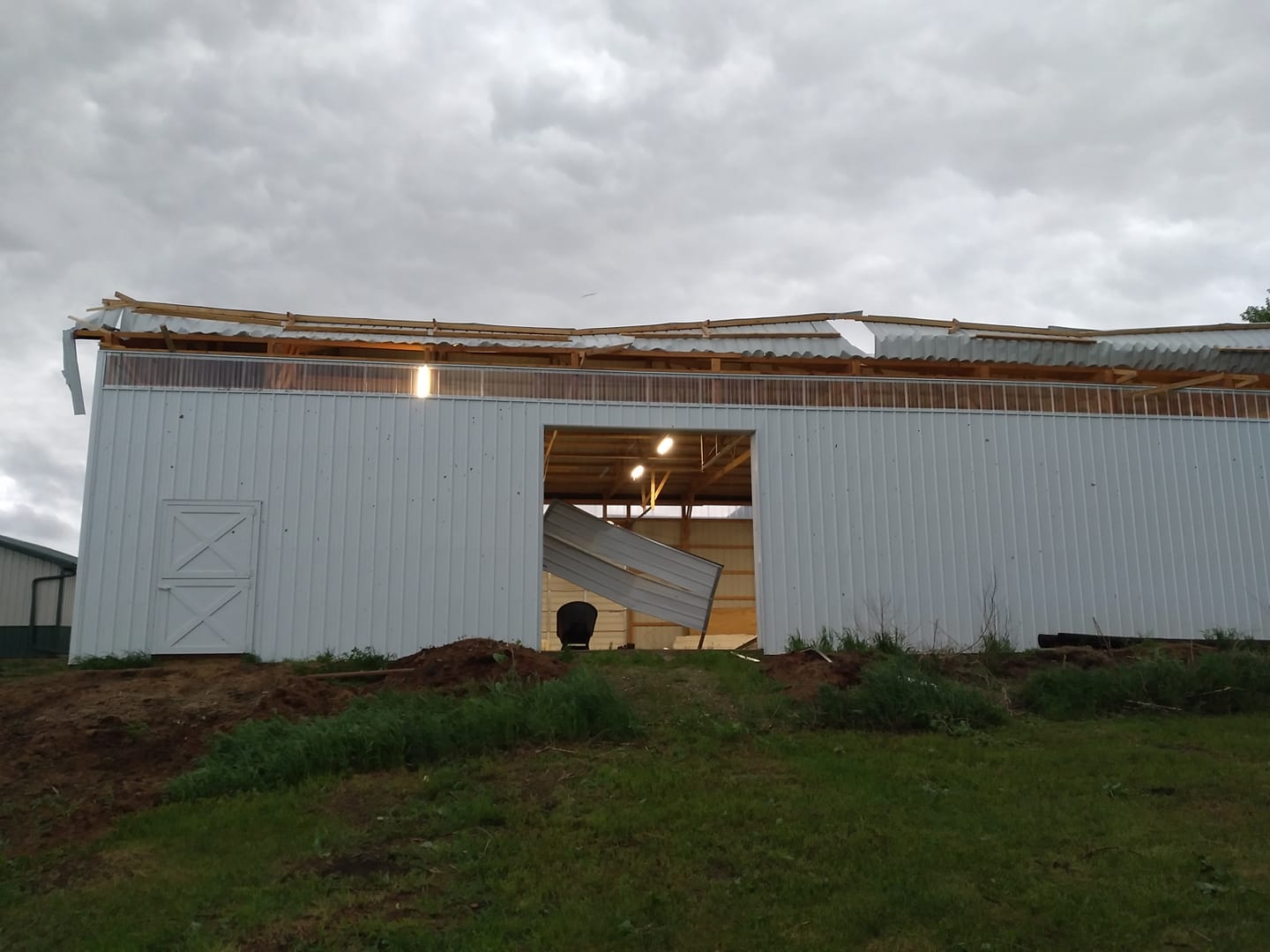
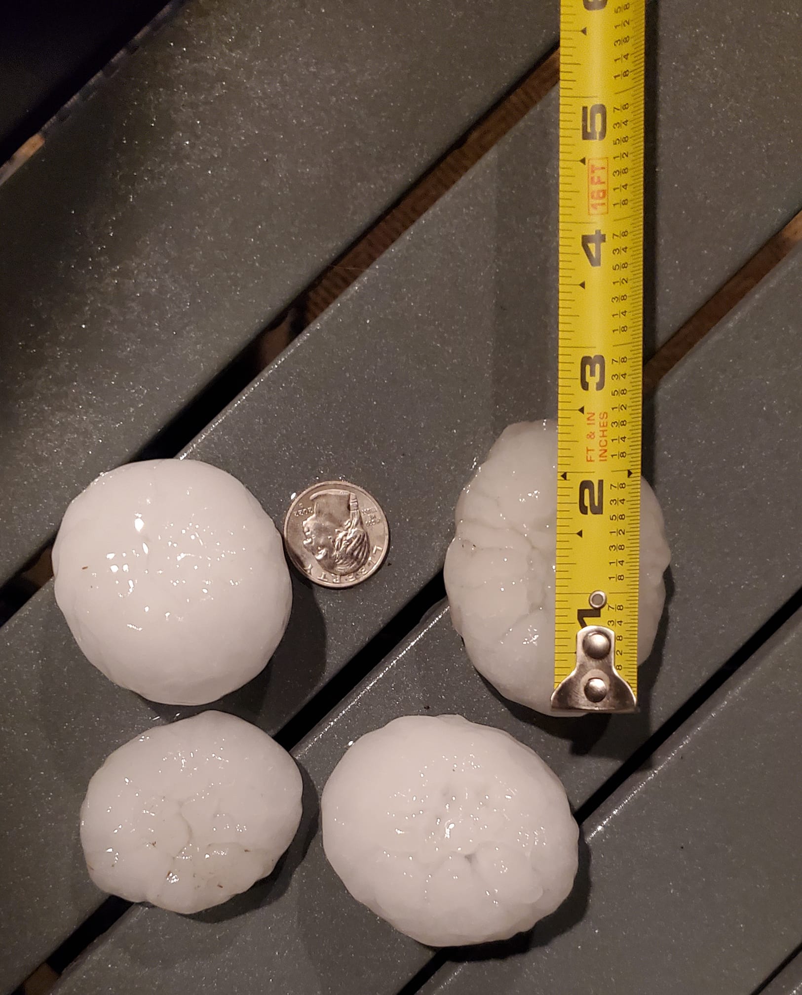
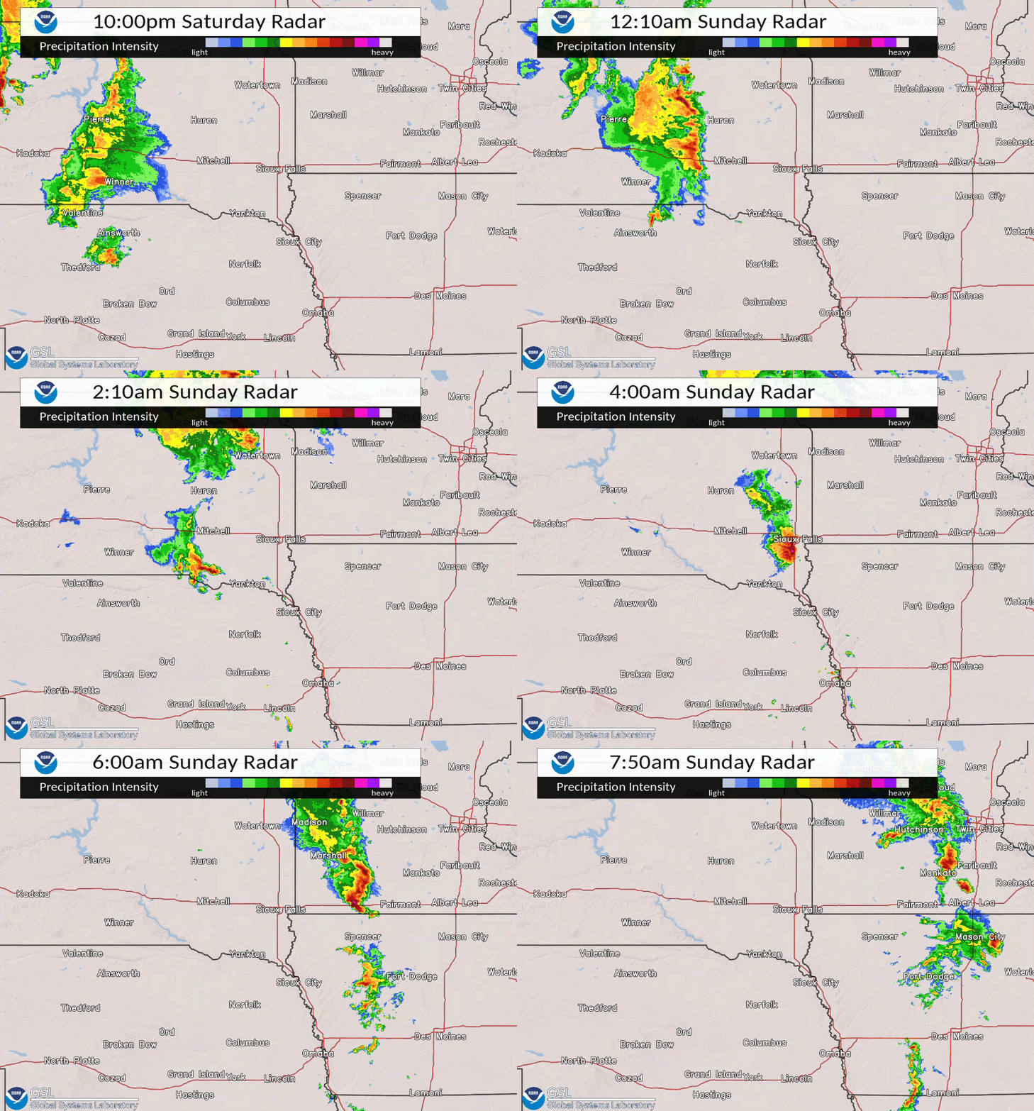
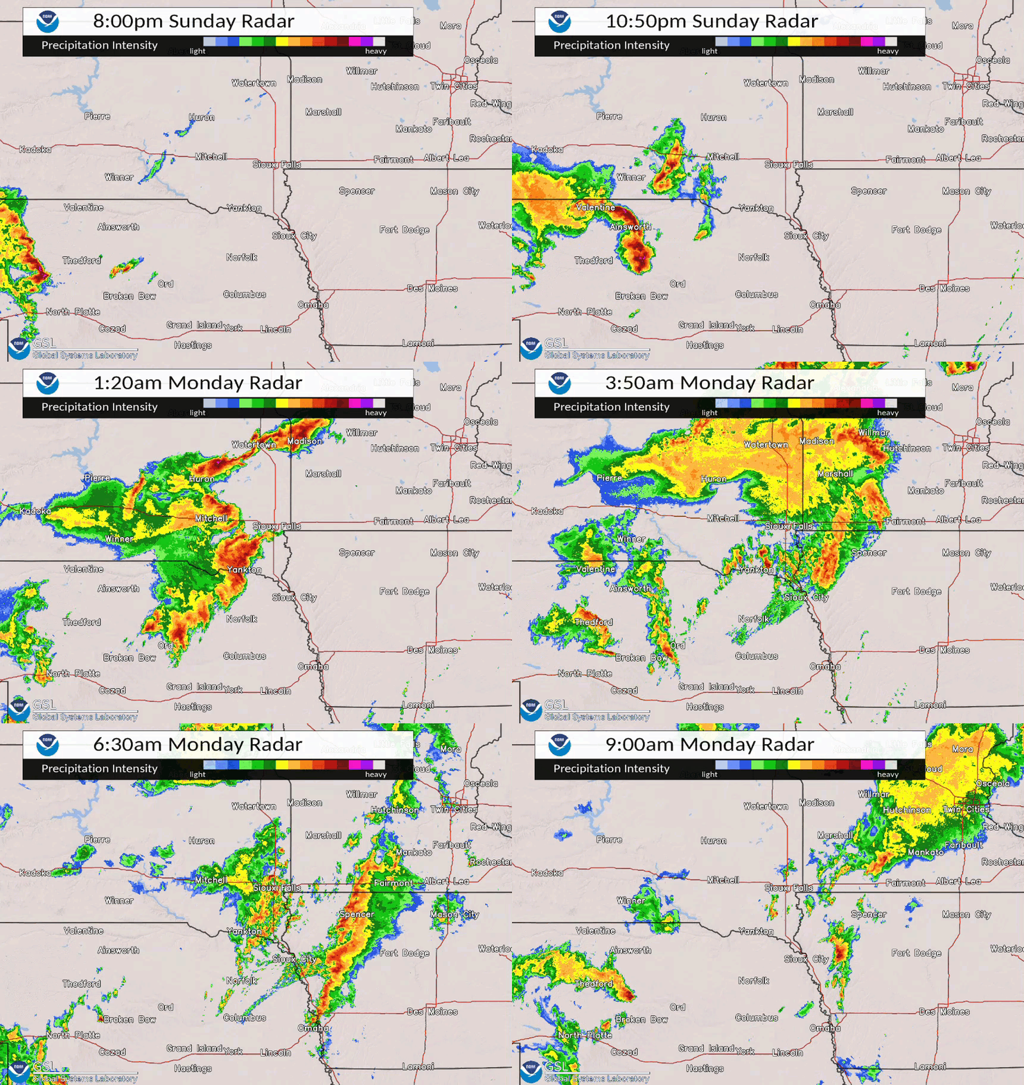
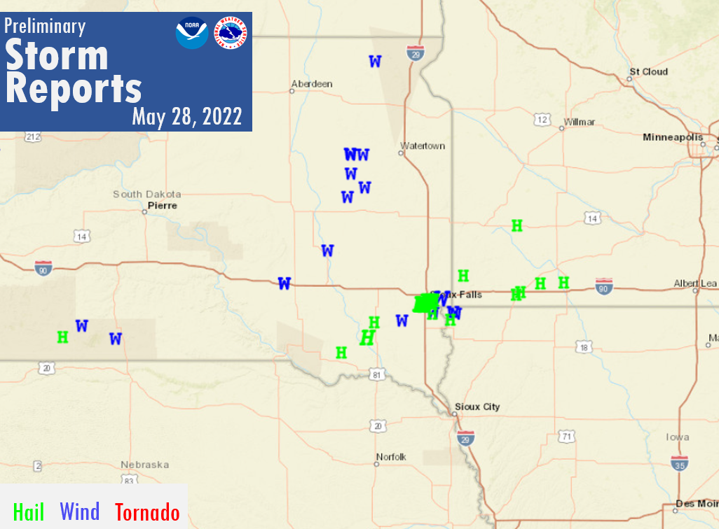
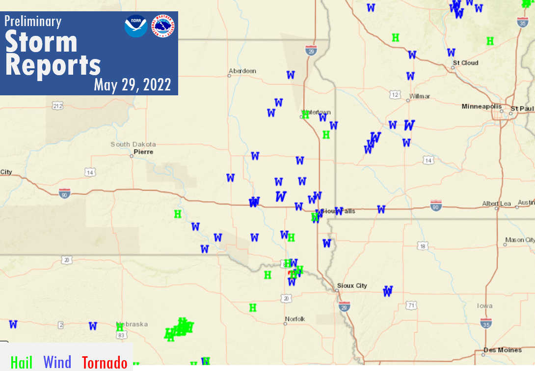
Multiple rounds of severe weather impacted the region through the Memorial Day weekend, bringing widespread wind damage, large hail, and even a few tornadoes. The active weekend began late Saturday evening with a line of storms moving into central South Dakota that brought gusty winds. Additional storms formed during the early morning hours Sunday and eventually moved into southern Minnesota. This strong cluster of storms brought large hail to the western half of Sioux Falls and then wind as they moved further east. The next round of storms moved through the region Sunday night into the early morning, bringing very strong winds, occasional large hail, and a few brief tornadoes. The break in activity was short lived as additional storms formed by late morning on Memorial Day. The early to mid afternoon storms on Memorial carried a risk of all modes of severe weather. One final round of storms moved through during the early evening hours Monday, bringing yet another round of strong wind. |
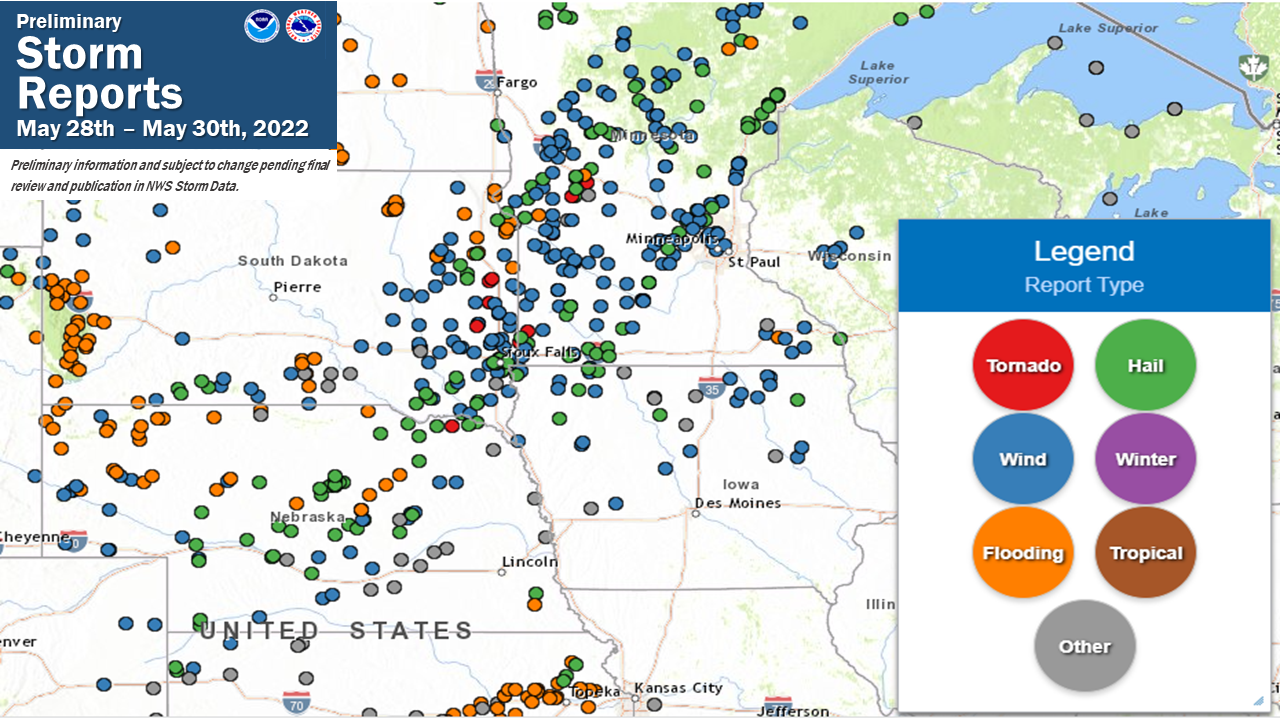 Severe weather reports from May 28th thru May 30th |
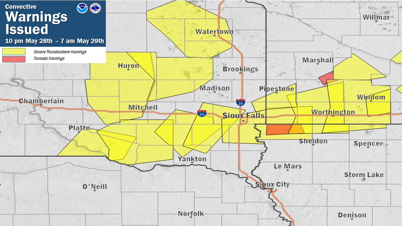 |
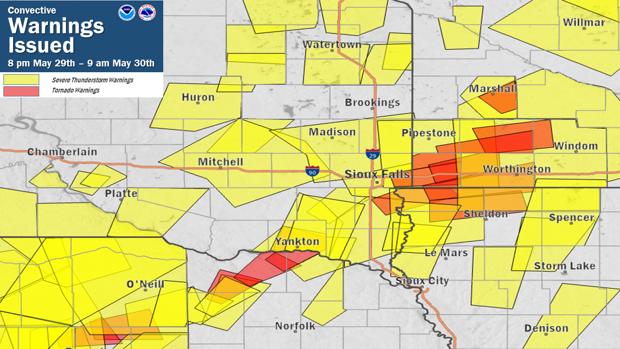 |
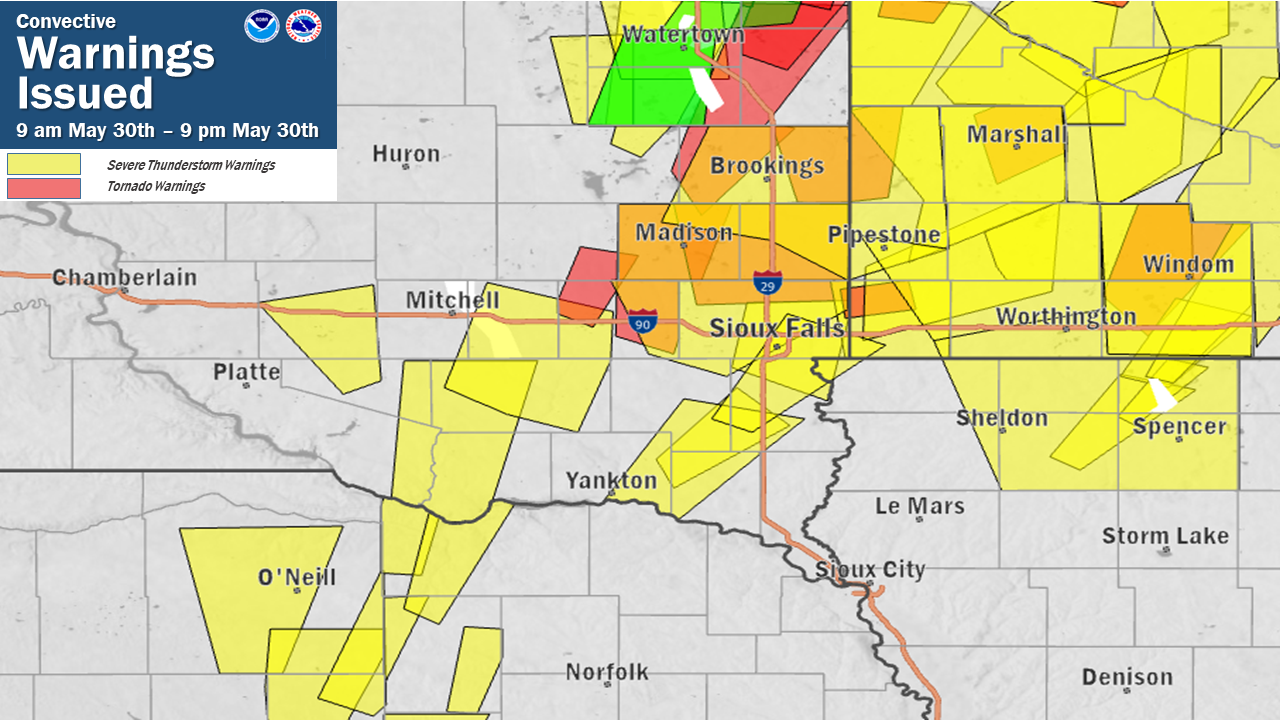 |
| Warnings issued from 10 pm May 28th thru 7 am May 29th | Warnings issued from 8 pm May 29th thru 9 am May 30th | Warnings issued from 9 am May 30th thru 9 pm May 30th |
Tornadoes:
|
Tornado - Brandon, SD
Track Map 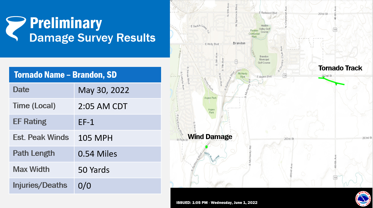 
|
||||||||||||||||
|
Tornado - Near Lester, IA
Track Map 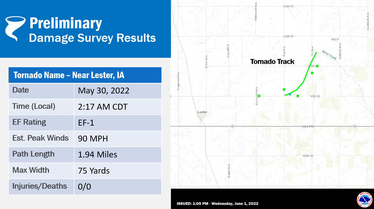  |
||||||||||||||||
|
Tornado - Near Adrian, MN
Track Map 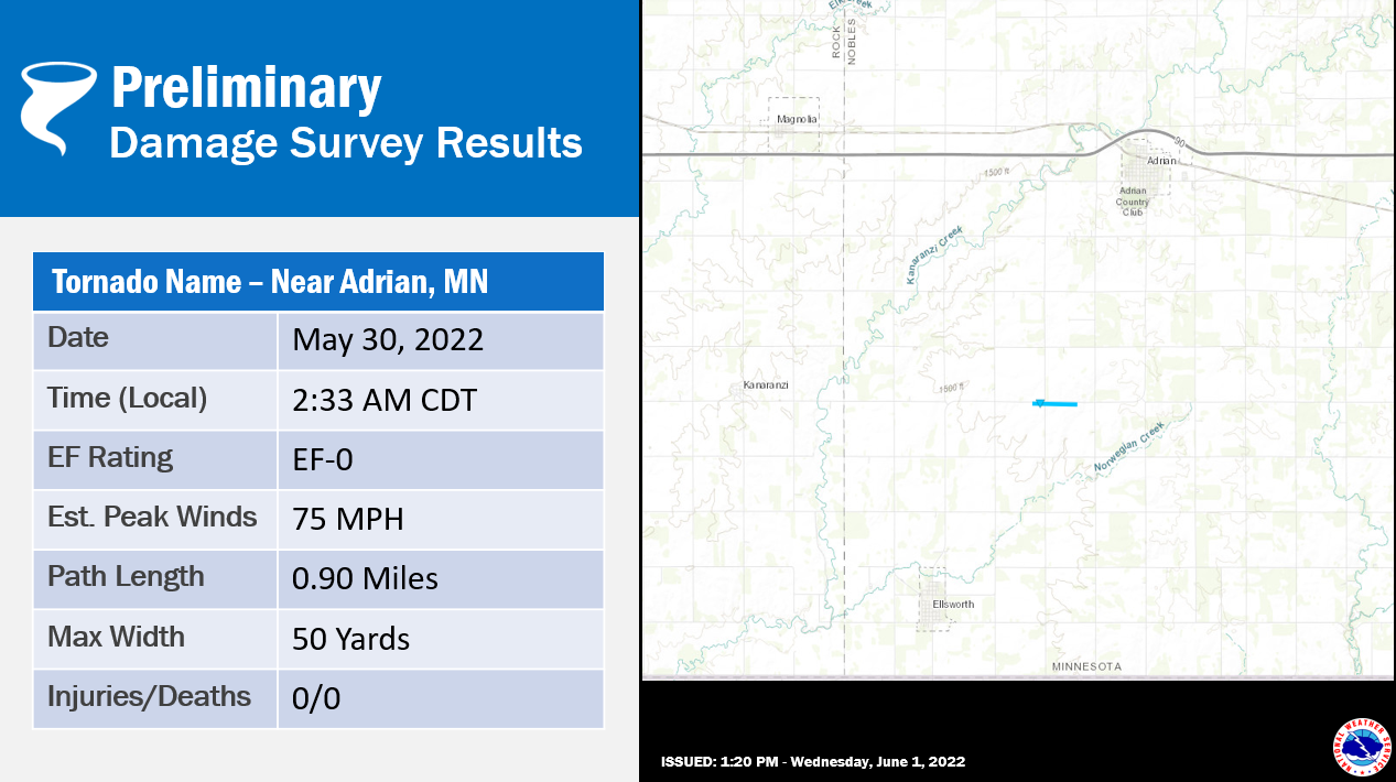  |
||||||||||||||||
|
Tornado - Sioux Falls, SD
Track Map 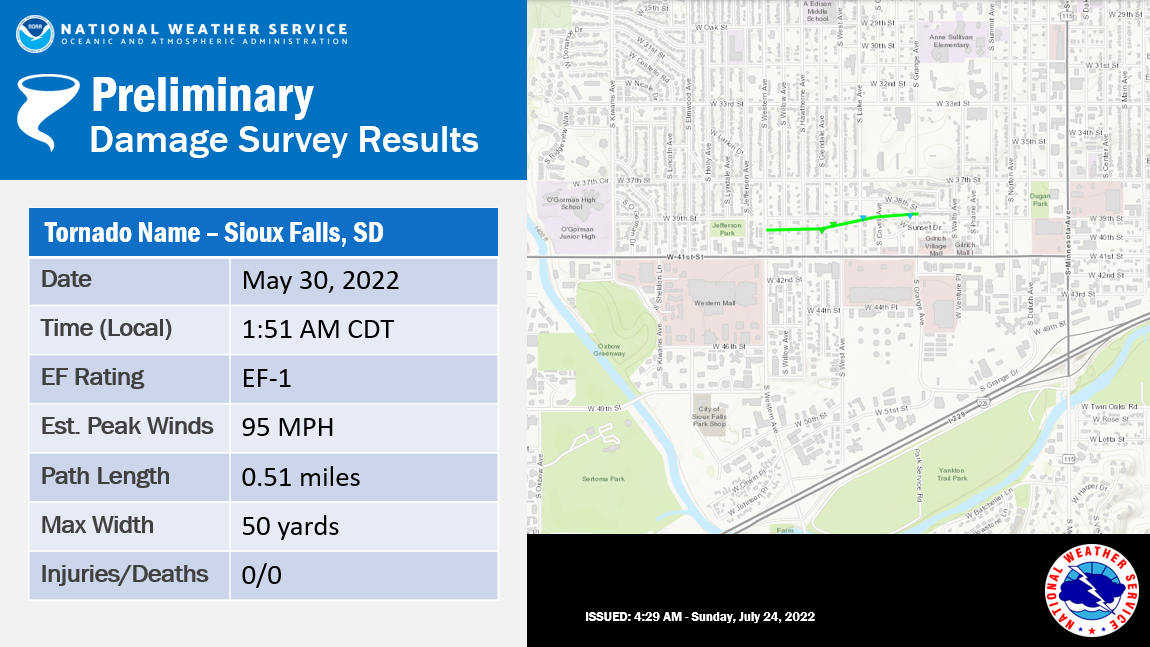  |
||||||||||||||||
The Enhanced Fujita (EF) Scale classifies tornadoes into the following categories:
| EF0 Weak 65-85 mph |
EF1 Moderate 86-110 mph |
EF2 Significant 111-135 mph |
EF3 Severe 136-165 mph |
EF4 Extreme 166-200 mph |
EF5 Catastrophic 200+ mph |
 |
|||||
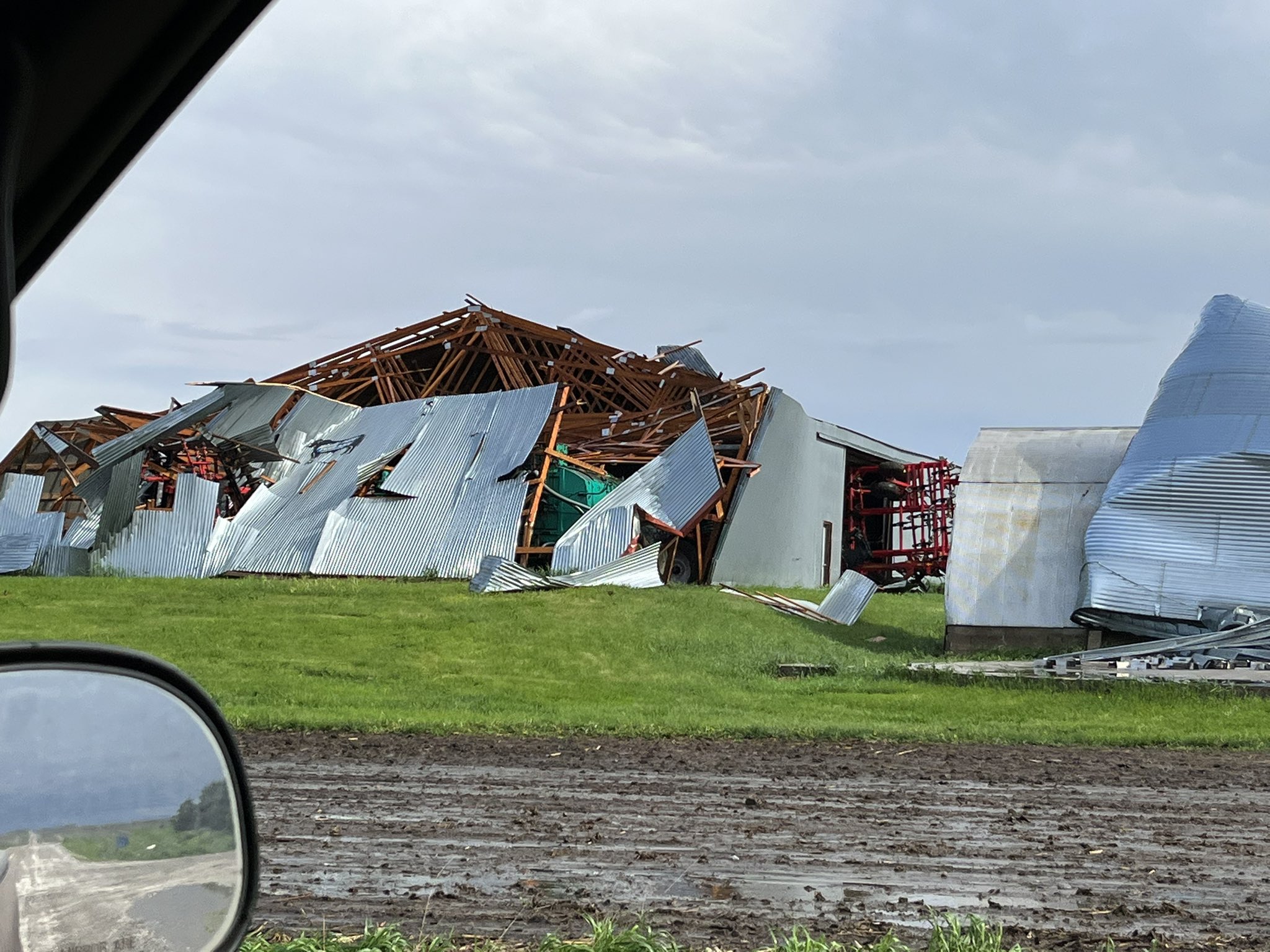
Photos & Video
 |
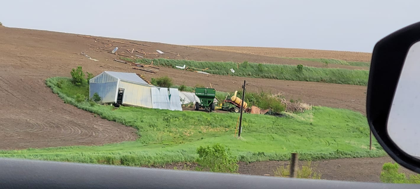 |
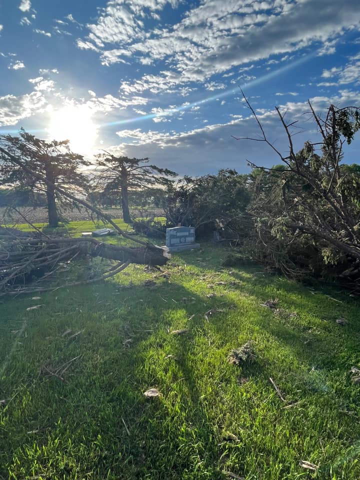 |
 |
| Brookings, SD (Jessica Moss) |
Galva, IA (Timary Tweedy) |
South of Canton, SD (Kathy Moulton) |
Slayton, MN (Rachel Martin) |
 |
 |
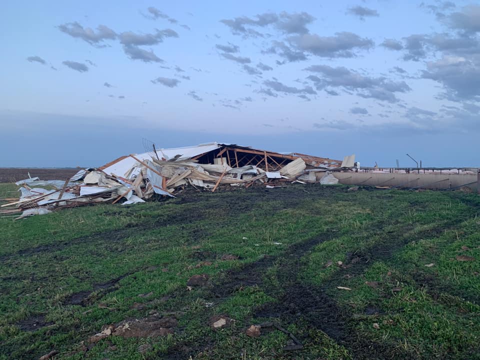 |
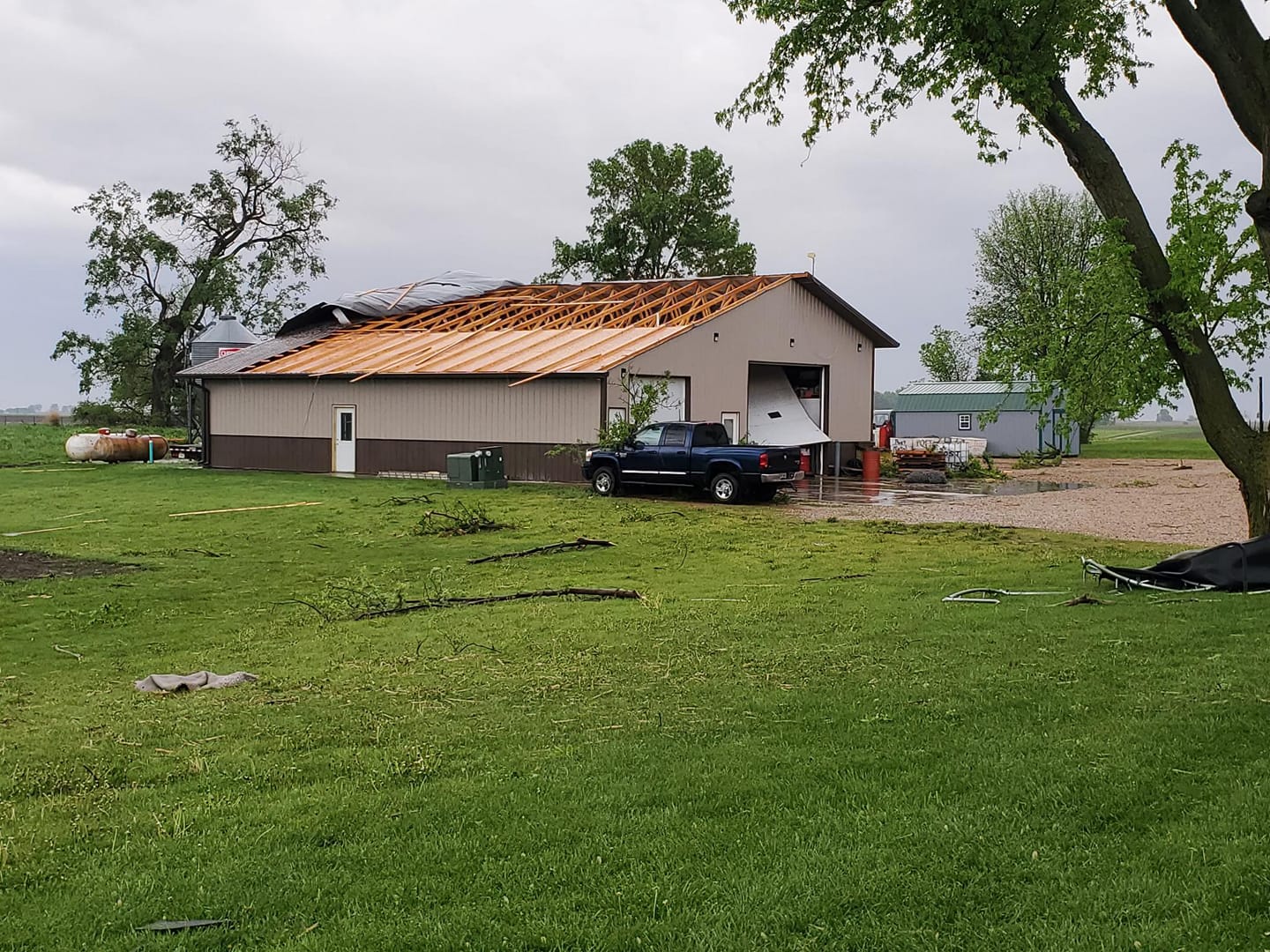 |
| Wakonda, SD (Alicia De Grammont) |
Southern Sioux Falls, SD (Sherry Miller) |
South of Lakefield, MN (Danielle Fischer) |
Near Canton, SD (Brandon Wollman) |
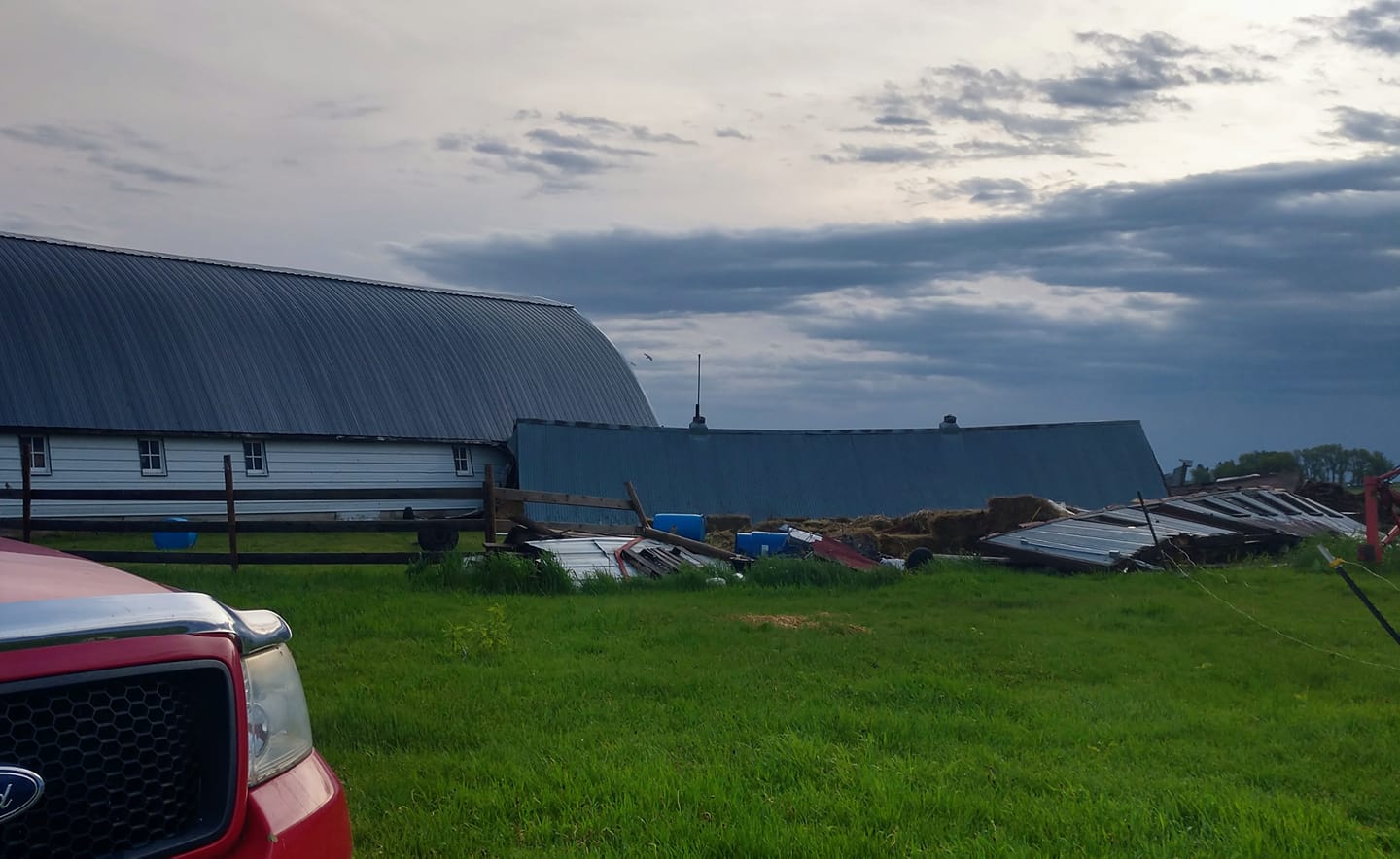 |
 |
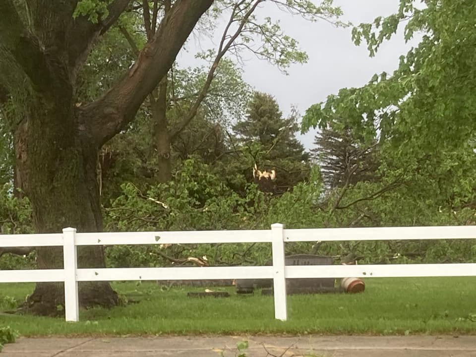 |
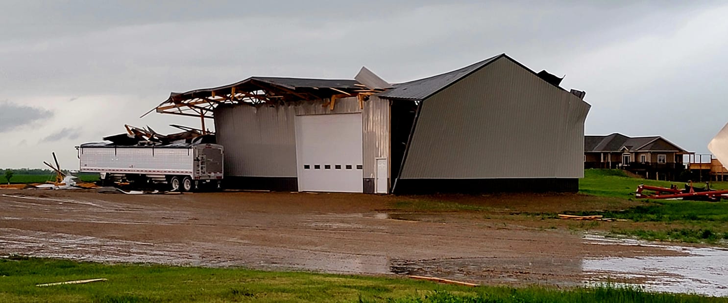 |
| Near Balaton (Judy Przybilla) |
Near Canton (Kathy Moulton) |
Near Current Lake Suanne Christiansen) |
Near Howard, SD (Dean Colling) |
 |
 |
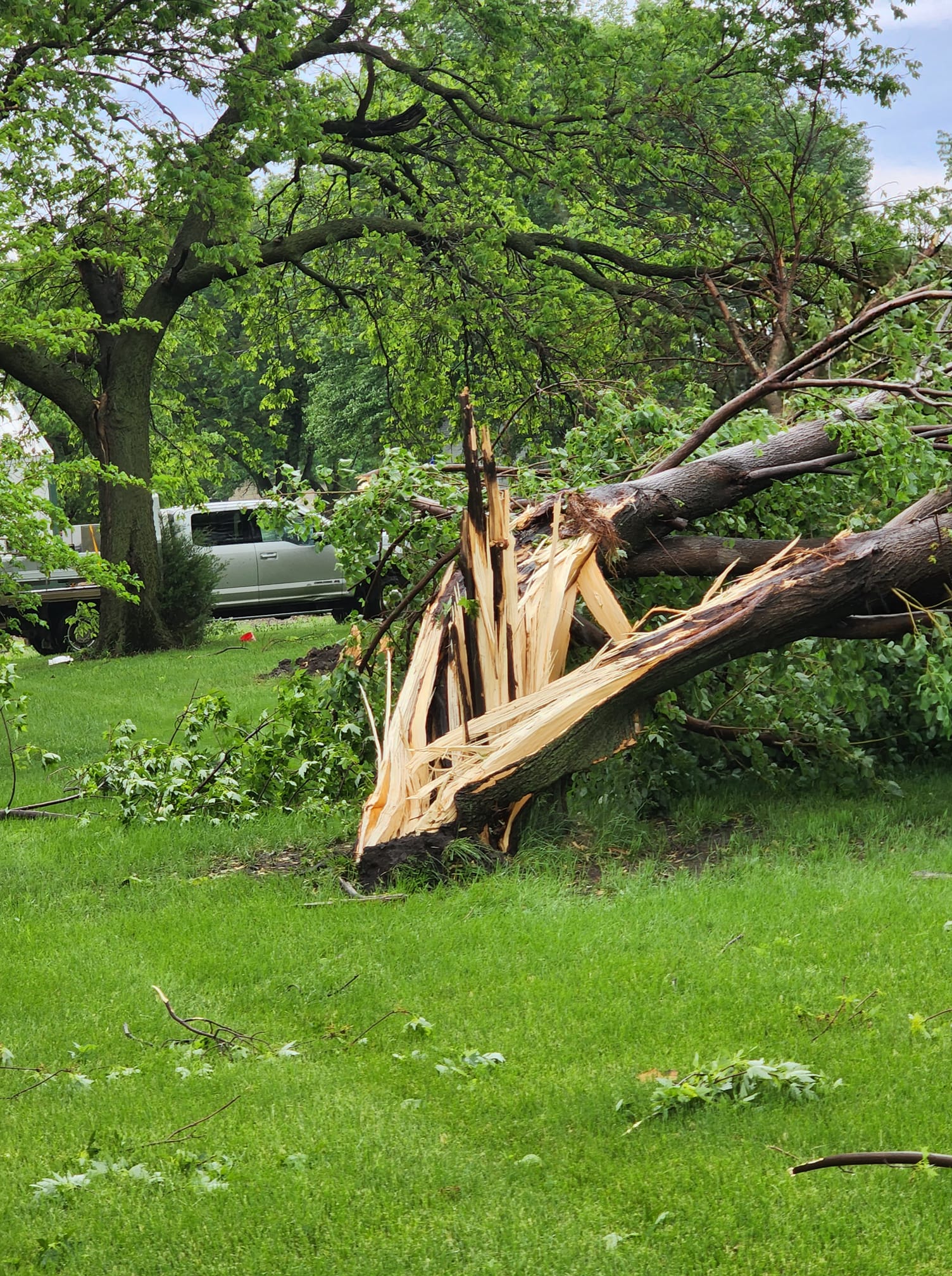 |
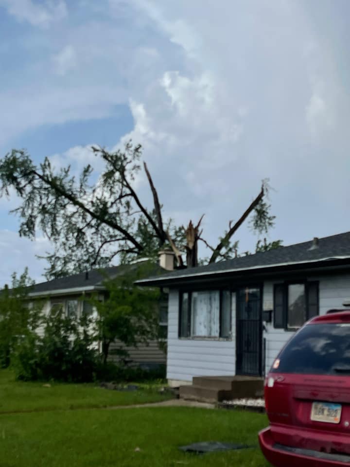 |
| Lakefield, MN (Danielle Fisher) |
In Sioux Falls, SD (Christopher Park) |
Near Doon, IA (LeeAnn Reichert) |
In Sioux Falls, SD (Dana Rickel) |
 |
 |
 |
 |
| Cottonwood, MN (Elsie Lou) |
Reading, MN (Phyliss Brunk) |
In Sioux Falls (Sara Letsche) |
In Sioux Falls (Dana Rickel) |
 |
 |
 |
 |
| Rushmore, MN (Michaela Ann) |
In Sioux Falls (Tonya Herbert Cox) |
In Sioux Falls (Cory Stephens) |
Near Lester (Moser Seed and Ag) |
 |
|||
| In Sioux Falls (Will McReynolds) |
Radar
 |
 |
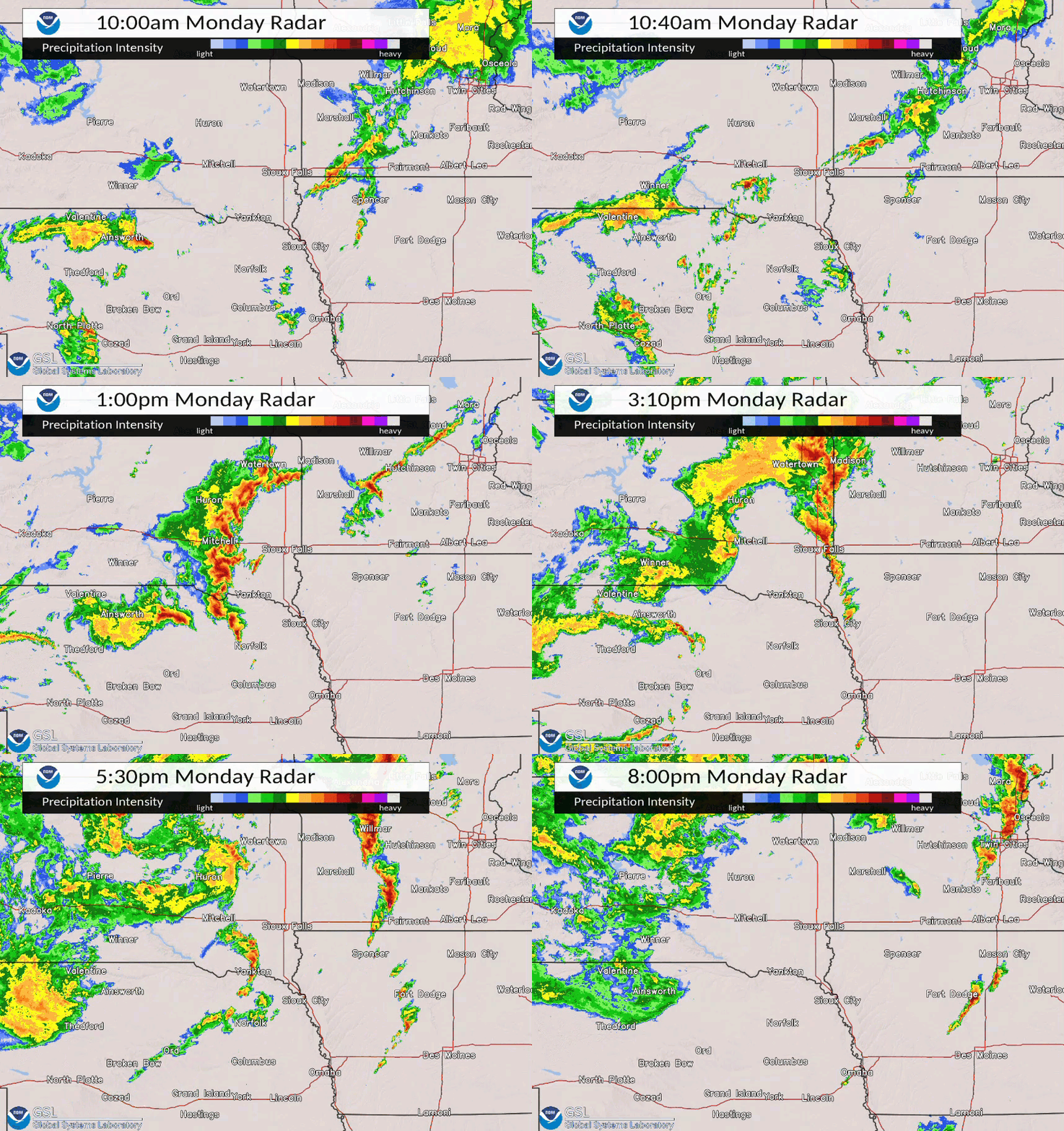 |
| Radar Loop from night of May 28th to morning of May 29th | Radar Loop from night of May 29th to morning of May 30th | Radar Loop from the day of May 30th |
Storm Reports
An interactive map of received reports can be found here.
 |
 |
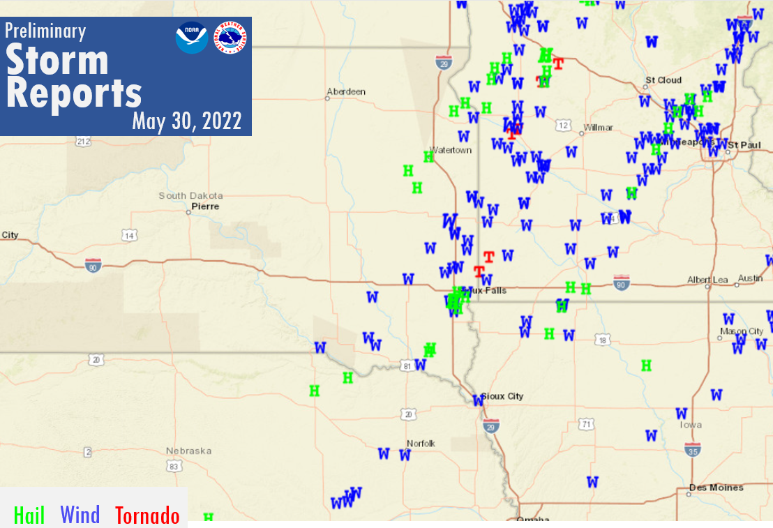 |
| May 28th Severe Weather Reports | May 29th Severe Weather Reports | May 30th Severe Weather Reports |
Three Day Local Storm Report Summary |
||
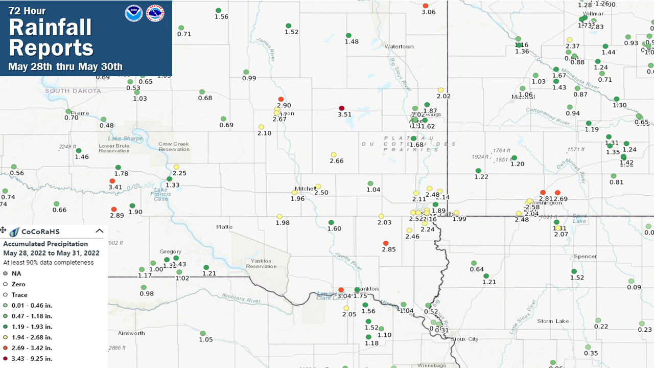
Rain Reports
Here's a look at the 72 hour rainfall totals provided by CoCoRaHS observers in the area.
Additional Information
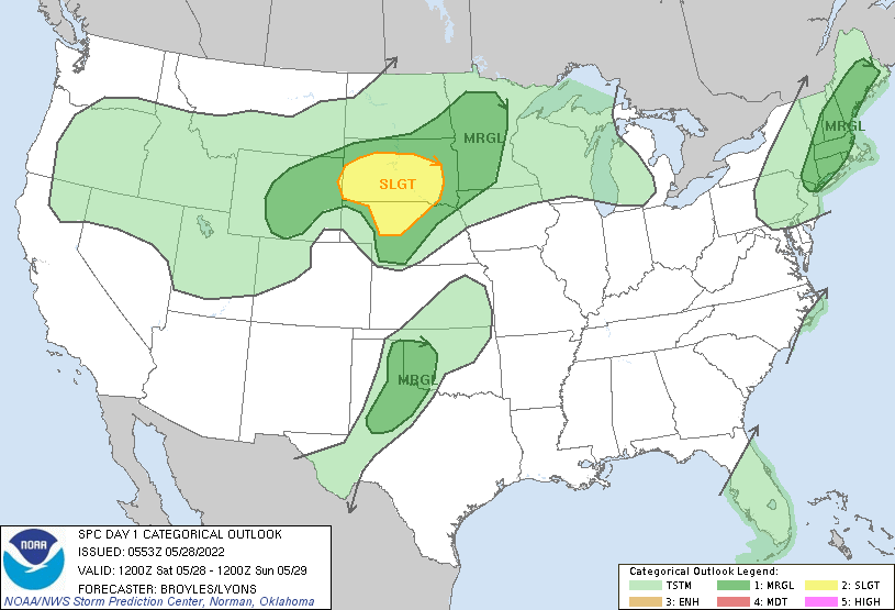
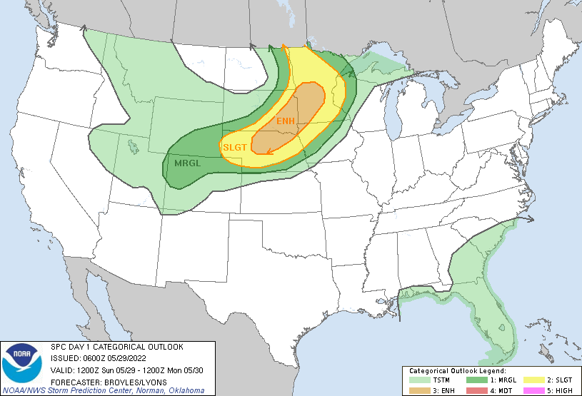
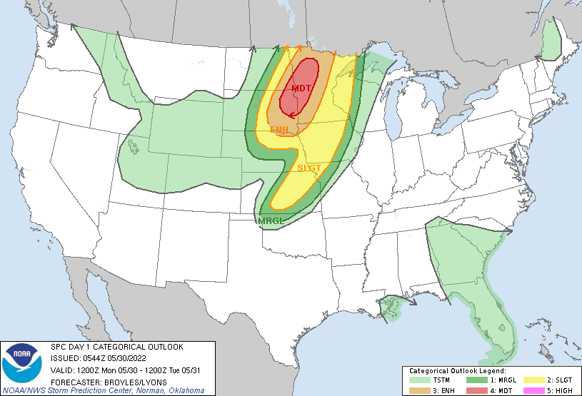
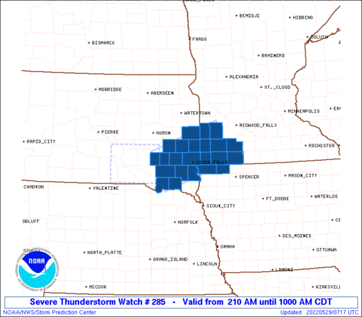
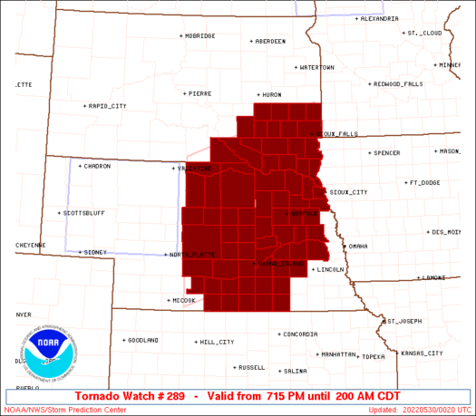
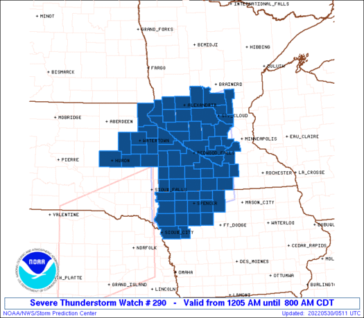
Convective Watches and Outlooks
 |
 |
 |
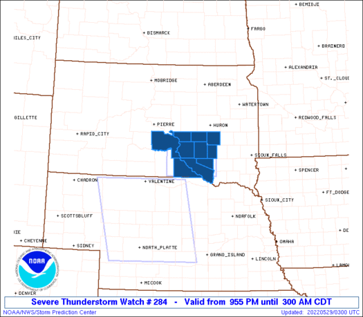 |
| SPC Day 1 Outlook May 28 | SPC Day 1 Outlook May 29 | SPC Day 1 Outlook May 30 | Severe Thunderstorm Watch 284 (Morning of 29th) |
 |
 |
 |
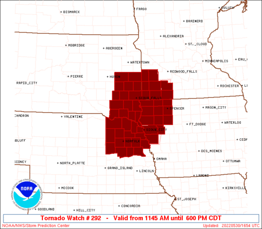 |
| Severe Thunderstorm Watch 285 (Morning of 29th) | Tornado Watch 289 Evening/Overnight of 29th) | Severe Thunderstorm Watch 290 (Overnight of 29th) | Tornado Watch 292 (Afternoon of 30th) |
Summaries from other NWS Offices
 |
Media use of NWS Web News Stories is encouraged! Please acknowledge the NWS as the source of any news information accessed from this site. |
 |