Overview
Hail, then Wind:
Multiple rounds of severe storms produced large hail on April 22-23, 2022. The strong storm system responsible for the severe storms then intensified further, resulting in very strong winds which persisted for several hours.
Hail
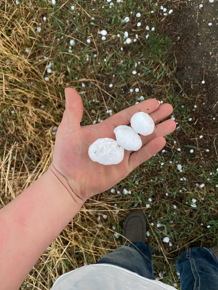
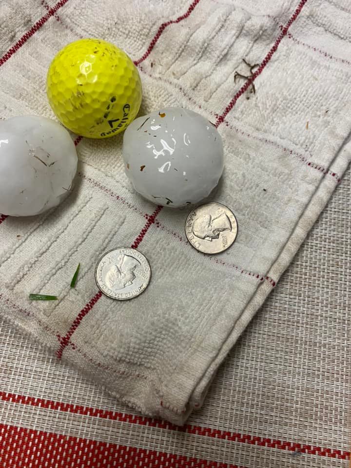
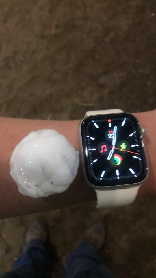
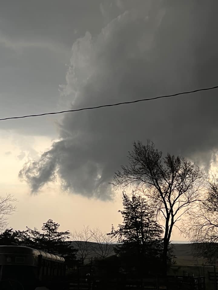
These photos show the hail and wall cloud associated with a supercell in central South Dakota on the evening of April, 22, 2022.
 |
 |
 |
 |
| Large Hail in Crow Lake, SD (courtesy of Coy Fastnacht) |
Large Hail in Wessington Springs, SD (courtesy of Shane Fastnacht) | Large Hail in Wessington Springs, SD (courtesy of Amy Schimke) | Wall Cloud near Wessington Springs, SD (courtesy of Emma Wilde) |
Wind & Dust
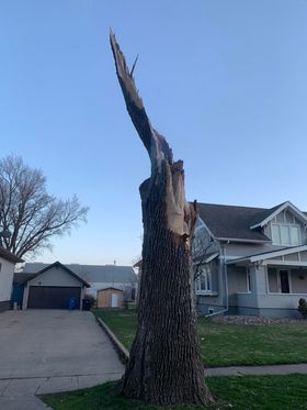
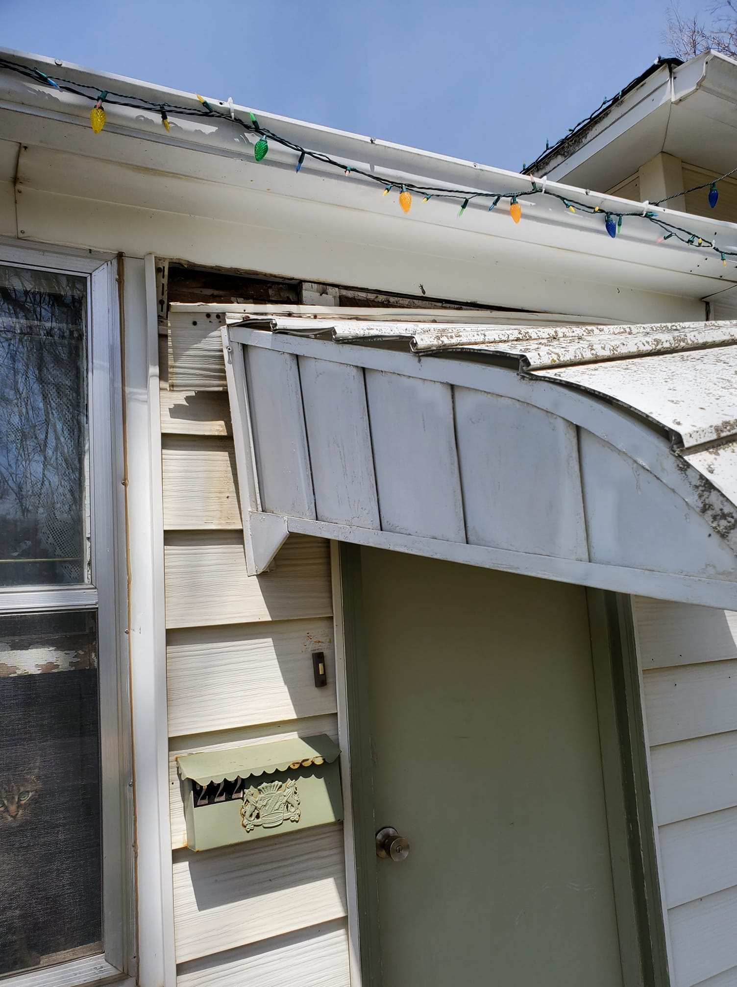
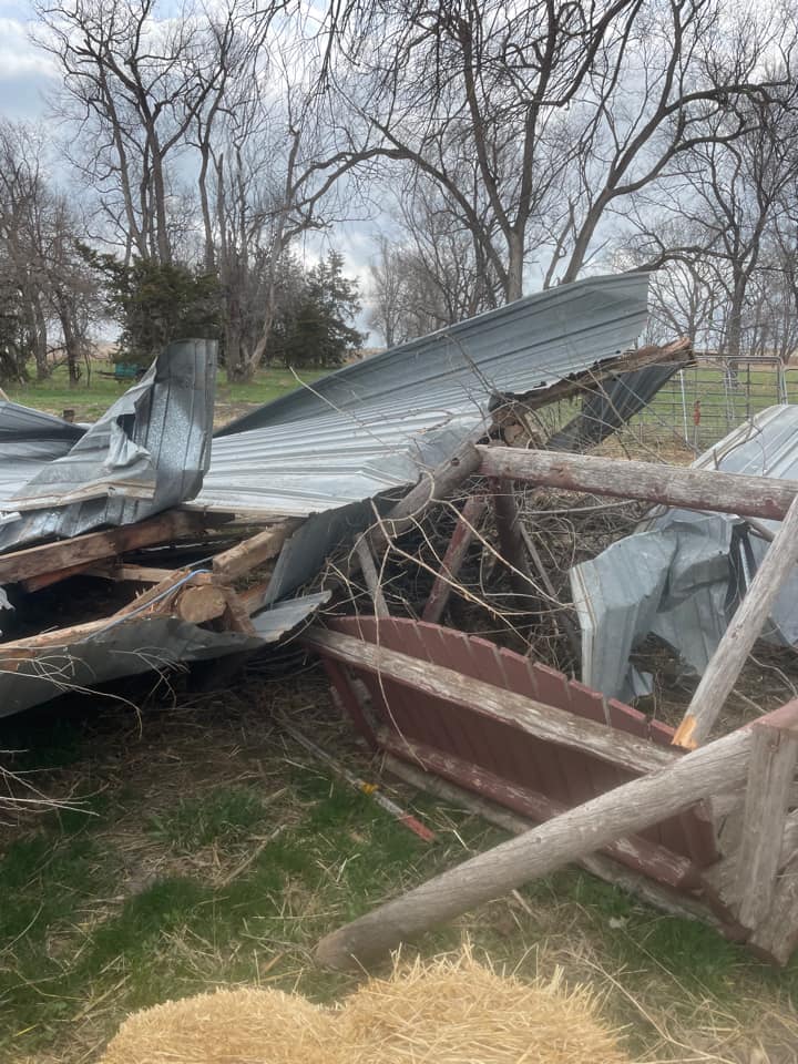
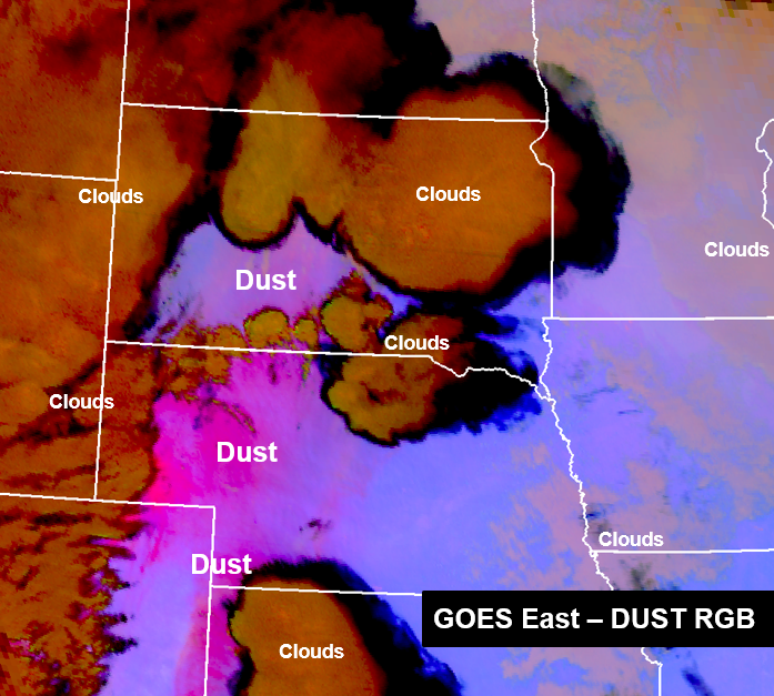
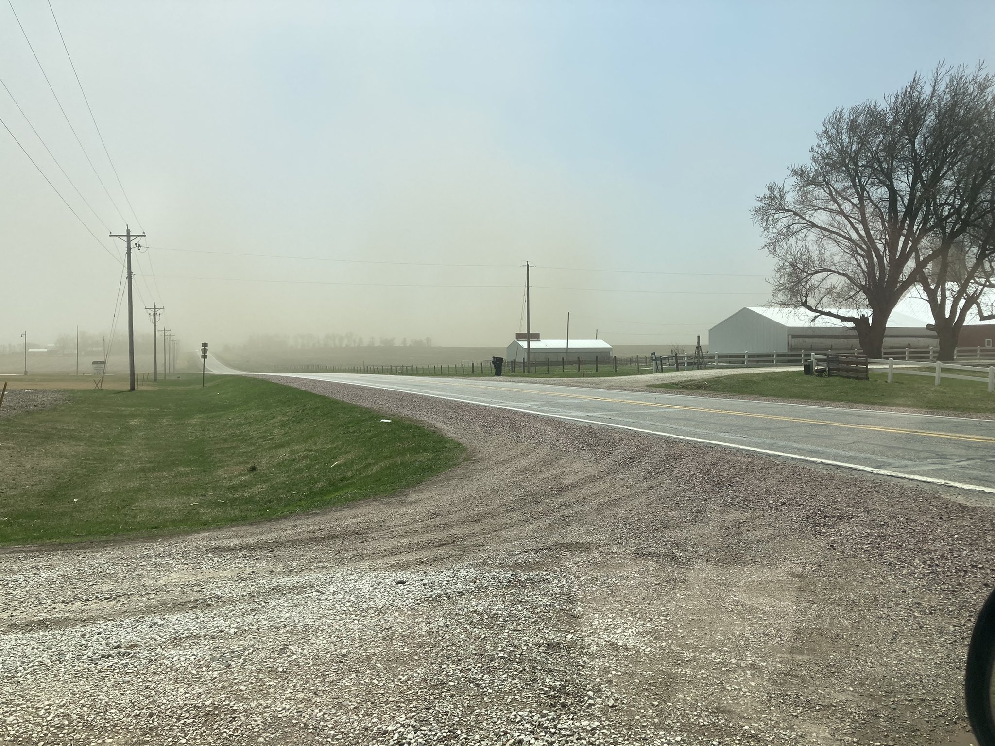
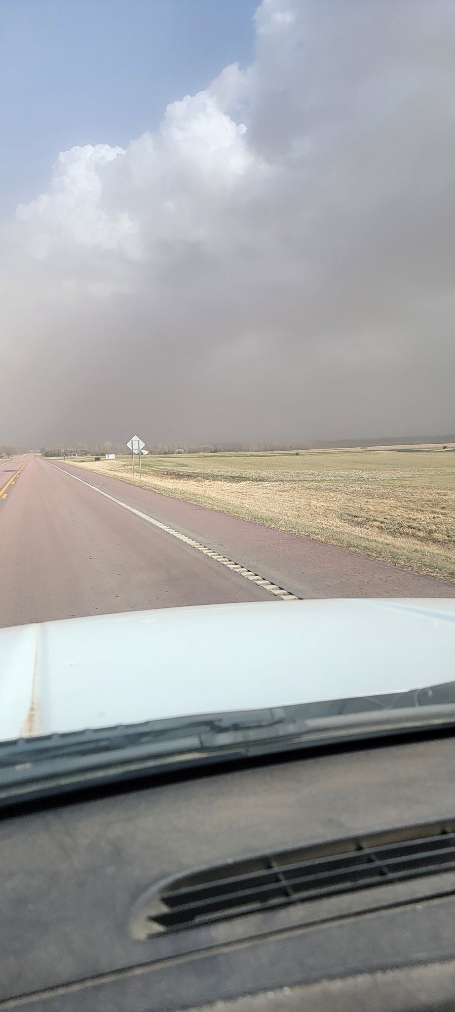
Very strong non-thunderstorm winds produced by an intensifying storm system in central South Dakota on Saturday, April 23, 2022. These photos show a variety of damage caused by these very strong winds, which lasted for several hours! In addition to wind damage, these strong winds lifted considerable amounts of dust.
 |
 |
 |
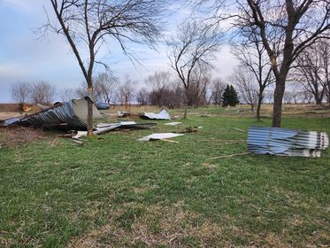 |
| Brandon Van Lo - Hull, IA Storm Damage | Brandi Keleher - Wind Damage in Orange City, IA | Leslie Olsen - Wind Damage in Chamberlain, SD | Steven Luke - Wind Damage in Parker/Marion |
 |
 |
 |
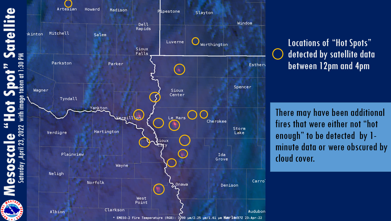 |
| Dust on Satellite over the Plains | Dust near Sioux Center, IA by @konstestr | Dust near Sioux Falls by Jeff Andera | Fire "Hot Spots" Detected Saturday Afternoon |
Radar
Header
 |
 |
 |
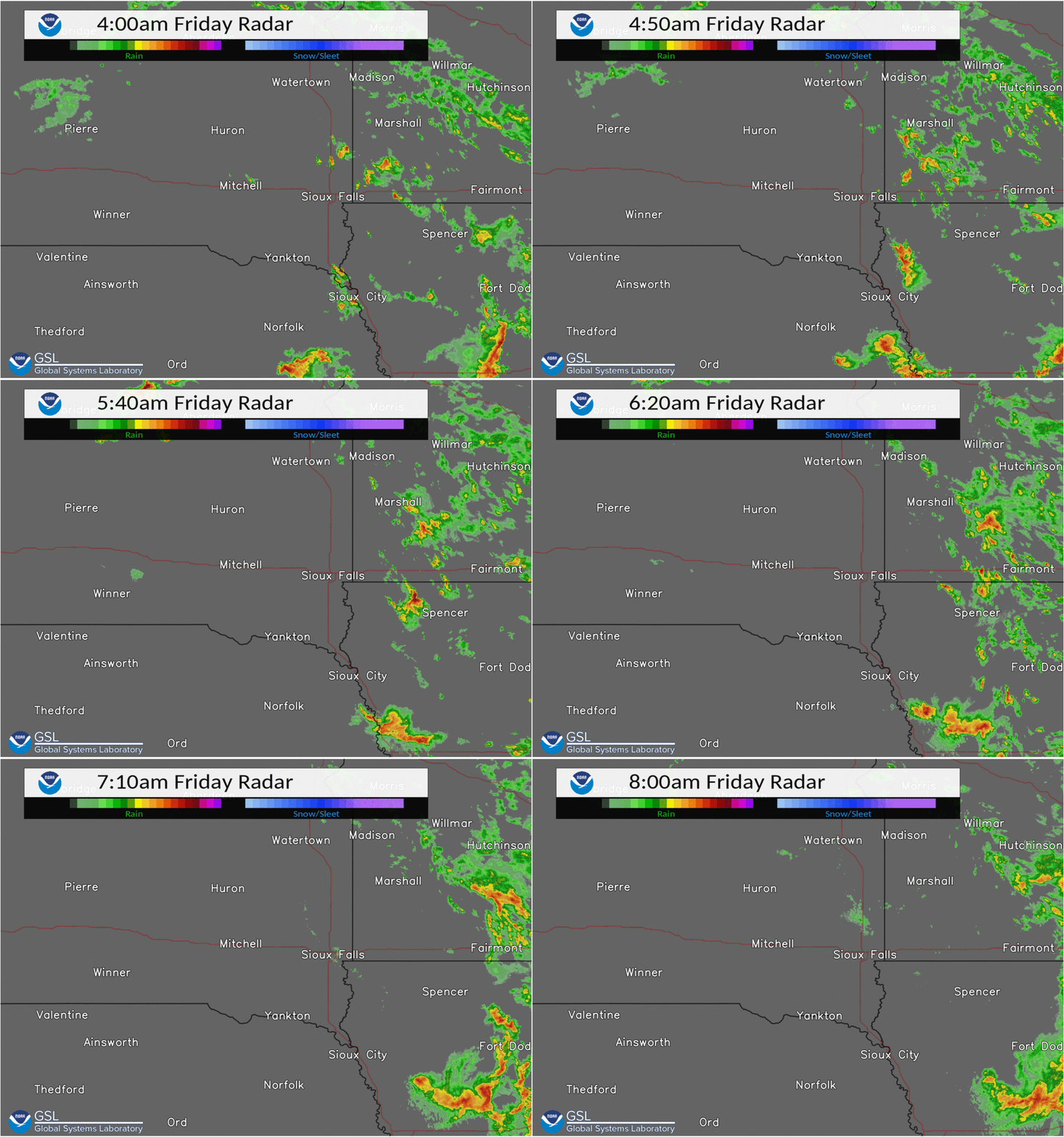
| Radar Loop: 4am-8am Fri, April 22, 2022. Hail-producing thunderstorm in northwest Iowa & southwest Minnesota, amid other scattered storms. |
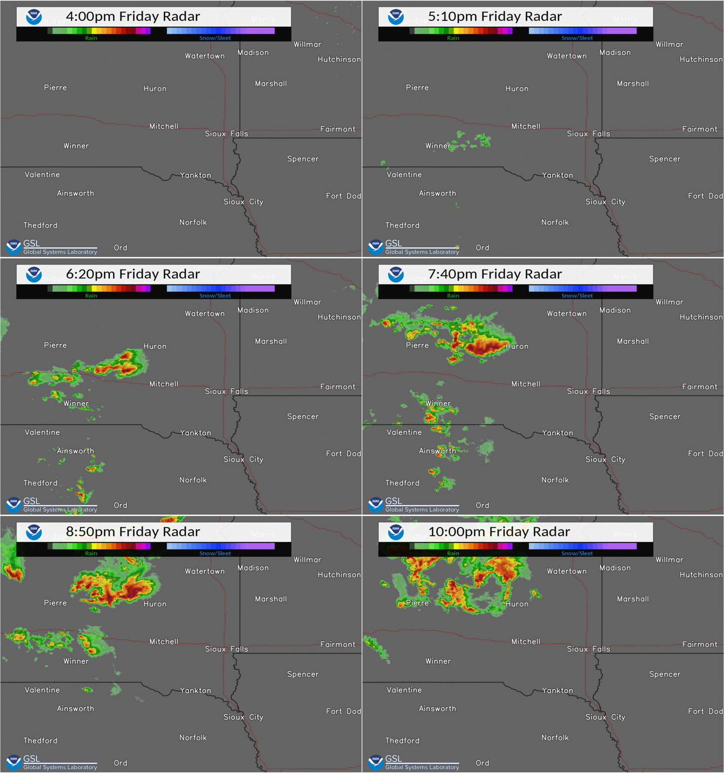
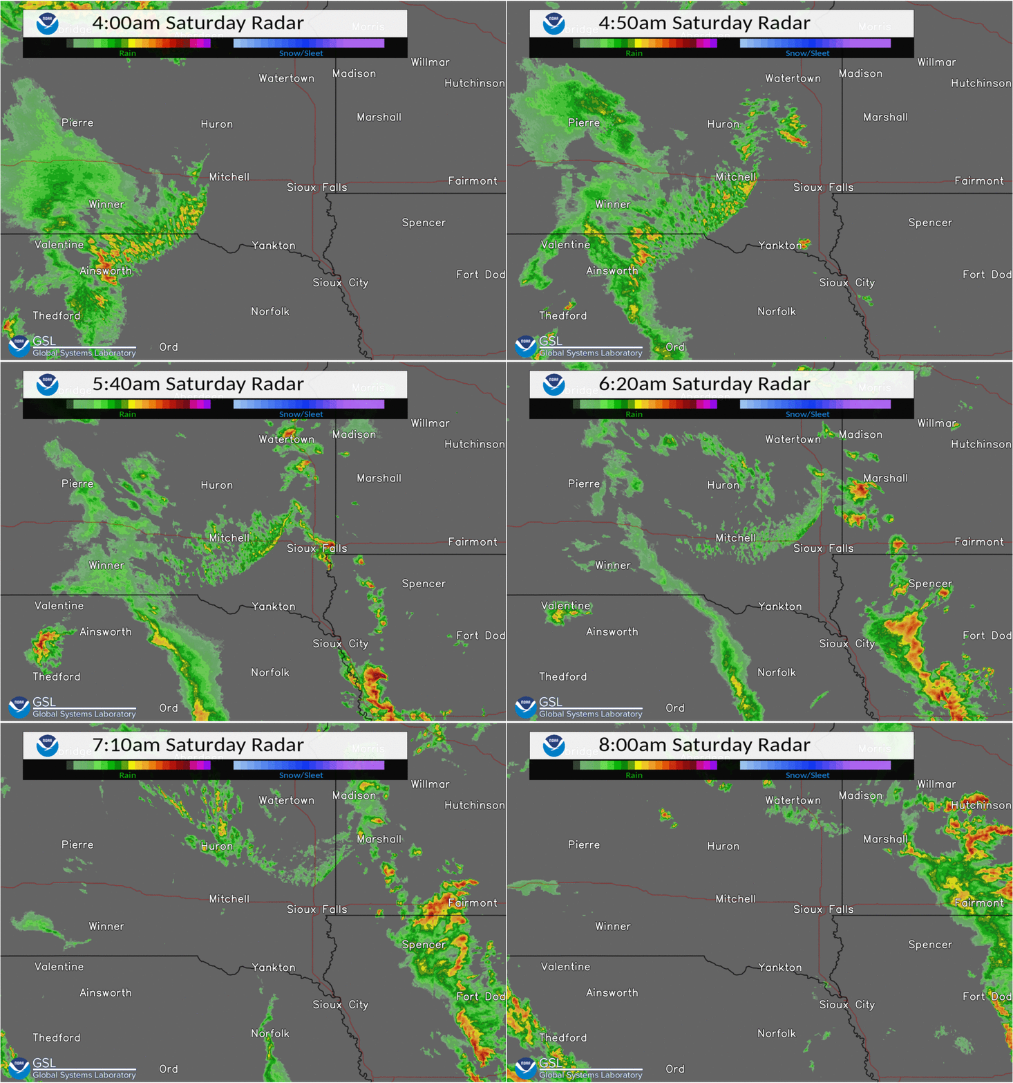
Radar Loop: 4pm-10pm Fri, April 22, 2022. Scattered storms moving through central South Dakota produced large hail and a brief tornado. | Radar Loop: 4am-8am Sat, April 23, 2022. Another round of hail-producing thunderstorms in far southeast South Dakota, northwest Iowa & southwest Minnesota. |
Storm Reports
PRELIMINARY LOCAL STORM REPORT...SUMMARY
NATIONAL WEATHER SERVICE SIOUX FALLS SD
551 AM CDT SUN APR 24 2022

..TIME...   ...EVENT...      ...CITY LOCATION...     ...LAT.LON...
..DATE...   ....MAG....      ..COUNTY LOCATION..ST.. ...SOURCE....
            ..REMARKS..

0534 AM     HAIL             4 NNE MELVIN            43.34N 95.57W
04/22/2022  M1.75 INCH       OSCEOLA            IA   PUBLIC


0550 AM     HAIL             1 SE HARRIS             43.43N 95.42W
04/22/2022  M1.75 INCH       OSCEOLA            IA   PUBLIC


0600 AM     HAIL             9 E ROUND LAKE          43.53N 95.28W
04/22/2022  M0.75 INCH       JACKSON            MN   TRAINED SPOTTER


0600 AM     HAIL             6 ESE ROUND LAKE        43.51N 95.35W
04/22/2022  E1.25 INCH       JACKSON            MN   PUBLIC


0529 PM     HAIL             8 SSE KIMBALL           43.65N 98.88W
04/22/2022  M1.00 INCH       BRULE              SD   TRAINED SPOTTER


0543 PM     HAIL             6 WSW WHITE LAKE        43.69N 98.81W
04/22/2022  E1.25 INCH       BRULE              SD   EMERGENCY MNGR


0545 PM     TSTM WND GST     1 S KIMBALL             43.74N 98.96W
04/22/2022  M66 MPH          BRULE              SD   MESONET

            MESONET STATION 25 SD RWIS KIMBALL.

0550 PM     HAIL             10 N KIMBALL            43.89N 98.96W
04/22/2022  E2.50 INCH       BRULE              SD   PUBLIC

            REPORT VIA PHOTO ON SOCIAL MEDIA.

0602 PM     HAIL             9 NE KIMBALL            43.85N 98.86W
04/22/2022  E1.75 INCH       BRULE              SD   EMERGENCY MNGR


0616 PM     HAIL             18 WNW WESSINGTON SPRIN 44.17N 98.91W
04/22/2022  E0.88 INCH       JERAULD            SD   PUBLIC


0619 PM     HAIL             11 SW WESSINGTON SPRING 43.98N 98.75W
04/22/2022  E1.50 INCH       JERAULD            SD   PUBLIC

            SOCIAL MEDIA REPORT WITH PICTURE. TIME
            APPROXIMATED BY RADAR.

0630 PM     HAIL             14 WSW WESSINGTON SPRIN 44.02N 98.83W
04/22/2022  E2.00 INCH       JERAULD            SD   PUBLIC

            LARGE HAIL UP TO 2.25 INCH IN DIAMETER.

0633 PM     HAIL             10 W WESSINGTON SPRINGS 44.08N 98.77W
04/22/2022  E1.50 INCH       JERAULD            SD   PUBLIC

            REPORT VIA LIVE STREAM STORM CHASER.

0644 PM     HAIL             8 W WESSINGTON SPRINGS  44.08N 98.73W
04/22/2022  E1.00 INCH       JERAULD            SD   TRAINED SPOTTER


0645 PM     HAIL             9 W WESSINGTON SPRINGS  44.08N 98.75W
04/22/2022  M1.75 INCH       JERAULD            SD   PUBLIC

            REPORT VIA PICTURE ON SOCIAL MEDIA.

0802 PM     HAIL             4 SE WESSINGTON         44.41N 98.65W
04/22/2022  E1.50 INCH       BEADLE             SD   PUBLIC


0804 PM     HAIL             4 NNW WOLSEY            44.46N 98.50W
04/22/2022  E0.75 INCH       BEADLE             SD   PUBLIC

            REPORT FROM MPING: DIME (0.75 IN.).

0806 PM     HAIL             4 E WESSINGTON          44.46N 98.61W
04/22/2022  E0.70 INCH       BEADLE             SD   TRAINED SPOTTER


0812 PM     HAIL             2 SSE WESSINGTON        44.42N 98.69W
04/22/2022  E2.00 INCH       BEADLE             SD   CO-OP OBSERVER

            MOSTLY SMALLER HAIL, BUT SOME STONES UP TO 2
            INCHES IN DIAMETER, ALONG WITH ABOUT AN INCH
            OF RAINFALL.

0819 PM     HAIL             1 ENE WESSINGTON        44.46N 98.68W
04/22/2022  E0.75 INCH       BEADLE             SD   PUBLIC

            REPORT FROM MPING: DIME (0.75 IN.).

0835 PM     TORNADO          5 NW WOLSEY             44.46N 98.55W
04/22/2022                   BEADLE             SD   STORM CHASER


0904 PM     HAIL             11 W HITCHCOCK          44.62N 98.64W
04/22/2022  E0.50 INCH       BEADLE             SD   TRAINED SPOTTER

            MULTIPLE ROUNDS OF SMALL HAIL MADE THE
            GROUND WHITE. HAIL ENDED BY TIME OF REPORT.
            PLENTY OF RAINFALL TOO.

0936 PM     HAIL             7 WSW HITCHCOCK         44.59N 98.53W
04/22/2022  E1.50 INCH       BEADLE             SD   TRAINED SPOTTER

            PING PONG BALL SIZED HAIL JUST WEST OF
            BONILLA AND US 281. LOTS OF LIGHTNING, HAIL,
            AND HEAVY RAIN KNOCKED OUT POWER IN TOWN.

0300 AM     NON-TSTM WND DMG 7 S MARION              43.33N 97.24W
04/23/2022                   TURNER             SD   LAW ENFORCEMENT

            SOCIAL MEDIA REPORT WITH PICTURES OF A SHED
            WITH THE ROOF TORN OFF. WIND GUSTS FROM
            PARKER RWIS AT THIS TIME WERE 50-55 MPH.

0504 AM     HAIL             5 NW BERESFORD          43.13N 96.84W
04/23/2022  E1.75 INCH       LINCOLN            SD   TRAINED SPOTTER


0524 AM     HAIL             3 E HARRISBURG          43.43N 96.63W
04/23/2022  E0.70 INCH       LINCOLN            SD   TRAINED SPOTTER


0533 AM     HAIL             4 WNW ROWENA            43.54N 96.62W
04/23/2022  M0.88 INCH       MINNEHAHA          SD   NWS EMPLOYEE


0534 AM     HAIL             2 W VALLEY SPRINGS      43.59N 96.51W
04/23/2022  M1.00 INCH       MINNEHAHA          SD   PUBLIC

            REPORTS VIA SOCIAL MEDIA.

0540 AM     HAIL             SHELDON                 43.18N 95.84W
04/23/2022  E1.00 INCH       O`BRIEN            IA   PUBLIC

            REPORT VIA PHOTO ON SOCIAL MEDIA.

0550 AM     HAIL             JASPER                  43.85N 96.40W
04/23/2022  M1.25 INCH       PIPESTONE          MN   PUBLIC

            REPORT VIA SOCIAL MEDIA.

0610 AM     TSTM WND DMG     1 N GALVA               42.52N 95.42W
04/23/2022                   IDA                IA   PUBLIC

            A FEW 6 TO 9 INCH DIAMETER TREE LIMBS DOWN.
            TIME ESTIMATED FROM RADAR.

0639 AM     HAIL             1 SE SPENCER            43.13N 95.14W
04/23/2022  E0.88 INCH       CLAY               IA   PUBLIC


0653 AM     HAIL             4 WNW TERRIL            43.33N 95.05W
04/23/2022  E1.00 INCH       DICKINSON          IA   PUBLIC


1015 AM     NON-TSTM WND GST 3 NNE SHELDON           43.22N 95.82W
04/23/2022  M56 MPH          O`BRIEN            IA   AWOS

            AWOS STATION KSHL SHELDON AIRPORT.

1028 AM     NON-TSTM WND GST 2 NE YANKTON            42.92N 97.37W
04/23/2022  M59 MPH          YANKTON            SD   AWOS

            AWOS STATION KYKN YANKTON MUNICIPAL AIRPORT.

1033 AM     NON-TSTM WND GST 3 N MITCHELL            43.77N 98.04W
04/23/2022  M56 MPH          DAVISON            SD   ASOS

            ASOS STATION KMHE MITCHELL MUNICIPAL
            AIRPORT.

1135 AM     NON-TSTM WND GST 2 NNE WINDOM            43.90N 95.10W
04/23/2022  M51 MPH          COTTONWOOD         MN   AWOS

            AWOS STATION KMWM WINDOM MUNICIPAL AIRPORT.

1150 AM     NON-TSTM WND DMG 1 ESE GARRETSON         43.71N 96.49W
04/23/2022                   MINNEHAHA          SD   PUBLIC

            SOCIAL MEDIA REPORT WITH PICTURE OF BUILDING
            DAMAGE.

1153 AM     NON-TSTM WND GST 1 WSW SLAYTON           43.98N 95.78W
04/23/2022  M55 MPH          MURRAY             MN   AWOS

            AWOS STATION KDVP SLAYTON MUNICIPAL AIRPORT.

1246 PM     NON-TSTM WND GST 2 NNW HURON             44.39N 98.23W
04/23/2022  M69 MPH          BEADLE             SD   ASOS

            ASOS STATION KHON HURON REGIONAL AIRPORT.

1255 PM     NON-TSTM WND GST 3 WSW LAKESIDE          42.60N 95.22W
04/23/2022  M59 MPH          BUENA VISTA        IA   AWOS

            AWOS STATION KSLB STORM LAKE AIRPORT.

0100 PM     NON-TSTM WND DMG HULL                    43.19N 96.13W
04/23/2022                   SIOUX              IA   PUBLIC

            SOCIAL MEDIA REPORT WITH PICTURES OF A LARGE
            TREE ESTIMATED 1 FT DIAMETER SNAPPED OFF
            ABOUT MID TRUNK. PEAK WINDS FROM LE MARS
            MUNICIPAL AT ABOUT 1 PM THIS AFTERNOON 60
            MPH.

0100 PM     NON-TSTM WND DMG ORANGE CITY             43.00N 96.06W
04/23/2022                   SIOUX              IA   PUBLIC

            SOCIAL MEDIA REPORT WITH PICTURE OF AWNING
            DAMAGE.

0115 PM     NON-TSTM WND GST 1 ENE MADISON           44.02N 97.08W
04/23/2022  M58 MPH          LAKE               SD   AWOS

            AWOS STATION KMDS MADISON AIRPORT.

0115 PM     NON-TSTM WND GST 2 NE MAURICE            42.99N 96.16W
04/23/2022  M63 MPH          SIOUX              IA   MESONET

            MESONET STATION KSXK SIOUX COUNTY REGIONAL
            AIRPORT.

0131 PM     NON-TSTM WND GST 2 SW BROOKINGS          44.28N 96.82W
04/23/2022  M54 MPH          BROOKINGS          SD   AWOS

            AWOS STATION KBKX BROOKINGS MUNICIPAL
            AIRPORT.

0155 PM     NON-TSTM WND GST 2 SW LE MARS            42.77N 96.20W
04/23/2022  M60 MPH          PLYMOUTH           IA   AWOS

            AWOS STATION KLRJ LE MARS AIRPORT.

0200 PM     NON-TSTM WND DMG 2 NW SIOUX FALLS        43.56N 96.76W
04/23/2022                   MINNEHAHA          SD   PUBLIC

            SOCIAL MEDIA POST WITH PICTURE OF LARGE
            BRANCHES DOWN: APPROXIMATELY 3 INCHES. WIND
            SPEED AT FSD ASOS AT THE ESTIMATED TIME OF
            OCCURRENCE WAS 55 MPH.

0211 PM     NON-TSTM WND GST 3 NNW SIOUX FALLS       43.58N 96.75W
04/23/2022  M63 MPH          MINNEHAHA          SD   ASOS

            ASOS STATION KFSD SIOUX FALLS AIRPORT.

0215 PM     NON-TSTM WND GST 2 S PIPESTONE           43.97N 96.32W
04/23/2022  M52 MPH          PIPESTONE          MN   AWOS

            AWOS STATION KPQN PIPESTONE AIRPORT.

0233 PM     NON-TSTM WND GST 4 WNW SPENCER           43.17N 95.22W
04/23/2022  M62 MPH          CLAY               IA   ASOS

            ASOS STATION KSPW SPENCER MUNICIPAL AIRPORT.

0247 PM     NON-TSTM WND GST 1 W MARSHALL            44.45N 95.82W
04/23/2022  M56 MPH          LYON               MN   AWOS

            AWOS STATION KMML MARSHALL MUNICIPAL
            AIRPORT.

0255 PM     NON-TSTM WND GST 3 S LUVERNE             43.62N 96.22W
04/23/2022  M63 MPH          ROCK               MN   AWOS

            AWOS STATION KLYV LUVERNE AIRPORT.

0341 PM     NON-TSTM WND GST 2 ENE WORTHINGTON       43.63N 95.57W
04/23/2022  M54 MPH          NOBLES             MN   AWOS

            AWOS STATION KOTG WORTHINGTON AIRPORT.

0415 PM     NON-TSTM WND GST 1 S CHEROKEE            42.73N 95.55W
04/23/2022  M51 MPH          CHEROKEE           IA   AWOS

            AWOS STATION KCKP CHEROKEE MUNICIPAL
            AIRPORT.

0425 PM     NON-TSTM WND GST 2 SW SERGEANT BLUFF     42.38N 96.38W
04/23/2022  M68 MPH          WOODBURY           IA   ASOS

            ASOS STATION KSUX SIOUX GATEWAY AIRPORT.


&&
 |
Media use of NWS Web News Stories is encouraged! Please acknowledge the NWS as the source of any news information accessed from this site. |
 |