Overview
|
A mid January Alberta Clipper brought moderate to heavy snowfall to locations east of I-29. Meanwhile locations near and west of I-29 initially received a wintry mix and lighter snowfall totals. Increasing winds into the evening hours resulted in some patchy blowing and drifting snow across the region. |
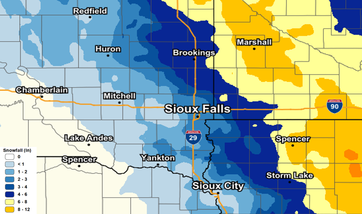 Snowfall Totals Across the Region. |
Snow/Ice
Location                     Amount    Time/Date       Provider

...Iowa...

...Cherokee County...
Cleghorn                     3.5 in    0916 AM 01/15   Public

...Clay County...
Spencer                      10.4 in   0928 AM 01/15   COOP

...Dickinson County...
Orleans                      11.0 in   0915 PM 01/14   Public
Spirit Lake                  10.5 in   0731 AM 01/15   Public
Okoboji                      9.0 in    0925 AM 01/15   Public
Okoboji                      8.5 in    0915 AM 01/15   Public
Milford                      8.0 in    0852 AM 01/15   Public
Milford                      7.0 in    0445 PM 01/14   Public
Lake Park                    7.0 in    0830 PM 01/14   Public
4.0 N Wahpeton               6.5 in    1200 AM 01/15   UCOOP

...Sioux County...
Orange City                  4.0 in    0700 AM 01/15   COOP
1 N Hospers                  2.8 in    0748 AM 01/15   Public

...Minnesota...

...Jackson County...
Heron Lake                   8.0 in    0714 AM 01/15   Public

...Lincoln County...
Hendricks 8.0 SE             5.0 in    0700 AM 01/15   COCORAHS

...Lyon County...
Russell                      11.0 in   1015 AM 01/15   Public
Garvin                       10.0 in   0630 PM 01/14   Public
Marshall                     10.0 in   0716 AM 01/15   Public
Tracy                        10.0 in   1135 AM 01/15   Public
Marshall                     9.0 in    0830 PM 01/14   Public

...Murray County...
Slayton                      6.3 in    1022 AM 01/15   Public

...Nobles County...
1 WNW Worthington            7.5 in    0900 PM 01/14   Public

...Pipestone County...
Pipestone                    5.0 in    0939 AM 01/15   Public

...Rock County...
Hills 0.2 NW                 3.1 in    0700 AM 01/15   COCORAHS

...South Dakota...

...Beadle County...
Huron 1.3 S                  2.1 in    0800 AM 01/15   COCORAHS

...Brookings County...
1 WNW Brookings              6.0 in    0619 PM 01/14   Public
Volga                        5.0 in    0415 PM 01/14   Public
Brookings 1.6 S              5.0 in    0700 AM 01/15   COCORAHS
Brookings 1.4 SW             5.0 in    0800 AM 01/15   COCORAHS
Bruce 5.3 W                  5.0 in    0800 AM 01/15   COCORAHS
Brookings 0.2 SSW            4.8 in    0700 AM 01/15   COCORAHS
1 WNW Brookings              4.0 in    0400 PM 01/14   Public

...Kingsbury County...
Lake Preston                 6.0 in    0300 PM 01/14   Public

...Lake County...
Madison                      3.5 in    0630 PM 01/14   Public

...Lincoln County...
Canton                       2.8 in    0900 AM 01/15   COOP
Harrisburg 0.8 NNE           2.3 in    0700 AM 01/15   COCORAHS

...Miner County...
Howard                       2.9 in    0707 AM 01/15   Public

...Minnehaha County...
Sioux Falls 5.2 E            3.2 in    0700 AM 01/15   COCORAHS
Sioux Falls 5.0 SE ARPT      3.0 in    0700 AM 01/15   COCORAHS
3 N Sioux Falls              2.7 in    1020 PM 01/14   Official NWS Obs
Sioux Falls                  2.3 in    0741 AM 01/15   Public

Observations are collected from a variety of sources with varying
equipment and exposures. We thank all volunteer weather observers
for their dedication. Not all data listed are considered official.
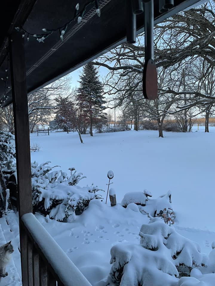
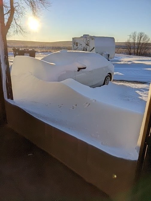
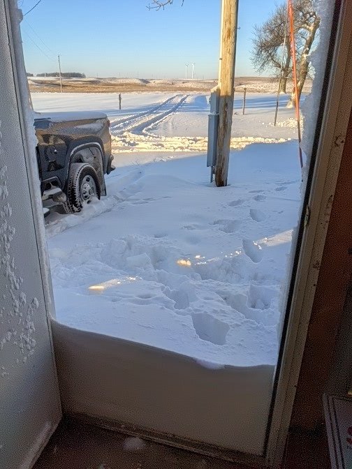
Photos & Video
 |
 |
 |
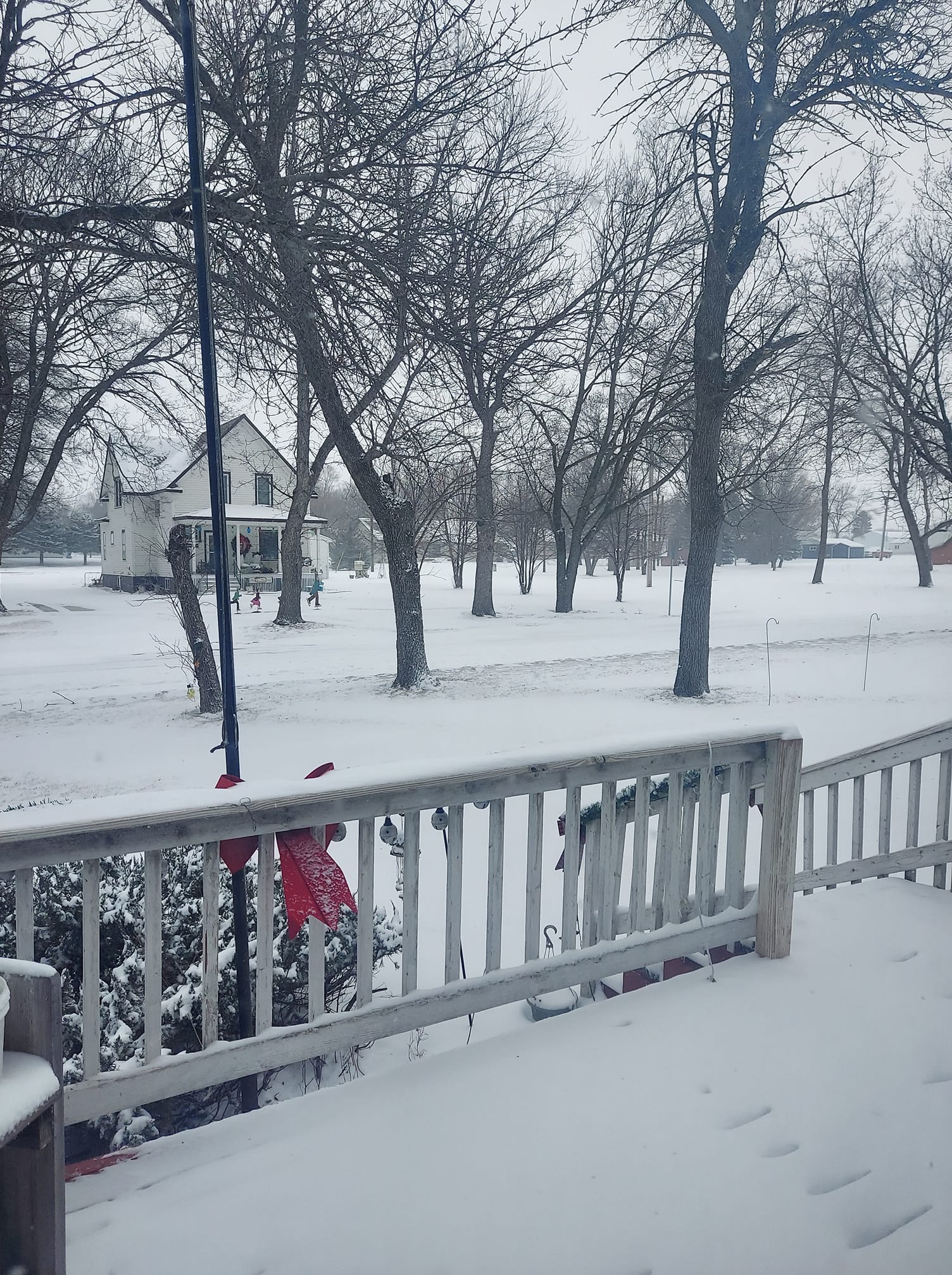 |
| Cherokee, IA Credit to Teri Chafin |
Lake Park, IA Credit to Mike Ehret |
Lake Park, IA Credit to Mike Ehret |
Lake Preston, SD Credit to Mary Coppock |
 |
 |
 |
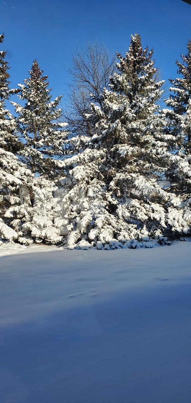 |
| Marshall, MN Credit to Cheryl Geihl |
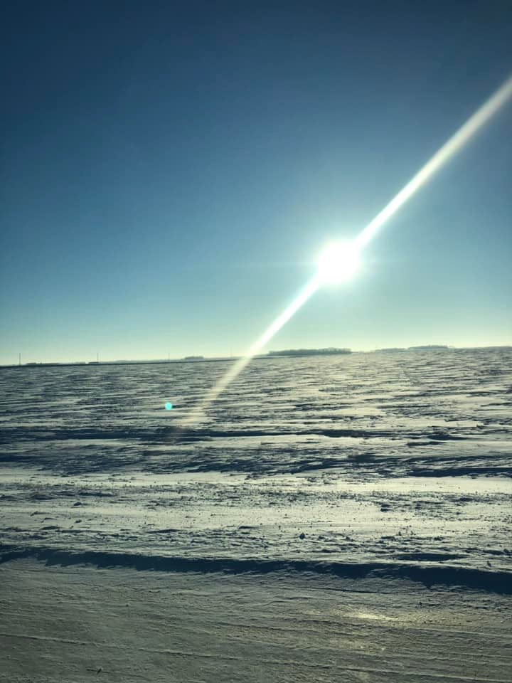
Okoboji, IA Credit to Dee Fettes Pyle |
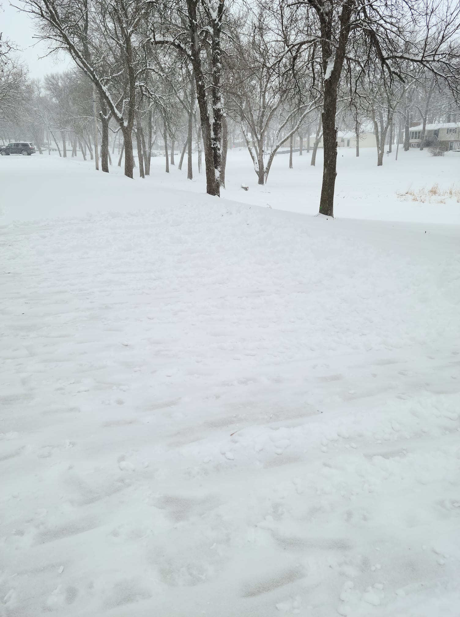
Volga, SD Credit to Kris Bishop |
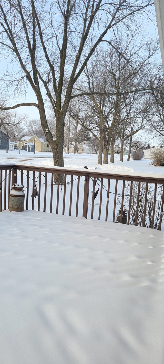
Marshall, MN Credit to Dawn Bahn |
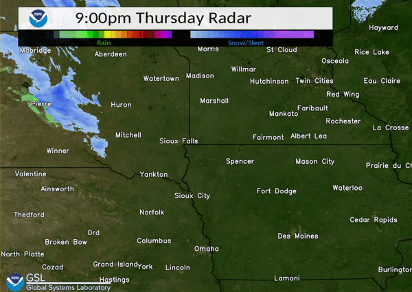
Radar
 |
|||
| Radar loop for January14th. | Caption | Caption | Caption |
 |
Media use of NWS Web News Stories is encouraged! Please acknowledge the NWS as the source of any news information accessed from this site. |
|


 Weather Story
 Weather Map
 Local Radar