Overview
|
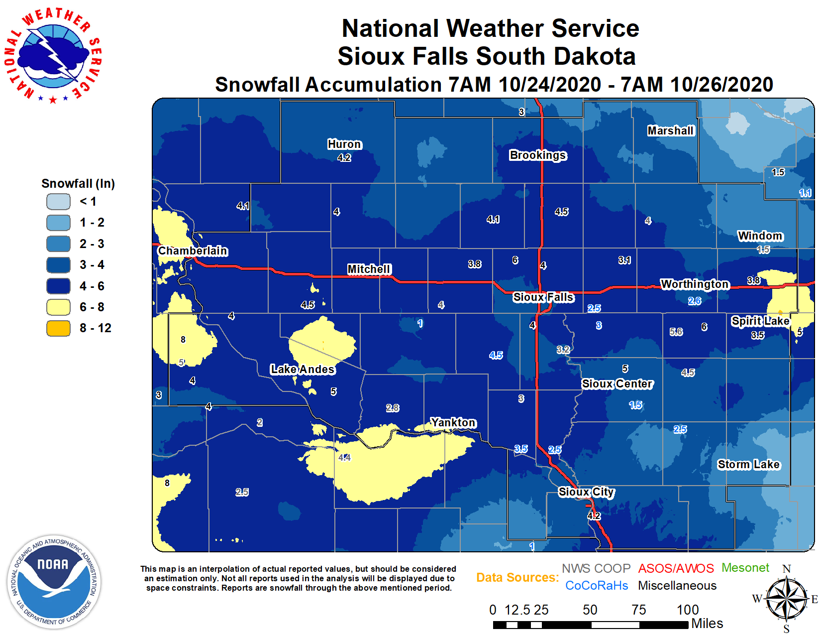
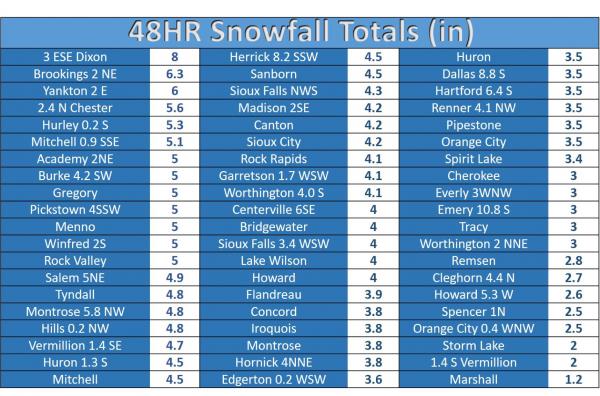
A record cold air mass moved into the northern United States during late October 2020. This cold air set multiple records, including coldest high temperatures and record low temperatures. A persistent and long duration snow also moved through the region after the cold arrived, with snow falling for over 24 hours in some locations. This widespread snow moved across the region, beginning the evening of Saturday October 24th and ending during the evening hours of Sunday October 25th. Snowfall totals ranged on average from 2 to 6 inches in most locations. The highest snowfall total was located in Gregory county of South Dakota with 8 inches of snow. A few snowfall totals included 4.3" in Sioux Falls, 4.2" in Sioux City, 4.5" in Mitchell, and 3.5" in Huron. |
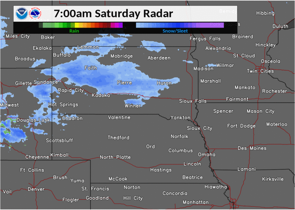 Radar Animation of The Snow |
Record Cold and Snow
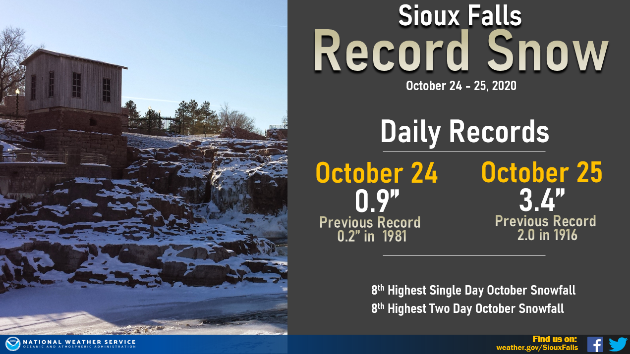
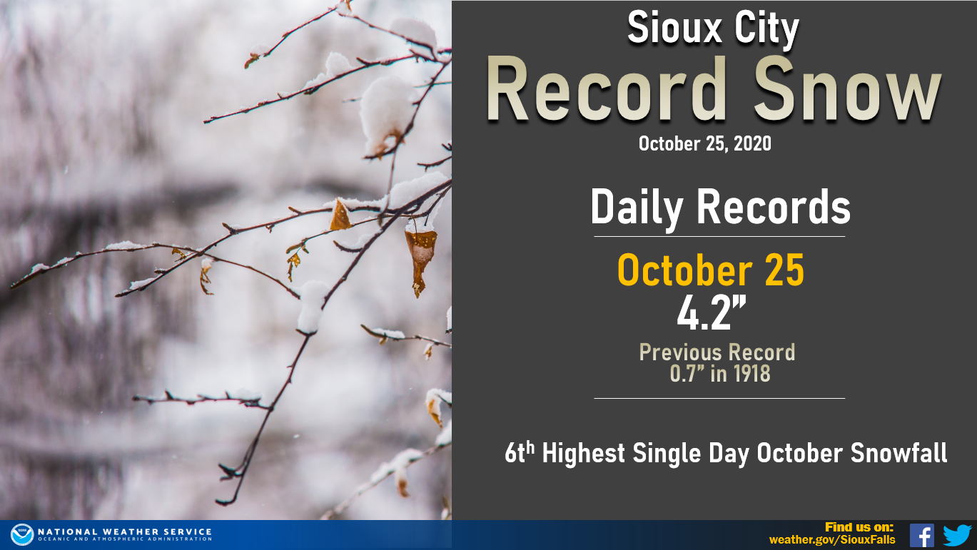
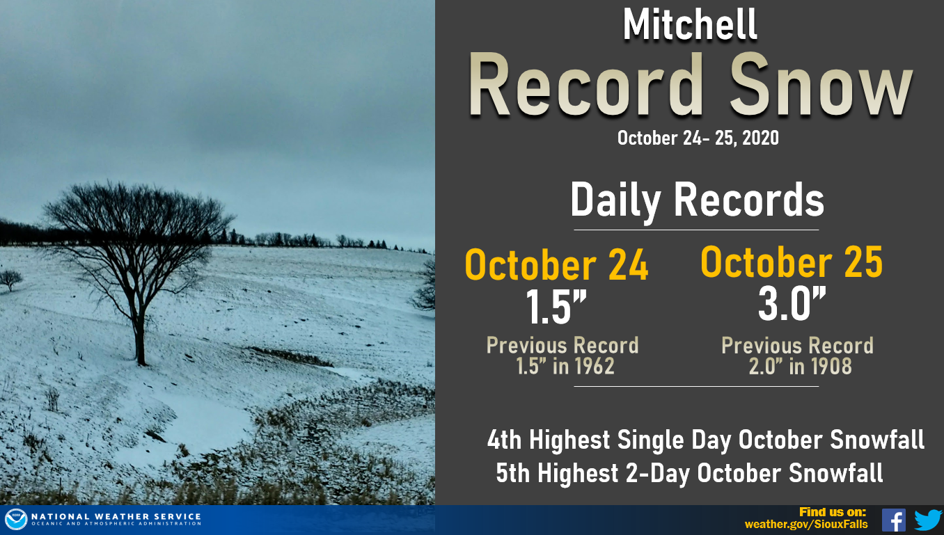
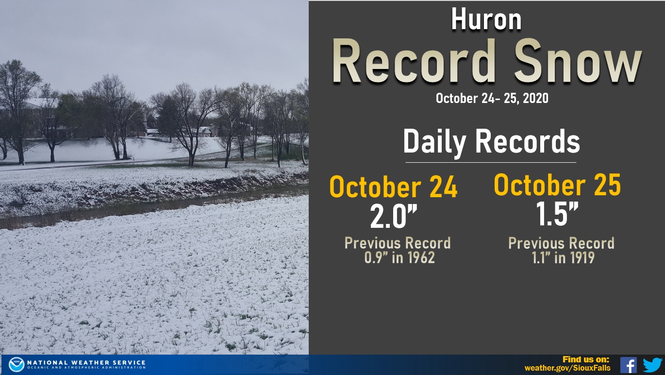
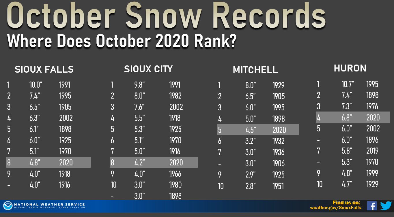
An historically cold air mass settled into the Central United States, breaking multiple temperature and snowfall records for the region. Here is a look at the snowfall records for the four primary climate locations in the Sioux Falls Forecast area, along with the top 10 snowiest months of October on record. This snowstorm placed October 2020 in the top 10 snowiest Octobers on record. Meanwhile, single day snowfall totals also ranked in the top 10 in many areas.
 |
 |
 |
 |
Sioux Falls Snow Records |
Sioux City Snow Records | Mitchell Snow Records | Huron Snow Records |
 |
|||
| Top 10 Snowiest Octobers on Record | |||
Storm Reports
Snowfall totals across much of the region ranged from 2 inches to 6 inches. Isolated heavier pockets of snow were observed, with as much as 8 inches of snow reported in portions of Gregory county in South Dakota.
 |
Listing of Snowfall Reports |
 |
 |
Media use of NWS Web News Stories is encouraged! Please acknowledge the NWS as the source of any news information accessed from this site. |
|


 Weather Story
 Weather Map
 Local Radar