Overview
|
Strong to severe thunderstorms formed during the evening hours over western and central portions of South Dakota, before congealing into a line and moving east into the overnight hours. This line of storms brought damaging winds to areas north of I-90, particularly along the Highway 14 corridor, in eastern South Dakota and southwest Minnesota. Some wind gusts as high as around 80 mph were observed. In addition to the strong winds, brief circulations on the front edge of the line of storms prompted several Tornado Warnings. Two brief tornadoes were confirmed north and south of De Smet, SD. The first tornado was rated an EF-1. A rating could not be determined for the second tornado due to a lack of damage in an open field. |
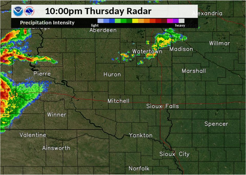 Radar Loop from 10 pm August 27, to 4 am August 28, 2020 |
Tornadoes
|
Tornado - #1
Track Map 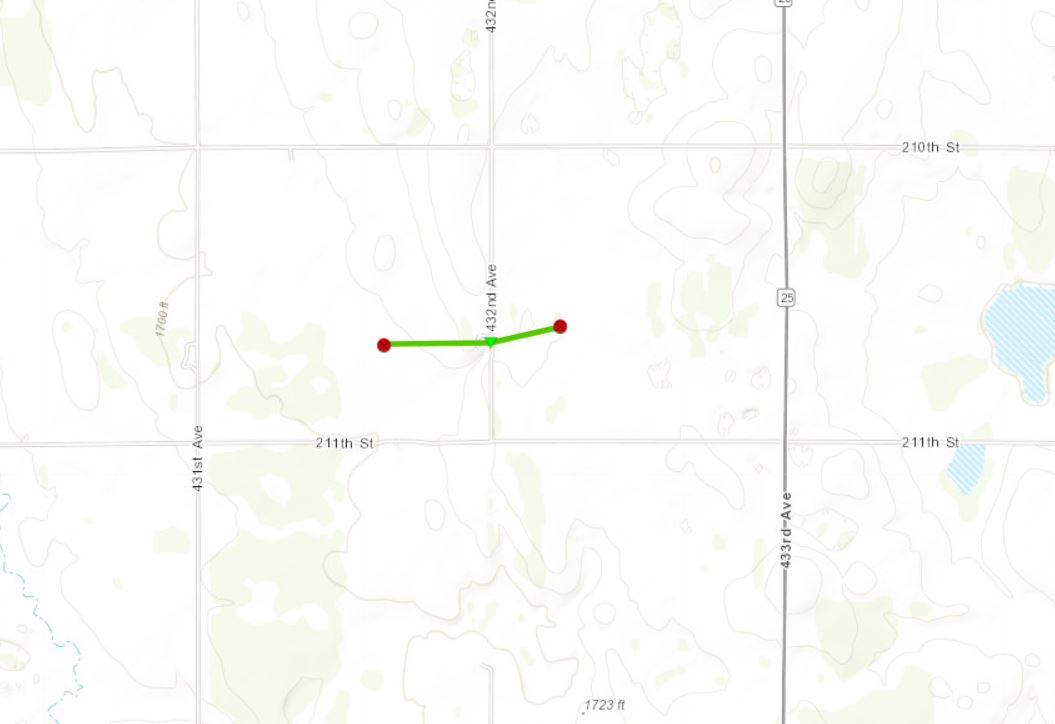 
|
||||||||||||||||
|
Tornado - #2
Track Map 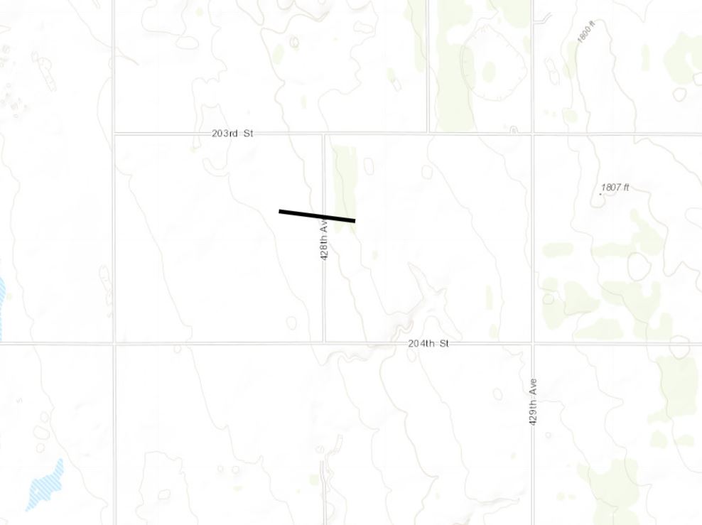
|
||||||||||||||||
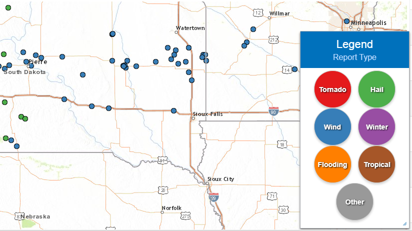
Storm Reports
PRELIMINARY LOCAL STORM REPORT...SUMMARY
NATIONAL WEATHER SERVICE SIOUX FALLS SD
342 PM CDT FRI AUG 28 2020

..TIME...   ...EVENT...      ...CITY LOCATION...     ...LAT.LON...
..DATE...   ....MAG....      ..COUNTY LOCATION..ST.. ...SOURCE....
            ..REMARKS..

1240 AM     TSTM WND GST     1 S KIMBALL             43.74N 98.96W
08/28/2020  M52 MPH          BRULE              SD   MESONET


1254 AM     TSTM WND GST     3 NNW WOLSEY            44.46N 98.50W
08/28/2020  M61 MPH          BEADLE             SD   MESONET


1256 AM     TSTM WND DMG     1 S HURON               44.35N 98.21W
08/28/2020                   BEADLE             SD   PUBLIC

            SOCIAL MEDIA REPORT OF POWER POLE SNAPPED
            WITH PICTURE.
1256 AM     TSTM WND DMG     2 WNW HURON             44.38N 98.26W
08/28/2020                   BEADLE             SD   PUBLIC

            PART OF GARAGE ROOF TORN OFF.
            CAR...CAMPER...AND BOAT ROLLED OVER NEAR
            HOUSE.
1258 AM     TSTM WND GST     2 WNW HURON             44.37N 98.25W
08/28/2020  M80 MPH          BEADLE             SD   PUBLIC

            DAVIS PERSONAL WEATHER STATION.

1258 AM     TSTM WND GST     2 NNW HURON             44.39N 98.23W
08/28/2020  M84 MPH          BEADLE             SD   ASOS


0100 AM     TSTM WND GST     5 W PLANKINTON          43.71N 98.58W
08/28/2020  M55 MPH          AURORA             SD   MESONET


0103 AM     TSTM WND GST     7 NE HURON              44.46N 98.17W
08/28/2020  E70 MPH          BEADLE             SD   TRAINED SPOTTER

            WINDS ESTIMATED 70+ MPH.

0114 AM     TSTM WND GST     3 E CAVOUR              44.37N 97.98W
08/28/2020  M75 MPH          BEADLE             SD   MESONET


0132 AM     TSTM WND DMG     4 N DE SMET             44.44N 97.55W
08/28/2020                   KINGSBURY          SD   EMERGENCY MNGR

            TIPPED OVER TRAILER. SIDING RIPPED OFF TIN
            SHED. SOME TREE DAMAGE.

0152 AM     TSTM WND DMG     BADGER                  44.48N 97.21W
08/28/2020                   KINGSBURY          SD   PUBLIC

            2-6 INCH BRANCHES DOWN.

0155 AM     TSTM WND DMG     5 NE ARLINGTON          44.41N 97.06W
08/28/2020                   BROOKINGS          SD   PUBLIC

            SOCIAL MEDIA PICTURE SHARED OF TREE CRUSHING
            A SWING SET. NOTED THAT SEVERAL TREES WERE
            DOWN ON PROPERTY.

0203 AM     TSTM WND DMG     BRUCE                   44.44N 96.89W
08/28/2020                   BROOKINGS          SD   EMERGENCY MNGR

            REPORTED TREE DAMAGE IN TOWN.

0207 AM     TSTM WND GST     2 SW BROOKINGS          44.28N 96.82W
08/28/2020  M54 MPH          BROOKINGS          SD   AWOS


0213 AM     TSTM WND GST     3 SE MONTROSE           43.67N 97.15W
08/28/2020  M58 MPH          MCCOOK             SD   MESONET


0217 AM     TSTM WND GST     10 SSW AURORA           44.15N 96.76W
08/28/2020  M58 MPH          MOODY              SD   MESONET


0221 AM     TSTM WND GST     8 NE WHITE              44.51N 96.53W
08/28/2020  M59 MPH          BROOKINGS          SD   MESONET


0225 AM     TSTM WND GST     3 SSW HENDRICKS         44.46N 96.44W
08/28/2020  M62 MPH          LINCOLN            MN   MESONET
 |
Media use of NWS Web News Stories is encouraged! Please acknowledge the NWS as the source of any news information accessed from this site. |
|


 Weather Story
 Weather Map
 Local Radar