Overview
|
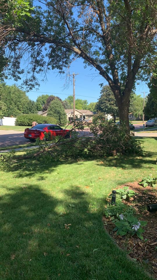
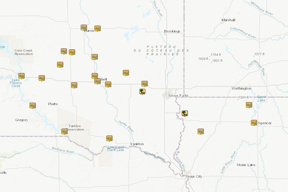
A bowing line of storms developed in north central Nebraska and south central South Dakota late Saturday evening. This line pushed across southeast South Dakota overnight, weakening as it moved into southwest Minnesota and northwest Iowa early Sunday morning. Widespread reports of 55 to 70 mph winds were received, with the highest winds focused near the I-90 corridor between Chamberlain and Alexandria, SD. The winds resulted in mainly tree damage, with isolated reports of damage to grain bins and metal buildings. |
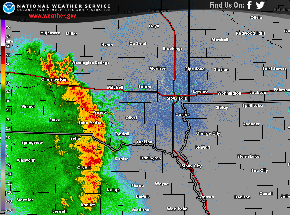 Radar Image at the time of outbuilding damage southeast of Armour. |
Wind Damage:
Widespread reports of 55 to 70 mph winds were received, with the highest wind reports focused near the I-90 corridor between Chamberlain and Alexandria, SD.
 |
 |
 |
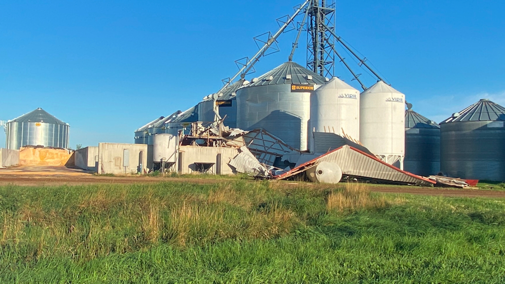 |
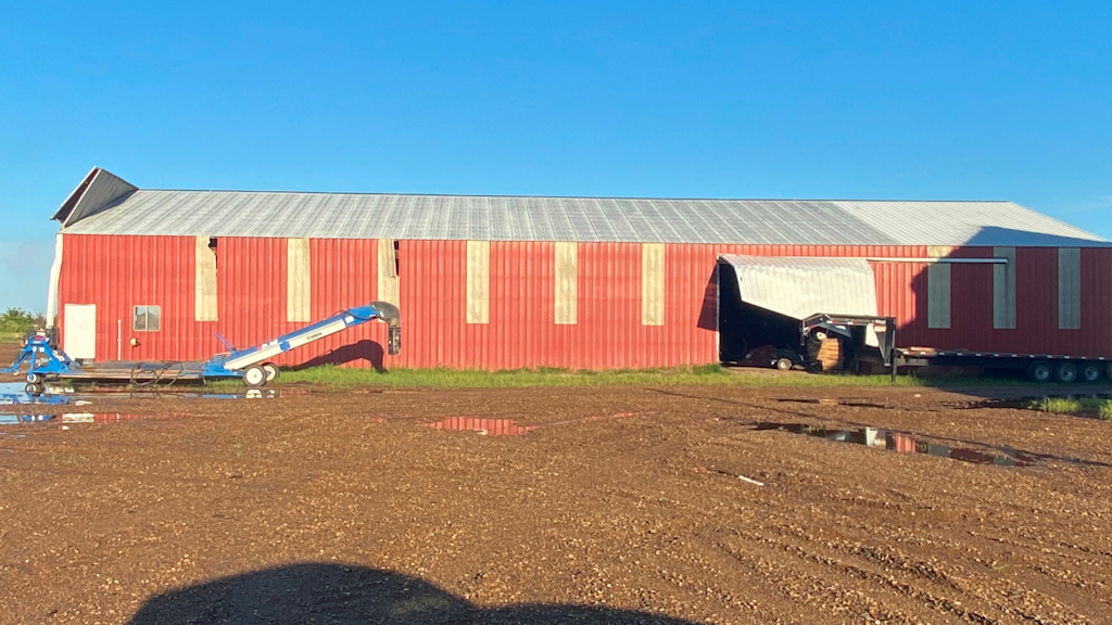
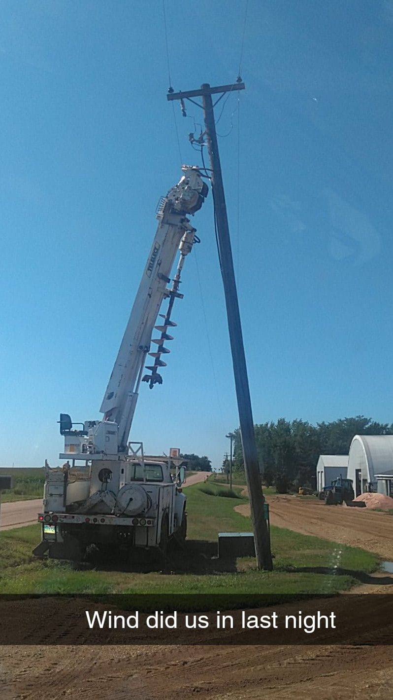
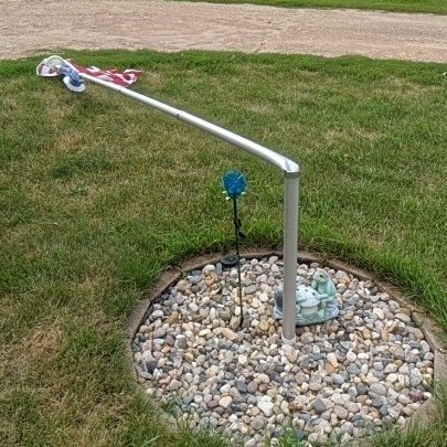
| Farm outbuildings damaged southeast of Armour (photos courtesy Douglas County Emergency Management) | |||
 |
 |
 |
 |
 |
 |
| Mitchell, SD (M. Culhane) |
Montrose, SD (J.B. Hagemann) |
Dell Rapids, SD (K. Larson) |
Parker, SD (S. Merrill) |
Inwood, IA (A. Evans) |
Lake Park, IA (M. Ehret) |
Radar & Warnings
 |
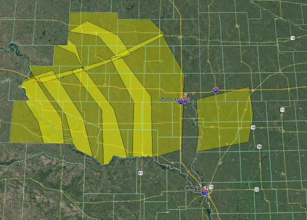 |
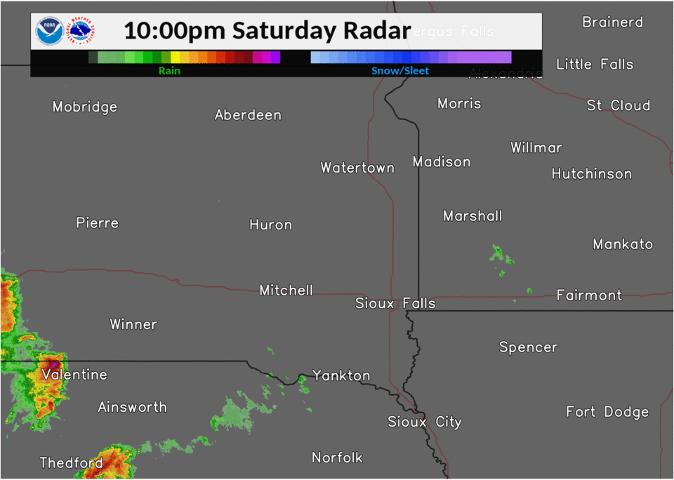
| Radar Loop from 10 pm Saturday Evening to 4 am Sunday morning | Map of Severe Thunderstorm Warnings issued by NWS Sioux Falls |
Storm Reports
PRELIMINARY LOCAL STORM REPORT...SUMMARY
NATIONAL WEATHER SERVICE SIOUX FALLS SD
1229 PM CDT SUN AUG 9 2020

..TIME...   ...EVENT...      ...CITY LOCATION...     ...LAT.LON...
..DATE...   ....MAG....      ..COUNTY LOCATION..ST.. ...SOURCE....
            ..REMARKS..

1255 PM     TSTM WND GST     MINNEOTA                44.56N 95.98W
08/08/2020  E60 MPH          LYON               MN   PUBLIC

            REPORT VIA SOCIAL MEDIA.

0109 PM     TSTM WND DMG     6 ENE MINNEOTA          44.61N 95.87W
08/08/2020                   LYON               MN   TRAINED SPOTTER

            LARGE TREE TOPPLED ON FARMSTEAD.

0109 PM     TSTM WND GST     2 W MARSHALL            44.46N 95.83W
08/08/2020  M51 MPH          LYON               MN   AWOS


0114 PM     TSTM WND GST     1 NE MARSHALL           44.46N 95.78W
08/08/2020  M55 MPH          LYON               MN   MESONET


1159 PM     TSTM WND GST     14 W PLATTE             43.39N 99.12W
08/08/2020  M60 MPH          CHARLES MIX        SD   MESONET


1214 AM     TSTM WND GST     2 WSW PICKSTOWN         43.06N 98.56W
08/09/2020  M60 MPH          GREGORY            SD   MESONET


1215 AM     TSTM WND GST     3 S CHAMBERLAIN         43.77N 99.32W
08/09/2020  M67 MPH          BRULE              SD   ASOS


1224 AM     TSTM WND GST     1 S KIMBALL             43.74N 98.96W
08/09/2020  M58 MPH          BRULE              SD   MESONET


1228 AM     TSTM WND DMG     4 SE ARMOUR             43.29N 98.29W
08/09/2020                   DOUGLAS            SD   EMERGENCY MNGR

            SEVERAL FARM OUTBUILDINGS.
1239 AM     TSTM WND GST     5 NNE STICKNEY          43.65N 98.39W
08/09/2020  M68 MPH          AURORA             SD   MESONET

            PERSONAL WEATHER STATION KSDPLANK3.

1241 AM     TSTM WND GST     12 SSW WESSINGTON SPRIN 43.91N 98.64W
08/09/2020  M60 MPH          AURORA             SD   MESONET

            PERSONAL WEATHER STATION (KSDWESSI5).

1257 AM     TSTM WND GST     WESSINGTON SPRINGS      44.08N 98.57W
08/09/2020  E60 MPH          JERAULD            SD   PUBLIC

            BRANCHES DOWN WITH TREE DEBRIS BLOWN ACROSS
            THE STREET. ESTIMATED WIND SPEED OF 60 MPH.

1259 AM     TSTM WND GST     3 SE MITCHELL           43.70N 97.98W
08/09/2020  M72 MPH          DAVISON            SD   MESONET

            PERSONAL WEATHER STATION (KSDMITCH21).

1259 AM     TSTM WND GST     LANE                    44.07N 98.43W
08/09/2020  M56 MPH          JERAULD            SD   MESONET

            PERSONAL WEATHER STATION (KSDLANE2).

0104 AM     TSTM WND GST     1 NNW ALEXANDRIA        43.66N 97.79W
08/09/2020  E65 MPH          HANSON             SD   STORM CHASER

            MEASURED WIND GUST TO 65 MPH.

0105 AM     TSTM WND GST     5 ESE TYNDALL           42.97N 97.77W
08/09/2020  M58 MPH          BON HOMME          SD   MESONET


0110 AM     TSTM WND GST     4 ESE FORESTBURG        44.01N 98.03W
08/09/2020  M60 MPH          SANBORN            SD   MESONET


0114 AM     TSTM WND GST     3 N MITCHELL            43.77N 98.03W
08/09/2020  M54 MPH          DAVISON            SD   ASOS

            KMHE ASOS.

0125 AM     TSTM WND GST     5 SSE CANOVA            43.81N 97.48W
08/09/2020  M53 MPH          MCCOOK             SD   MESONET

            PERSONAL WEATHER STATION (KSDCANOV2).

0128 AM     TSTM WND GST     1 N HURON               44.38N 98.22W
08/09/2020  M56 MPH          BEADLE             SD   ASOS

            KHON ASOS.

0132 AM     TSTM WND DMG     5 ESE CANISTOTA         43.57N 97.19W
08/09/2020                   MCCOOK             SD   PUBLIC

            TREE BRANCHES DOWN AND GRAIN BIN LIDS RIPPED
            OFF. TIME ESTIMATED BASED ON RADAR. REPORTED
            VIA SOCIAL MEDIA.

0133 AM     TSTM WND GST     3 E CAVOUR              44.37N 97.98W
08/09/2020  E54 MPH          BEADLE             SD   MESONET


0209 AM     TSTM WND GST     3 SE MONTROSE           43.67N 97.15W
08/09/2020  M51 MPH          MCCOOK             SD   MESONET


0222 AM     TSTM WND DMG     INWOOD                  43.29N 96.44W
08/09/2020                   LYON               IA   PUBLIC

            CORRECTS PREVIOUS TSTM WND DMG REPORT FROM
            INWOOD. SNAPPED TREE SEVERAL FEET OFF THE
            GROUND. TIME ESTIMATED BASED ON RADAR.
            RECEIVED VIA SOCIAL MEDIA.

0235 AM     TSTM WND GST     1 SSE SIOUX CENTER      43.06N 96.16W
08/09/2020  M50 MPH          SIOUX              IA   MESONET

            PERSONAL WEATHER STATION (KIASIOUX79).

0325 AM     TSTM WND GST     3 SSE LAKE PARK         43.40N 95.31W
08/09/2020  M50 MPH          DICKINSON          IA   EMERGENCY MNGR


0337 AM     TSTM WND GST     4 WNW SPENCER           43.17N 95.22W
08/09/2020  M51 MPH          CLAY               IA   ASOS
 |
Media use of NWS Web News Stories is encouraged! Please acknowledge the NWS as the source of any news information accessed from this site. |
|


 Weather Story
 Weather Map
 Local Radar