Sioux Falls, SD
Weather Forecast Office
Overview
|
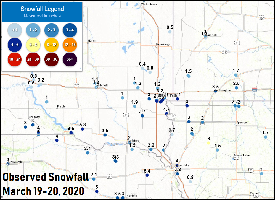
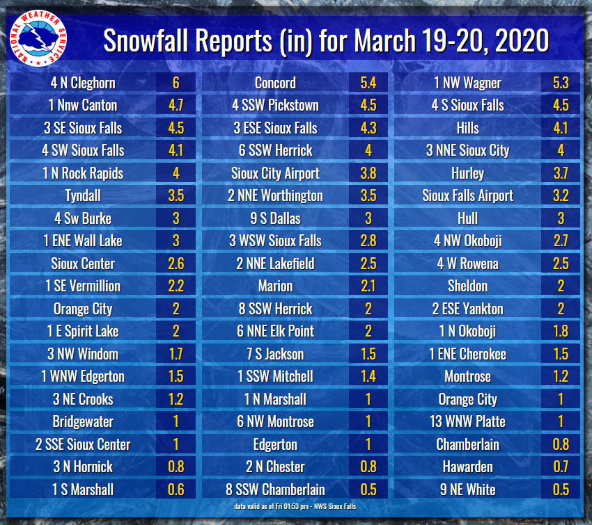
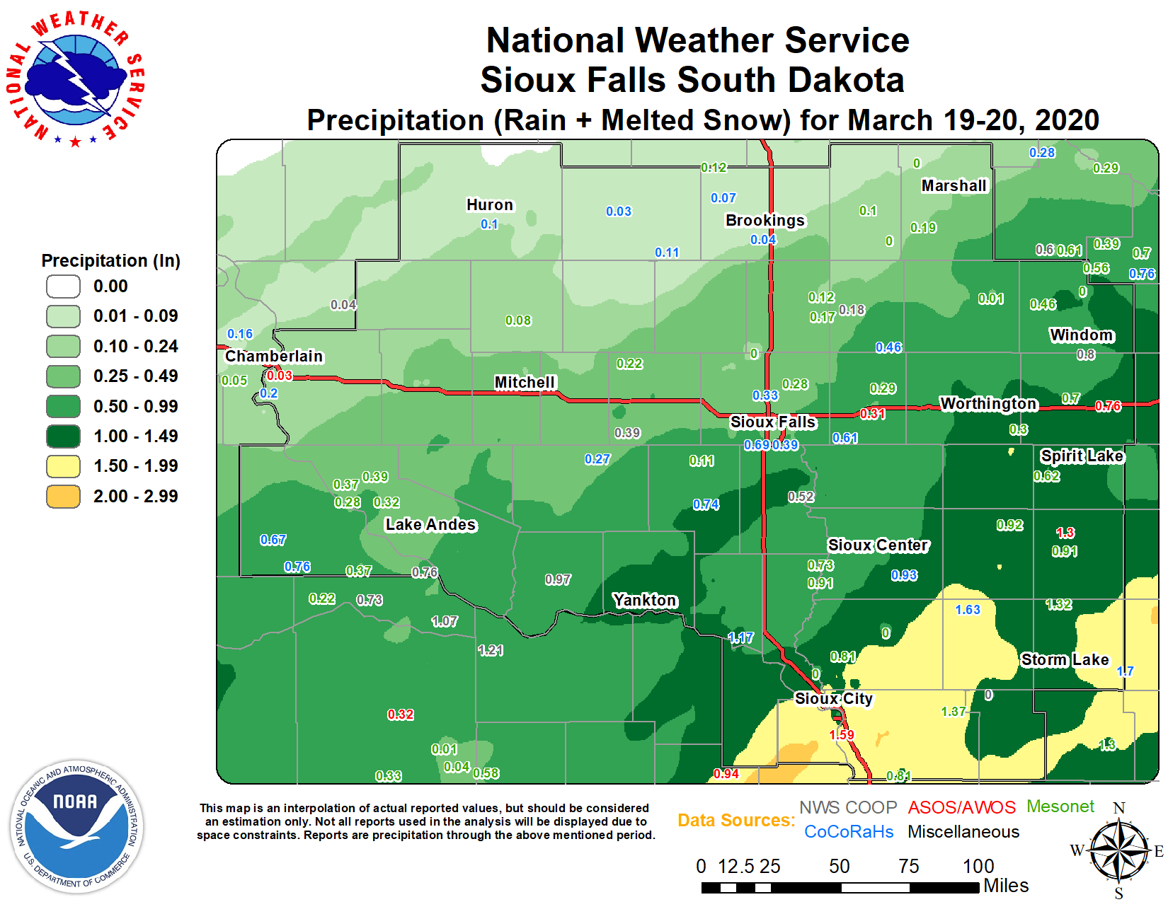
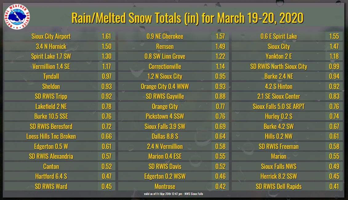
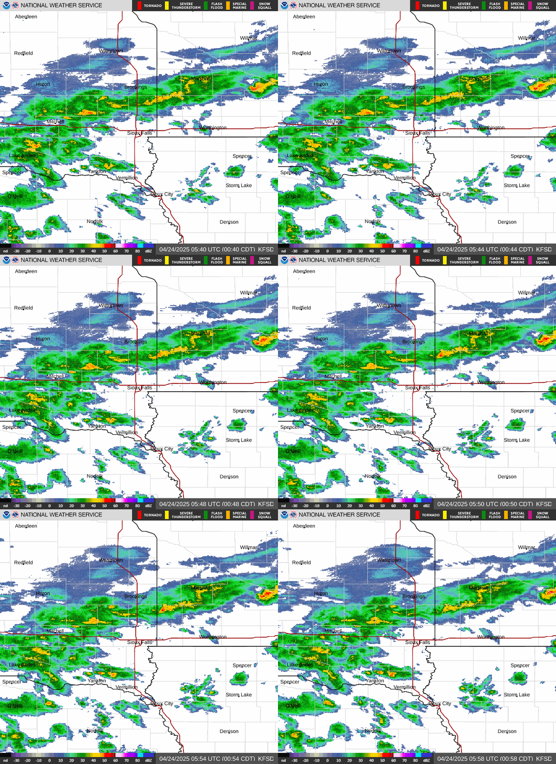
A strong late-season storm system brought rain, a few thunderstorms, gusty winds and snow to the region on March 19, 2020, which happened to be the 1st day of Spring this year! The heaviest rainfall occurred over northwest Iowa, where several locations reported 1-1.5 inches of rain and/or melted snow. This includes a new daily record precipitation in Sioux City for March 19th. Overall snowfall amounts were in the 1-4 inch range, with a couple of embedded heavier bands with isolated amounts of 4-6 inches. |
|
Snow/Ice
Radar
Header
 |
 |
 |
 |
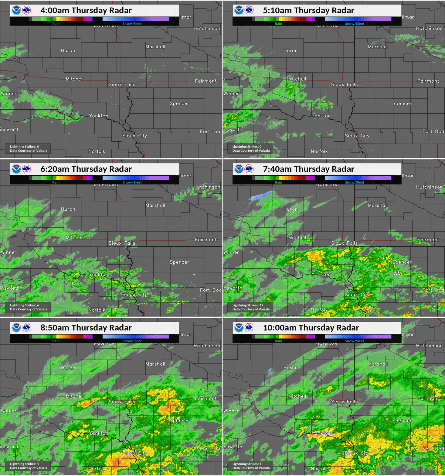
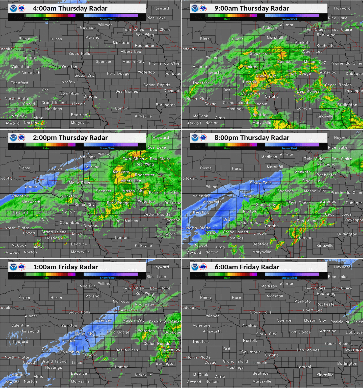
| Radar Loop 4am-10am Note the white dots, indicating detected lightning strikes |
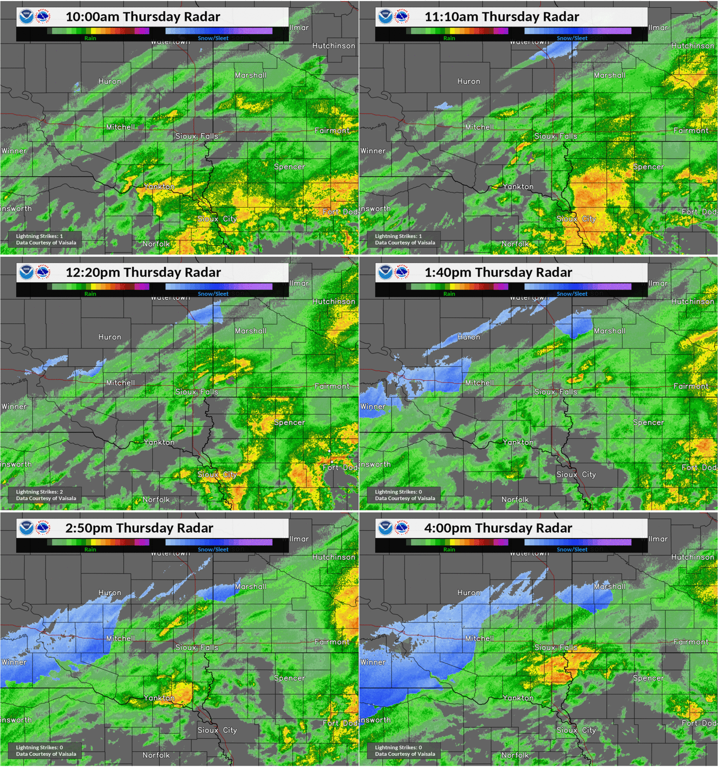
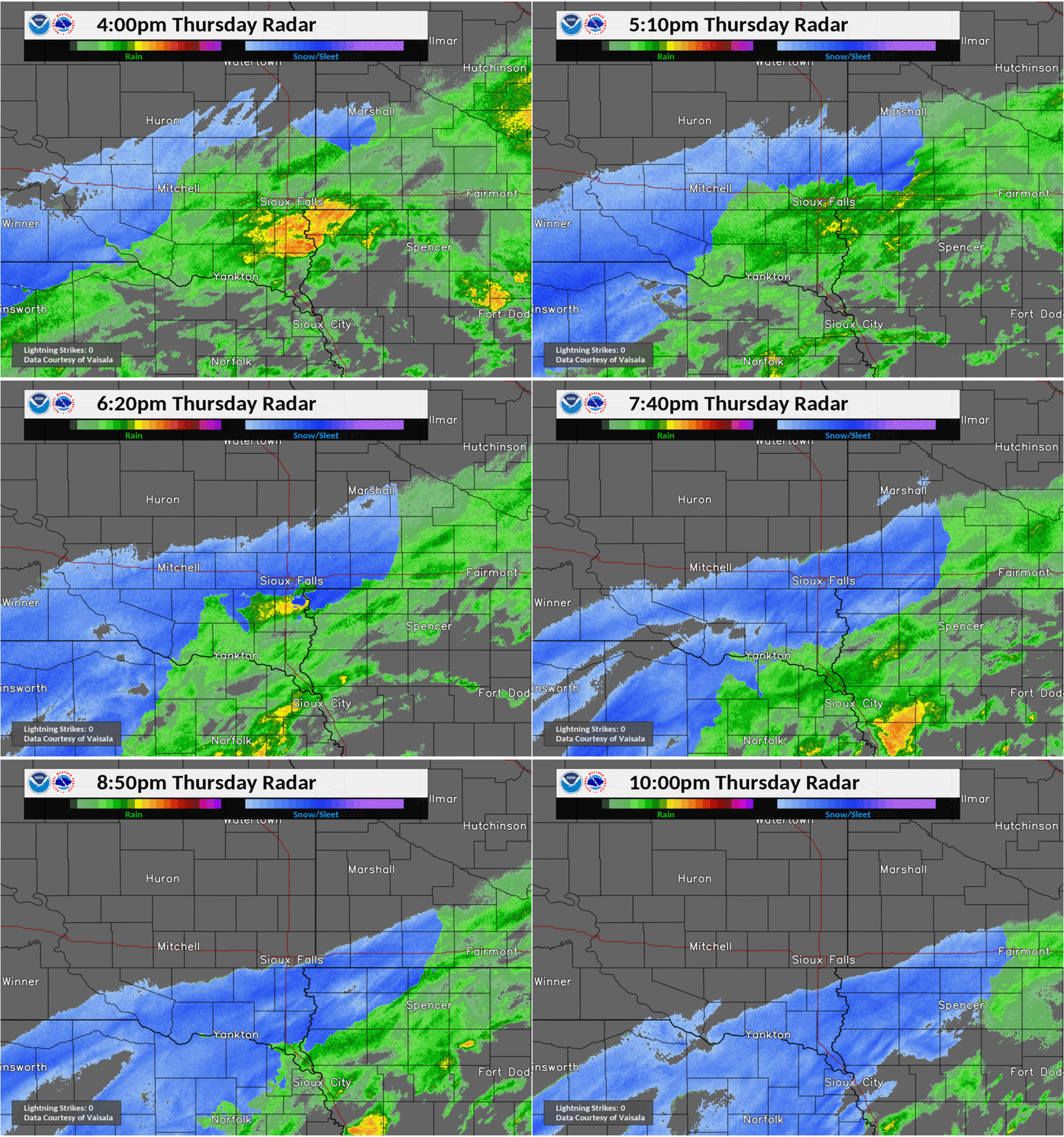
Radar Loop 10am-4pm The transition to snow begins in northwest portions of the region. |
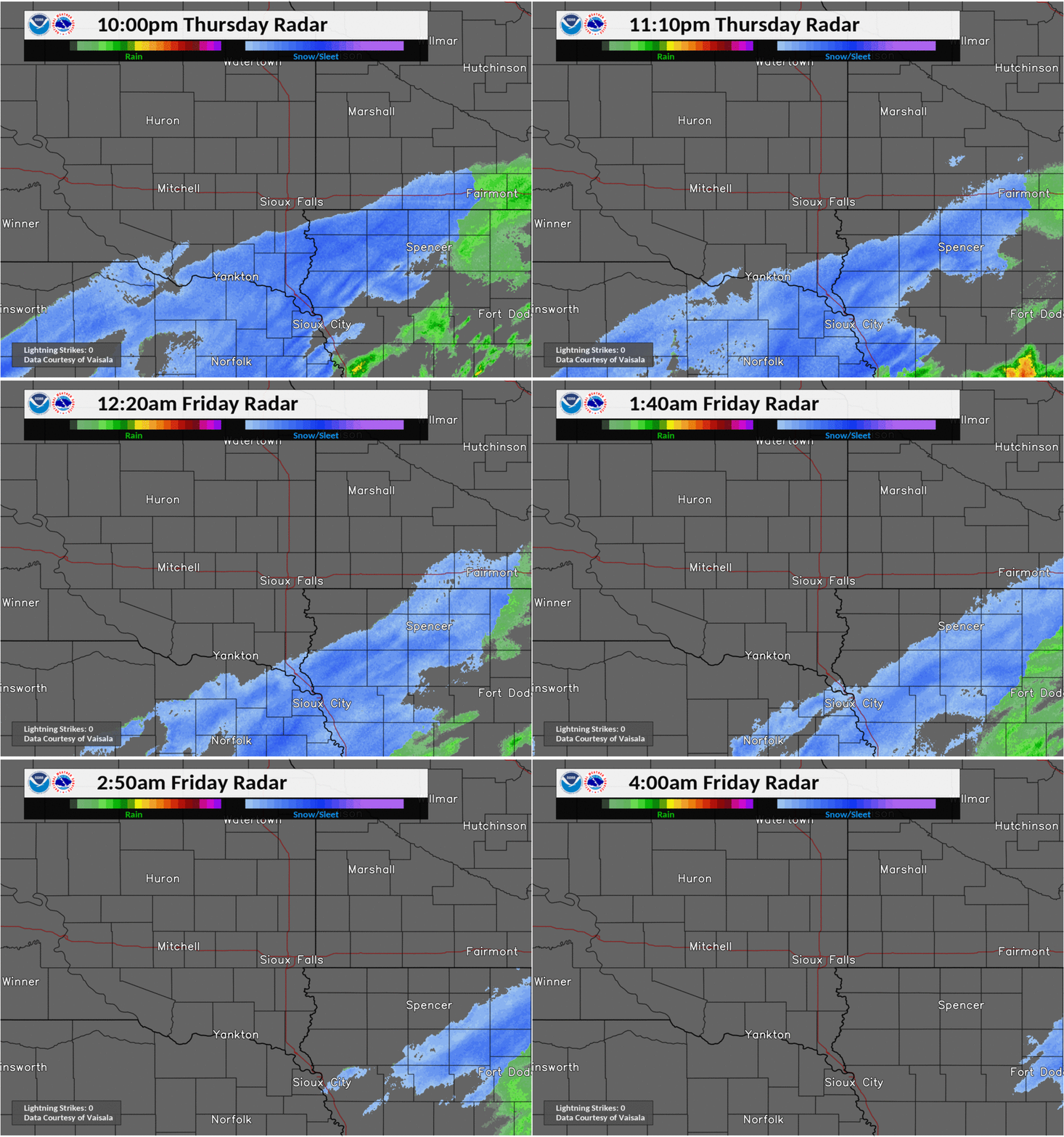
Radar Loop 4pm-10pm Most areas change over to snow during this time period. |
Radar Loop 10pm Thursday-4am Friday Transition to snow works into far southeast portions of the region before precipitation moves east of the area. |
Rain Reports
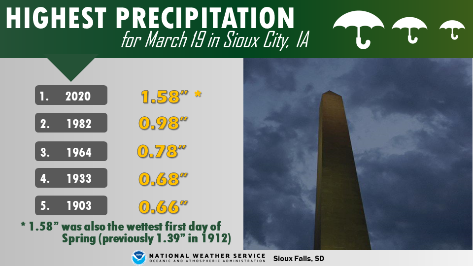
Wind:
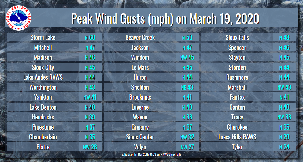
Strong winds created areas of blowing and drifting snow.
Wind
 |
Media use of NWS Web News Stories is encouraged! Please acknowledge the NWS as the source of any news information accessed from this site. |
 |
Popular Pages
Past Weather Events
Regional Weather Roundup
Daily Temp/Precip
Hazardous Weather
Local Climate Archives
Climate Graphs and Data
Seasonal
EvapoTranspiration
Fire Weather
Grassland Fire Danger
Flooding (River)
Summer Weather
Travel Forecasts
Winter Weather
Winter Preparedness
Forecast Snowfall Graphic
Winter Temp Climatology
US Dept of Commerce
National Oceanic and Atmospheric Administration
National Weather Service
Sioux Falls, SD
26 Weather Lane
Sioux Falls, SD 57104-0198
605-330-4247
Comments? Questions? Please Contact Us.


 Weather Story
 Weather Map
 Local Radar