Overview
|
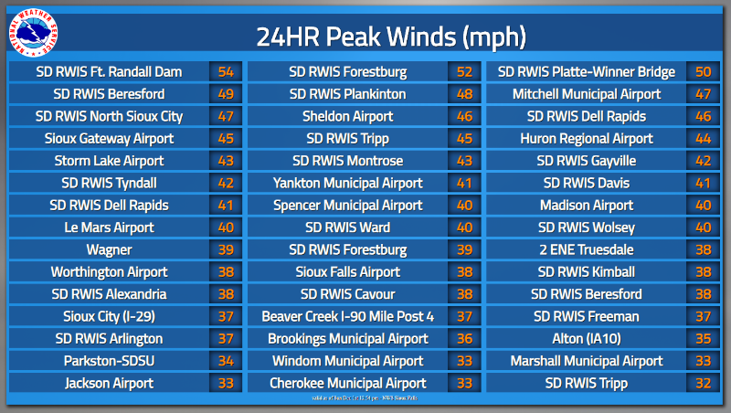
A very strong storm system moved across the region after the Thanksgiving 2019 holiday. This storm produced widespread heavy snow from far northwest Nebraska and western/central South Dakota into northern Minnesota. In some areas, the snow was accompanied or followed by wind gusts of 40 to 50+ mph, compounding post-holiday travel issues. Southeast of the heaviest snow, temperatures warmed enough on Saturday to produce rain or drizzle. However, as temperatures cooled back below freezing Saturday night, wet roads quickly became icy, resulting in additional travel headaches. |
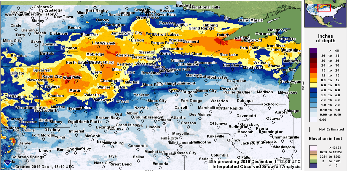 Regional 48-Hour Snowfall Map |
Snow/Wind
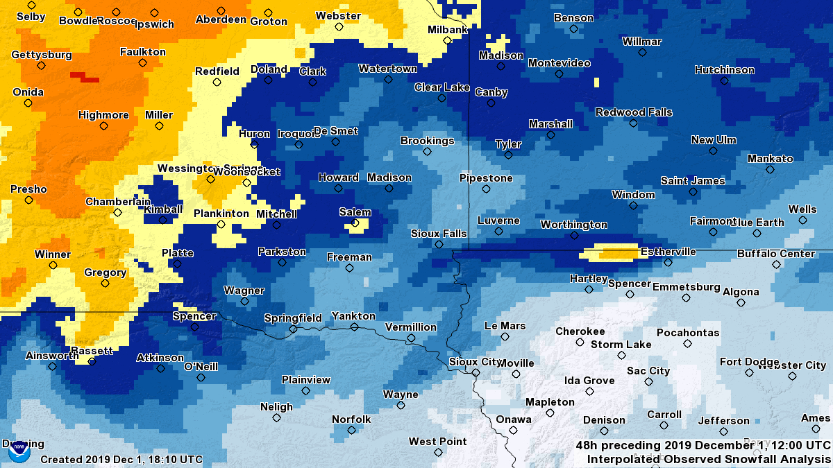
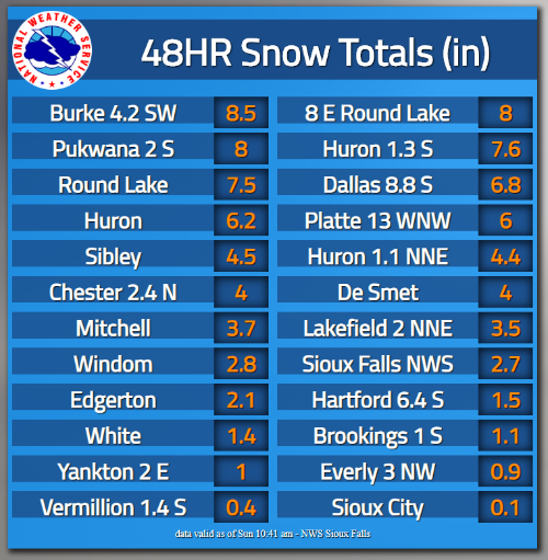
While the heaviest snow generally fell across west and north parts of the region, an isolated pocket of heavy snow impacted areas near the Minnesota/Iowa state line Saturday evening. Here, amounts averaged around 8 inches, surrounded by more widespread 1 to 3 inch reports.
Photos & Video
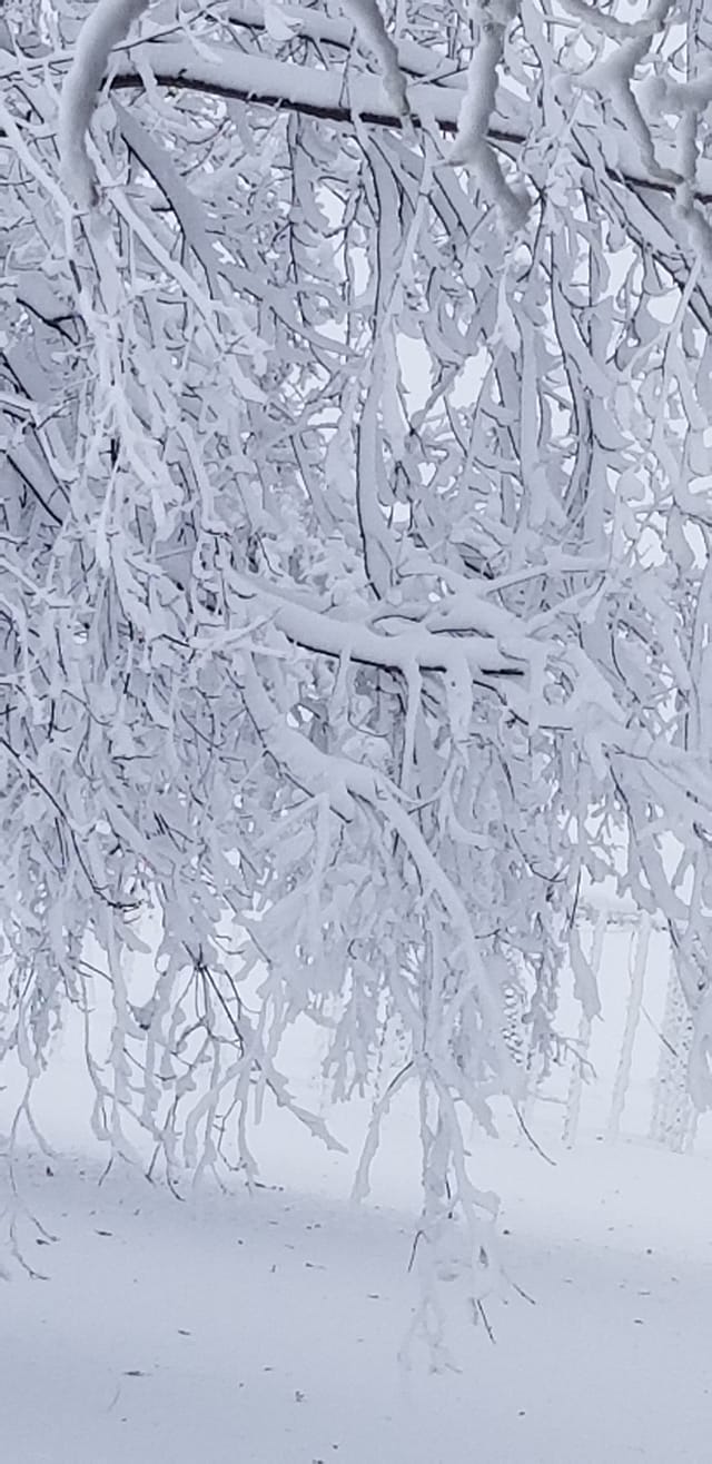
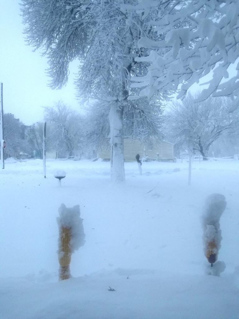
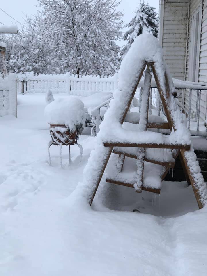
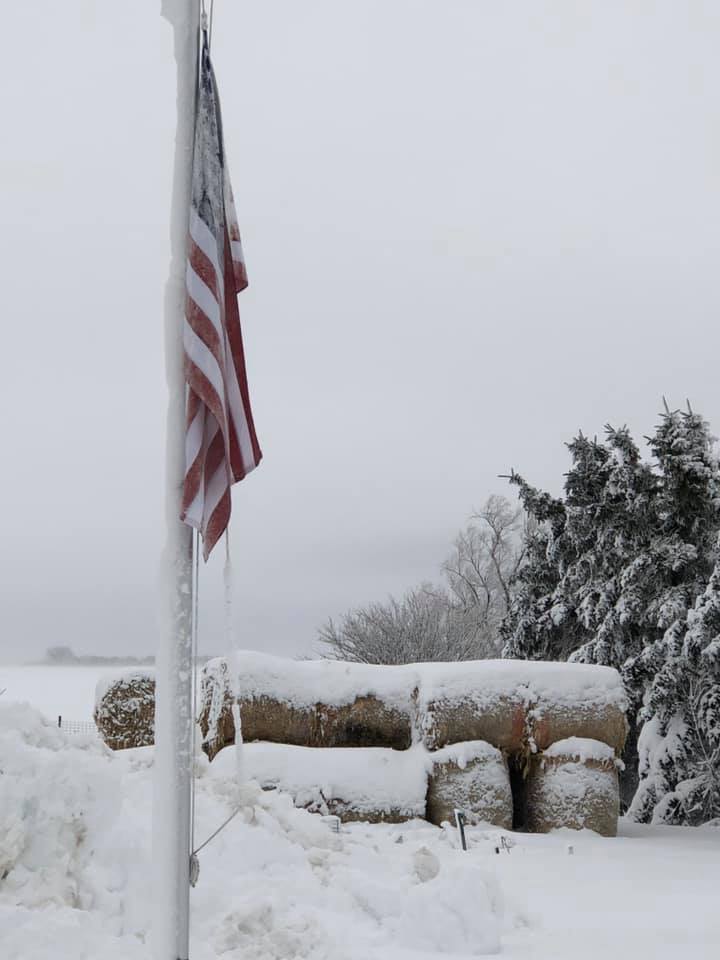
Photos from the isolated 6-8 inches of snow along the MN/IA state line Saturday evening.
 |
 |
 |
 |
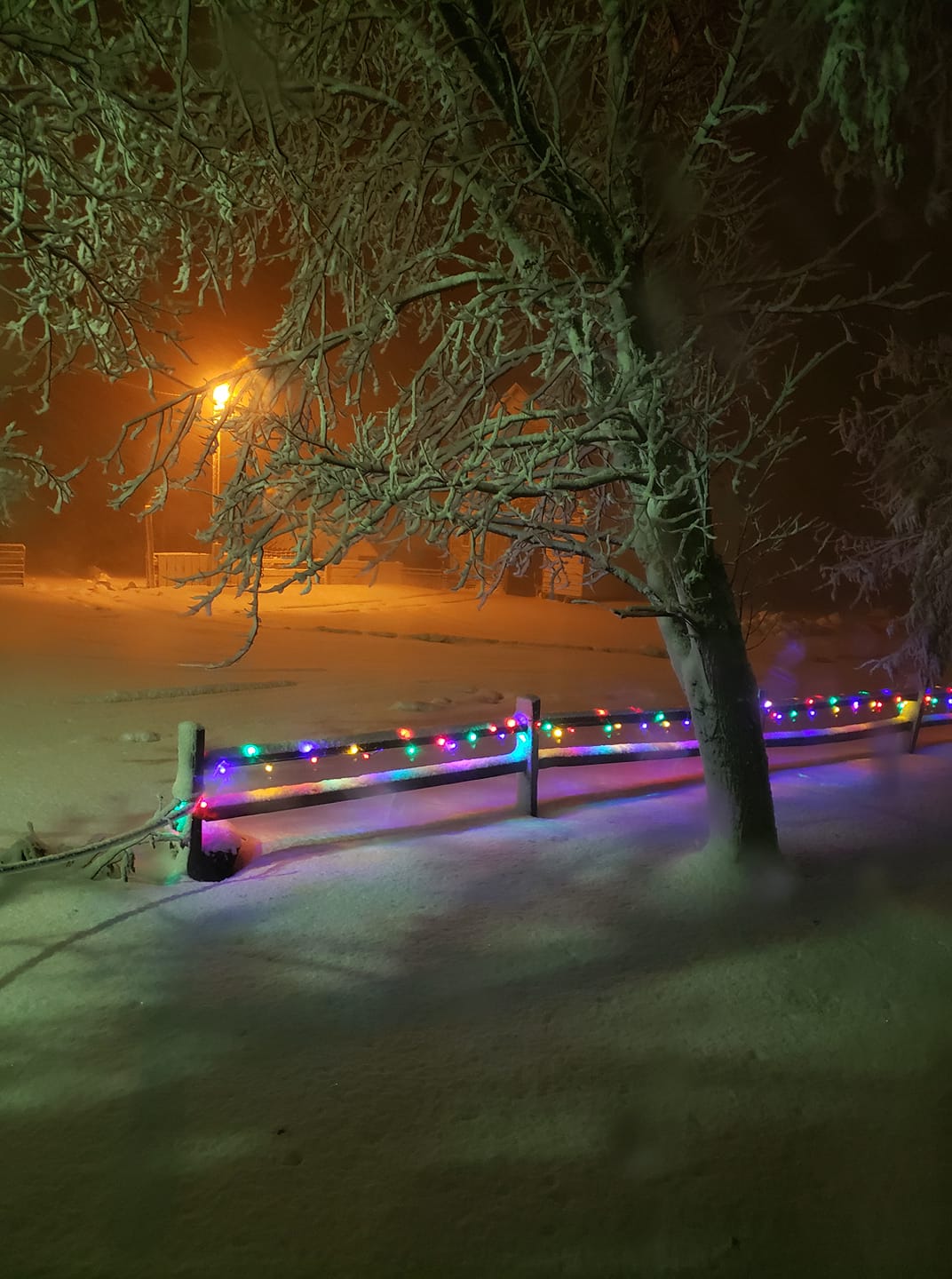 |
| North of Lake Park, IA (Roxie Lueders) |
Round Lake, MN (Ida Reimer) |
North of Lake Park, IA (Susan/Dennis Voehl) |
North of Lake Park, IA (Susan/Dennis Voehl) |
Sioux Valley, MN (Kelly Ahrenstorff) |
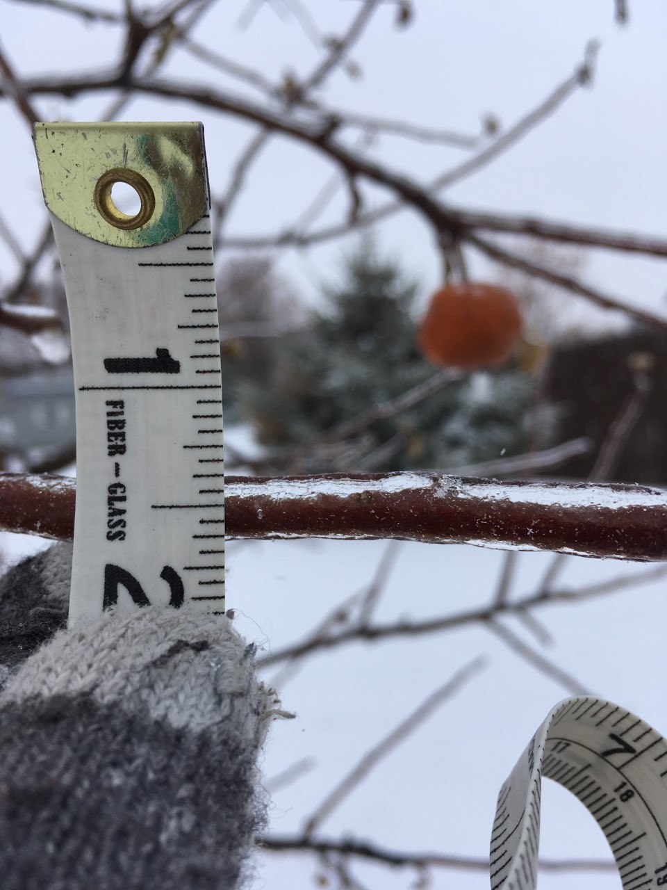
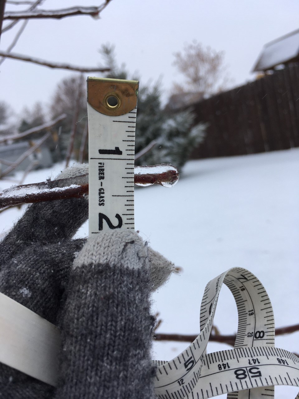
Ice-covered trees and roads
 |
 |
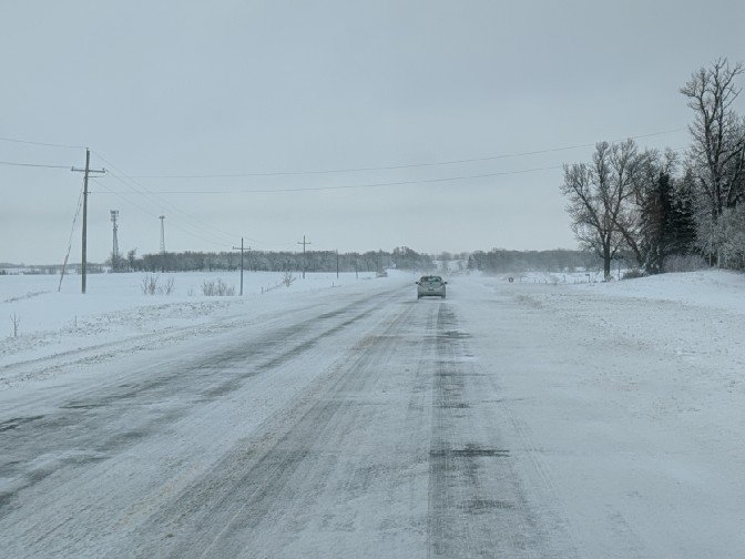 |
| Ice accumulation around Brookings due to freezing rain/drizzle Saturday | Ice accumulation around Brookings due to freezing rain/drizzle Saturday | Ice-covered roads after slush froze Saturday night (Dickinson County Emergency Management) |
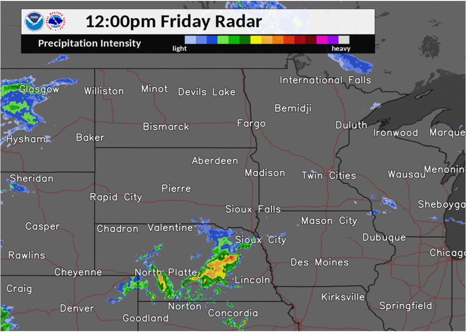
Radar
 |
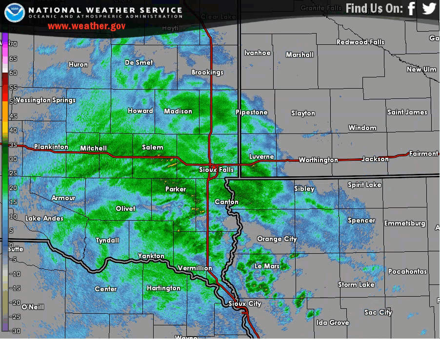 |
| Regional Radar Loop from Noon Friday through 7 am Sunday | Radar Loop from 430pm-1030pm Saturday Evening, showing the narrow band of snow pivoting over areas between Worthington and Spirit Lake |
 |
Media use of NWS Web News Stories is encouraged! Please acknowledge the NWS as the source of any news information accessed from this site. |
|


 Weather Story
 Weather Map
 Local Radar