Overview
|
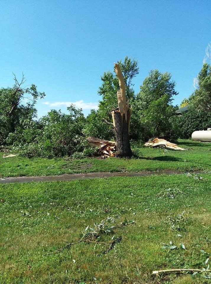
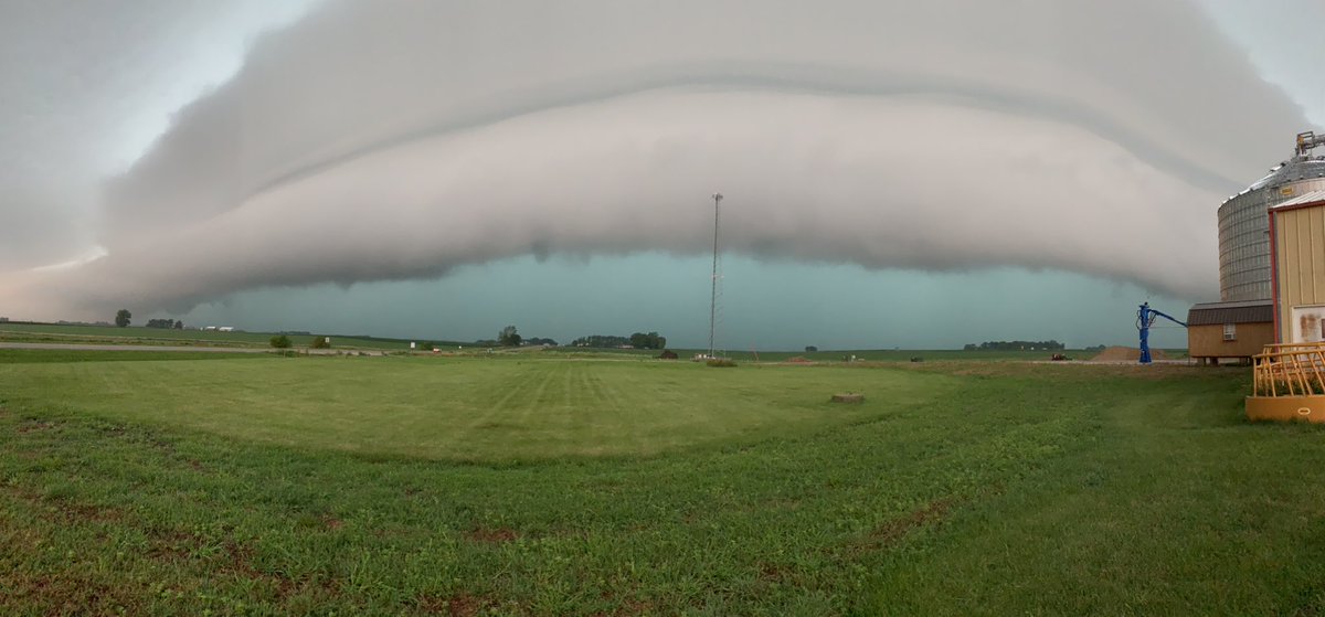
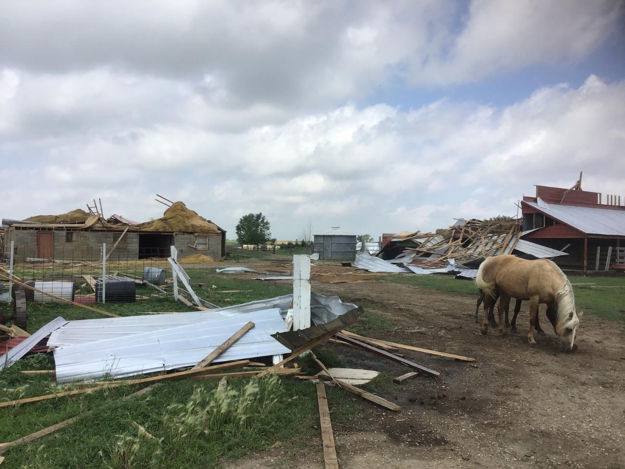
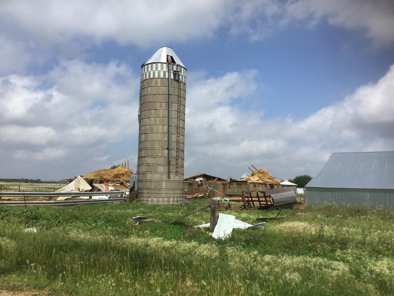
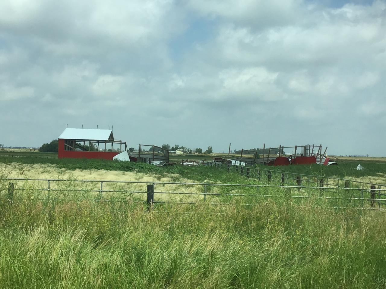
Starting early on Wednesday July 17th, 2019 a line of severe thunderstorms moved across southeast South Dakota and into northwest Iowa. While there was some small hail, damaging winds were the biggest hazard with these storms. Many reports of uprooted trees, branches ripped off, as well as some damage to farm buildings and other structures occurred as the storms moved eastward. While most of the damage that occurred was the result of severe straight line winds, a short-lived EF-1 tornado did occur 1 mile north of Tripp, SD that damaged three farmsteads. Aside from the severe threat, the storms produced very heavy rainfall causing urban flooding. |
|
Tornado
|
Tornado - Tripp, SD
Track Map 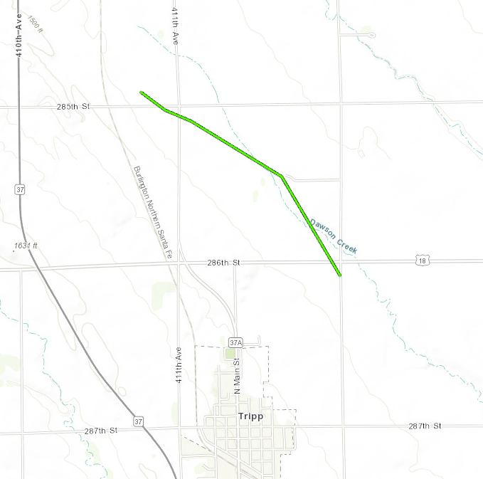 
|
||||||||||||||||
|
||||||||||||||||
Wind:
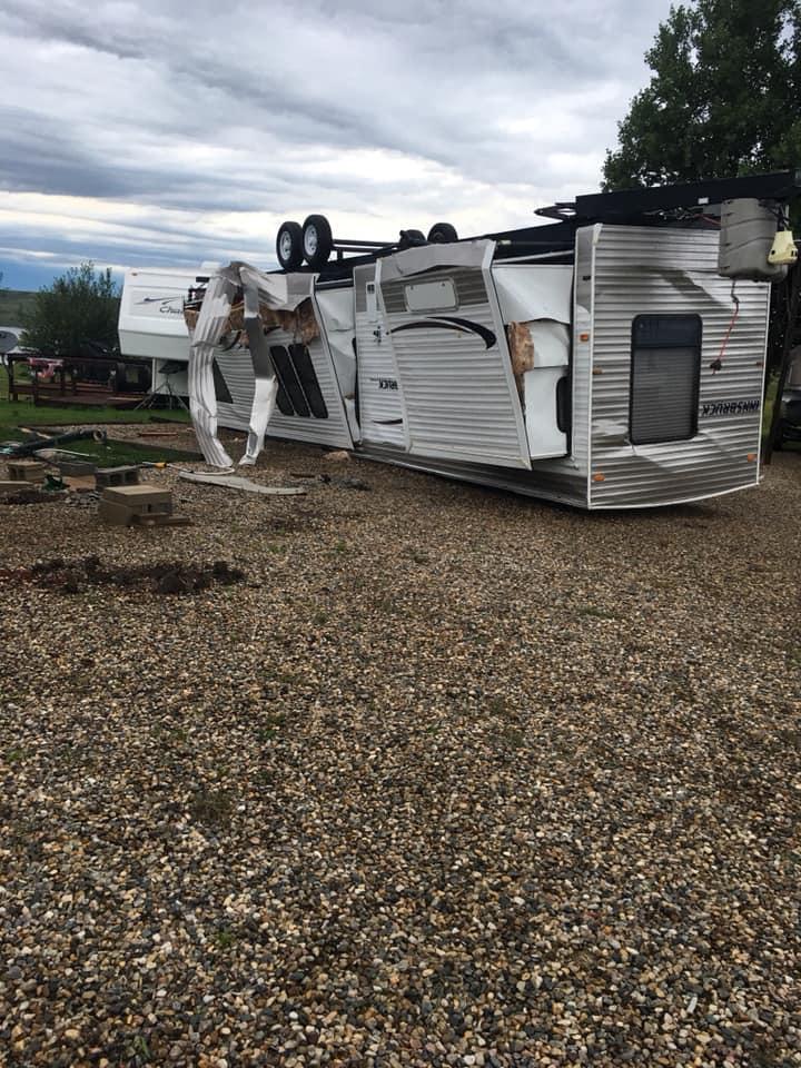
The aforementioned wind was the biggest threat with the storms. As the line of thunderstorms moved across southeast South Dakota, the line evolved into a mature squall line, evident by a bow echo signature on radar. This is a classic indicator of a storm that is capable of very strong winds. There were a couple injuries reported at the Snake Creek Campground west of Platte, SD, but no fatalities occurred.
 |
 |
 |
 |
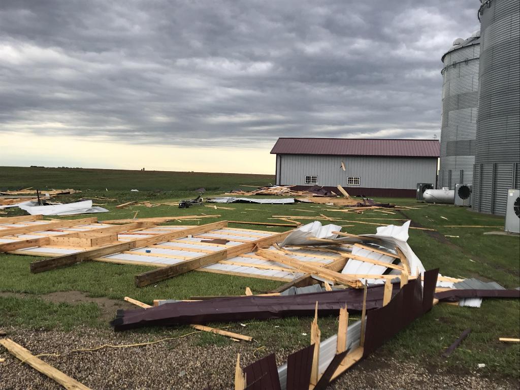
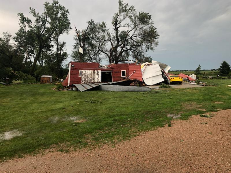
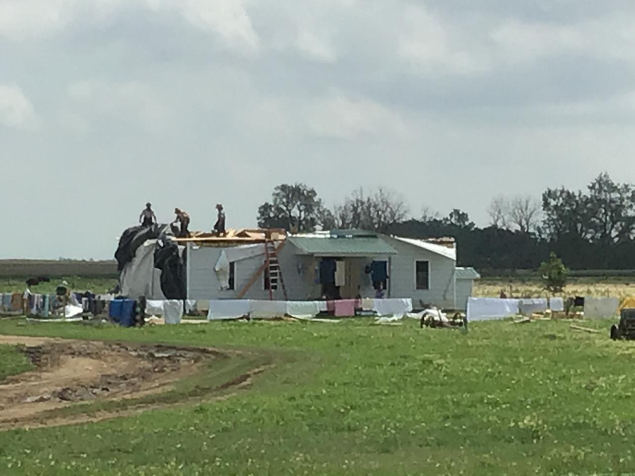
| Image Credit: Dan & McKenzie Schaefers occurred 6 miles N of Tripp, SD | Image Credit: Heather Benson occurred in Beresford, SD | Image Credit: Barbara Hoffman occurred in Delmont, SD | Image Credit: Cindy Minder-Doyle occurred at Snake Creek Campground, SD |
 |
 |
 |
 |
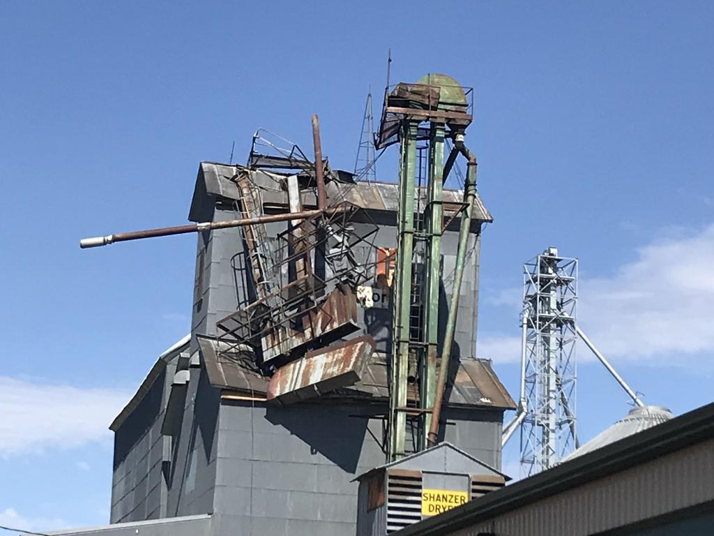
| Image Credit: Pat Harrington occurred near Armour, SD |
Image Credit: Pat Harrington occurred near Armour, SD |
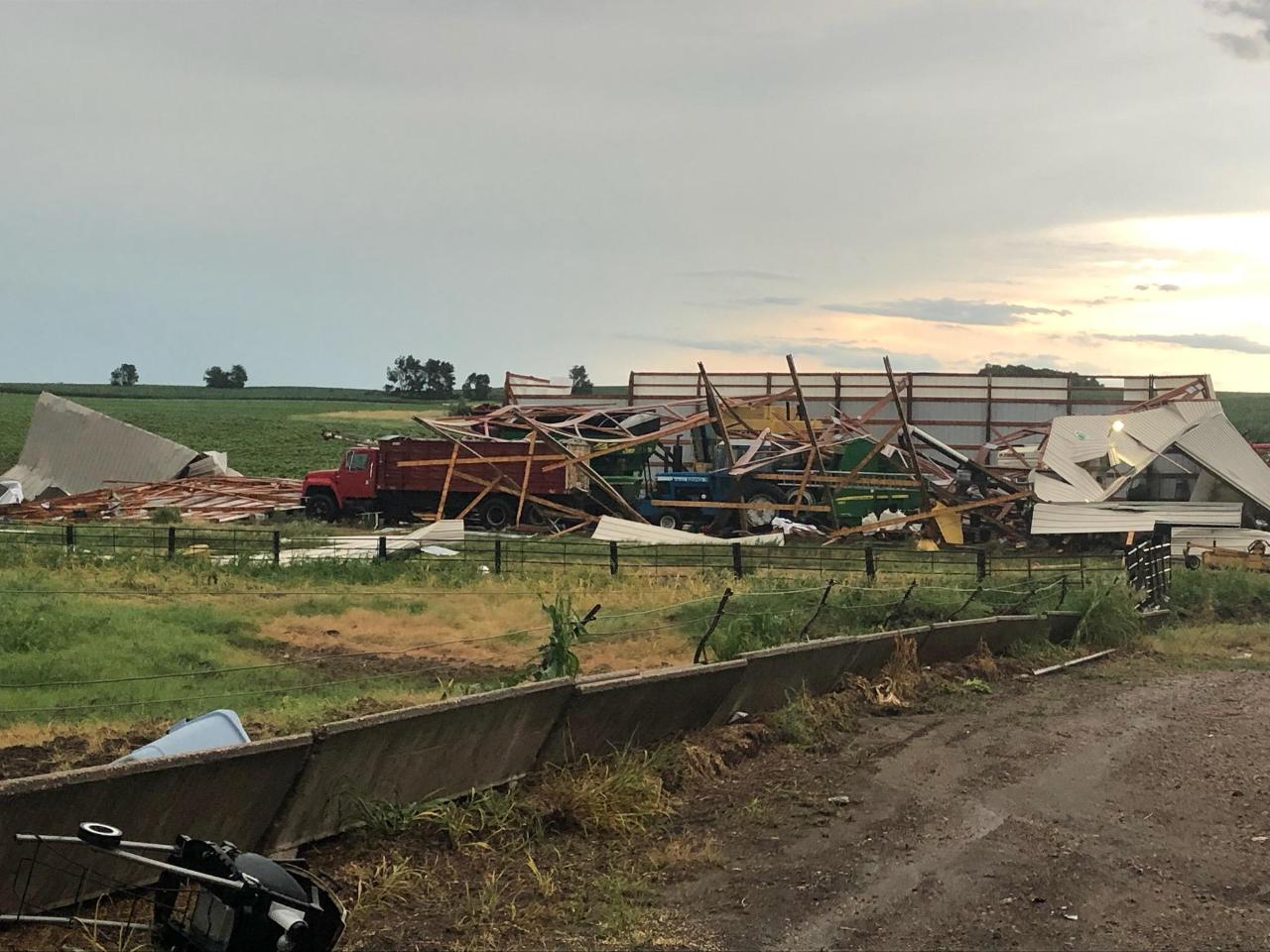
Image Credit: Mike Pollman occurred west of Wakonda, SD | Image Credit: Mike Pollman occurred east of Wakonda, SD |
Flooding
Hydrograph
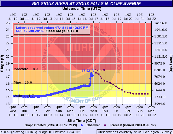 |
| Big Sioux River at North Cliff Ave in Sioux Falls |
Photos
 |
| Cars Stranded at 69th and Minnesota in Sioux Falls, SD |
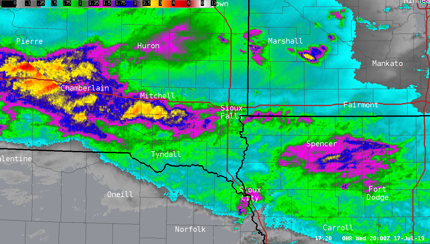
Radar
Radar Loop from 1 AM through 1 PM
Storm Reports
.
..TIME... ...EVENT... ...CITY LOCATION... ...LAT.LON...
..DATE... ....MAG.... ..COUNTY LOCATION..ST.. ...SOURCE....
..REMARKS..
0412 AM Tstm Wnd Dmg 14 W Platte 43.39N 99.12W
07/17/2019 Charles Mix SD Emergency Mngr
*** 3 Injured ***
Tree damage at Snake Creek Campground,
injuries occurred due to branches falling on
tents. Time estimated from radar.
0416 AM Tstm Wnd Gst 14 W Platte 43.39N 99.12W
07/17/2019 M115 MPH Charles Mix SD Mesonet
DOT RWIS reported 115 mph wind gust.
0416 AM Tstm Wnd Gst 1 S Kimball 43.74N 98.96W
07/17/2019 E63 MPH Brule SD Dept of Highways
0425 AM Tstm Wnd Gst 7 S Platte 43.28N 98.87W
07/17/2019 M66 MPH Charles Mix SD Public
0437 AM Tstm Wnd Gst 4 SE White Lake 43.69N 98.66W
07/17/2019 E65 MPH Aurora SD CO-OP Observer
Wind gusts up to around 65 mph during severe
thunderstorm with rainfall 1.59 inches.
0439 AM Tstm Wnd Gst 3 W Geddes 43.26N 98.76W
07/17/2019 M63 MPH Charles Mix SD Other Federal
RAWS site.
0500 AM Tstm Wnd Dmg Armour 43.32N 98.34W
07/17/2019 Douglas SD Emergency Mngr
Widespread tree damage.
0506 AM Tstm Wnd Gst Pickstown 43.06N 98.53W
07/17/2019 E70 MPH Charles Mix SD Trained Spotter
large picnic table blown over.
0508 AM Tstm Wnd Gst 2 S Armour 43.30N 98.34W
07/17/2019 E65 MPH Douglas SD Emergency Mngr
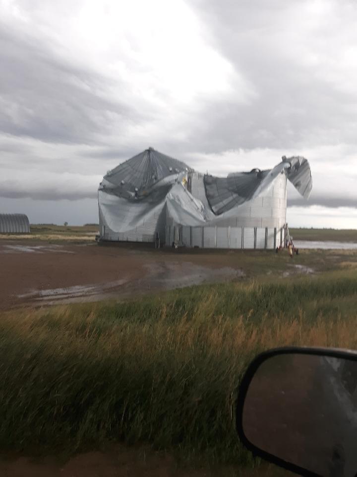
0510 AM Tstm Wnd Dmg 6 N Tripp 43.31N 97.97W
07/17/2019 Hutchinson SD Emergency Mngr
Corrects previous tstm wnd dmg report from 6
N Tripp. Two big grain bins damaged with the
roofs collapsed.
0522 AM Tstm Wnd Dmg 1 N Tripp 43.24N 97.97W
07/17/2019 Hutchinson SD Emergency Mngr
Lumber yard buildings lost part of its roof,
fences taken out.
0533 AM Tstm Wnd Gst 1 SSW Parkston 43.38N 97.99W
07/17/2019 M89 MPH Hutchinson SD Mesonet
0535 AM Tstm Wnd Dmg Tyndall 42.99N 97.87W
07/17/2019 Bon Homme SD CO-OP Observer
Tree branches and a few small limbs broken
by wind gusts during severe thunderstorm.
0545 AM Tstm Wnd Dmg Parkston 43.39N 97.99W
07/17/2019 Hutchinson SD Emergency Mngr
Several trees downed in Parkston.
0553 AM Tstm Wnd Gst 3 NNE Menno 43.27N 97.56W
07/17/2019 M80 MPH Hutchinson SD Public
0617 AM Tstm Wnd Dmg 3 WNW Wakonda 43.02N 97.16W
07/17/2019 Clay SD Fire Dept/Rescue
Destruction of farm outbuilding northwest of
Wakonda. Time estimated from radar.
0622 AM Tstm Wnd Dmg 4 ENE Wakonda 43.03N 97.04W
07/17/2019 Clay SD Fire Dept/Rescue
Wind damage at farmstead. Time estimated
from radar.
0640 AM Tstm Wnd Dmg Beresford 43.08N 96.78W
07/17/2019 Union SD Public
Large tree limb broken down on top of car by
severe thunderstorm wind gusts. Report via
social media.
0705 AM Tstm Wnd Dmg 8 SW Rock Valley 43.13N 96.43W
07/17/2019 Sioux IA Emergency Mngr
3 Powerline Poles Blown Over.
0706 AM Tstm Wnd Dmg 7 SW Rock Valley 43.13N 96.39W
07/17/2019 Sioux IA Emergency Mngr
Machine shed doors blown in, and backwall
blown out with debris going out into the
field.
0710 AM Tstm Wnd Dmg 4 NW Sioux Center 43.12N 96.23W
07/17/2019 Sioux IA Trained Spotter
Large trees downed by wind gusts.
0715 AM Tstm Wnd Dmg Sioux Center 43.08N 96.18W
07/17/2019 Sioux IA Law Enforcement
Truck blown over west of town.
0720 AM Flash Flood 4 NNE Sioux Falls 43.59N 96.70W
07/17/2019 Minnehaha SD Public
Reported via social media.
0755 AM Tstm Wnd Dmg 1 NE Sheldon 43.19N 95.84W
07/17/2019 O'Brien IA Emergency Mngr
Medium tree knocked over.
0802 AM Flash Flood 1 NNE Sioux City 42.52N 96.39W
07/17/2019 Woodbury IA Public
Report via social media. Flooding at 25th
Street and Chambers Avenue.
0815 AM Tstm Wnd Gst 1 E Anthon 42.39N 95.85W
07/17/2019 E60 MPH Woodbury IA Trained Spotter
Pea-sized hail, and a few tree branches
down.
 |
| Map of the Local Storm Reports |
$$
Rain Reports
 |
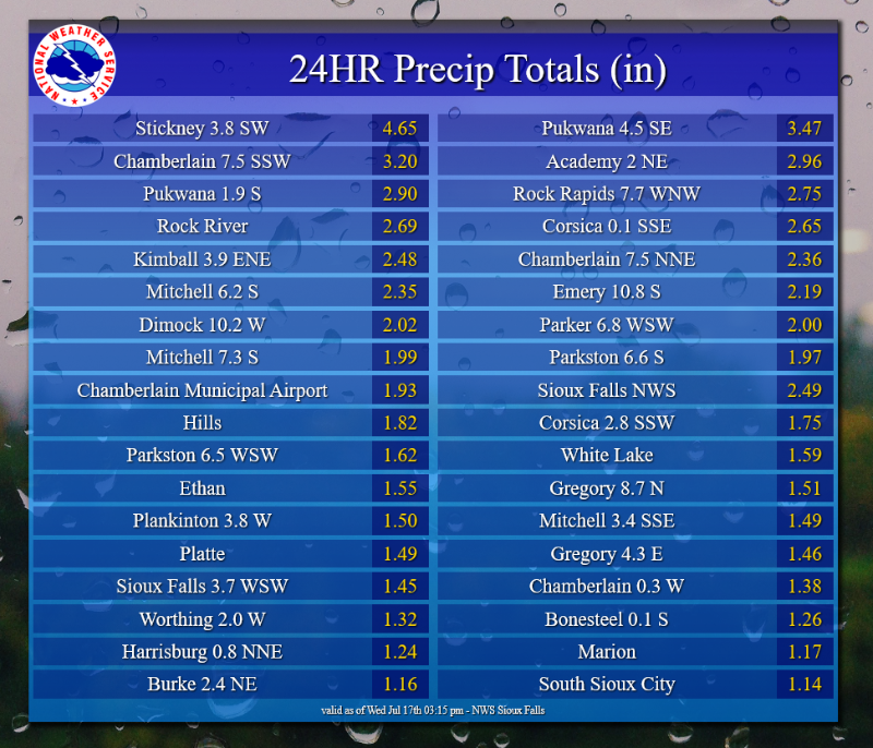 |
| Radar Estimated Rainfall Totals | 24 Hour Rain Reports |
 |
Media use of NWS Web News Stories is encouraged! Please acknowledge the NWS as the source of any news information accessed from this site. |
|


 Weather Story
 Weather Map
 Local Radar