Sioux Falls, SD
Weather Forecast Office
Overview
|
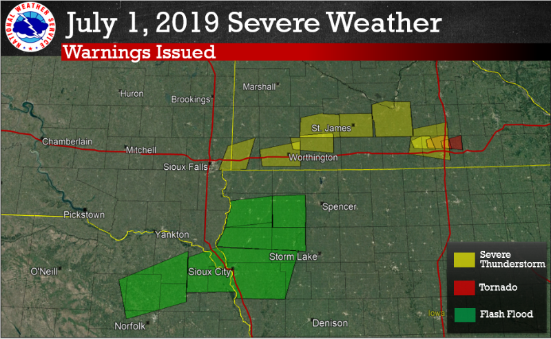
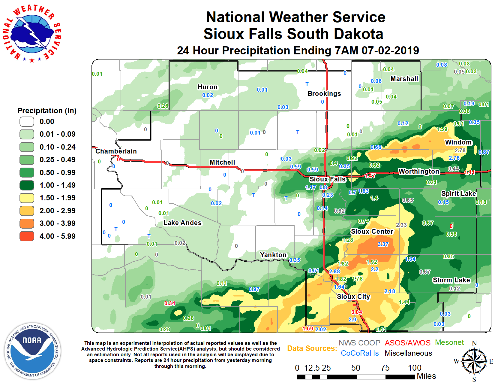
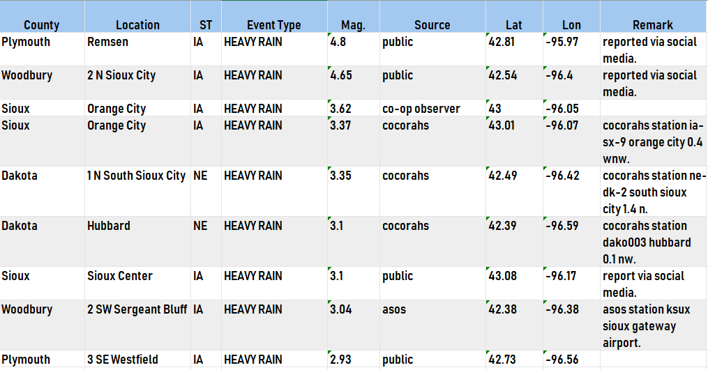
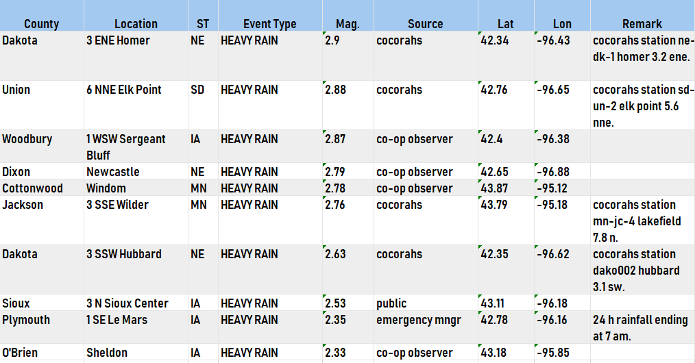
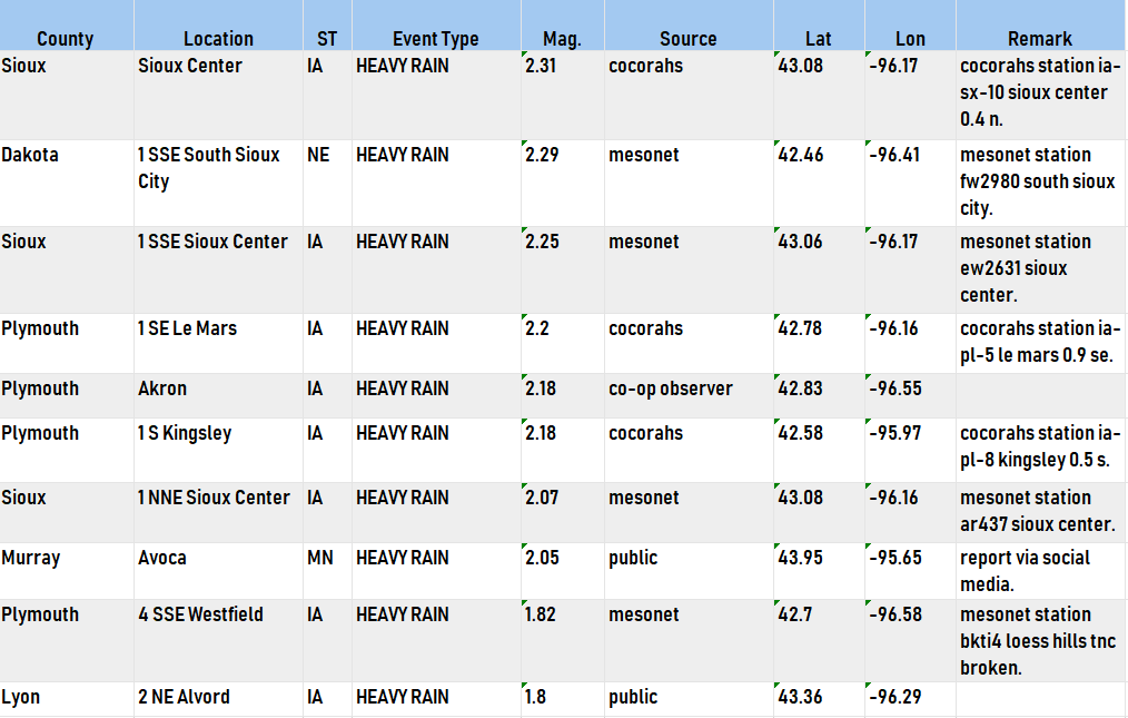
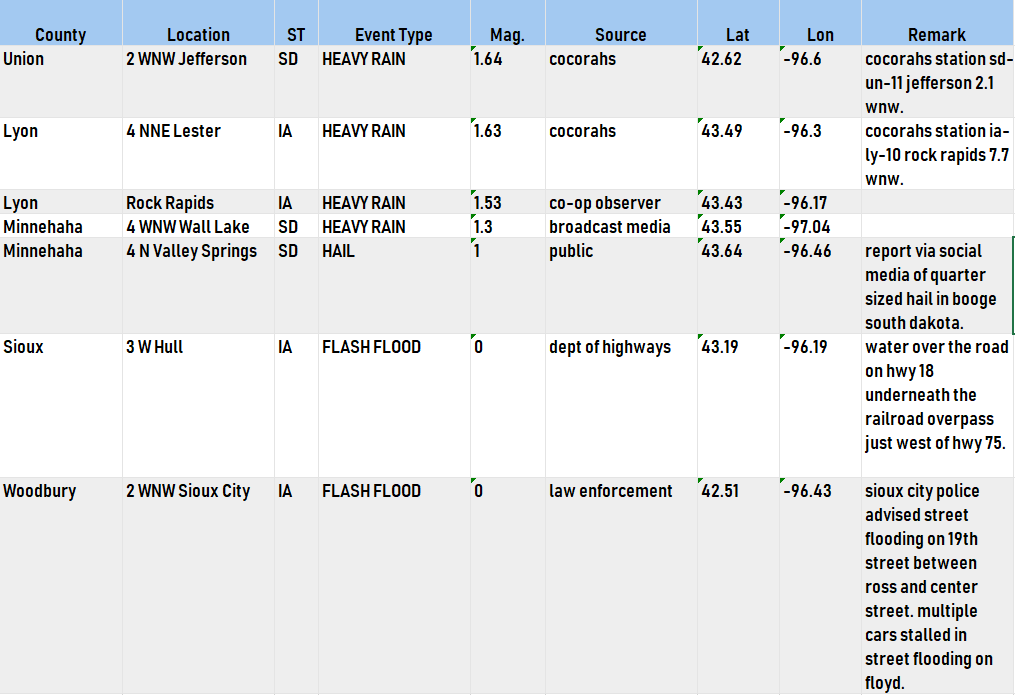
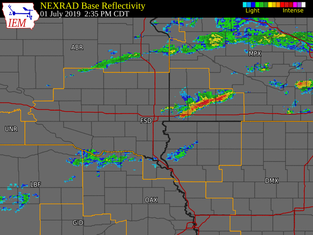
Scattered thunderstorms moved over the region during the afternoon and evening of July 1st, producing heavy rainfall and isolated hail over southwest Minnesota. Hours later, a line of thunderstorms developed along and east of a line from Yankton to Hartford, SD, before slowly moving southeast into northwest Iowa. These storms produced total rainfall amounts as high as 4+ inches in portions of northwest Iowa. |
July 1 - 2, 2019 |
 |
 |
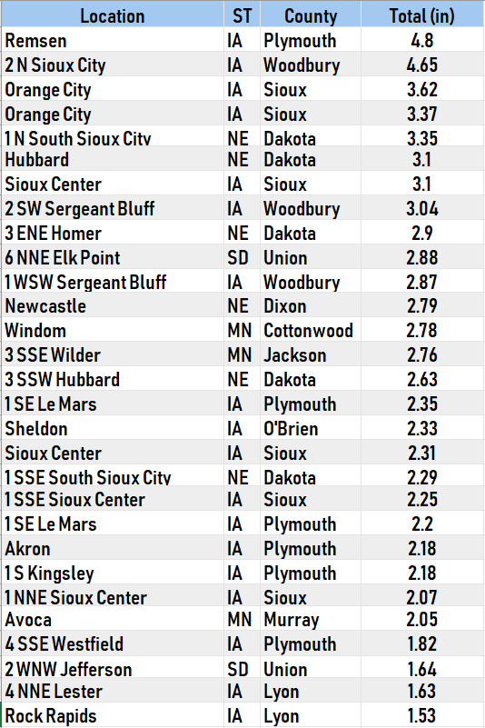 |
| All warnings issued during the event. | Oberved precipitation over the past 24 hours. | Some preliminary rainfall totals. Highest rainfall amounts were reported in northwest Iowa. |
Storm Reports
 |
Media use of NWS Web News Stories is encouraged! Please acknowledge the NWS as the source of any news information accessed from this site. |
|
Popular Pages
Past Weather Events
Regional Weather Roundup
Daily Temp/Precip
Hazardous Weather
Local Climate Archives
Climate Graphs and Data
Seasonal
EvapoTranspiration
Fire Weather
Grassland Fire Danger
Flooding (River)
Summer Weather
Travel Forecasts
Winter Weather
Winter Preparedness
Forecast Snowfall Graphic
Winter Temp Climatology
US Dept of Commerce
National Oceanic and Atmospheric Administration
National Weather Service
Sioux Falls, SD
26 Weather Lane
Sioux Falls, SD 57104-0198
605-330-4247
Comments? Questions? Please Contact Us.


 Weather Story
 Weather Map
 Local Radar