Overview
|
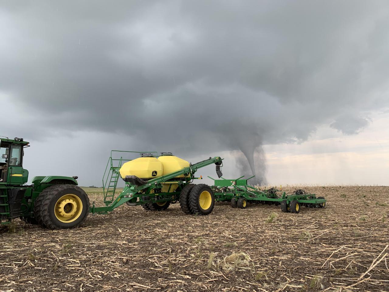
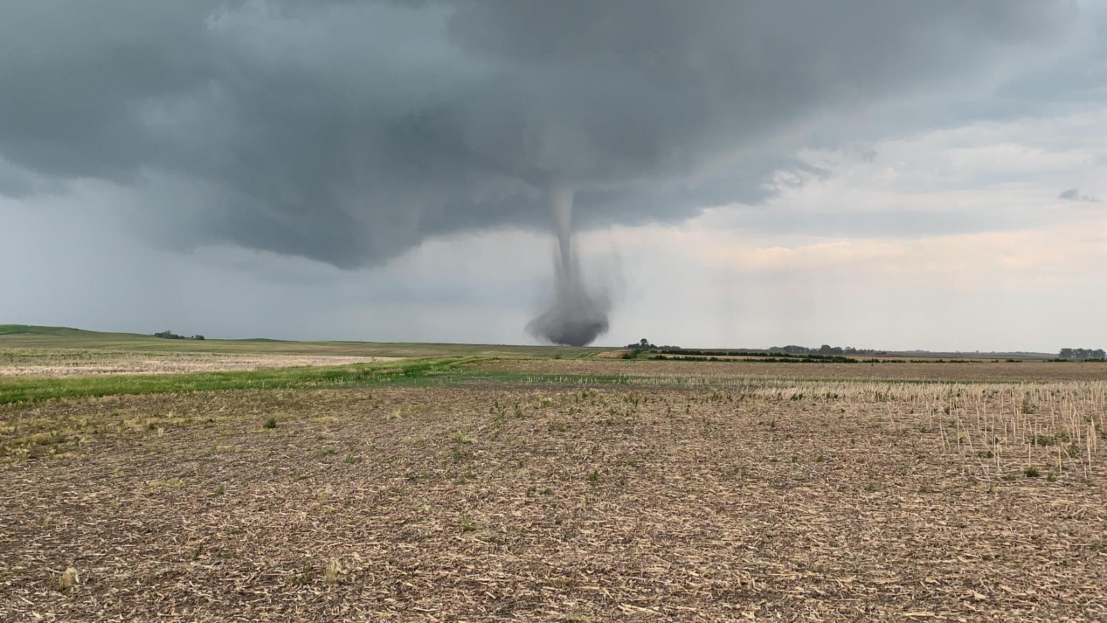
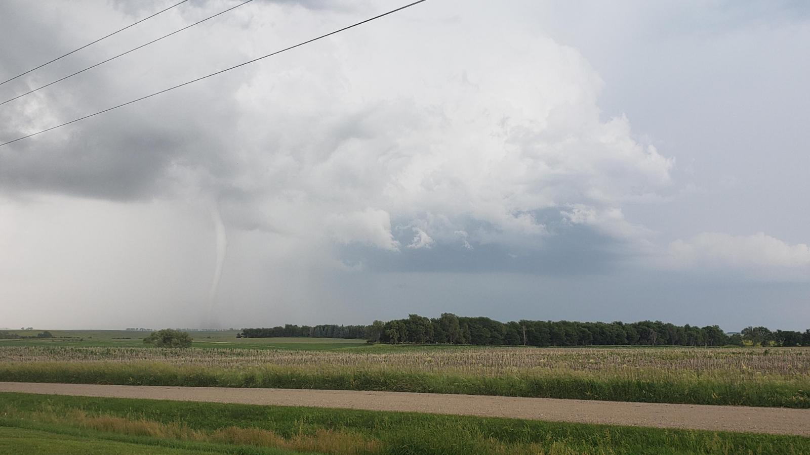
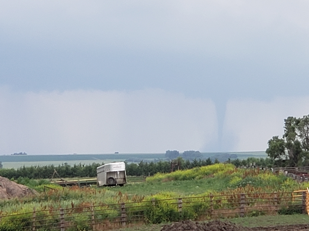
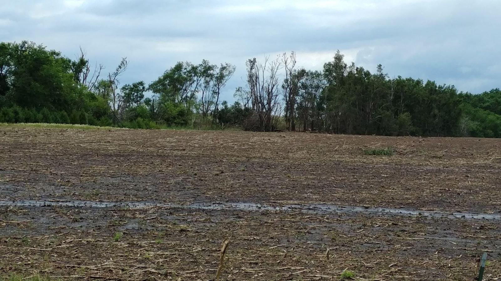
Isolated rotating storms developed along a front in south central South Dakota in the afternoon of Sunday, June 30, 2019. These storms produced 1 confirmed tornado near the small town of Lucas in northern Gregory County, as well as up to golf ball size hail. An earlier isolated storm in southwest Minnesota briefly produced up to half dollar size hail. Additional storms moved from south central to east central South Dakota after sunset, producing isolated damaging wind gusts, with damage primarily to trees and power lines. |
|
Tornadoes
|
Tornado - near Lucas, SD
Track Map 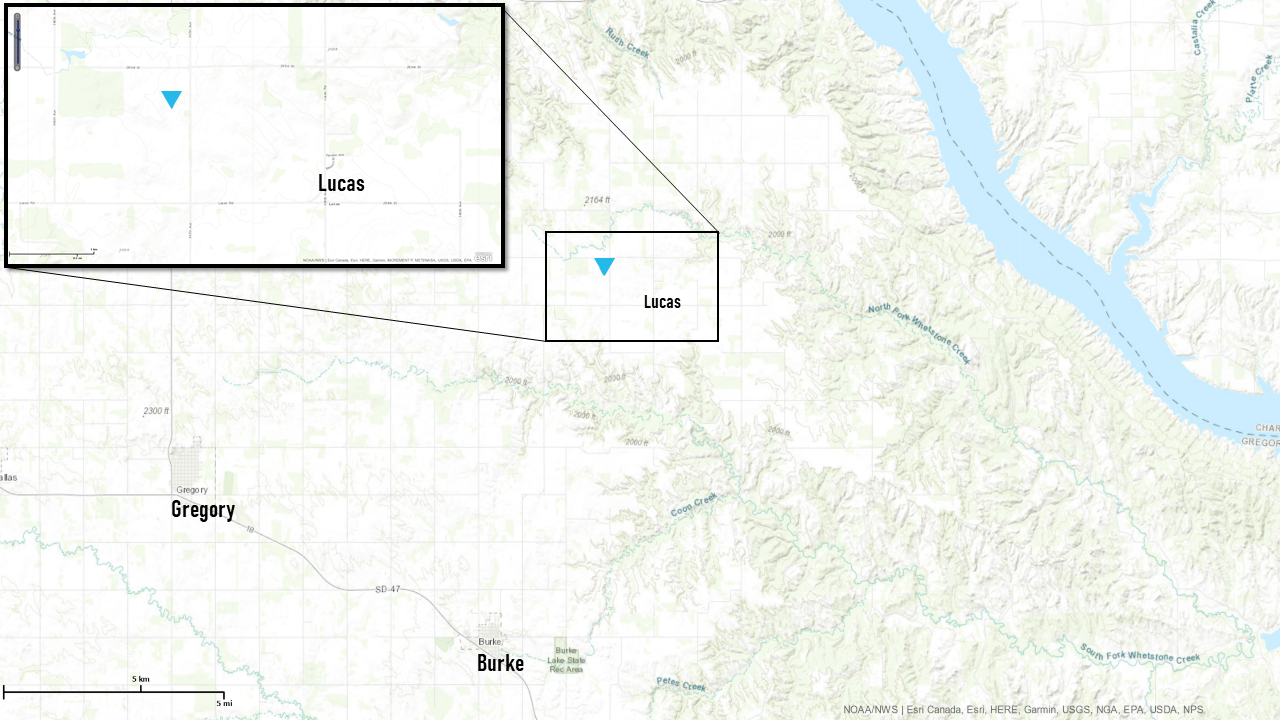 
|
||||||||||||||||
|
||||||||||||||||
The Enhanced Fujita (EF) Scale classifies tornadoes into the following categories:
| EF0 Weak 65-85 mph |
EF1 Moderate 86-110 mph |
EF2 Significant 111-135 mph |
EF3 Severe 136-165 mph |
EF4 Extreme 166-200 mph |
EF5 Catastrophic 200+ mph |
 |
|||||
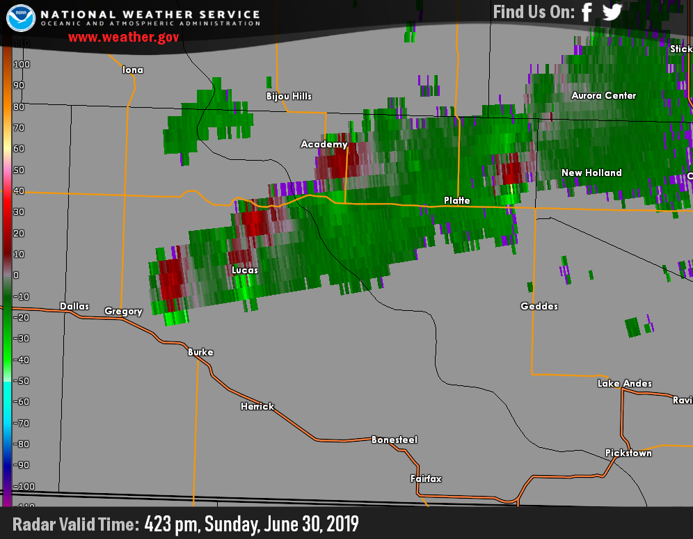
Radar
Header
 |
 |
 |
| Reflectivity Loop from 402 pm to 532 pm in Gregory and Charles Mix Counties. | Storm Relative Velocity Image at 423 pm, showing multiple rotating storms. |
Toggling Reflectivity and Storm Relative Velocity at 423 pm. |
 |
Media use of NWS Web News Stories is encouraged! Please acknowledge the NWS as the source of any news information accessed from this site. |
|


 Weather Story
 Weather Map
 Local Radar