Overview
|
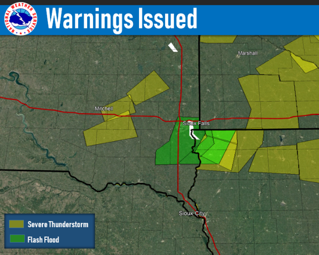
A thunderstorm complex moved across the region during the early to mid morning hours on June 27, 2019. Isolated severe storms within the complex produced large hail and damaging winds, with heavy rain and localized flash flooding also reported. |
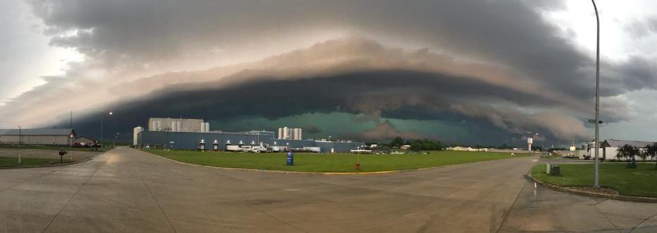 Shelf Cloud approaching Hull, Iowa. Photo courtesy Sioux County Sheriff. |
Wind & Hail:
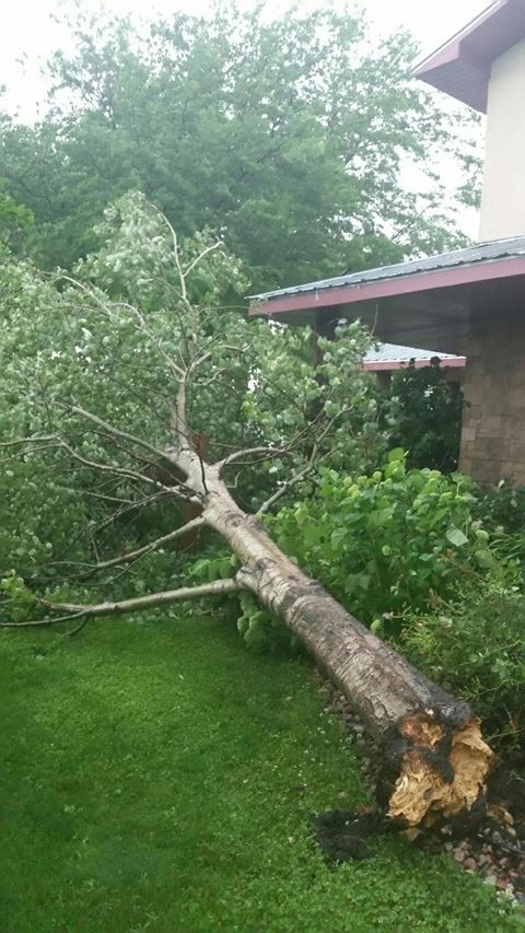
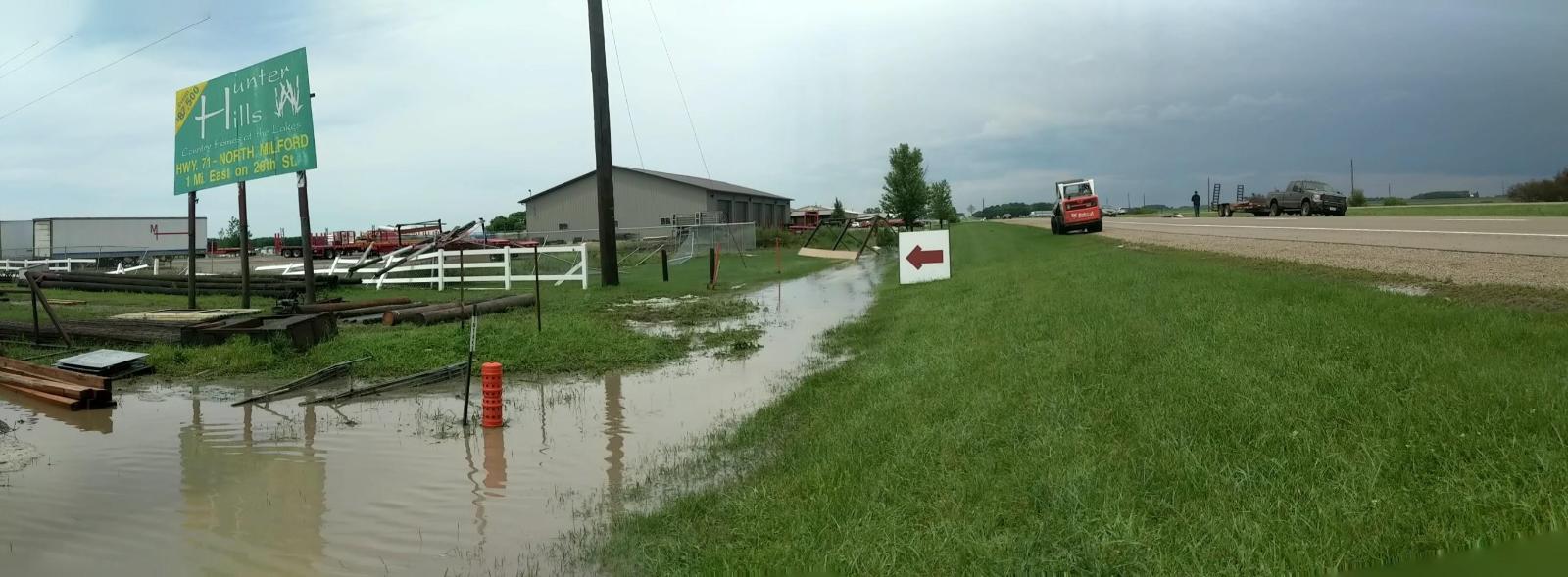
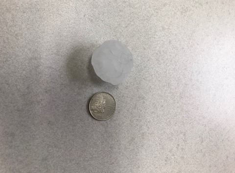
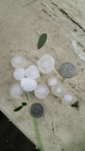
This storm system produced pockets of large hail and damaging winds. Among the hardest hit was Spencer, Iowa, where hail up to 1.5 inches in diameter was accompanied by damaging winds. A wind gust of 73 mph was recorded by the automated observation system at the Spencer airport.
Wind
 |
 |
 |
| Downed Tree near Booge, SD. Photo courtesy of Max Johnson. | Damage at Spencer Livestock facility. Photo courtesy Cassie Oleson. |
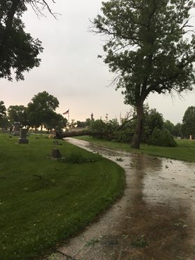
Downed tree at Riverside Cemetery in Spencer, IA. Photo courtesy of Leeann Rosales. |
Hail
 |
 |
 |
| Large hail near Spencer, IA. Photo courtesy of Steve Grimmius. |
Hailstones in Spencer, IA. Photo courtesy of Mark Stover. |
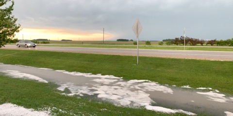
Hail collects in a rain-filled ditch in Spencer, IA. Photo courtesy of Alissa Gray. |
Flooding
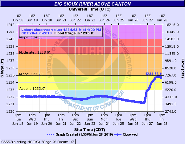
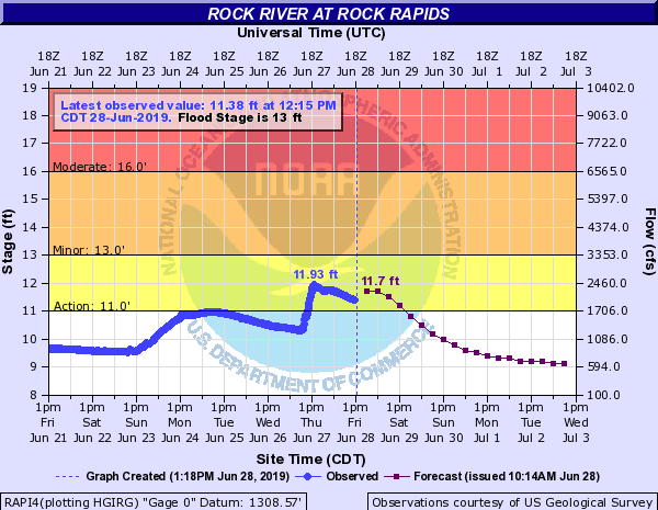
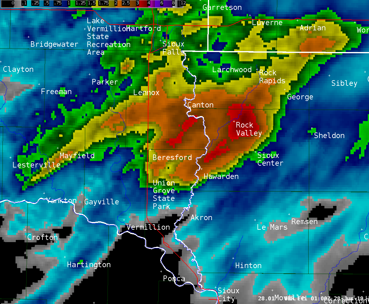
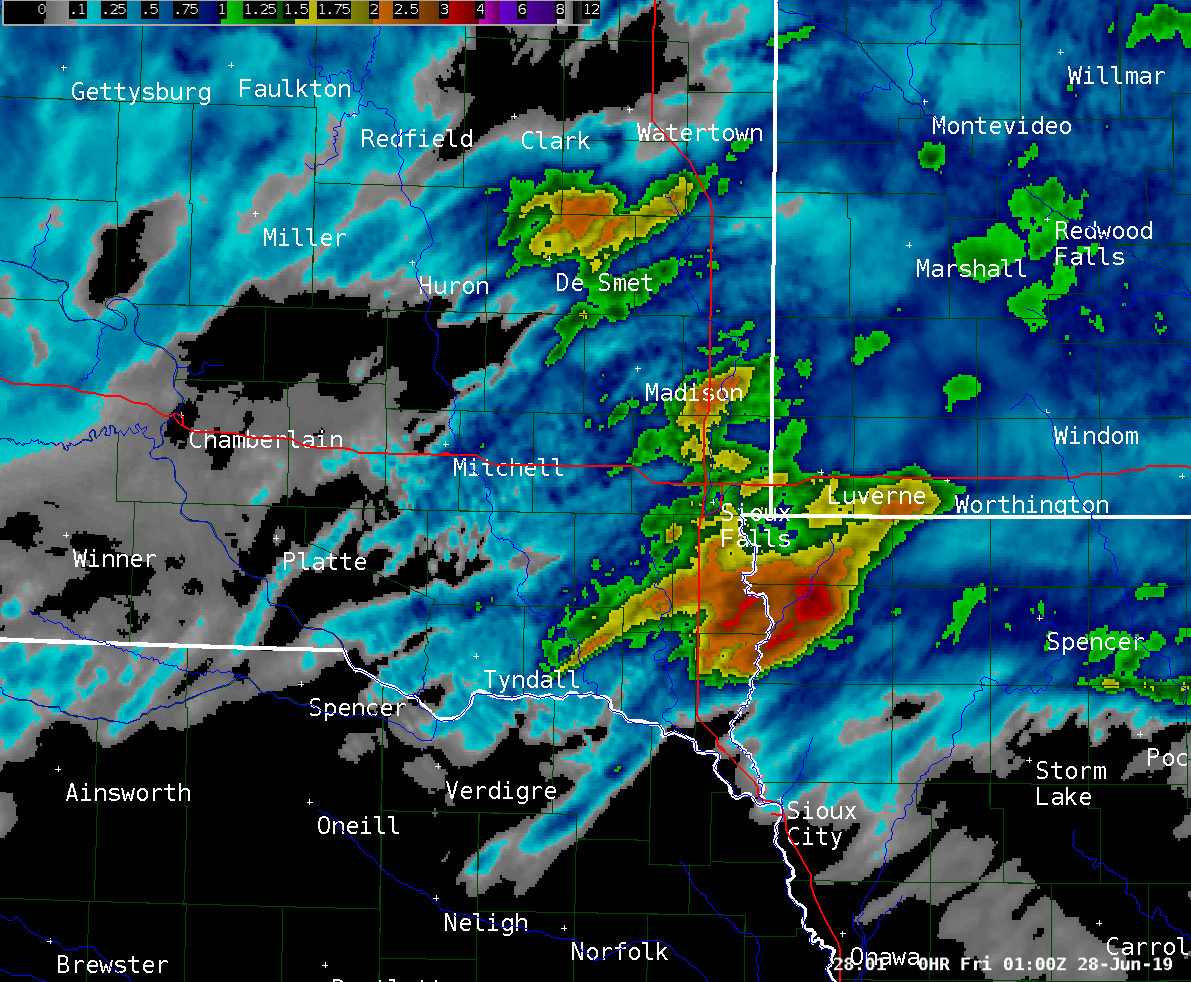
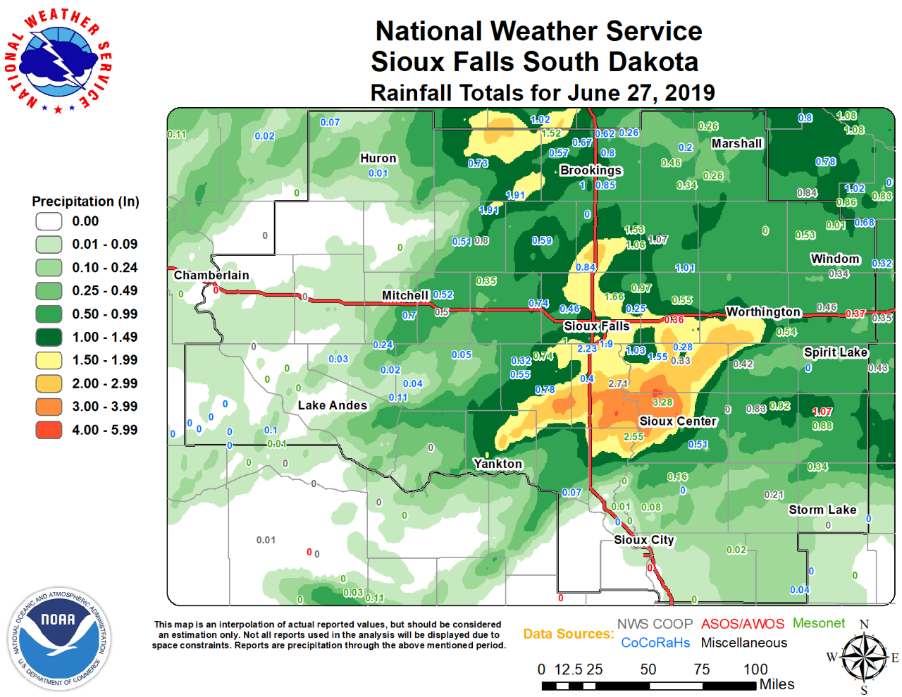
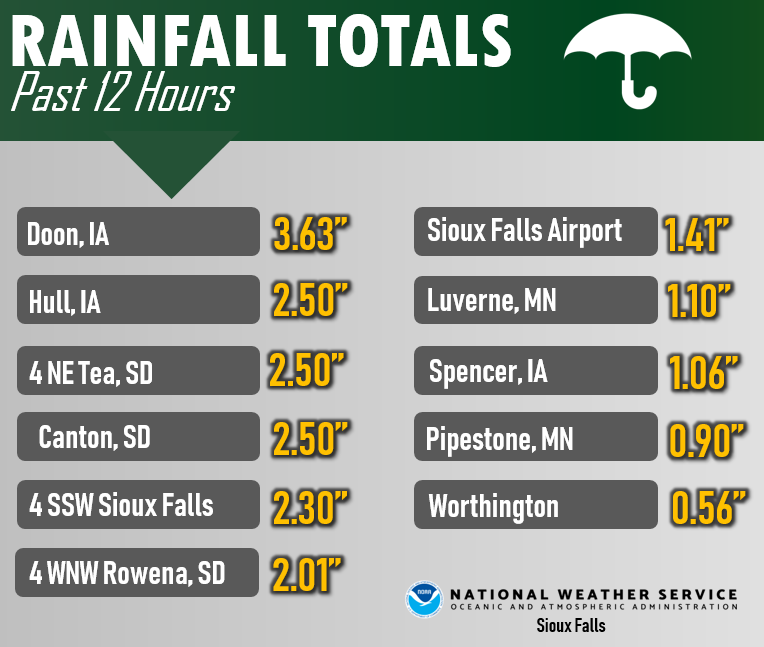
An area of 2 to 4 inches of rain fell from southeast Sioux Falls, south and east toward Beresford, Canton, and Rock Valley, within just 2 to 3 hours. This heavy rain caused localized flooding in streets and parking lots.
Hydrographs
 |
 |
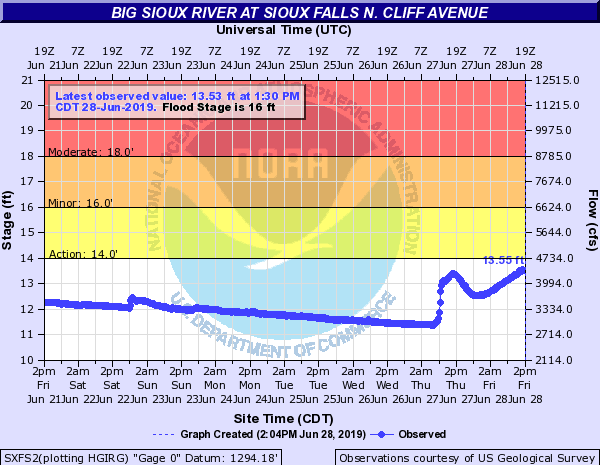 |
| Big Sioux River above Canton | Rock River at Rock Rapids | Big Sioux River at Sioux Falls North Cliff Ave |
Radar/Photos
 |
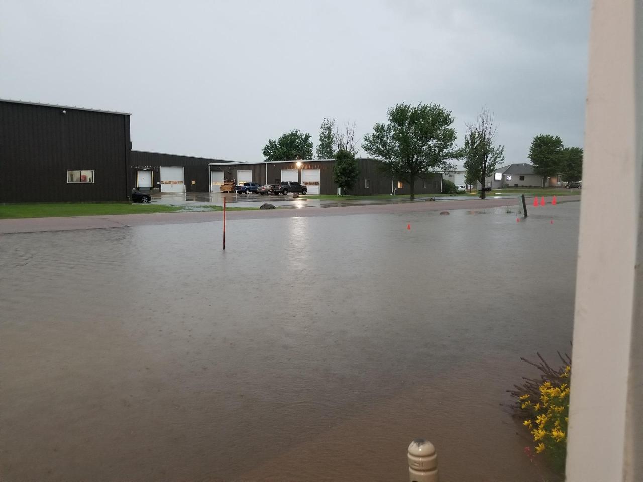 |
| Radar-estimated rainfall of 2 to 4 inches over a small area of far southeast SD and far northwest IA. | Flooded parking lot near the Tea exit of I-29. Photo courtesy of Nancy Priborski |
Radar
 |
 |
|
| Radar Loop from 2 am to 2 pm, Thursday, June 27, 2019 |
Radar-estimated rainfall for June 27th. Highest amounts greater than 3 inches were reported toward Doon and Rock Valley, Iowa. | All Warnings Issued |
Storm Reports
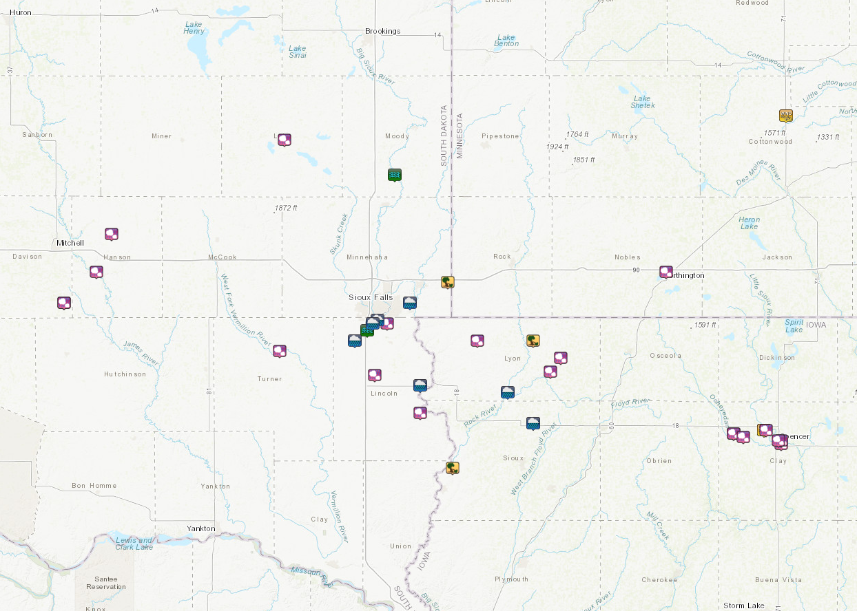
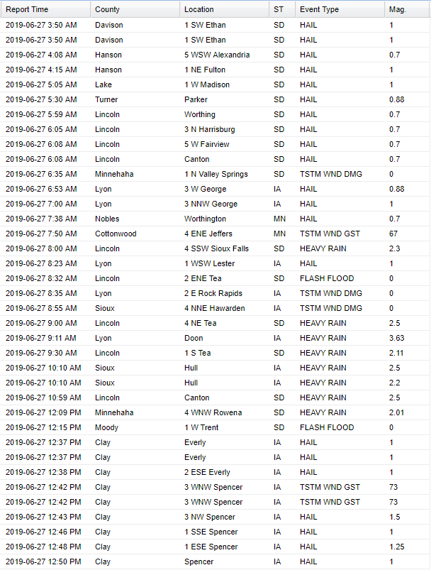
Rain Reports
 |
Media use of NWS Web News Stories is encouraged! Please acknowledge the NWS as the source of any news information accessed from this site. |
 |