Sioux Falls, SD
Weather Forecast Office
Overview
|
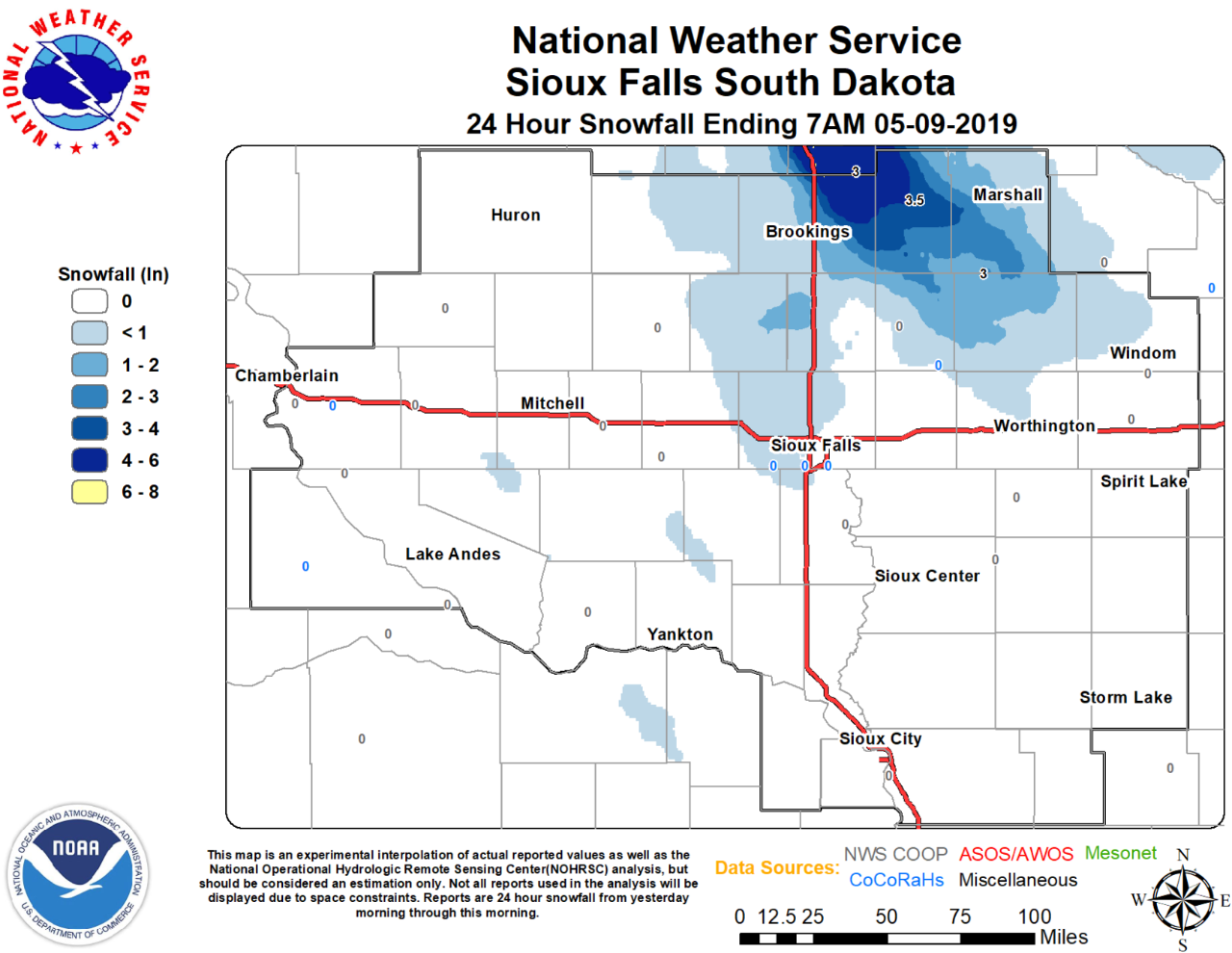
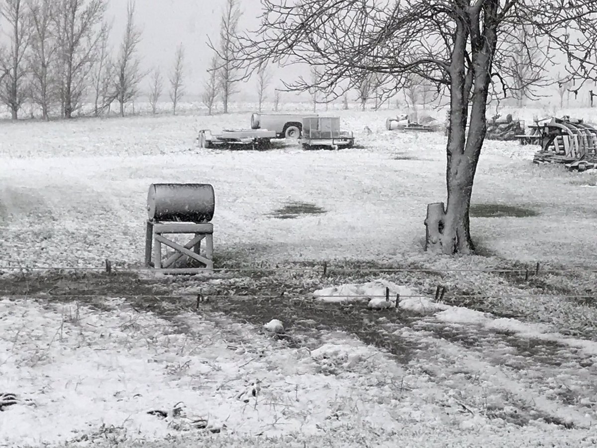
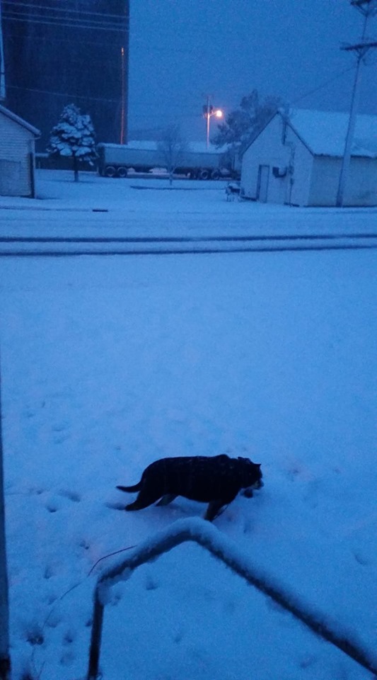
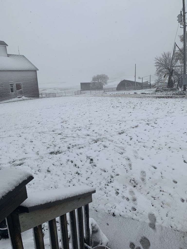
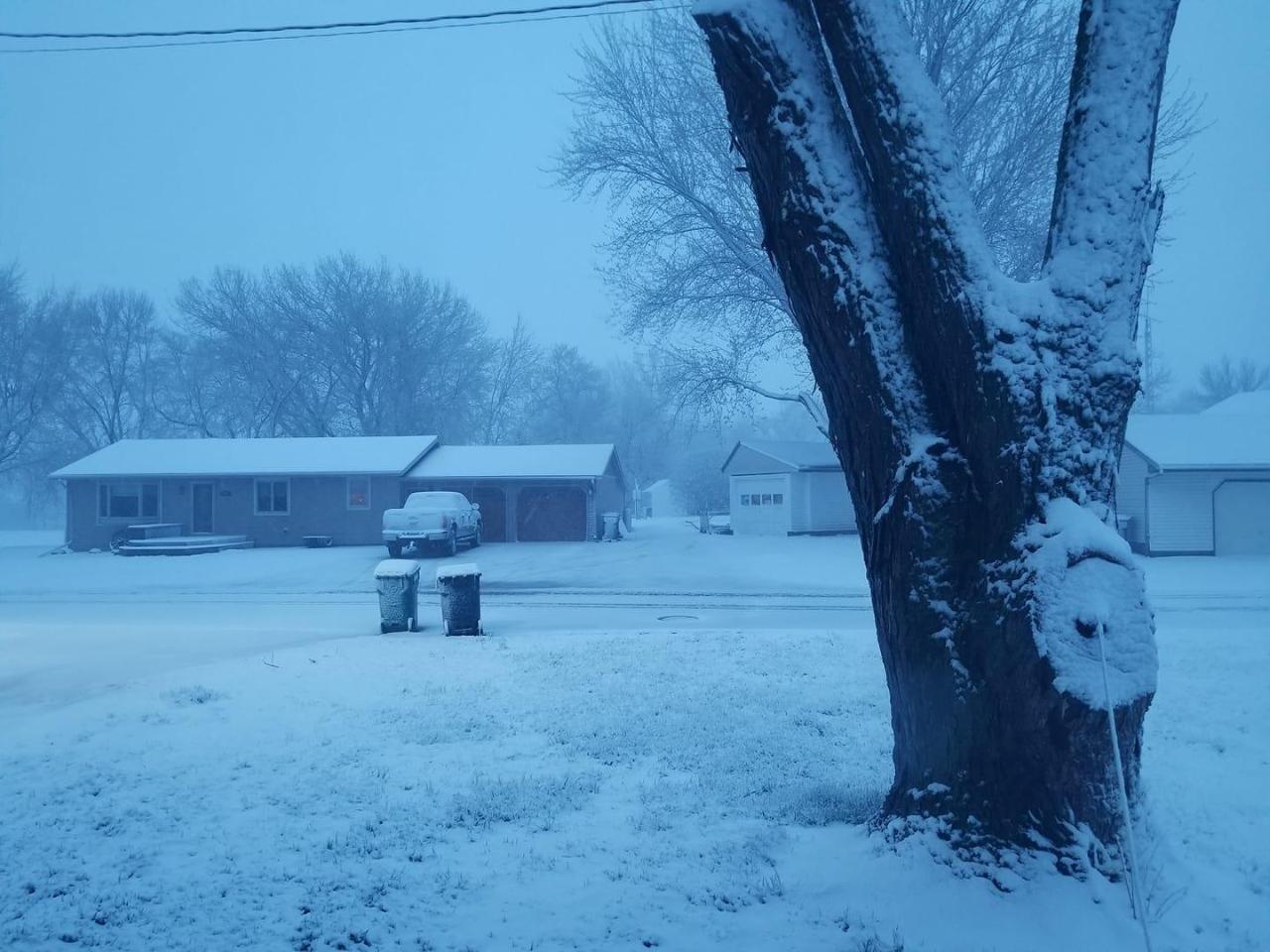
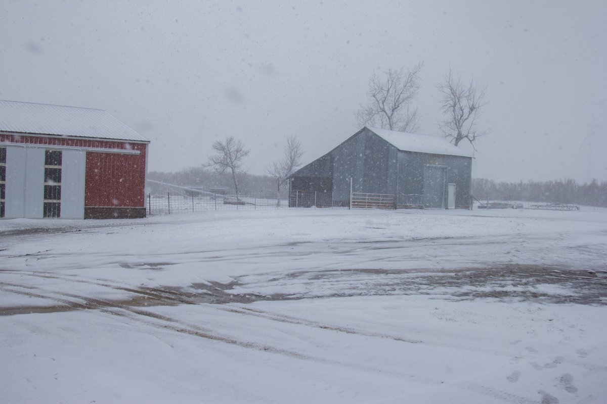
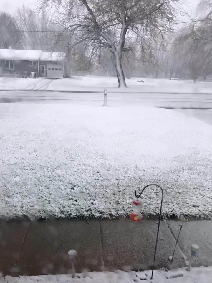
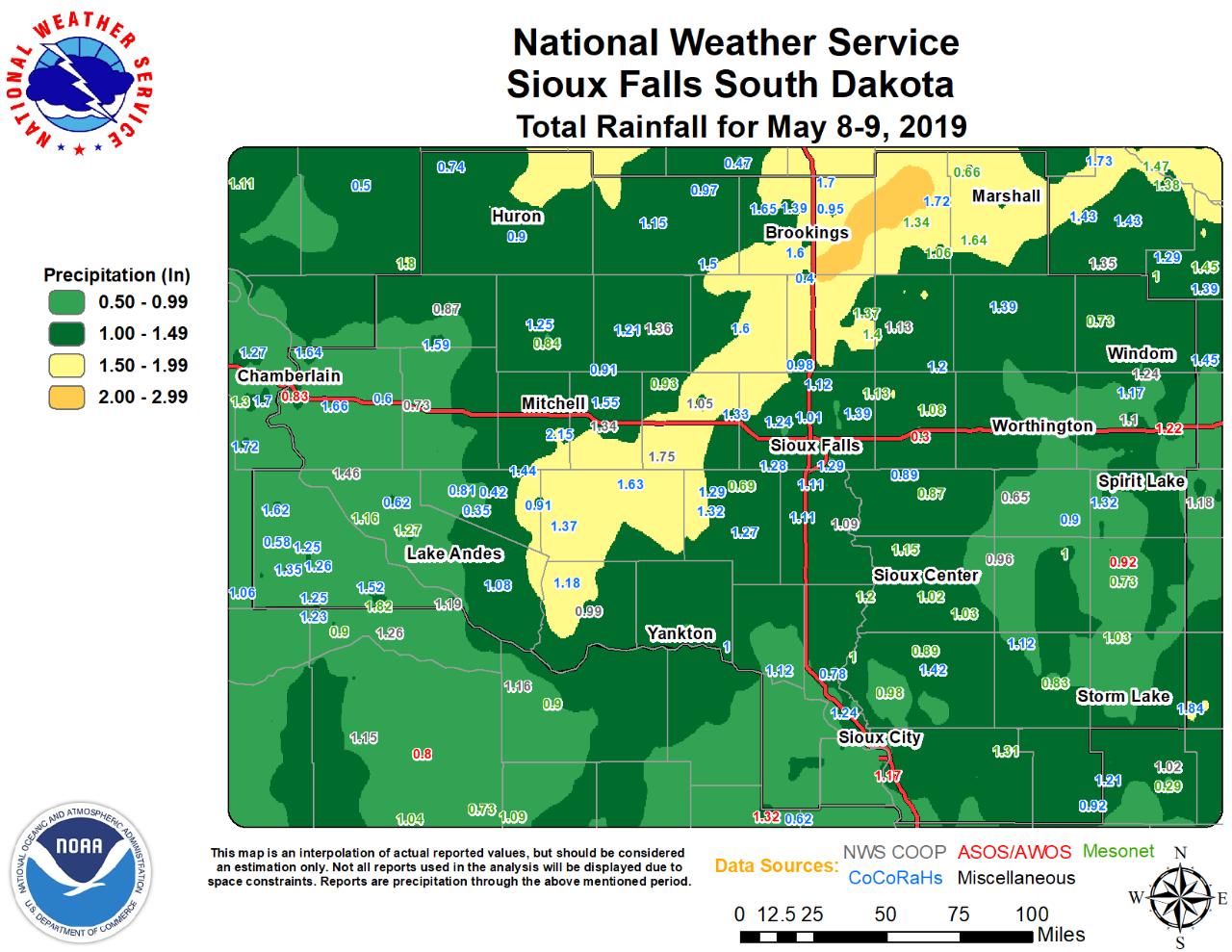
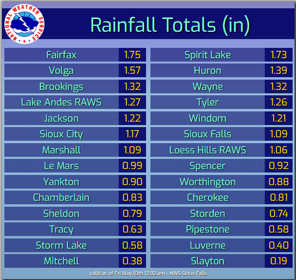
A spring low pressure system brought widespread rainfall to the region, which is already off to record or near record precipitation so far this year. Of equal significance with this event was the switch over to snow for some locations toward the end of the event. This provided the somewhat rare glimpse of May snowflakes and even accumulating snow to portions of the Buffalo Ridge area and other higher elevation locations. |
 |
 |
Media use of NWS Web News Stories is encouraged! Please acknowledge the NWS as the source of any news information accessed from this site. |
|
Popular Pages
Past Weather Events
Regional Weather Roundup
Daily Temp/Precip
Hazardous Weather
Local Climate Archives
Climate Graphs and Data
Seasonal
EvapoTranspiration
Fire Weather
Grassland Fire Danger
Flooding (River)
Summer Weather
Travel Forecasts
Winter Weather
Winter Preparedness
Forecast Snowfall Graphic
Winter Temp Climatology
US Dept of Commerce
National Oceanic and Atmospheric Administration
National Weather Service
Sioux Falls, SD
26 Weather Lane
Sioux Falls, SD 57104-0198
605-330-4247
Comments? Questions? Please Contact Us.


 Weather Story
 Weather Map
 Local Radar