Overview
|
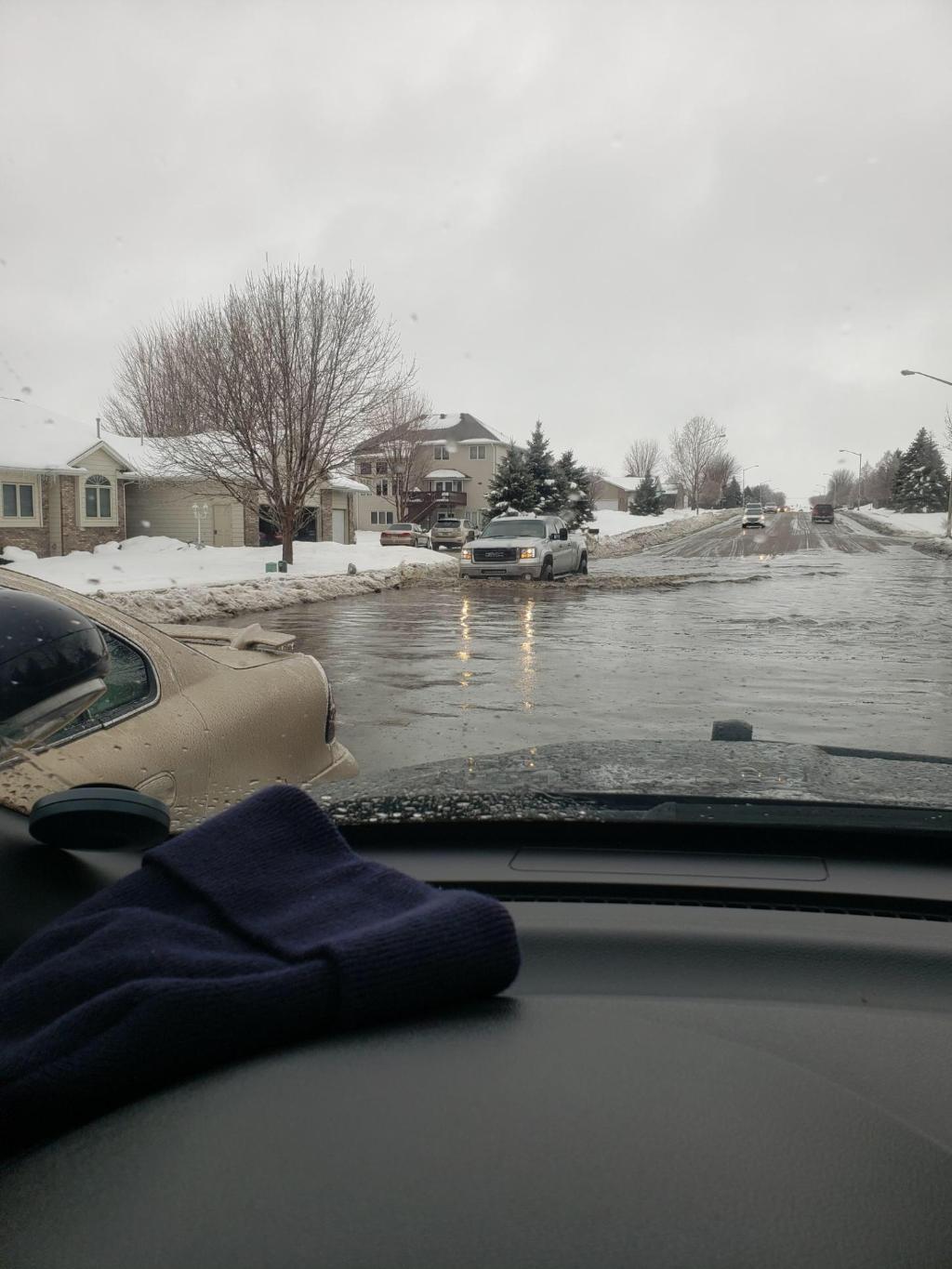
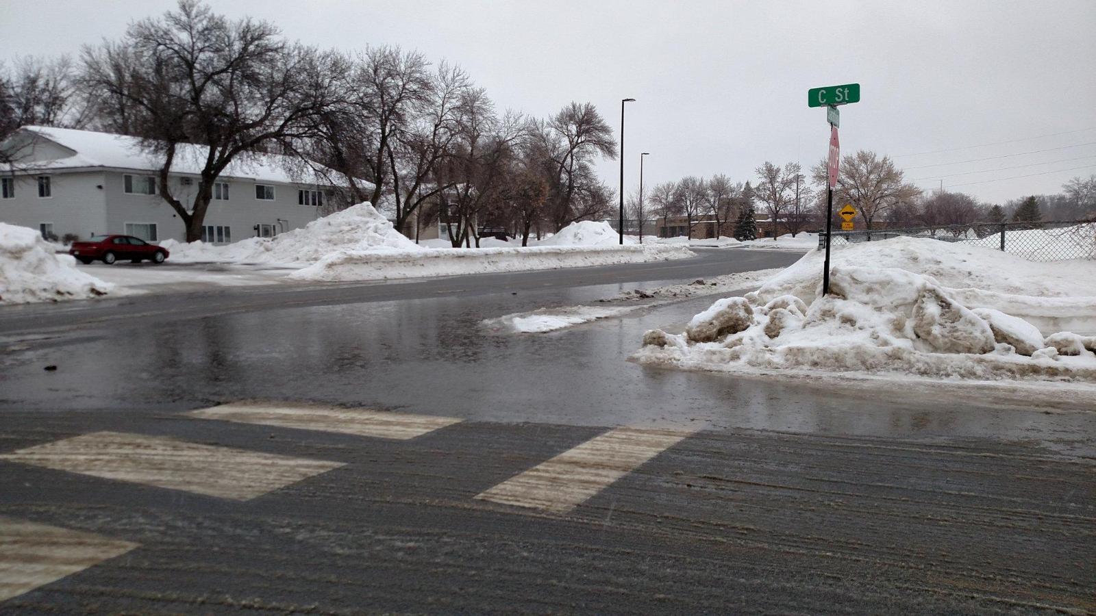
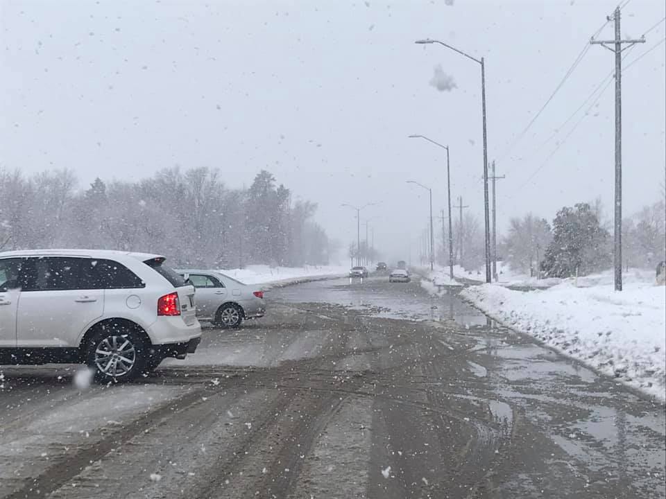
A large winter storm moved through the region on March 9, 2019, bringing a mix of precipitation and snow. As the main system moved northward into the region, precipitation started as freezing rain at many locations. Ice accumulations up to a tenth of an inch were reported. This resulted in hazardous travel conditions in the early morning hours. Precipitation changed over to rain through the morning, before transitioning over to all snow from west to east by midday. Moderate rain (including a record rainfall of 0.86 inches at the Sioux Falls Airport) and poor drainage due to snow on the ground, created ponding water and street flooding around the Sioux Falls metro area. Following the change to snow, gusty northwest winds caused drifting snow which iced over on several roads, prompting the closure of Interstate 90 west of Mitchell from Saturday evening until early Sunday morning. |
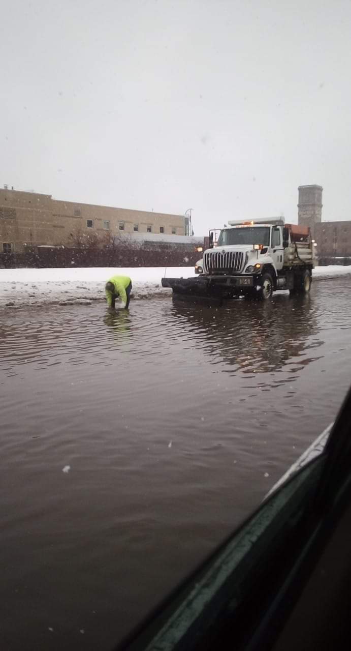
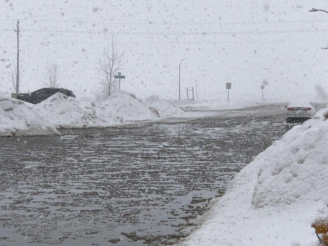 Flooded street in southeast Sioux Falls turning to slush as snow starts to accumulate. (Photo courtesy Galen Smidt) |
Snow/Ice
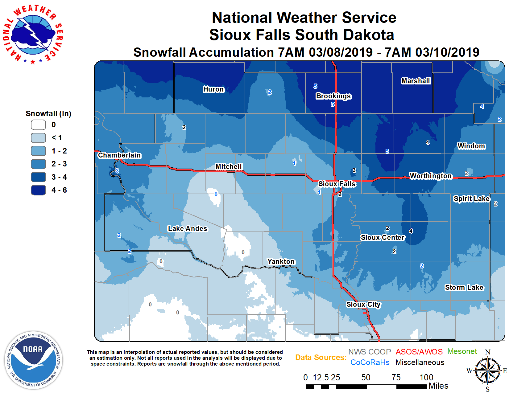
Public Information Statement
National Weather Service Sioux Falls SD
1152 AM CDT Sun Mar 10 2019

...24 HOUR SNOWFALL REPORTS...

Location                     Amount    Time/Date       Lat/Lon
Lake Benton                  7.0 in    0549 PM 03/09   44.26N/96.29W
Edgerton                     5.1 in    0700 AM 03/10   43.87N/96.13W
Marshall                     5.0 in    0700 AM 03/10   44.45N/95.79W
1 SW Brookings               5.0 in    0700 AM 03/10   44.30N/96.80W
5 W Bruce                    4.7 in    0700 AM 03/10   44.44N/96.99W
Sheldon                      4.0 in    0700 AM 03/10   43.18N/95.84W
Pipestone                    3.8 in    0700 AM 03/10   44.00N/96.31W
2 N Chester                  3.4 in    0700 AM 03/10   43.92N/96.93W
3 NNW Wahpeton               3.3 in    0700 AM 03/10   43.42N/95.19W
3 WNW Everly                 3.0 in    0700 AM 03/10   43.18N/95.38W
2 NNE Worthington            3.0 in    0700 AM 03/10   43.65N/95.58W
3 ESE Sioux Falls            2.8 in    0700 AM 03/10   43.53N/96.67W
De Smet                      2.5 in    0700 AM 03/10   44.39N/97.55W
7 SSW Chamberlain            2.4 in    0700 AM 03/10   43.71N/99.37W
2 NE Lakefield               2.4 in    0700 AM 03/10   43.70N/95.14W
2 SE Madison                 2.1 in    0700 AM 03/10   43.99N/97.08W
Huron                        2.0 in    0700 AM 03/10   44.36N/98.22W
Canton                       2.0 in    0700 AM 03/10   43.30N/96.58W
4 SW Burke                   2.0 in    0700 AM 03/10   43.14N/99.35W
Orange City                  1.7 in    0700 AM 03/10   43.00N/96.06W
3 N Sioux Falls              1.6 in    0700 AM 03/10   43.59N/96.73W
4 N Cleghorn                 1.5 in    0700 AM 03/10   42.87N/95.71W
Wall Lake                    1.0 in    0445 PM 03/09   43.53N/96.96W
Cherokee                     1.0 in    0700 AM 03/10   42.75N/95.55W
6 NW Montrose                1.0 in    0700 AM 03/10   43.76N/97.27W
1 NE Wall Lake               1.0 in    0700 AM 03/10   43.54N/96.94W

Observations are collected from a variety of sources with varying
equipment and exposures. We thank all volunteer weather observers
for their dedication. Not all data listed are considered official.
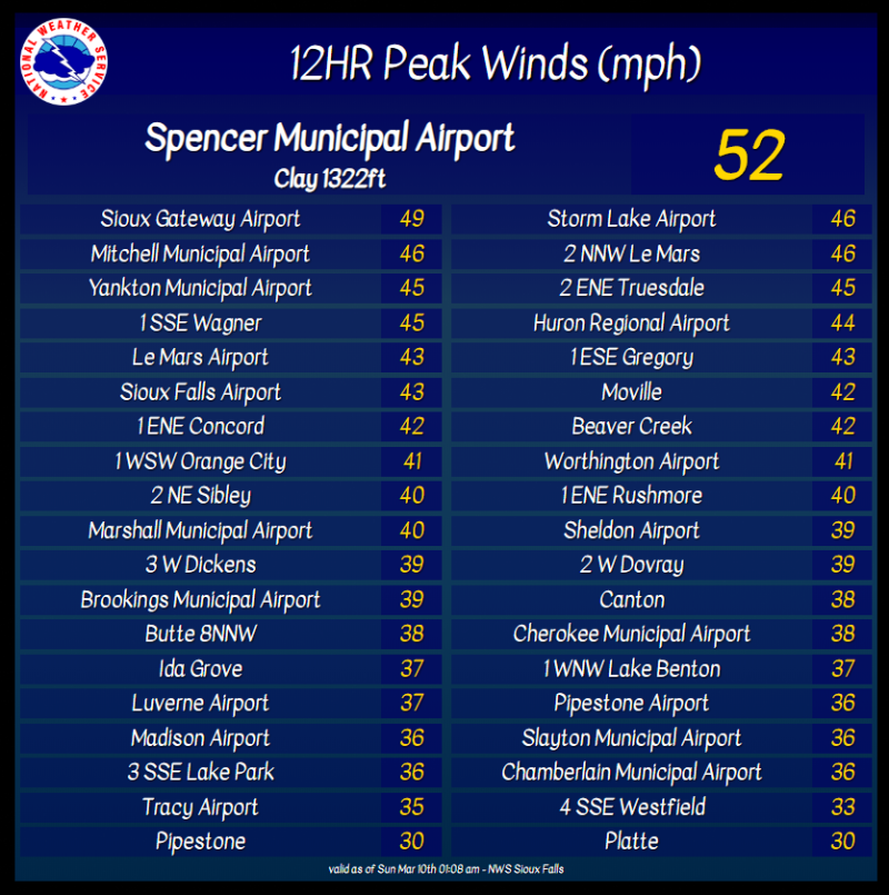
Wind Gusts
Photos & Video
Header
 |
 |
 |
 |
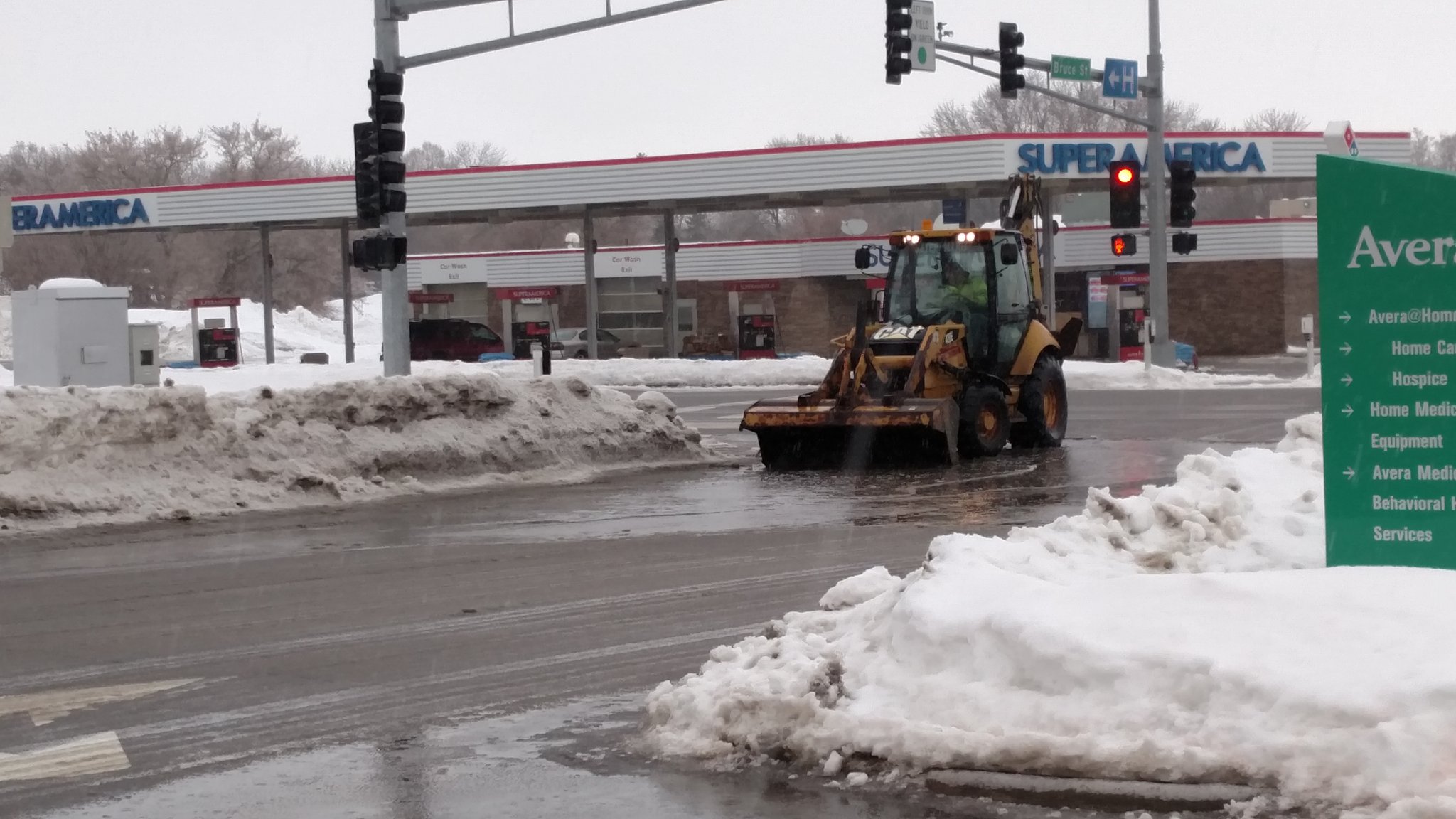
| Flooding in Sioux Falls (Sioux Falls Police Dept) |
Crews clearing storm drains to ease flooding in Sioux City | Crews clearing storm drains to ease flooding in Marshall (City of Marshall) |
Flooded Intersection in Marshall (City of Marshall) |
 |
 |
 |
 |
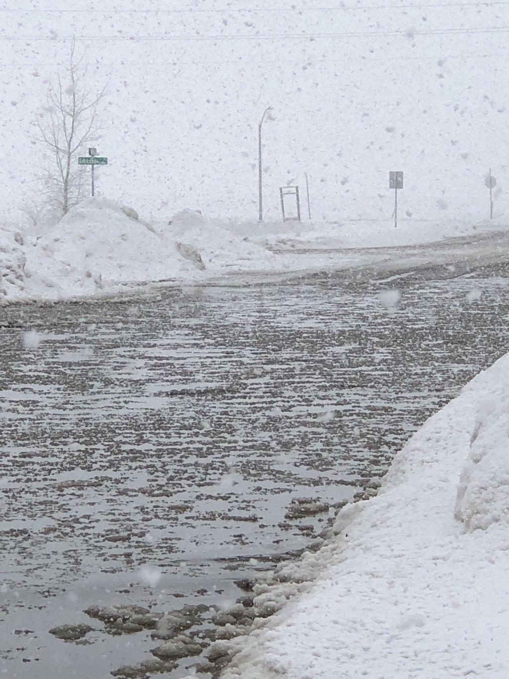
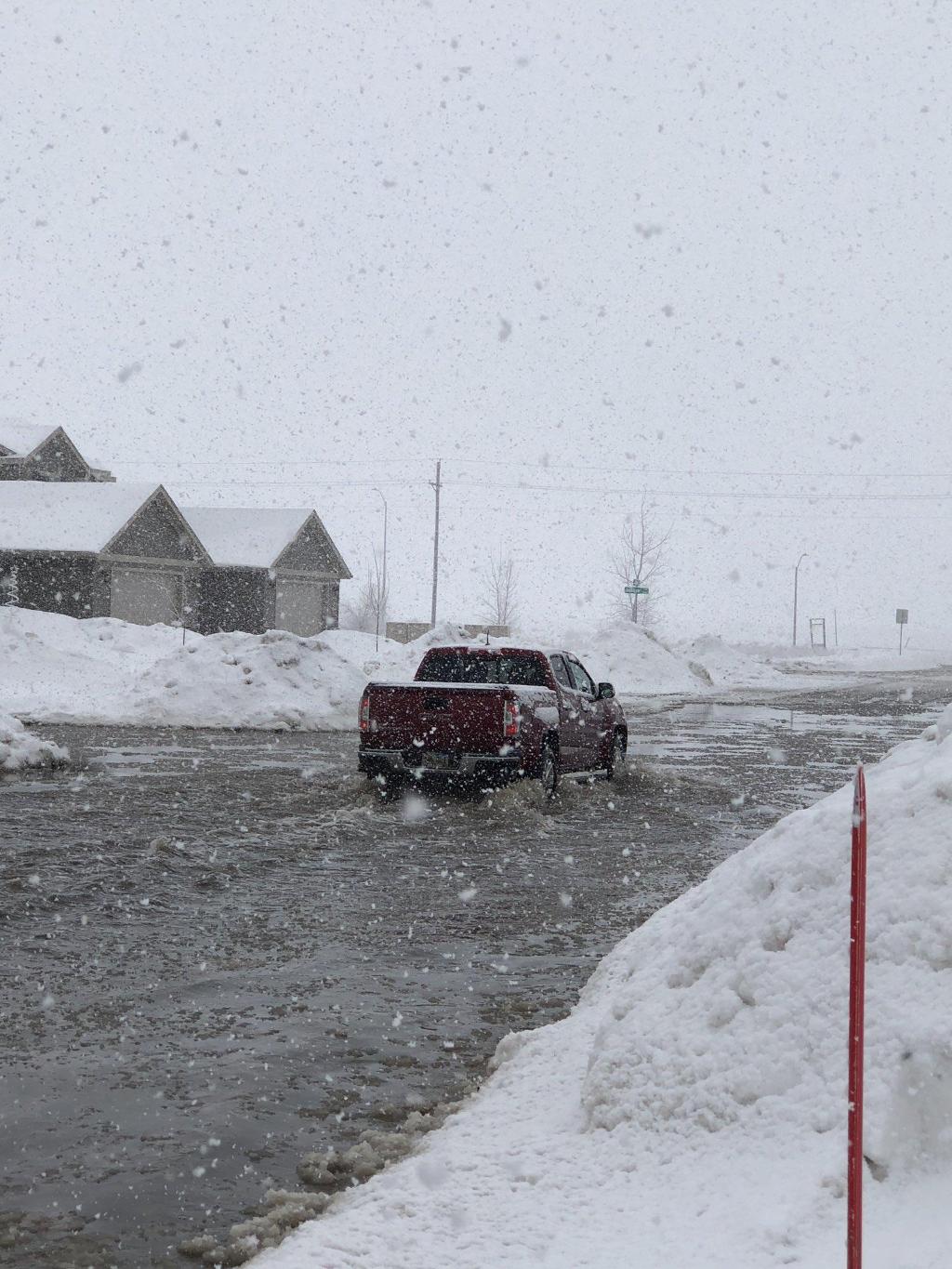
| Snow falling into flooded street in southeast Sioux Falls (Galen Smidt) |
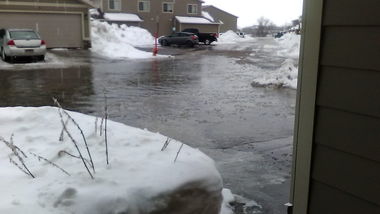
Southeast Sioux Falls (Galen Smidt) |
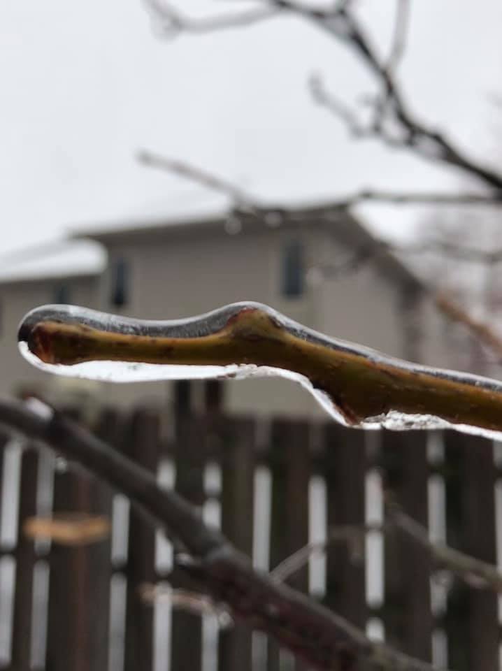
Ice-covered branch in Sioux Falls (Rebecca Reddy) |
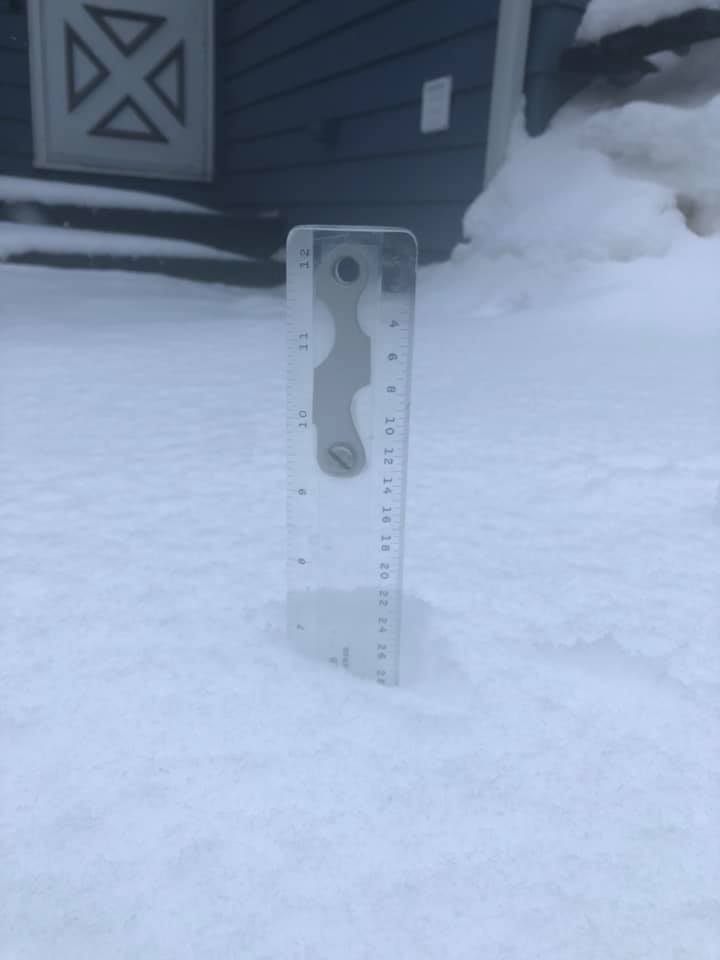
Snowfall in Marshall (Cara Bloom Bressler) |
 |
 |
 |
 |
| Southeast Sioux Falls (NWS Employee) |
Southern Sioux Falls (Erica Locke) |
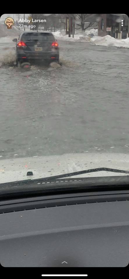
Southern Sioux Falls (Abby Larsen) |
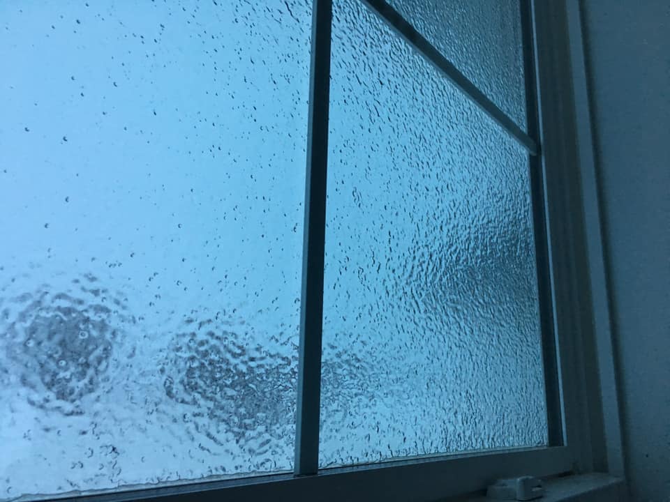
Early morning freezing rain coated this window near the Ward exit of I-29 (Curt Roland) |
Radar
 |
 |
 |
 |
| Radar Loop Early Saturday Morning |
Radar Loop Saturday Morning |
Radar Loop Saturday Afternoon |
Radar Loop of Reflectivity and Correlation Coefficient showing Rain/Snow line moving across I-29 |
Rain Reports
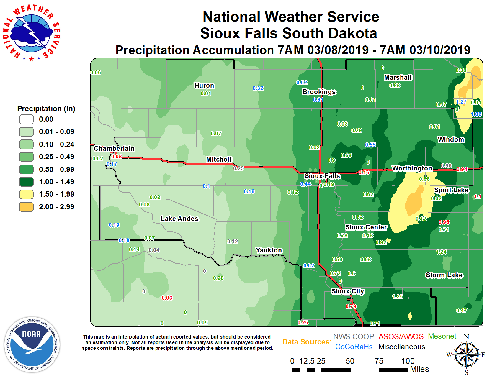
NOTE: Some plotted point values are from automated gages which have difficulty recording liquid equivalents, and thus may be inaccurate.
Public Information Statement
National Weather Service Sioux Falls SD
1231 PM CDT Sun Mar 10 2019

...24 HOUR RAINFALL REPORTS...

Location                     Amount    Time/Date       Lat/Lon
Ida Grove                    2.80 in   0400 PM 03/09   42.35N/95.48W
Correctionville              1.18 in   0400 PM 03/09   42.48N/95.79W
Linn Grove                   0.98 in   0400 PM 03/09   42.90N/95.24W
Spirit Lake                  0.93 in   0415 PM 03/09   43.47N/95.12W
6 ESE Baltic                 0.90 in   0400 PM 03/09   43.73N/96.62W
Hills                        0.89 in   1200 PM 03/09   43.53N/96.36W
1 ESE North Sioux City       0.85 in   0430 PM 03/09   42.52N/96.48W
Sioux Falls 14 NNE           0.78 in   0400 PM 03/09   43.73N/96.62W
Alton                        0.77 in   0400 PM 03/09   42.98N/96.00W
3 N Hawarden                 0.77 in   0430 PM 03/09   43.05N/96.49W
2 NE Crooks                  0.76 in   0200 PM 03/09   43.69N/96.78W
1 SW Sioux City              0.76 in   0400 PM 03/09   42.49N/96.41W
1 WSW Garretson              0.72 in   0415 PM 03/09   43.71N/96.53W
Hornick                      0.71 in   0400 PM 03/09   42.23N/96.08W
4 W Hinton                   0.71 in   0415 PM 03/09   42.63N/96.37W
4 SSE Westfield              0.70 in   0411 PM 03/09   42.70N/96.58W
3 SSW Hinton                 0.69 in   0400 PM 03/09   42.58N/96.31W
3 WSW Spencer                0.69 in   0445 PM 03/09   43.13N/95.21W
2 NNW Sioux City             0.68 in   0400 PM 03/09   42.54N/96.41W
Jasper                       0.68 in   0415 PM 03/09   43.78N/96.44W
Pipestone                    0.67 in   0421 PM 03/09   44.01N/96.32W
2 SE Sioux Center            0.66 in   0347 PM 03/09   43.05N/96.15W
2 NNW Le Mars                0.65 in   0456 PM 03/09   42.82N/96.19W
1 NNE Round Lake             0.64 in   0446 PM 03/09   43.56N/95.45W
6 NW Hinton                  0.59 in   0445 PM 03/09   42.69N/96.37W
Rock Valley                  0.58 in   0400 PM 03/09   43.20N/96.31W
Akron                        0.57 in   0400 PM 03/09   42.84N/96.56W
Rock Rapids 2 S              0.53 in   0415 PM 03/09   43.42N/96.16W
1 NE Sioux Falls             0.51 in   0430 PM 03/09   43.57N/96.71W
3 W Sioux Falls              0.42 in   0430 PM 03/09   43.53N/96.79W
2 WNW Windom                 0.36 in   0400 PM 03/09   43.89N/95.16W
1 WSW Orange City            0.35 in   0400 PM 03/09   43.00N/96.08W
2 N Vermillion               0.34 in   0415 PM 03/09   42.82N/96.92W
Luverne                      0.31 in   0430 PM 03/09   43.65N/96.20W
2 WSW Marshall               0.23 in   0445 PM 03/09   44.43N/95.83W
3 NNE Parker                 0.12 in   0415 PM 03/09   43.45N/97.11W
Sioux Center                 0.12 in   0446 PM 03/09   43.06N/96.17W
1 SSE Wagner                 0.11 in   1255 PM 03/09   43.06N/98.30W
4 SE Olivet                  0.10 in   0430 PM 03/09   43.19N/97.64W

Observations are collected from a variety of sources with varying
equipment and exposures. We thank all volunteer weather observers
for their dedication. Not all data listed are considered official.
 |
Media use of NWS Web News Stories is encouraged! Please acknowledge the NWS as the source of any news information accessed from this site. |
|


 Weather Story
 Weather Map
 Local Radar